List of civil parishes in Hertfordshire

Last updated

This is a list of civil parishes in the ceremonial county of Hertfordshire, England. There are 128 civil parishes.

Contents

List of civil parishes and unparished areas

ImageNameStatusDistrictPre-1974 districtRef(s)
St Mary Cheshunt Herts.jpg Cheshunt Unparished area Broxbourne Cheshunt Urban District [1]
HoddesdonTownCentre.jpg Hoddesdon Unparished area Broxbourne Hoddesdon Urban District [2]
The Paper Mill - geograph.org.uk - 506965.jpg Hemel Hempstead Unparished area Dacorum Hemel Hempstead Municipal Borough [3]
Timber Framed House, Aldbury - geograph.org.uk - 1578645.jpg Aldbury Civil parish Dacorum Berkhamsted Rural District [4]
Berkhamsted Collegiate School, The Chapel - geograph.org.uk - 590498.jpg Berkhamsted Town Dacorum Berkhamsted Urban District [5]
St Lawrence Church Bovingdon.JPG Bovingdon Civil parish Dacorum Hemel Hempstead Rural District [6]
Chipperfield, War Memorial and The Two Brewers - geograph.org.uk - 122311.jpg Chipperfield Civil parish Dacorum Hemel Hempstead Rural District [6]
Trowley Bottom, Trowley Hill Road - geograph.org.uk - 142142.jpg Flamstead Civil parish Dacorum Hemel Hempstead Rural District [6]
St Mary Magdelene at Flaunden - geograph.org.uk - 27976.jpg Flaunden Civil parish Dacorum Hemel Hempstead Rural District [6]
DSC 7460-great-gaddesden-church.JPG Great Gaddesden Civil parish Dacorum Hemel Hempstead Rural District [6]
Grand Union Canal, West Coast Main Line railway bridge - geograph.org.uk - 127833.jpg Kings Langley Civil parish Dacorum Hemel Hempstead Rural District [6]
East Wing of Ashridge Management College, Hertfordshire. - geograph.org.uk - 228243.jpg Little Gaddesden Civil parish Dacorum Berkhamsted Rural District [4]
Red Lion Pub in Markyate - geograph.org.uk - 41176.jpg Markyate Civil parish Dacorum Hemel Hempstead Rural District [6]
Nash Mill Church of England Primary School original building.jpg Nash Mills Civil parish Dacorum Watford Rural District [7]
Nettleden - geograph.org.uk - 290423.jpg Nettleden with Potten End Civil parish Dacorum Berkhamsted Rural District [4]
Northchurch, The High Street - geograph.org.uk - 590808.jpg Northchurch Civil parish Dacorum Berkhamsted Rural District [4]
Tring Park, The Summerhouse - geograph.org.uk - 185101.jpg Tring Town Dacorum Tring Urban District [8]
Tin Tabernacle at Puttenham, Hertfordshire - geograph.org.uk - 1587684.jpg Tring Rural Civil parish Dacorum Berkhamsted Rural District [4]
Believed to be pumping station - geograph.org.uk - 844454.jpg Wigginton Civil parish Dacorum Berkhamsted Rural District [4]
St Mary the Virgin, Albury, Herts - Churchyard - geograph.org.uk - 362617.jpg Albury Civil parish East Hertfordshire Braughing Rural District [9]
Anstey Village Pump - geograph.org.uk - 275719.jpg Anstey Civil parish East Hertfordshire Braughing Rural District [9]
Moor Green - geograph.org.uk - 214624.jpg Ardeley Civil parish East Hertfordshire Braughing Rural District [9]
St Mary, Aspenden, Herts - geograph.org.uk - 355532.jpg Aspenden Civil parish East Hertfordshire Braughing Rural District [9]
St Mary, Aston, Herts - geograph.org.uk - 377612.jpg Aston Civil parish East Hertfordshire Hertford Rural District [10]
Bayford to Cuffley railway line - geograph.org.uk - 306539.jpg Bayford Civil parish East Hertfordshire Hertford Rural District [10]
Harvesting Barley - geograph.org.uk - 1059853.jpg Bengeo Rural Civil parish East Hertfordshire Hertford Rural District [10]
Benington Lordship Country House and Gardens - geograph.org.uk - 526055.jpg Benington Civil parish East Hertfordshire Hertford Rural District [10]
The Corn Exchange - geograph.org.uk - 546210.jpg Bishop's Stortford Town East Hertfordshire Bishop's Stortford Urban District [11]
Bramfield Village - geograph.org.uk - 4130.jpg Bramfield Civil parish East Hertfordshire Hertford Rural District [10]
House with wind turbine - geograph.org.uk - 471699.jpg Braughing Civil parish East Hertfordshire Braughing Rural District [9]
Brent Pelham Church - geograph.org.uk - 23034.jpg Brent Pelham Civil parish East Hertfordshire Braughing Rural District [9]
'The Farmer's Boy' public house at Brickendon - geograph.org.uk - 1494088.jpg Brickendon Liberty Civil parish East Hertfordshire Hertford Rural District [10]
Public Footpath, just west of Buckland, Herts. - geograph.org.uk - 261629.jpg Buckland Civil parish East Hertfordshire Braughing Rural District [9]
Buntingford, Former railway station - geograph.org.uk - 620049.jpg Buntingford Town East Hertfordshire Braughing Rural District [9]
St John the Baptist Church, Cottered - geograph.org.uk - 173861.jpg Cottered Civil parish East Hertfordshire Braughing Rural District [9]
The Corner shop - Datchworth Green - geograph.org.uk - 229170.jpg Datchworth Civil parish East Hertfordshire Hertford Rural District [10]
St Botolph, Eastwick, Herts - geograph.org.uk - 357829.jpg Eastwick Civil parish East Hertfordshire Ware Rural District [12]
St Mary, Furneux Pelham, Herts - geograph.org.uk - 356537.jpg Furneux Pelham Civil parish East Hertfordshire Braughing Rural District [9]
Bridleway west of Gilston Park - geograph.org.uk - 1445306.jpg Gilston Civil parish East Hertfordshire Ware Rural District [12]
Poet's Corner, The New River. - geograph.org.uk - 141022.jpg Great Amwell Civil parish East Hertfordshire Ware Rural District [12]
St Nicholas Church, Great Munden.jpg Great Munden Civil parish East Hertfordshire Ware Rural District [12]
Hertford Castle.jpg Hertford Town East Hertfordshire Hertford Municipal Borough [13]
Holy Trinity Church, Hertford Heath - geograph.org.uk - 135402.jpg Hertford Heath Civil parish East Hertfordshire Hertford Rural District [10]
St Mary, Hertingfordbury, Herts - East end - geograph.org.uk - 363053.jpg Hertingfordbury Civil parish East Hertfordshire Hertford Rural District [10]
Entrance Driveway to Sayes Park Farm - geograph.org.uk - 405903.jpg High Wych Civil parish East Hertfordshire Braughing Rural District [9]
Church - Little Hormead - geograph.org.uk - 122344.jpg Hormead Civil parish East Hertfordshire Braughing Rural District [9]
Hunsdon Lodge Farm - geograph.org.uk - 320444.jpg Hunsdon Civil parish East Hertfordshire Ware Rural District [12]
Little Berkhamsted, War Memorial - geograph.org.uk - 306426.jpg Little Berkhamsted Civil parish East Hertfordshire Hertford Rural District [10]
Close-up of signpost - geograph.org.uk - 238386.jpg Little Hadham Civil parish East Hertfordshire Braughing Rural District [9]
All Saints, Little Munden, Herts - Tomb chest - geograph.org.uk - 355381.jpg Little Munden Civil parish East Hertfordshire Ware Rural District [12]
S Mary, Meesden, Herts - geograph.org.uk - 355519.jpg Meesden Civil parish East Hertfordshire Braughing Rural District [9]
Red Lion Much Hadham.jpg Much Hadham Civil parish East Hertfordshire Braughing Rural District [9]
St. Catherine's Church - Sacombe, Hertfordshire - geograph.org.uk - 126787.jpg Sacombe Civil parish East Hertfordshire Hertford Rural District [10]
St Mary the Great, Sawbridgeworth, Herts - geograph.org.uk - 358893.jpg Sawbridgeworth Town East Hertfordshire Sawbridgeworth Urban District [14]
River Rib taken from footbridge beside Hanging Wood Ford - geograph.org.uk - 322346.jpg Standon Civil parish East Hertfordshire Ware Rural District [12]
Wingates Cottage and North Cottage at Bonningtons, near Hunsdon - geograph.org.uk - 396052.jpg Stanstead Abbots Civil parish East Hertfordshire Ware Rural District [12]
Stanstead Marina.JPG Stanstead St Margarets Civil parish East Hertfordshire Ware Rural District [12]
Stapleford Railway Bridge - geograph.org.uk - 147135.jpg Stapleford Civil parish East Hertfordshire Hertford Rural District [10]
St. Mary - the parish church of Stocking Pelham - geograph.org.uk - 1279639.jpg Stocking Pelham Civil parish East Hertfordshire Braughing Rural District [9]
St Peter's, Tewin - geograph.org.uk - 4135.jpg Tewin Civil parish East Hertfordshire Hertford Rural District [10]
Airfield memorial - geograph.org.uk - 245768.jpg Thorley Civil parish East Hertfordshire Braughing Rural District [9]
'The Feathers Inn' at Wadesmill - geograph.org.uk - 1214534.jpg Thundridge Civil parish East Hertfordshire Ware Rural District [12]
Oakbeam, Ware-geograph.org.uk-4233939.jpg Walkern Civil parish East Hertfordshire Hertford Rural District [10]
New Gauge.jpg Ware Town East Hertfordshire Ware Urban District [15]
Holy Trinity, the parish church of Wareside - geograph.org.uk - 1220959.jpg Wareside Civil parish East Hertfordshire Ware Rural District [12]
St Andrew and St Mary, Watton at Stone.jpg Watton at Stone Civil parish East Hertfordshire Hertford Rural District [10]
Farm road to Whatbarns Farm - geograph.org.uk - 261415.jpg Westmill Civil parish East Hertfordshire Braughing Rural District [9]
Derelict Farm Sheds, Noblands Green - geograph.org.uk - 283181.jpg Widford Civil parish East Hertfordshire Ware Rural District [12]
St Giles, Wyddial, Hertfordshire - geograph.org.uk - 363001.jpg Wyddial Civil parish East Hertfordshire Braughing Rural District [9]
Aldenham green - geograph.org.uk - 118340.jpg Aldenham Civil parish Hertsmere Watford Rural District [7]
The High Street, Bushey - geograph.org.uk - 84349.jpg Bushey Unparished area Hertsmere Bushey Urban District [16]
Elstree Studios - Entrance Area.jpg Elstree and Borehamwood Town Hertsmere Elstree Rural District [17]
B556 Muttons Lane, Potters Bar - geograph.org.uk - 1413440.jpg Potters Bar Unparished area Hertsmere Potters Bar Urban District [18]
Path to School Lane - geograph.org.uk - 1551985.jpg Hertsmere Meriden Civil parish Hertsmere Watford Rural District [19]
Shenley War Memorial - geograph.org.uk - 594331.jpg Shenley Civil parish Hertsmere Elstree Rural District [17]
South Mimms, Hickson's Almshouses - geograph.org.uk - 709261.jpg South Mimms and Ridge Civil parish Hertsmere Potters Bar Urban District and Elstree Rural District [18] [20] [19]
St. Mary - the parish church of Ashwell - geograph.org.uk - 1246802.jpg Ashwell Civil parish North Hertfordshire Hitchin Rural District [21]
The Boot, Baldock - geograph.org.uk - 622369.jpg Baldock Unparished area North Hertfordshire Baldock Urban District [22]
BarkwayChurch.10.5.08.jpg Barkway Civil parish North Hertfordshire Hitchin Rural District [21]
Footpath to Smith's End Farm - geograph.org.uk - 215143.jpg Barley Civil parish North Hertfordshire Hitchin Rural District [21]
St Margaret's of Antioch Church, Bygrave.jpg Bygrave Civil parish North Hertfordshire Hitchin Rural District [21]
Farm cottages Ashwell to Newnham Rd. - geograph.org.uk - 48985.jpg Caldecote Civil parish North Hertfordshire Hitchin Rural District [21]
St Mary the Virgin in Clothall, Hertfordshire.jpg Clothall Civil parish North Hertfordshire Hitchin Rural District [21]
Welwyn Equestrian Centre - Rabley Heath. - geograph.org.uk - 97280.jpg Codicote Civil parish North Hertfordshire Hitchin Rural District [21]
House in Graveley, Hertfordshire.jpg Graveley Civil parish North Hertfordshire Hitchin Rural District [21]
Great Ashby, Stevenage - geograph.org.uk - 307628.jpg Great Ashby Civil parish North Hertfordshire Hitchin Rural District [21]
The Raven at Hexton - geograph.org.uk - 385824.jpg Hexton Civil parish North Hertfordshire Hitchin Rural District [21]
Church of St Nicholas, Hinxworth (5630340081).jpg Hinxworth Civil parish North Hertfordshire Hitchin Rural District [21]
St Mary's Church - geograph.org.uk - 620709.jpg Hitchin Unparished area North Hertfordshire Hitchin Urban District [23]
St Peter, Holwell, Herts - geograph.org.uk - 471792.jpg Holwell Civil parish North Hertfordshire Hitchin Rural District [21]
Cadwell Farm - Hitchin Lavender - 21 - geograph.org.uk - 890006.jpg Ickleford Civil parish North Hertfordshire Hitchin Rural District [21]
St Faith, Kelshall, Herts - geograph.org.uk - 374415.jpg Kelshall Civil parish North Hertfordshire Hitchin Rural District [21]
GOC Kimpton 135 Kimpton (5727258958).jpg Kimpton Civil parish North Hertfordshire Hitchin Rural District [21]
St Mary, King's Walden, Herts - geograph.org.uk - 471773.jpg King's Walden Civil parish North Hertfordshire Hitchin Rural District [21]
Knebworth House - Flickr - foshie (1).jpg Knebworth Civil parish North Hertfordshire Hitchin Rural District [21]
Minsden Chapel 1 (4647599117).jpg Langley Civil parish North Hertfordshire Hitchin Rural District [21]
Fountain in Broadway Gardens. - geograph.org.uk - 106319.jpg Letchworth Garden City Unparished area North Hertfordshire Letchworth Urban District [24] [25] [26]
Offley Chase - geograph.org.uk - 198959.jpg Lilley Civil parish North Hertfordshire Hitchin Rural District [21]
Church of St Vincent Newnham.jpg Newnham Civil parish North Hertfordshire Hitchin Rural District [21]
Thatched cottage in Nuthampstead - geograph.org.uk - 284204.jpg Nuthampstead Civil parish North Hertfordshire Hitchin Rural District [21]
St Mary Magdalene, Great Offley, Herts - geograph.org.uk - 471774.jpg Offley Civil parish North Hertfordshire Hitchin Rural District [21]
Toot Hill, Pirton - geograph.org.uk - 22072.jpg Pirton Civil parish North Hertfordshire Hitchin Rural District [21]
The Chequers, Preston, Hertfordshire, England-9May2011.jpg Preston Civil parish North Hertfordshire Hitchin Rural District [21]
Wrayfields - geograph.org.uk - 95213.jpg Radwell Civil parish North Hertfordshire Hitchin Rural District [21]
Terraced houses in Reed village - geograph.org.uk - 389361.jpg Reed Civil parish North Hertfordshire Hitchin Rural District [21]
Royston Priory.JPG Royston Town North Hertfordshire Royston Urban District [27]
Church at Rushden - Hertfordshire - geograph.org.uk - 301973.jpg Rushden Civil parish North Hertfordshire Hitchin Rural District [21]
All Saints Church - Sandon, Hertfordshire - geograph.org.uk - 129449.jpg Sandon Civil parish North Hertfordshire Hitchin Rural District [21]
St. Ippolyts Church, Herts - geograph.org.uk - 118233.jpg St Ippolyts Civil parish North Hertfordshire Hitchin Rural District [21]
Hitch Wood - geograph.org.uk - 559548.jpg St Paul's Walden Civil parish North Hertfordshire Hitchin Rural District [21]
'Fox and Duck' public house at Therfield - geograph.org.uk - 389609.jpg Therfield Civil parish North Hertfordshire Hitchin Rural District [21]
St Mary, Wallington, Herts - geograph.org.uk - 361525.jpg Wallington Civil parish North Hertfordshire Hitchin Rural District [21]
Weston Cottages.jpg Weston Civil parish North Hertfordshire Hitchin Rural District [21]
St Marys Church, Great Wymondley, Hertfordshire.jpg Wymondley Civil parish North Hertfordshire Hitchin Rural District [21]
StAlbansCathedral-PS02.JPG St Albans Unparished area St Albans St Albans Municipal Borough [28]
Colney Heath Local Nature Reserve 7.JPG Colney Heath Civil parish St Albans St Albans Rural District [29]
Fair-Harpenden-Common-20040531-002.jpg Harpenden Town Town St Albans Harpenden Urban District [30]
Kinsbourne Green - church 01.jpg Harpenden Rural Civil parish St Albans St Albans Rural District [29]
London Colney, Napsbury Park - geograph.org.uk - 475383.jpg London Colney Civil parish St Albans St Albans Rural District [29]
'The Bull Inn' on the High Street in Redbourn - geograph.org.uk - 1330587.jpg Redbourn Civil parish St Albans St Albans Rural District [29]
Sandridge- St Leonard's church, Queen's Head Pub and Lychgate War Memorial.jpg Sandridge Civil parish St Albans St Albans Rural District [29]
20050613-007-childwickbury.jpg St Michael Civil parish St Albans St Albans Rural District [29]
How Wood, How Wood (2) - geograph.org.uk - 595674.jpg St Stephen Civil parish St Albans St Albans Rural District [29]
Devils Dyke, Wheathamstead - geograph.org.uk - 799.jpg Wheathampstead Civil parish St Albans St Albans Rural District [29]
Stevenage Town Centre - geograph.org.uk - 29369.jpg Stevenage Unparished area Stevenage Stevenage Urban District [31]
Abbots Langley, Former Ovaltine Model Dairy Farm - geograph.org.uk - 677646.jpg Abbots Langley Civil parish Three Rivers Watford Rural District [7]
Interior, St Mary's church Rickmansworth - geograph.org.uk - 1395194.jpg Batchworth Civil parish Three Rivers Rickmansworth Urban District [32]
The Cross, Maple Cross - geograph.org.uk - 177035.jpg Rickmansworth (part) [33] Unparished area Three Rivers Rickmansworth Urban District [34] [32]
Christ Church, Chorley Wood, Herts - geograph.org.uk - 361590.jpg Chorleywood Civil parish Three Rivers Chorleywood Urban District [35]
Croxley station building.JPG Croxley Green Civil parish Three Rivers Rickmansworth Urban District [32]
River Chess - geograph.org.uk - 411356.jpg Sarratt Civil parish Three Rivers Watford Rural District [7]
South Oxhey, St Andrew's Road shops - geograph.org.uk - 1375008.jpg Watford Rural Civil parish Three Rivers Watford Rural District [7]
Watford County Court.jpg Watford Unparished area Watford Watford Municipal Borough [36]
The Parkway Fountain.jpg Welwyn Garden City Unparished area Welwyn Hatfield Welwyn Garden City Urban District [37]
GOC Kimpton 121 New St Lawrence Church (5727236326).jpg Ayot St Lawrence Civil parish Welwyn Hatfield Welwyn Rural District [38]
St Peter, Ayot St Peter, Herts - geograph.org.uk - 367944.jpg Ayot St Peter Civil parish Welwyn Hatfield Welwyn Rural District [38]
Houses in Essendon - geograph.org.uk - 35214.jpg Essendon Civil parish Welwyn Hatfield Hatfield Rural District [39]
Hatfield GascoyneCecil statue.jpg Hatfield Town Welwyn Hatfield Hatfield Rural District [39]
North Mymms Park - geograph.org.uk - 174709.jpg North Mymms Civil parish Welwyn Hatfield Hatfield Rural District [39]
Two Brewers pub at Northaw - geograph.org.uk - 32866.jpg Northaw and Cuffley Civil parish Welwyn Hatfield Hatfield Rural District [39]
Welwyn. Parish Church of St Mary the Virgin. - geograph.org.uk - 80587.jpg Welwyn Civil parish Welwyn Hatfield Welwyn Rural District [38]
Woolmer Green Village Pond - geograph.org.uk - 150857.jpg Woolmer Green Civil parish Welwyn Hatfield Welwyn Rural District [38]

See also

Related Research Articles

<span class="mw-page-title-main">Watford</span> Town and borough in Hertfordshire, England

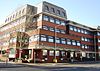
Watford is a town and borough in Hertfordshire, England, 15 mi (24 km) north-west of Central London, on the banks of the River Colne.

<span class="mw-page-title-main">Potters Bar</span> Town in Hertfordshire, England

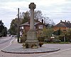
Potters Bar is a town in Hertfordshire, England, 13 miles (21 km) north of central London. In 2011, it had a population of 21,882. In the 2021 census, the four wards that make up Potters Bar - Bentley Heath & The Royds, Furzefield, Oakmere and Parkfield - had a combined population of 22,536. This includes several smaller outlying hamlets contained in the Bentley Heath & The Royds ward, such as Bentley Heath and Ganwick Corner. In 2022 the population was around 23,325.

<span class="mw-page-title-main">Rickmansworth</span> Town in Hertfordshire, England

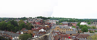
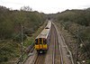
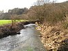
Rickmansworth is a town in southwest Hertfordshire, England, about 17 miles (27 km) northwest of central London and inside the perimeter of the M25 motorway. The town is mainly to the north of the Grand Union Canal and the River Colne. The town of Watford is 5 miles (8 km) to the northeast. Rickmansworth is the administrative seat of the Three Rivers District Council. The confluence of the River Chess and the River Gade with the Colne in Rickmansworth inspired the district's name. The enlarged Colne flows south to form a major tributary of the River Thames. The town is served by the Metropolitan line of the London Underground and Chiltern Railways from London Marylebone to Aylesbury railway station.

<span class="mw-page-title-main">Hertsmere</span> Place in England

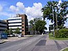
Hertsmere is a local government district with borough status in Hertfordshire, England. Its council is based in Borehamwood. Other settlements in the borough include Bushey, Elstree, Radlett and Potters Bar. The borough contains several film studios, including Elstree Studios and the BBC Elstree Centre at Borehamwood. The borough borders Three Rivers, Watford, St Albans, and Welwyn Hatfield in Hertfordshire and the three north London boroughs of Harrow, Barnet and Enfield. Hertsmere is located mainly within the M25 Motorway.

<span class="mw-page-title-main">North Hertfordshire</span> Non-metropolitan district in England

North Hertfordshire is one of ten local government districts in the county of Hertfordshire, England. Its council is based in Letchworth. The district borders East Hertfordshire, Stevenage, Welwyn Hatfield, St Albans, Central Bedfordshire, Luton, and South Cambridgeshire.

<span class="mw-page-title-main">Bushey</span> Town in Hertfordshire, England

Bushey is a town in the Hertsmere borough of Hertfordshire in the East of England. It had a population of 25,328 in the 2011 census, rising to 28,416 in the 2021 census, an increase of 12.19%. This makes Bushey the second most populated town in Hertsmere. Bushey Heath is a large neighbourhood south east of Bushey on the boundary with the London Borough of Harrow reaching elevations of 165 metres (541 ft) above sea level.

<span class="mw-page-title-main">Three Rivers District</span> Non-metropolitan district in England

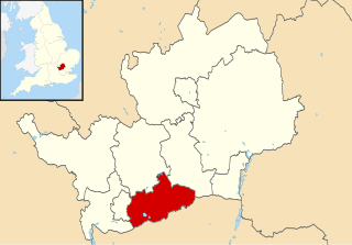
Three Rivers is a local government district in south-west Hertfordshire, England. Its council is based in Rickmansworth. The district borders Hertsmere, Watford, St Albans, Dacorum, Buckinghamshire, and the London boroughs of Hillingdon and Harrow.

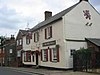
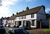
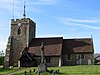
Croxley Green is both a village and a suburb of Rickmansworth in Hertfordshire, England. It is also a civil parish. Located on the A412 between Watford to the northeast and Rickmansworth to the southwest, it is approximately 20 miles (32 km) northwest of central London.

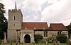
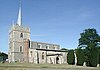
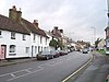
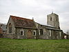
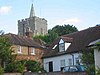
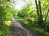
Chorleywood is both a village and a civil parish in the Three Rivers District, Hertfordshire, on the border with Buckinghamshire, approximately 20 miles (32 km) northwest of Charing Cross. The village is adjacent to the Chiltern Hills Area of Outstanding Natural Beauty and is part of the London commuter belt included in the government-defined Greater London Urban Area. Chorleywood was historically part of the parish of Rickmansworth, becoming a separate ecclesiastical parish in 1845 and a separate civil parish in 1898. The population of the parish was 11,286 at the 2011 census.

<span class="mw-page-title-main">Civil parishes in Bedfordshire</span> List of places

A civil parish is a country subdivision, forming the lowest unit of local government in England. There are 125 civil parishes in the ceremonial county of Bedfordshire, most of the county being parished: Luton is completely unparished; Central Bedfordshire is entirely parished. At the 2001 census, there were 312,301 people living in the 125 parishes, which accounted for 55.2 per cent of the county's population.

<span class="mw-page-title-main">Civil parishes in Lancashire</span>

A civil parish is a subnational entity, forming the lowest unit of local government in England. There are 219 civil parishes in the ceremonial county of Lancashire; Blackpool is completely unparished; Pendle and Ribble Valley are entirely parished. At the 2001 census, there were 587,074 people living in the 219 parishes, accounting for 41.5 per cent of the county's population.

<span class="mw-page-title-main">Civil parishes in the West Midlands (county)</span> Subnational entity

A civil parish is a subnational entity, forming the lowest unit of local government in England. There are 21 civil parishes in the ceremonial county of West Midlands, most of the county being unparished; Dudley, Sandwell, Walsall and Wolverhampton are completely unparished. At the 2001 census, there were 89,621 people living in the parishes, accounting for 3.5 per cent of the county's population.

<span class="mw-page-title-main">South West Hertfordshire (UK Parliament constituency)</span> Parliamentary constituency in the United Kingdom, 1950 onwards

South West Hertfordshire is a constituency in the House of Commons of the UK Parliament, represented since 2019 by Gagan Mohindra, a Conservative.

<span class="mw-page-title-main">Potters Bar Urban District</span>

<span class="mw-page-title-main">Broxbourne</span> Town in Hertfordshire, England

Broxbourne is a town and former civil parish, now in the unparished area of Hoddesdon, in the Borough of Broxbourne district, in Hertfordshire, England, with a population of 15,303 at the 2011 Census. It is located to the south of Hoddesdon and to the north of Cheshunt, 17 miles (27 km) north of London. The town is near the River Lea, which forms the boundary with Essex, and 5 miles (8.0 km) north of the M25 motorway. To the west of the town are Broxbourne Woods, a national nature reserve. The Prime Meridian runs just east of Broxbourne.

<span class="mw-page-title-main">Batchworth</span> Human settlement in England

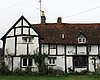
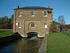
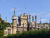
Batchworth was once a hamlet and is now a civil parish and part of Rickmansworth in Hertfordshire. The parish of Batchworth was created on 1 April 2017 consisting of two Three Rivers District Council wards: Rickmansworth Town, and Moor Park and Eastbury. The first election to Batchworth Parish Council was on 4 May 2017. There are eight councillors; four in each ward.

<span class="mw-page-title-main">Civil parishes in Cornwall</span>

A civil parish is a country subdivision, forming the lowest unit of local government in England. There are 218 civil parishes in the ceremonial county of Cornwall, which includes the Isles of Scilly. The county is effectively parished in its entirety; only the unpopulated Wolf Rock is unparished. At the 2001 census, there were 501,267 people living in the current parishes, accounting for the whole of the county's population. The final unparished areas of mainland Cornwall, around St Austell, were parished on 1 April 2009 to coincide with the structural changes to local government in England.

References

  1. "Cheshunt Urban District". A Vision of Britain Through Time. Archived from the original on 24 December 2012. Retrieved 13 April 2012.
  2. "Hoddesdon Urban District". A Vision of Britain Through Time. Archived from the original on 24 December 2012. Retrieved 13 April 2012.
  3. "Hemel Hempstead Municipal Borough". A Vision of Britain Through Time. Archived from the original on 24 December 2012. Retrieved 13 April 2012.
  4. 1 2 3 4 5 6 "Berkhamsted Rural District". A Vision of Britain Through Time. Archived from the original on 24 December 2012. Retrieved 13 April 2012.
  5. "Berkhamsted Urban District". A Vision of Britain Through Time. Retrieved 13 April 2012.[ permanent dead link ]
  6. 1 2 3 4 5 6 7 "Hemel Hempstead Rural District". A Vision of Britain Through Time. Archived from the original on 13 March 2012. Retrieved 13 April 2012.
  7. 1 2 3 4 5 "Watford Rural District". A Vision of Britain Through Time. Archived from the original on 26 April 2012. Retrieved 13 April 2012.
  8. "Tring Urban District". A Vision of Britain Through Time. Archived from the original on 15 September 2012. Retrieved 13 April 2012.
  9. 1 2 3 4 5 6 7 8 9 10 11 12 13 14 15 16 17 18 19 "Braughing Rural District". A Vision of Britain Through Time. Archived from the original on 14 May 2011. Retrieved 13 April 2012.
  10. 1 2 3 4 5 6 7 8 9 10 11 12 13 14 15 "Hertford Rural District". A Vision of Britain Through Time. Archived from the original on 14 September 2012. Retrieved 13 April 2012.
  11. "Bishop's Stortford Urban District". A Vision of Britain Through Time. Archived from the original on 24 December 2012. Retrieved 13 April 2012.
  12. 1 2 3 4 5 6 7 8 9 10 11 12 "Ware Rural District". A Vision of Britain Through Time. Archived from the original on 24 December 2012. Retrieved 13 April 2012.
  13. "Hertford Municipal Borough". A Vision of Britain Through Time. Archived from the original on 24 December 2012. Retrieved 13 April 2012.
  14. "Sawbridgeworth Urban District". A Vision of Britain Through Time. Archived from the original on 15 September 2012. Retrieved 13 April 2012.
  15. "Ware Urban District". A Vision of Britain Through Time. Archived from the original on 24 December 2012. Retrieved 13 April 2012.
  16. "Bushey Urban District". A Vision of Britain Through Time. Archived from the original on 24 December 2012. Retrieved 13 April 2012.
  17. 1 2 "Elstree Rural District". A Vision of Britain Through Time. Archived from the original on 29 June 2011. Retrieved 13 April 2012.
  18. 1 2 "Potters Bar Urban District". A Vision of Britain Through Time. Archived from the original on 18 April 2012. Retrieved 13 April 2012.
  19. 1 2 "The Hertsmere Borough Council (Reorganisation of Community Governance) Order 2022" (PDF). Local Government Boundary Commission for England. Retrieved 13 May 2023.
  20. The Hertsmere (Parish Electoral Arrangements) Order 2008
  21. 1 2 3 4 5 6 7 8 9 10 11 12 13 14 15 16 17 18 19 20 21 22 23 24 25 26 27 28 29 30 31 32 33 34 "Hitchin Rural District". A Vision of Britain Through Time. Archived from the original on 24 December 2012. Retrieved 13 April 2012.
  22. "Baldock Urban District". A Vision of Britain Through Time. Archived from the original on 14 September 2012. Retrieved 13 April 2012.
  23. "Hitchin Urban District". A Vision of Britain Through Time. Archived from the original on 15 September 2012. Retrieved 13 April 2012.
  24. "Bulletin of Changes to Local Authority Areas and Names in England" (PDF). Communities and Local Government. p. 7. Archived from the original (PDF) on 19 September 2012.
  25. "Letchworth Urban District". A Vision of Britain Through Time. Archived from the original on 18 September 2012. Retrieved 13 April 2012.
  26. The North Hertfordshire District Council (Reorganisation of Community Governance) Order 2013 (PDF). Letchworth: North Hertfordshire District Council. Retrieved 16 September 2021.
  27. "Royston Urban District". A Vision of Britain Through Time. Archived from the original on 15 September 2012. Retrieved 13 April 2012.
  28. "St Albans Municipal Borough". A Vision of Britain Through Time. Archived from the original on 24 December 2012. Retrieved 13 April 2012.
  29. 1 2 3 4 5 6 7 8 "St Albans Rural District". A Vision of Britain Through Time. Archived from the original on 24 December 2012. Retrieved 13 April 2012.
  30. "Harpenden Urban District". A Vision of Britain Through Time. Archived from the original on 17 September 2012. Retrieved 13 April 2012.
  31. "Stevenage Urban District". A Vision of Britain Through Time. Archived from the original on 25 December 2012. Retrieved 13 April 2012.
  32. 1 2 3 "Rickmansworth Urban District". A Vision of Britain Through Time. Archived from the original on 24 December 2012. Retrieved 13 April 2012.
  33. The majority of the former Rickmansworth Urban District became part of the new parish of Batchworth in 2017, but there are two discrete parcels of the former urban district which did not join Batchworth and therefore remain unparished areas. The larger unparished area covers the area around Maple Cross and Mill End, whilst the smaller unparished area covers parts of Loudwater.
  34. "Ordnance Survey Election Maps" . Retrieved 11 September 2021.
  35. "Chorleywood Urban District". A Vision of Britain Through Time. Archived from the original on 24 December 2012. Retrieved 13 April 2012.
  36. "Watford Municipal Borough". A Vision of Britain Through Time. Archived from the original on 24 December 2012. Retrieved 13 April 2012.
  37. "Welwyn Garden City Urban District". A Vision of Britain Through Time. Archived from the original on 24 December 2012. Retrieved 13 April 2012.
  38. 1 2 3 4 "Welwyn Rural District". A Vision of Britain Through Time. Archived from the original on 24 December 2012. Retrieved 13 April 2012.
  39. 1 2 3 4 "Hatfield Rural District". A Vision of Britain Through Time. Archived from the original on 24 December 2012. Retrieved 13 April 2012.