| Added | Closed | Total at end of period |
|---|
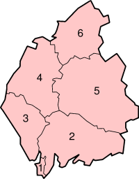
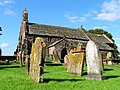
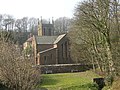
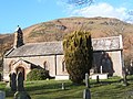
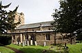
| Medieval parish churches | Addingham Old, Aikton, Appleby St Lawrence, Appleby St Michael, Arlecdon, Arthuret, Asby, Askham, Bampton, Beaumont, Beckermet St Bridget, Beckermet St John, Bewcastle, Bootle, Bowness-on-Solway, Brampton Old, Brough, Brougham St Ninian, Burgh-by-Sands, Caldbeck, Carlisle Cathedral, Carlisle St Cuthbert, Castle Carrock, Castle Sowerby, Cleator, Cliburn, Clifton, Corney, Crosby Garrett, Crosby-on-Eden, Crosby Ravensworth, Cumrew, Cumwhitton, Dalston, Drigg, Dufton, Easton, Egremont, Farlam, Gosforth, Great Musgrave, Grinsdale, Haile, Hayton, Irton, Irthington, Kirkandrews-on-Eden, Kirkandrews-on-Esk, Kirkbampton, Kirkby Stephen, Kirkby Thore, Kirkcambeck, Kirklinton, Lamplugh, Lanercost, Long Marton, Lowther, Moresby, Morland, Muncaster, Nether Denton, Newbiggin, Ormside, Orton (Cumberland), Orton (Westmorland), Ponsonby, Ravenstonedale, Rockcliffe, St Bees, Scaleby, Sebergham, Shap, Stanwix, Stapleton, Upper Denton, Waberthwaite, Walton, Warcop, Warwick, Wetheral, Whicham, Whitbeck | Addingham Old, Easton | |
|---|
| Medieval chapels | Bleatarn, Bolton, Brougham St Wilfrid, Carlisle Holy Trinity, Carlisle St Alban, Ennerdale, Eskdale St Catherine, Highhead, Linstock, Little Asby, Mallerstang, Milburn, Nether Wasdale, Raughton Head, Temple Sowerby, Westward Old, Whitehaven St Nicholas, Wreay | Carlisle Holy Trinity, Cockermouth St Helen, Cockermouth St Leonard, Ireleth St Helen, Linstock, Little Asby, Westward Old | |
|---|
| 16th century | Addingham St Michael, Mardale, Thrimby, Walney, Wasdale Head, Westward New | Brackenthwaite, Carlisle St Alban | |
|---|
| 17th century | Nicholforest, Soulby, Stainmore St Stephen, Swindale | Casterton St Columba, Great Broughton, Kirkandrews-on-Eden | |
|---|
| 18th century | Brampton New, Hensingham, Whitehaven Holy Trinity, Whitehaven St James | Applethwaite, Staveley St Margaret | |
|---|
| 1800-1830 | Carlisle Christ Church, Little Strickland | Thrimby | |
|---|
| 1830s | Carlisle Holy Trinity, Houghton | | |
|---|
| 1840s | Calder Bridge, Holme Eden, Rosley, Talkin, Upperby, Whitehaven Christ Church | | |
|---|
| 1850s | Colby, Gilsland, Murton-with-Hilton, Scotby | Wythop Old | |
|---|
| 1860s | Barrow St George, Barrow St James, Carlisle St James, Carlisle St John, Carlisle St Paul, Carlisle St Stephen, Cotehill, Frizington, Gaitsgill, Ivegill, Stainmore St Mary | | |
|---|
| 1870s | Barrow St John, Barrow St Luke, Barrow St Mark, Barrow St Matthew, Barrow St Paul, Blackford, Carlisle St Mary's Church, Cleator Moor, Cumdivock, Eamont Bridge, Great Strickland, Hethersgill, Keekle, Welton | | |
|---|
| 1880s | Bigrigg, Kirkland, Seascale, Tebay | | |
|---|
| 1890s | Barrow St Perran, Carlisle St Aidan, Carlisle St Andrew, Carlisle St Barnabas, Eskdale St Bega, Newbiggin-on-Lune, Wath Brow | | |
|---|
| 1900s | Knock, Moresby Parks | | |
|---|
| 1910s | | | |
|---|
| 1920s | Cummersdale | | |
|---|
| 1930s | Barrow St Francis, Carlisle St Herbert, Kells, Kingmoor, Thornhill | Carlisle Christ Church, Eamont Bridge, Swindale, Mardale | |
|---|
| 1940s | | Whitehaven Holy Trinity | |
|---|
| 1950s | Barrow St Aidan, Belah St Mark, Carlisle St Luke, Harraby, Mirehouse | Carlisle St Mary's Church, Colby, Kirkcambeck, Kirksanton, Swarthmoor | |
|---|
| 1960s | | Carlisle St Stephen, Uldale St John | |
|---|
| 1970s | | Appleby St Michael, Brougham St Ninian, Brampton Old, Carlisle St Paul, Gaitsgill, Highhead, Hunsonby, Ireby Old, Knock, Little Salkeld, Newton, Stainmore St Mary, Ulverston Holy Trinity, Upper Denton, Whitehaven Christ Church | |
|---|
| 1980s | | Ambleside St Anne, Blawith, Dalton St Margaret, Newbiggin-on-Lune, Vale of Lune | |
|---|
| 1990s | | Windermere St John | |
|---|
| 2000s | | Gamblesby, Grinsdale, Kendal All Hallows, Low Wray, Moresby Parks, Papcastle, Sandsfield, Sandside, Soulby | |
|---|
| 2010s | | Barrow St Luke, Barrow St Matthew, Barrow St Perran, Broughton Moor, Causewayhead, Grizebeck, Keekle, Lindale, Maryport Christ Church, Rampside, Warwick, Wath Brow, West Seaton | |
|---|
| 2020s | | Brougham St Wilfrid, Carlisle Holy Trinity, Cummersdale, Lowther, Waverton | |
|---|