
Carlisle is a city located in the Northern English county of Cumbria. It is administrated by Cumberland Council, which covers an area similar to the historic county of Cumberland.

Sutton Hoo is the site of two Anglo-Saxon cemeteries dating from the 6th to 7th centuries near Woodbridge, Suffolk, England. Archaeologists have been excavating the area since 1938, when an undisturbed ship burial containing a wealth of Anglo-Saxon artifacts was discovered. The site is important in establishing the history of the Anglo-Saxon kingdom of East Anglia as well as illuminating the Anglo-Saxons during a period which lacks historical documentation.

Tullie House Museum and Art Gallery, officially known as Tullie since July 2024, is a museum in Carlisle, England. Opened by the Carlisle Corporation in 1893, the original building is a converted Jacobean mansion, with extensions added when it was converted. At first the building contained the museum and also a library, an art school and a technical school.

The Langdale axe industry is the name given by archaeologists to a Neolithic centre of specialised stone tool production in the Great Langdale area of the English Lake District. The existence of the site, which dates from around 4,000–3,500 BC, was suggested by chance discoveries in the 1930s. More systematic investigations were undertaken by Clare Fell and others in the 1940s and 1950s, since when several field surveys of varying scope have been carried out.

The Oseberg ship is a well-preserved Viking ship discovered in a large burial mound at the Oseberg farm near Tønsberg in Vestfold county, Norway. This ship is commonly acknowledged to be among the finest artifacts to have survived from the Viking Age. The ship and some of its contents are displayed at the Viking Ship Museum at Bygdøy on the western side of Oslo, Norway.

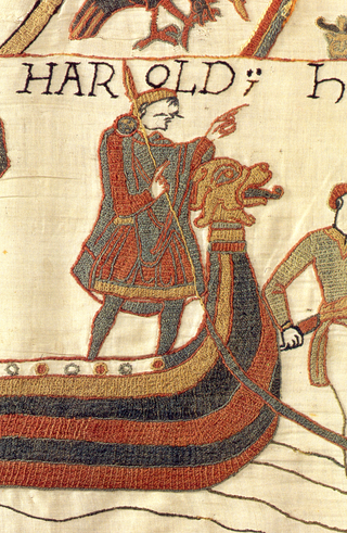
Norse funerals, or the burial customs of Viking Age North Germanic Norsemen, are known both from archaeology and from historical accounts such as the Icelandic sagas and Old Norse poetry.
Luguvalium was an ancient Roman city in northern Britain located within present-day Carlisle, Cumbria, and may have been the capital of the 4th-century province of Valentia. It was the northernmost city of the Roman Empire.

Cumwhinton is a small village in Cumbria, England. It is around one mile away from both Scotby and Wetheral, and four miles from Carlisle. The village lies in Wetheral civil parish.
Anglo-Saxon dress refers to the clothing and accessories worn by the Anglo-Saxons from the middle of the fifth century to the eleventh century. Archaeological finds in Anglo-Saxon cemeteries have provided the best source of information on Anglo-Saxon costume. It is possible to reconstruct Anglo-Saxon dress using archaeological evidence combined with Anglo-Saxon and European art, writing and literature of the period. Archaeological finds have both supported and contradicted the characteristic Anglo-Saxon costume as illustrated and described by these contemporary sources.

Martin Rundkvist is a Swedish archaeologist and associate professor at the University of Łódź in Poland. His research focuses on the Bronze, Iron, and Middle Ages of Scandinavia, including significant excavations in the province of Östergötland.

Uxelodunum was a Roman fort with associated civilian settlement (vicus) in modern-day Carlisle, Cumbria, England. It was the largest fort on Hadrian's Wall and is now buried beneath the suburb of Stanwix.

William James Blacklock was an English landscape painter, painting scenery in Cumbria, the Lake District and the Scottish Borders.

The Taplow Barrow is an early medieval burial mound in Taplow Court, an estate in the south-eastern English county of Buckinghamshire. Constructed in the seventh century, when the region was part of an Anglo-Saxon kingdom, it contained the remains of a deceased individual and their grave goods, now mostly in the British Museum. It is often referred to in archaeology as the Taplow burial.

The Crosby Garrett Helmet is a copper alloy Roman cavalry helmet dating from the late 2nd or early 3rd century AD. It was found by an unnamed metal detectorist near Crosby Garrett in Cumbria, England, in May 2010. Later investigations found that a Romano-British farming settlement had occupied the site where the helmet was discovered, which was located a few miles away from a Roman road and a Roman army fort. It is possible that the owner of the helmet was a local inhabitant who had served with the Roman cavalry.
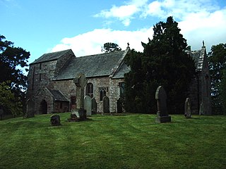
St James' Church is in the village of Great Ormside, Cumbria, England. It is an active Anglican parish church in the deanery of Appleby, the archdeaconry of Carlisle, and the diocese of Carlisle. The parish is united with nine other parishes and thirteen places of worship to form the Heart of Eden benefice. The church is recorded in the National Heritage List for England as a designated Grade I listed building. It stands on top of a circular mound overlooking the River Eden.

The Street House Anglo-Saxon cemetery is an Anglo-Saxon burial ground, dating to the second half of the 7th century AD, that was discovered at Street House Farm near Loftus, in the unitary authority of Redcar and Cleveland, England. Monuments dating back as far as 3300 BC are located in the vicinity of the cemetery, which was discovered after aerial photography revealed the existence of an Iron Age rectangular enclosure. The excavations, carried out between 2005 and 2007, revealed over a hundred graves dating from the 7th century AD and the remains of several buildings. An array of jewellery and other artefacts was found, including the jewels once worn by a young high-status Anglo-Saxon woman who had been buried on a bed and covered by an earth mound.
Burton Fleming is an Iron Age archaeological site from the Arras culture of East Yorkshire. The site is named from the parish of Burton Fleming within which the Iron Age cemetery lies, and is closely associated with the Iron Age barrows at Rudston.
Buckland Anglo-Saxon cemetery was a place of burial. It is located on Long Hill in the town of Dover in Kent, South East England. Belonging to the Anglo-Saxon period, it was part of the much wider tradition of burial in Early Anglo-Saxon England.
Welbeck Hill is the site of Roman and early Saxon pottery finds, and an Anglo-Saxon cemetery, located around 1.75 miles from Laceby, and around 3 miles from Riby, in North East Lincolnshire, England.

The Reihengräber culture is an archaeological culture that refers to the burial practice of regularly arranged, identically oriented inhumation graves between the mid-fifth and early-eighth century in central and western Europe. Existing within the Merovingian sphere of influence, the Reihengräber culture was dominant in modern Belgium, northern France and the Rhineland.


