Ponsonby, Cumbria

Last updated

Ponsonby
Ponsonby Church. - geograph.org.uk - 132001.jpg
Ponsonby Church
Location map Borough of Copeland.svg
Red pog.svg
Ponsonby
Location in Copeland Borough
Cumbria UK location map.svg
Red pog.svg
Ponsonby
Location within Cumbria
Population205  [1]
OS grid reference NY050048
Civil parish
  • Ponsonby
Unitary authority
Ceremonial county
Region
Country England
Sovereign state United Kingdom
Post town SEASCALE
Postcode district CA20
Dialling code 01946
Police Cumbria
Fire Cumbria
Ambulance North West
UK Parliament
List of places
UK
England
Cumbria
54°25′48″N3°27′50″W / 54.430°N 3.464°W / 54.430; -3.464
Historical Map of Ponsonby, Cumbria Historical Map of Ponsonby, Cumbria.jpg
Historical Map of Ponsonby, Cumbria
Storm Clouds over Sellafield - geograph.org.uk - 330062.jpg

Ponsonby is a village and civil parish in the Cumberland district of the county of Cumbria, England. Ponsonby has a church which was constructed in 1840 and had further additions in 1874. [2] Ponsonby is located along and just off the A595. It has a population of 205 according to the 2011 Census Data. [3]

Contents

Location

Ponsonby is located along the A595 and is on the edge of the Lake District National Park. [4] Ponsonby is 2.5 miles away from the next large village of Gosforth [5] and 10.9 miles away from Whitehaven [6] which is Ponsonby's nearest town.

History

In the 1870s Ponsonby was described as

"PONSONBY, a parish in Whitehaven district, Cumberland; on the river Calder, at Calder-Bridge. The manor was held, at the Norman Conquest, by the Ponsonbys, ancestors of the Earl of Bessborough, and, with P. Hall, belongs now to W. Stanley, Esq. The hall was built about 1786; containsmany old curiosities, brought from Dalegarth; and stands in a finely wooded park, with picturesque features, and commanding extensive views. A Roman camp is at P. Fell. The living is a p. curacy in the diocese of Carlisle. Value, £113.* Patron, W. Stanley, Esq. The church is ancient; and has some old stained glass, and a tower and spire; and contains monuments of the Stanleys." [7]

Just outside the village of Ponsonby is Calder Bridge, within which lies the Grade II listed Pelham House (named after Herbert Pelham, 3rd bishop of Barrow-in-Furness) but formerly known as Ponsonby Hall. It was built in 1774 and was designed by James Paine for Edward Stanley. This is currently used as offices for the Nuclear Decommissioning Authority (NDA), and before this was used as a School for Boys. [8]

Ponsonby Church

The church is located between the Village of Ponsonby and Calder Bridge [9] and is a Grade 2 listed building. [10] The church has many links to the Stanley Family who were part of the village of Ponsonby and lived in the Calderbridge during the 14th Century and the church has a number of different memorials to the family. The church can be accessed by passing the dry moat, the moat is there due to the time the Church was built. From the Church you can see Sellafield (West) and the Lakeland Fells (North-East) [11]

Population

Population time Series for Ponsonby, Cumbria between 1801 and 2011 Population time Series for Ponsonby, Cumbria between 1801 and 2011.jpg
Population time Series for Ponsonby, Cumbria between 1801 and 2011

The village's population has increased since 1801 to a figure of 205 in 2011, in 106 households, all identifying as White. [12] [13] 165 people living in Ponsonby state that they are Christian, with 1 person Buddhist, and the remainder stating no religion or did not answer the section in the Census. [14] The village is made up of 106 households, 7 do not have central heating.

Employment

Employment in 1881 Employment in 1881.jpg
Employment in 1881

The Employment graph of 1881 shows there are many more men employed in the village than women. Women were often 'Home Workers' meaning that they would do domestic duties around the home. The sector that employed the most women is the Domestic Indoor Servant, essentially meaning that they were doing domestic duties in wealthy households within the community. The male population of Ponsonby were largely employed in the agricultural sector, either being a farmer, a farmer's son or male relative or an agricultural worker. The graph shows that there are very few people employed in high paying jobs, this could be due to the lack of education within the area.[ citation needed ]

Employment in 2001 Employment in 2001.jpg
Employment in 2001

The employment graph of 2001 shows there has been an increase in the number of women employed in Ponsonby and an increase in the different sectors that people are employed in. There are a lot more people employed in 'office' jobs now compared to 1881, however agriculture is still the biggest employer. There is an increase in women working in Agriculture and Manufacturing, but males still dominate this area of work. From the graph it is apparent that there is more people travelling away from the village to work in cities where the 'office' jobs are located.[ citation needed ] There has also been an increase in the variety of Jobs that people from Ponsonby are working in, during 1881 many of the jobs were practical jobs and manual jobs, however there has now been a switch and the majority of people are working in 'office' jobs or terrestrial jobs.

See also

Related Research Articles

<span class="mw-page-title-main">A595 road</span> Road in Cumbria, England

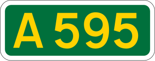
The A595 is a primary route in Cumbria, in Northern England that starts in Carlisle, passes through Whitehaven and goes close to Workington, Cockermouth and Wigton. It passes Sellafield and Ravenglass before ending at the Dalton-in-Furness by-pass, in southern Cumbria, where it joins the A590 trunk road. The road is mostly single carriageway, apart from in central Carlisle, where it passes the castle as a busy dual carriageway road named Castle Way, and prior to that as Bridge Street and Church Street, where it passes close to the McVitie's or Carr's biscuit factory. The Lillyhall bypass is also dual carriageway.

<span class="mw-page-title-main">Egremont, Cumbria</span> Town and parish in England

Egremont is a market town, civil parish and two electoral wards in Cumbria, England, and historically part of Cumberland. It is situated just outside the Lake District National Park, five miles south of Whitehaven and on the River Ehen.

<span class="mw-page-title-main">Broughton-in-Furness</span> Town in Cumbria, England

Broughton in Furness is a market town in the civil parish of Broughton West in the Westmorland and Furness district of Cumbria, England. It had a population of 529 at the 2011 Census. It is located on the south western boundary of England's Lake District National Park, and in the Furness region, which was historically part of Lancashire.

<span class="mw-page-title-main">Belstead</span> Human settlement in England

Belstead is a village and civil parish in the Babergh district of the English county of Suffolk. Located on the southern edge of Ipswich, around 3 miles (5 km) south-west of Ipswich town centre. It had a population of 202 according to the 2011 census. Belstead has amenities such as a village hall, St Mary's the Virgin Church, The bridge school for children with learning difficulties and Belstead Brook Hotel and Spa. It is in the Belstead Brook electoral division of Suffolk County Council.

<span class="mw-page-title-main">Bothel and Threapland</span> Human settlement in England

Bothel and Threapland is a civil parish in Cumbria, England, just outside the Lake District National Park. According to the 2001 census, it had a population of 438. The parish includes the villages of Bothel and Threapland. The village of Bothel is south-east of the parish of Aspatria and Threapland is south of Aspatria and Carlisle is eighteen miles (29 km) North-east of the parish. It had a population of 483 in the 2011 census figures.

<span class="mw-page-title-main">Gosforth, Cumbria</span> Village in Cumbria, England

Gosforth is a village, civil parish and electoral ward in the Lake District, in Cumberland, England. It is situated on the A595 road between Whitehaven and Barrow-in-Furness. It had a population of 1,230 at the 2001 Census. At the 2011 census Gosforth was grouped with Ponsonby and Wasdale giving a total population of 1,396.

<span class="mw-page-title-main">Seascale</span> Village in Cumbria, England

Seascale is a village and civil parish on the Irish Sea coast of Cumbria, England, historically within Cumberland. The parish had a population of 1,754 in 2011, barely decreasing by 0.4% in 2021.

<span class="mw-page-title-main">Beckermet</span> Village and civil parish in Cumbria, England

Beckermet is a village and civil parish in Cumbria, England, between Egremont and Seascale. The parish had a population of 1,619 in the 2011 census.

<span class="mw-page-title-main">Hensingham</span> Suburb of Whitehaven, Cumbria, England

Hensingham is a suburb of Whitehaven and former civil parish, now in the parish of Whitehaven, in the Cumberland district, in the ceremonial county of Cumbria, England. The ward population taken at the 2011 census was 4,145.

<span class="mw-page-title-main">Irthington</span> Village in Cumbria, England

Irthington is a village and civil parish within the Cumberland district in Cumbria, England, situated to the north-east of Carlisle Lake District Airport. The population in 2011 was 860 according to the 2011 census.

<span class="mw-page-title-main">Moor Row</span> Human settlement in England

Moor Row is a village in Cumbria, North West England. It is in Egremont civil parish and lies on a minor road off the A595, south-east of Whitehaven. In 2018 it had an estimated population of 759.

<span class="mw-page-title-main">Gilcrux</span> Village and civil parish in Cumbria, England

Gilcrux is a small village and civil parish in the ceremonial county of Cumbria, England, and historically part of Cumberland. It is situated just outside the Lake District National Park.

<span class="mw-page-title-main">Distington</span> Village in Cumbria, England

Distington is a large village and civil parish in Cumbria, England, 3 miles (4.8 km) south of Workington and 4 miles (6.4 km) north of Whitehaven. Historically a part of Cumberland, the civil parish includes the nearby settlements of Common End, Gilgarran and Pica. The parish had a population of 2,247 in the 2001 census, increasing slightly to 2,256 at the 2011 census.

<span class="mw-page-title-main">Calder Bridge</span> Human settlement in England

Calder Bridge is a small village in Cumbria in England. It is located between the hamlets of Gosforth and Beckermet and lies on the River Calder.

<span class="mw-page-title-main">Stainton (near Kendal)</span> Human settlement in England

Stainton is a village and civil parish in the Westmorland and Furness district of Cumbria, England. It is near the village of Sedgwick and 5.3 miles (8.5 km) south Kendal. Killington Reservoir runs alongside the parish of Stainton and the village is near the A590 road. In 2021 the parish had a population of 316. From 1974 to 2023 it was in South Lakeland district.

<span class="mw-page-title-main">Haile, Cumbria</span> Human settlement in England

Haile is a small village and civil parish in Cumberland district, in the county of Cumbria, England. It had a population of 617 at the 2011 census.

<span class="mw-page-title-main">Cookley, Suffolk</span> Human settlement in England

Cookley is a small village and civil parish in the East Suffolk district, in the east of the county of Suffolk, England. Nearby settlements include the town of Halesworth and the village of Walpole. The village includes the church, cottages and a farm that follows the stream which joins the Blyth River at the town of Halesworth. The church and houses are on the rising ground to the North of the stream.

<span class="mw-page-title-main">Clifford, Herefordshire</span> Village in Herefordshire, England

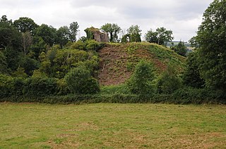
Clifford is a village and civil parish in Herefordshire, England, and 2.5 miles (4.0 km) to the north of Hay-on-Wye. It lies on the south bank of the River Wye, which here forms the border between Wales and England. The village sits on the B4350 road. The civil parish includes the hamlets of Priory Wood and Hardwicke.

<span class="mw-page-title-main">Mirehouse, Copeland</span> Human settlement in England

Mirehouse is an area and ward in the English county of Cumbria and within the boundaries of the historic county of Cumberland. Mirehouse is 1.5 miles south of the town of Whitehaven near the A595 road. Mirehouse Estate, locally colloquially known as ‘The Valley’. The West was referred to 09 side and the East as 07 side, taken from the numbers of the bus routes that served them. The ward was 5,481 at the 2021 census.

References

  1. "Ponsonby, Cumbria: Key Figures for 2011 Census: Key Statistics". Neighbourhood Statistics. Office For National Statistics. Retrieved 27 January 2015.
  2. The Cumbria Directory. "Ponsonby" . Retrieved 23 March 2015.{{cite web}}: |last1= has generic name (help)
  3. "Ponsonby, Cumbria: Key Figures for 2011 Census: Key Statistics". Neighbourhood Statistics. Office For National Statistics. Retrieved 27 January 2015.
  4. Ordnance Survey. "Ponsonby Data" . Retrieved 26 March 2015.
  5. Google Maps. "Ponsonby" . Retrieved 26 March 2015.{{cite web}}: |last1= has generic name (help)
  6. Google Maps. "Ponsonby" . Retrieved 26 March 2015.{{cite web}}: |last1= has generic name (help)
  7. Wilson, John Marius (1870). Imperial Gazetteer of England and Wales. A. Fullerton & Co. Retrieved 27 January 2015.
  8. Visit Cumbria. "Calder Bridge". Visit Cumbria. Retrieved 12 March 2015.
  9. The Cumbria Directory. "Ponsonby" . Retrieved 23 March 2015.{{cite web}}: |last1= has generic name (help)
  10. British Listed Buildings. "Ponsonby Church" . Retrieved 23 March 2015.
  11. Visit Cumbria. "Ponsonby Church" . Retrieved 23 March 2015.
  12. Office for National Statistics. "Ethnic Group 2011" . Retrieved 4 April 2015.
  13. Office for National Statistics. "Central Heating 2011" . Retrieved 4 April 2015.
  14. Office for National Statistics. "Religion 2011" . Retrieved 4 April 2015.

Commons-logo.svg Media related to Ponsonby, Cumbria at Wikimedia Commons