South Lakeland was a local government district in Cumbria, England, from 1974 to 2023. Its council was based in Kendal. The district covered the southern part of the Lake District region, as well as northwestern parts of the Yorkshire Dales. At the 2011 Census, the population of the district was 103,658, an increase from 102,301 at the 2001 Census.
The City of Lancaster, or simply Lancaster, is a local government district with city status in Lancashire, England. It is named after its largest settlement, Lancaster, and also includes the towns of Carnforth, Heysham and Morecambe and a wider rural hinterland. The district has a population of 144,446 (2022), and an area of 219 square miles (567 km2).

Corwen is a town and community in the county of Denbighshire in Wales. Historically, Corwen was part of the county of Merionethshire. Corwen stands on the banks of the River Dee beneath the Berwyn mountains. The town is situated 10 miles (16 km) west of Llangollen and 13 miles (21 km) south of Ruthin. At the 2011 Census, Corwen had a population of 2,325, decreasing slightly from the 2001 population of 2,398, The community, with an area of 69.51 km2 (26.84 sq mi), includes Corwen and the surrounding villages of Carrog, Clawdd Poncen and Glyndyfrdwy. The Office for National Statistics identifies Corwen Built-up area with a 2011 population of 477 and an area of 0.25 km2 (0.097 sq mi).
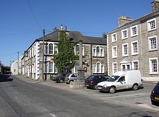
Burton-in-Kendal is a village and civil parish on the extreme southern edge of Cumbria, England. The parish contains around 660 houses and in the 2001 census had a population of 1,411, increasing at the 2011 census to 1,497. Historically within the county of Westmorland, the village straddles the A6070 road between Crooklands and Carnforth, at a point around midway between Lancaster and Kendal, and is in the shadow of the nearby limestone outcrop known as Farleton Knott.

The Borough of Burnley is a local government district with the borough status in Lancashire, England. It has an area of 42.9 square miles (111 km2) and a population of 95,553 (2022), and is named after its largest town, Burnley. The borough also contains the town of Padiham along with several villages and surrounding rural areas.
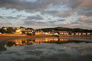
Arnside is a village and civil parish in Westmorland and Furness, Cumbria, England. It is historically part of Westmorland, near the border with Lancashire, England. The Lake District National Park is located a few miles north. Travelling by road, Arnside is 10 miles (16 km) to the south of Kendal, 25.3 miles (40.7 km) to the east of Ulverston, 35.2 miles (56.6 km) to the east of Barrow-in-Furness, 13 miles (21 km) to the north of Lancaster and 14.3 miles (23.0 km) to the east of Grange-over-Sands. In the 2001 census the parish had a population of 2,301, increasing at the 2011 census to 2,334.

A civil parish in England is the lowest unit of local government. There are 284 civil parishes in the ceremonial county of Cumbria, with most of the county being parished. At the 2001 census, there were 359,692 people living in those 284 parishes, accounting for 73.8 per cent of the county's population.

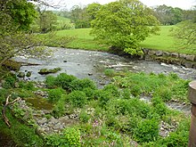
Lakes is a civil parish in the Westmorland and Furness district, in the ceremonial county of Cumbria, England. In the 2001 census the parish had a population of 5,127, decreasing at the 2011 census to 4,420. It covers the town of Ambleside, and the villages and hamlets of Clappersgate, Rydal, Grasmere, Troutbeck, Chapel Stile, Elterwater, Little Langdale and Waterhead.

Underbarrow is a small village in Cumbria, England, located 3 miles (4.8 km) west of Kendal. The village is in the Lake District National Park. It is in the civil parish of Underbarrow and Bradleyfield, in Westmorland and Furness district, and has a parish council. In the 2001 census Underbarrow and Bradleyfield had a population of 351, decreasing at the 2011 census to 330.

Briercliffe is a civil parish in the borough of Burnley, in Lancashire, England. It is situated 3 miles (4.8 km) north of Burnley. The parish contains suburbs of Burnley, and the rural area north east of the town. Hamlets in the parish include Cockden, Lane Bottom and in the Extwistle area, the tiny hamlet of Roggerham. According to the United Kingdom Census 2011, the parish has a population of 4,031.

Habergham Eaves is a civil parish in the borough of Burnley, in Lancashire, England. The parish consists of a rural area south of Burnley, and suburban areas on the outskirts of the town, including a large industrial estate in the north-west corner of the parish. Habergham is also the name of an area west of Burnley, although it is no longer within the parish. According to the United Kingdom Census 2011, the parish has a population of 1,466.

Worsthorne-with-Hurstwood is a civil parish in the Borough of Burnley, in Lancashire, England. Situated on the eastern outskirts of Burnley, in 2011 it had a population of 2,963.

Skelsmergh is a small village and former civil parish, now in the parish of Skelsmergh and Scalthwaiterigg, in Westmorland and Furness in rural Cumbria, England, about 4 miles (6.4 km) north of Kendal, on the A6 road.

Staveley-in-Cartmel is a village and civil parish in Westmorland and Furness Unitary Authority, Cumbria, England. It lies east of Newby Bridge, near the south end of Windermere, 9 miles (14 km) northeast of Ulverston. It is sometimes known as Staveley-in-Furness. Both names distinguish it from another Staveley in Cumbria. In the 2001 census the parish had a population of 428, decreasing at the 2011 census to 405.

Lathom South is a civil parish in the West Lancashire district of Lancashire, England, situated near the towns of Ormskirk and Skelmersdale. The parish council was established in 2007, and the area, which includes the hamlets of Blaguegate and Scarth Hill, has historical ties to the neighbouring parish of Lathom. As of 2011, Lathom South has a population of 657.

Old Hutton is a village in South Lakeland, Cumbria, England. It is in the civil parish of Old Hutton and Holmescales In the 2001 census the parish had a population of 357, increasing at the 2011 census to 417.

Scalthwaiterigg is a former civil parish, now in the parish of Skelsmergh and Scalthwaiterigg, in the Westmorland and Furness district, in the ceremonial county of Cumbria, England, immediately north east of Kendal. It previously had a joint parish council with the adjacent parish of Skelsmergh. In 2001 it had a population of 104.
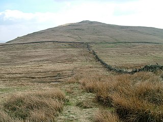
Whinfell is a civil parish in Westmorland and Furness, Cumbria, England. It does not have a parish council but a parish meeting. The parish lies north east of Kendal, between the A6 and the A685. The neighbouring parishes are Grayrigg to the east, Docker to the south, Skelsmergh to the south west, Selside and Fawcett Forest to the west, and Tebay to the north.

Whitwell and Selside is a former civil parish, now part of the parish of Selside and Fawcett Forest, in the Westmorland and Furness district, in the ceremonial county of Cumbria, England. It did not have a parish council but a parish meeting. The neighbouring parishes were Whinfell to the east, Skelsmergh and Strickland Roger to the south west, Kentmere and Longsleddale to the west and Shap Rural to the north. The main settlement was the village of Selside.