Shap Rural

Last updated

Shap Rural
Civil parish
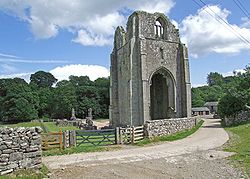
Shap Rural - Shap Abbey.jpg
Cumbria UK location map.svg
Red pog.svg
Shap Rural
Location within Cumbria
Population130 (2011) [1]
OS grid reference NY5415
District
Shire county
Region
Country England
Sovereign state United Kingdom
Post town PENRITH
Postcode district CA10
Dialling code 01931
Police Cumbria
Fire Cumbria
Ambulance North West
UK Parliament
List of places
UK
England
Cumbria
54°30′07″N2°43′16″W / 54.502°N 2.721°W / 54.502; -2.721

Shap Rural is a very large, but sparsely populated, civil parish in the Eden district of Cumbria in England, covering part of the Lake District National Park. It had a population of 119 in 2001, [2] 130 at the 2011 Census, [1] and 110 in 2021. [3]

Contents

Within the parish are the hamlets and settlements of Wet Sleddale, Hardendale and Swindale, most of the Shap Fells range and the reservoirs of Haweswater (part) and Wet Sleddale. The village of Mardale Green, which disappeared when Haweswater was converted into a reservoir in the 1930s, was in the parish.

The parish was created in 1904 with the splitting of the former civil parish of Shap into urban and rural parts. [4] Shap Urban, (since 1935 just Shap), was administered by an urban district council from 1905 to 1935. [5] Shap and Shap Rural today have a joint parish council.

Major landowners in the parish are the Lowther Family Estates and United Utilities.

Junction 39 of the M6 motorway lies within the parish.

Shapbeck Limestone quarry owned by Hanson plc is in the northern part of the parish though the Hardendale Corus limestone quarry and works and the famous Cemex (formerly RMC) Shap Granite quarries and works are within both Shap Rural and Shap parishes.

The cottage owned by Uncle Monty in the cult 1986 film Withnail & I is located by the reservoir at Wet Sleddale. [6]

See also

Related Research Articles

<span class="mw-page-title-main">Eden District</span> Former local government district in England

Eden was a local government district in Cumbria, England, based at Penrith Town Hall in Penrith. It was named after the River Eden, which flows north through the district toward Carlisle. Its population of 49,777 at the 2001 census, increased to 52,564 at the 2011 Census. A 2019 estimate was 53,253. In July 2021 it was announced that, in April 2023, Cumbria would be divided into two unitary authorities. On 1 April 2023, Eden District Council was abolished and its functions transferred to the new authority Westmorland and Furness, which also covers the former districts of Barrow-in-Furness and South Lakeland.

<span class="mw-page-title-main">Longsleddale</span> Valley and civil parish in Cumbria, England

Longsleddale is a valley and civil parish in the South Lakeland district of Cumbria, England. It includes the hamlet of Sadgill. The parish has a population of 73. As the population taken at the 2011 Census was less than 100, details are maintained in the civil parish of Whitwell and Selside.

<span class="mw-page-title-main">Orton, Westmorland and Furness</span> Village in Cumbria, England

Orton is a village and civil parish in Cumbria, England. It lies 15 miles (24 km) south of Penrith, 8 miles (13 km) from Appleby-in-Westmorland and 1.5 miles (2.4 km) from the M6 motorway. The village is in the upper Lune Valley, at the foot of Orton Scar in the Orton Fells. The Lake District is nearby. The parish includes a wide area outside the village, and had a population of 594 in 2001, decreasing to 588 at the 2011 Census.

<span class="mw-page-title-main">Shap</span> Village and civil parish in Cumbria, England

Shap is a village and civil parish located among fells and isolated dales in Westmorland and Furness, Cumbria, England. The village is in the historic county of Westmorland. The parish had a population of 1,221 in 2001, increasing slightly to 1,264 at the 2011 Census.

<span class="mw-page-title-main">Tebay</span> Human settlement in England

Tebay is a village and civil parish in Cumbria, England, within the historic borders of Westmorland. It lies in the upper Lune Valley, at the head of the Lune Gorge. The parish had a population of 728 in the 2001 census, increasing to 776 at the Census 2011.

<span class="mw-page-title-main">Lakes, Cumbria</span> Civil parish in England

Lakes is a civil parish in the Westmorland and Furness district, in the ceremonial county of Cumbria, England. In the 2001 census the parish had a population of 5,127, decreasing at the 2011 census to 4,420. It covers the town of Ambleside, and the villages and hamlets of Clappersgate, Rydal, Grasmere, Troutbeck, Chapel Stile, Elterwater, Little Langdale and Waterhead.

<span class="mw-page-title-main">Arlecdon and Frizington</span> Human settlement in England

Arlecdon and Frizington is a civil parish in the Borough of Copeland in Cumbria, England. The parish had a population of 3,678 in the 2001 census, decreasing to 3,607 at the 2011 census.

<span class="mw-page-title-main">Bampton, Cumbria</span> Village and parish in England

Bampton is a village and civil parish in the Westmorland and Furness unitary authority area of Cumbria, England, on the edge of the Lake District National Park. It is in the historic county of Westmorland. The parish had a population of 283 according to the 2001 census. In the 2011 census Bampton was grouped with Martindale to give a total of 373. The parish includes the villages of Bampton, Bampton Grange and Bomby.

<span class="mw-page-title-main">Lowther, Cumbria</span> Human settlement in England

Lowther is a civil parish in Westmorland and Furness, Cumbria. Within the parish are the settlements of Lowther Village, Newtown or Lowther Newtown, Hackthorpe, Whale, and Melkinthorpe. At the 2001 census the parish had a population of 402, increasing to 465 at the 2011 Census.

<span class="mw-page-title-main">Warton, Lancaster</span> Human settlement in England

Warton is a village, civil parish and electoral ward in the City of Lancaster in north Lancashire in the north-west of England, close to the boundary with Cumbria, with a population of around 2,000, measured at the 2011 Census to be 2,360. It is a village steeped in history; its earliest recording as a settlement is made in Domesday Book written in 1086. The nearest town to Warton is Carnforth, which was originally part of Warton parish. It has connections to the first President of the United States, George Washington: Washington's ancestor of seven generations, Lawrence Washington, is rumoured to have helped build the village church of St Oswald. The parish covers an area in excess of 11,000 acres (45 km2) and is predominantly rural. The parish of Warton had a population of 2,315 recorded in the 2001 census, and 2,360 in the 2011 census.

<span class="mw-page-title-main">River Lowther</span> River in Cumbria, England

The River Lowther is a small river which flows through limestone rock in Cumbria, England. It is a tributary of the River Eamont which in turn is a tributary of the River Eden which flows into the Solway Firth near Carlisle. The Lowther begins with the confluence of the Keld Gill and the Keld Dub near the village of Keld. It flows north-west until it passes between Bampton and Bampton Grange, before turning north until it flows into the River Eamont close to Penrith.

<span class="mw-page-title-main">Crosby Ravensworth</span> Human settlement in England

Crosby Ravensworth is a village and civil parish in the Eden district of Cumbria, England. The village is about 4 miles (6.4 km) east of the M6 motorway, and Shap. At the 2001 census the parish had a population of 538, decreasing to 517 at the 2011 Census.

<span class="mw-page-title-main">Sleddale Hall</span> Farmhouse in Cumbria, England, seen in Withnail and I.

Sleddale Hall is a farmhouse on the north side of the Wet Sleddale valley near Shap in Cumbria, England. It featured as "Crow Crag", Uncle Monty's Lake District country cottage in the cult film Withnail and I.

<span class="mw-page-title-main">Meathop and Ulpha</span> Human settlement in England

Meathop and Ulpha is a former civil parish, now in the parish of Witherslack, Meathop and Ulpha, in the South Lakeland district of the English county of Cumbria. Historically in Westmorland, it is located 3.6 miles (5.8 km) north east of Grange-over-Sands, 10.6 miles (17.1 km) south west of Kendal and 64.0 miles (103.0 km) south of Carlisle, between the confluence of the River Kent estuary and the River Winster. In 2001 it had a population of 143, increasing slightly to 154 at the Census 2011. It included the village of Meathop.

<span class="mw-page-title-main">Milton Keynes urban area</span> Settlement in Buckinghamshire, England

The Milton Keynes urban area or Milton Keynes Built-up Area is a designation established by the United Kingdom's Office for National Statistics. Milton Keynes has no statutory boundary: the 1967 designated area only determined the area assigned to the Milton Keynes Development Corporation for development. The wider urban area outside that designation includes Newport Pagnell and Woburn Sands as well as Aspley Guise (Bedfordshire) and part of Stoke Hammond civil parish.

<span class="mw-page-title-main">Morland, Cumbria</span> Village and civil parish in Cumbria, England

Morland is a village and civil parish in the rolling hills of the Eden Valley in the Eden District of Cumbria, England. It lies within the historic county of Westmorland. The parish includes the hamlets of Town Head and Morland Moor, and had a population of 380 in 2001, reducing marginally to 374 at the 2011 Census.

<span class="mw-page-title-main">Wet Sleddale Reservoir</span> Reservoir in Shap, Cumbria

Wet Sleddale Reservoir is an artificial reservoir set amongst the Shap Fells 4 kilometres (2 mi) south of the village of Shap in Cumbria, England, and lies just within the boundary of the Lake District National Park. The triangular shaped reservoir, which can store 2,300 million litres of water, was created by the construction of a dam across Sleddale Beck in order to supply Manchester with water. The dam is 21m high and 600m long.

<span class="mw-page-title-main">Wet Sleddale Horseshoe</span>

The Wet Sleddale Horseshoe is an upland area in the English Lake District, around the Wet Sleddale Reservoir, Cumbria. It is the subject of a chapter of Wainwright's book The Outlying Fells of Lakeland. His walk starts at the reservoir dam and follows a clockwise circuit over Sleddale Pike at 1,659 feet (506 m), Great Saddle Crag at 1,850 feet (560 m) and Ulthwaite Rigg at 1,648 feet (502 m).

<span class="mw-page-title-main">Whitwell and Selside</span> Human settlement in England

Whitwell and Selside is a former civil parish, now part of the parish of Selside and Fawcett Forest, in the Westmorland and Furness district, in the ceremonial county of Cumbria, England. It did not have a parish council but a parish meeting. The neighbouring parishes were Whinfell to the east, Skelsmergh and Strickland Roger to the south west, Kentmere and Longsleddale to the west and Shap Rural to the north. The main settlement was the village of Selside.

Shap Rural is a civil parish in the Eden District, Cumbria, England. It contains eleven listed buildings that are recorded in the National Heritage List for England. All the listed buildings are designated at Grade II, the lowest of the three grades, which is applied to "buildings of national importance and special interest". The parish is almost entirely rural, and the listed buildings consist of farm houses and farm buildings, three bridges, a lime kiln, and a monument.

References

  1. 1 2 UK Census (2011). "Local Area Report – Shap Rural Parish (E04002569)". Nomis. Office for National Statistics . Retrieved 20 April 2021.
  2. UK Census (2001). "Local Area Report – Shap Rural Parish (16UF060)". Nomis. Office for National Statistics . Retrieved 20 April 2021.
  3. "Shap Rural custom area profile". ONS. Retrieved 4 March 2024.
  4. "West Ward Registration District". UKBMD. Retrieved 12 January 2022.
  5. "Relationships and changes Shap UD through time". A Vision of Britain through Time. Retrieved 6 November 2022.
  6. Tyzack, Anna (21 January 2009). "Withnail's 'Horrible little shack' under the hammer". London: Telegraph.co.uk. Archived from the original on 23 January 2009. Retrieved 27 September 2011.