Aspatria

Last updated • 9 min readFrom Wikipedia, The Free Encyclopedia

Aspatria
St Kentigern's Church, Aspatria.jpg
St Kentigern's Church
Location map United Kingdom Allerdale.svg
Red pog.svg
Aspatria
Location in Allerdale
Cumbria UK location map.svg
Red pog.svg
Aspatria
Location within Cumbria
Population2,834 (2011) [1]
OS grid reference NY145417
Civil parish
  • Aspatria
Unitary authority
Ceremonial county
Region
Country England
Sovereign state United Kingdom
Post town WIGTON
Postcode district CA7
Dialling code 016973
Police Cumbria
Fire Cumbria
Ambulance North West
UK Parliament
List of places
UK
England
Cumbria
54°45′48″N3°19′41″W / 54.7633°N 3.3281°W / 54.7633; -3.3281

Aspatria /əsˈptriə/ [2] is a town and civil parish in Cumberland, Cumbria, England. The town rests on the north side of the Ellen Valley, overlooking a panoramic view of the countryside, with Skiddaw to the South and the Solway Firth to the North. Its developments are aligned approximately east–west along the A596 Carlisle to Workington road and these extend to approximately 2 miles (3.2 km) in length. It lies about 8 miles (13 km) northeast of Maryport, a similar distance to the Southwest of Wigton, about 9 miles (14 km) north of Cockermouth and 5 miles (8.0 km) from the coast and Allonby. It comprises the townships of Aspatria and Brayton, Hayton and Mealo, and Oughterside and Allerby, the united area being 8,345 acres (3,377 ha); while the town takes up an area of 1,600 acres (647 ha). In earlier days a Roman road leading from "Old Carlisle" to Ellenborough passed through the hamlet.

Contents

The population has greatly increased since the mid-19th century. In 1801, the village comprised 98 dwellings with a population of 321. By 1851, there were 236 family entities, comprising 1,123 residents; by 1871, the numbers had increased to 1,778; and twenty years later stood at 2,714. By the start of the 20th century, the population had risen to 2,885; twenty years later it peaked at 3,521. Although the population slumped in the 1930s to 3,189, it recovered to 3,500, in 1951; and by 1981, the population appeared stable at 2,745. It is served by Aspatria railway station. Aspatria is located on the fringe of the English Lake District.

The parish church of St Kentigern was completed in 1848. Fragments of masonry and crosses from earlier structures on the same site are preserved there.

History

Pre Norman

Aspatria is an ancient settlement and seems to have been home to a group of Norsemen who fled to the area from Ireland around 900. In 1789, a surgeon by the name of Rigg employed a group of labourers to level a mound called Beacon Hill, situated close behind his house at Aspatria. After reaching a depth of about one metre they dug into a cavity walled around with large stones and found the skeleton of a Viking chief. At the head of the skeleton lay a sword almost five feet in length, with a remarkably broad blade, ornamented with a gold and silver handle. The scabbard of the sword was made of wood, lined with cloth. The workmen also unearthed several pieces of armour, a dirk with a silver studded handle, a golden buckled belt, and a breast plate. The artefacts remain the property of the British Museum. [3] Further finds were made on the same site in 1997 when a mobile phone mast was being constructed. [4]

002 Aspatria Viking finds 002 Aspatria Viking finds.jpg
002 Aspatria Viking finds

The Manor

The manor of Aspatria is part of the ancient barony of Allerdale below Derwent. Awarded by Ranulph de Meschines, grantee of the whole of Cumberland from William the Conqueror, to Waltheof, son of Gospatrick, Earl of Dunbar, from whom the obsolete name of Aspatrick, may have been derived. Upon the division of the estates of William Fitz Duncan, and his wife Alice de Romney, among their three daughters, the manor passed to Alice, the youngest. However, Alice died without issue and the estates passed to an elder sister who had married into the Lucy family. The latter family terminated in a female heir Maud de Lucy. She married Henry Percy, the first Earl of Northumberland, who received the whole of her estates. It remained in this family through eleven generations before passing by the marriage of Lady Elizabeth, sole daughter and heiress of Josceline Percy to Charles Seymour, sixth Earl of Somerset. In recent times it again passed by a female heir to the Wyndham family, from whom it has descended to Lord Leconfield and now Lord Egremont. [5]

The village stands at the northern end of the West Cumberland Coalfield and there have been mines in the area since the 16th century. The opening of the Maryport and Carlisle Railway, in 1842, led to a rapid expansion of the industry. The Brayton Domain Collieries sank five different pits around the town at various times and there were also mines near Mealsgate, Baggrow and Fletchertown. In 1902, a new mine was sunk at Oughterside. The last pit in the town, Brayton Domain No.5, closed in 1940. [6]

In 1870, one of England's first farmers' co-operatives, the Aspatria Agricultural Cooperative Society was established here with offices in the market square, facing the Aspatria Agricultural College which flourished from 1874 until 1925. [7]

Sir Wilfrid Lawson MP (1829–1906) lived at Brayton Hall just outside the town. He was a committed nonconformist and a leader of the Temperance Movement. His memorial stands in the market square, topped by a bronze effigy of St George slaying the dragon – said to represent the demon drink. [7] Brayton Hall was destroyed by fire in 1918. [8]

Toponymy

According to one source, the origins of the name of Aspatria lie in Old Scandinavian and Celtic. It translates as "Ash-tree of St Patrick", and is composed of the elements askr (Old Scandinavian for "ash-tree") and the Celtic saint's name. The order of the elements of the name, with the ash-tree coming before the name of the saint, is particular to Celtic place-names. [9] The following forms of the name have been found in various charters:- Estpatrick in 1224, Asepatrick 1230, Aspatric 1233, Askpatrik 1291, Assepatrick 1303, Aspatrick 1357, Aspatre 1491. [10] The first entry in the parish register referring to the town as Aspatria in preference to the name Aspatrick or Aspatricke appears in 1712. It appears in the handwriting of the then vicar David Bell. [11] For the next fifty years the spelling fluctuated until eventually Aspatria became the dominant name. When Charles Dickens and Wilkie Collins passed through the town in 1857 they referred to the name Spatter which is not too dissimilar to 'Speatrie' the name locals prefer. [12] William Brough, a railway porter, discharging third class passengers after their arrival at Aspatria from the Bolton Loop railway connection would cry 'Speatrie Loup Oot'. Second class passengers would detect "Speatrie change ere for Measyat", while first class passengers heard a polite invitation, "Aspatriah, change heah for Mealsgate." [13]

There is a legend that the name comes from the ash tree that grew when St. Patrick's staff, the Bachal Isu, took root in the ground because it took so long for him to manage to convert the people from this area to Christianity. [14]

Governance

The town is in the parliamentary constituency of Penrith and Solway, and is represented by Markus Campbell-Savours of the Labour Party since the 2024 general election. In the December 2019 general election, the Tory candidate for Workington, Mark Jenkinson, was elected the MP, overturning a 9.4 per cent Labour majority from the 2017 election to eject shadow environment secretary Sue Hayman by a margin of 4,136 votes. [15] Until the December 2019 general election the Labour Party had won the seat in the constituency in every general election since 1979. The Conservative Party had previously only been elected once in Workington since World War II, at the 1976 by-election. [16]

Prior to Brexit for the European Parliament residents in Aspatria voted to elect MEPs for the North West England constituency.

An electoral ward exists with the same name. This ward stretches east to Allhallows with a total population taken at the 2011 Census of 3,380. [17]

Religious worship

Prior to the opening of the Brayton Domain Collieries the people of Aspatria had two places of worship, the long established Anglican parish church of St. Kentigern's and a non-conformist chapel of the Congregationalist persuasion, built by Sir Wilfrid Lawson, in 1826. The latter is now a café with dwelling behind. However, with the influx of new workers came a demand for new institutions. In 1864, the Primitive Methodists built a chapel in the lower end of Lawson Street. Twenty years later, to cater for their expanding congregation they built a new chapel, with adjoining manse for the minister, at the junction of Queen Street and Brayton Road, while retaining the original building for use as a Sunday school. In the 1980s they sold the property, which the new owner demolished and replaced with a private house. In 1874, a group of Bible Christians, originally from Cornwall built a chapel at the bottom of Richmond Hill. This is also now the site of a private house. The Wesleyan Methodists built their first chapel on the corner of North Road and Queen Street in 1898. This proved too small and was replaced by the existing building in 1921. Although the small numbers of Roman Catholics have had a variety of meeting places over the years, they have never built a church. [18]

Education

There are two primary schools in the town: Oughterside Primary School [19] and Richmond Hill School. [20]

Beacon Hill Community School is a secondary school in Aspatria. The school serves the town and neighbouring villages. [21]

Neighbouring parishes

The parish is bounded on the North by the parishes of Bromfield and Westnewton; on the West by Gilcrux and Crosscanonby; on the South by Plumbland and Torpenhow; and on the East by Bromfield and Allhallows.

Industry

There is a small industrial area next to the railway station where:-

Media

Local news and television programmes are provided by BBC North East and Cumbria and ITV Border. Television signals are received from the Caldbeck TV transmitter. [25] Local radio stations are BBC Radio Cumbria on 94.7 FM and Greatest Hits Radio Cumbria & South West Scotland on 96.4 FM. The town is served by the local newspaper, News and Star . [26]

Sport

Aspatria Hornets are the local rugby league team. Aspatria is also home to rugby union club Aspatria RUFC, currently playing in the RFU's North Lancashire/Cumbria Division. The 'Aspatria Eagles' are the club's second team, and the 'Aspatria Sinners' are the women's team. Aspatria FC are the town's football club who compete in the Tesco Cumberland County Premier League.

Notable people

See also

Related Research Articles

<span class="mw-page-title-main">Workington</span> Coastal town in Cumbria, England

Workington is a coastal town and civil parish at the mouth of the River Derwent on the west coast in Cumbria, England. At the 2011 census it had a population of 25,207.

<span class="mw-page-title-main">Cockermouth</span> Town in Cumbria, England

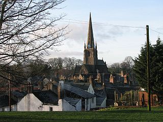
Cockermouth is a market town and civil parish in the Cumberland unitary authority area of Cumbria, England, so named because it is at the confluence of the River Cocker as it flows into the River Derwent. The mid-2010 census estimates state that Cockermouth has a population of 8,204, increasing to 8,761 at the 2011 Census.

<span class="mw-page-title-main">Allerdale</span> Former non-metropolitan district in England

Allerdale was a non-metropolitan district of Cumbria, England, with borough status. Its council – Allerdale Borough Council – was based in Workington, and the borough had a population of 96,422 at the 2011 census.

<span class="mw-page-title-main">Maryport</span> Town in Cumbria, England

Maryport is a town and civil parish in the Cumberland district, in the ceremonial county of Cumbria, England. In 2011 the parish had a population of 11,262.

<span class="mw-page-title-main">Maryport and Carlisle Railway</span> United Kingdom legislation

The Maryport & Carlisle Railway (M&CR) was an English railway company formed in 1836 which built and operated a small but eventually highly profitable railway to connect Maryport and Carlisle in Cumberland, England. There were many small collieries in the area and efficient access to the harbour at Maryport was important.

<span class="mw-page-title-main">Bromfield, Cumbria</span> Village and civil parish in England

Bromfield is a village and civil parish in Cumbria, in the north of England.

<span class="mw-page-title-main">Broughton Moor</span> Village in Cumbria, England

Broughton Moor is a village and civil parish in Cumbria, England. It is situated on an extensive moor about 2 miles (3.2 km) north of Broughton, 5 miles (8.0 km) north west of Cockermouth, 2.5 miles (4.0 km) south of Maryport and 4.5 miles (7.2 km) north of Workington.

<span class="mw-page-title-main">Greysouthen</span> Village in Cumbria, England

Greysouthen is a village and civil parish between the towns of Workington and Cockermouth, in Cumbria, North West England, historically part of Cumberland, near the Lake District National Park. The village has an historic association with coal mining.

<span class="mw-page-title-main">Flimby</span> Coastal village in Cumbria, England

Flimby is a coastal village and former civil parish, now in the parish of Maryport, in the Cumberland district, in the ceremonial county of Cumbria, England. It was historically in Cumberland. It is included in the Maryport South county division of Cumbria County Council. In 1951 the parish had a population of 2066.

<span class="mw-page-title-main">Baggrow</span> Human settlement in England

Baggrow is a small village situated north of the Lake District National Park in the English county of Cumbria, historically within Cumberland.

<span class="mw-page-title-main">Mealsgate</span> Village in Cumbria, England

Mealsgate is a village in Cumbria, England, historically within Cumberland.

<span class="mw-page-title-main">Dearham</span> Village in Cumbria, England

Dearham is a village and civil parish in Cumbria, historically part of Cumberland, near the Lake District National Park in England. It lies about 2 miles (3.2 km) east of Maryport and 5 miles (8.0 km) west of Cockermouth.

<span class="mw-page-title-main">Harriston, Cumbria</span> Human settlement in England

Harriston is a small hamlet in Cumbria, England, consisting of approximately 100 houses.

<span class="mw-page-title-main">Crosby Villa</span> A village in Cumbria, England

Crosby Villa is a hamlet in the civil parish of Crosscanonby in Cumbria, United Kingdom. It is located on the A596 road, 3.75 miles (6.04 km) north-east of Maryport and 3.75 miles (6.04 km) south-west of Aspatria. The village of Crosby is 1.5 miles (2.4 km) to the south-west, and the hamlet of Oughterside is 2.25 miles (3.62 km) to the north-east. Cumbria's county town, Carlisle, is 24 miles (39 km) to the north-east.

<span class="mw-page-title-main">Brayton Hall</span>

Brayton Hall is a ruined former mansion in Cumbria, England. Once the ancestral seat of the Lawson family, it stood in a large park, with views of the surrounding countryside and the mountains of the Lake District in the background. Located 1.5 miles east by north of the town of Aspatria, and 7 miles south west by west of the market town of Wigton, it was greatly enlarged and rebuilt in 1868. Brayton Hall was practically destroyed by fire in 1918.

<span class="mw-page-title-main">St James' Church, Hayton</span>

St James Church, Hayton, Cumbria is an active Anglican parish church in the deanery of Solway, the archdeaconry of West Cumberland and the diocese of Carlisle. The church dates from the 19th century.

Mealsgate railway station was in the former county of Cumberland, now Cumbria, England. It was a stop on the Bolton Loop of the Maryport and Carlisle Railway.

<span class="mw-page-title-main">Oughterside and Allerby</span>

Oughterside and Allerby is a civil parish in Allerdale district, Cumbria, England. In the 2011 census it had a population of 619. The north western boundary of the parish is a short stretch of coast, then, working clockwise, the parish is bordered by Hayton and Mealo to the north, Aspatria to the north east, Plumbland to the south east, Gilcrux to the south and Crosscanonby to the south west. The A596 road from Aspatria to Maryport passes through the parish, and the B5300 road follows its coastline in the north west. The main settlements in the parish are Allerby in the west and Oughterside and Prospect, in the east.

<span class="mw-page-title-main">Cumberland (unitary authority)</span> District in Cumbria, England

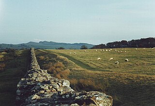
Cumberland is a unitary authority area in Cumbria, England, which means that it is a non-metropolitan county and district. It borders Scotland, Northumberland, Westmorland and Furness, and the Irish Sea. Part of the area is in the Lake District National Park and notable landmarks include Carlisle Cathedral, Carlisle Castle and Hadrian's Wall.

References

  1. "Parish population 2011". Archived from the original on 4 March 2016. Retrieved 16 June 2015.
  2. "Northern yet to fix Aspatria mispronunciation". BBC News. 5 February 2024. Retrieved 5 February 2024.
  3. P Abramson: A re-examination of a Viking Age burial at Beacon Hill, Aspatria, Cumberland and Westmorland Antiquarian and Archaeological Society Transactions 2000, p79-88;
  4. Holme St Cuthbert History Group: Plain People, 2004
  5. Bulmers History and Directory of Cumberland, 1901
  6. Durham Mining Museum Index of Mines
  7. 1 2 J Rose & M Dunglinson: Aspatria, a Cumbrian Town (Phillimore, 1987)
  8. Wigton Advertiser, 28 September 1918
  9. Oxford Dictionary of English Place Names, A D Mills, p. 16, 1998
  10. Bailey page 12
  11. Carlisle Herald and Examiner, 5 February 1887
  12. Collins and Dickens (2011) chapter 3
  13. West Cumberland Times 5 October 1895
  14. "Lurgan Ancestry ~ St. Patrick - First Bishop of Armagh". Lurganancestry.com. Retrieved 22 October 2021.
  15. "Workington parliamentary constituency - Election 2019 - BBC News". Bbc.com. Retrieved 22 October 2021.
  16. "A vision of Britain website – general elections section" . Retrieved 27 April 2012.
  17. "Ward population 2011" . Retrieved 16 June 2015.
  18. Rose & Dunglinson page 95
  19. "Home | Oughterside Foundation School". Oughtersideschool.co.uk. Retrieved 22 October 2021.
  20. "Home | Richmond Hill School". Richmondhillprimary.co.uk. Retrieved 22 October 2021.
  21. "Beacon Hill Community School" . Retrieved 22 October 2021.
  22. "Aspatria's Sealy factory closure leads to 267 job losses". BBC News. 4 May 2020.
  23. Cumberland News, 12 August 2011
  24. "Archived copy". Archived from the original on 17 December 2021. Retrieved 21 February 2022.{{cite web}}: CS1 maint: archived copy as title (link)
  25. "Caldbeck (Cumbria, England) Full Freeview transmitter". May 2004.
  26. "Times & Star" . Retrieved 26 February 2024.

Bibliography