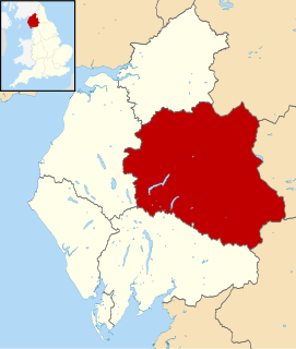
Eden is a local government district in Cumbria, England. Its council is based at Penrith Town Hall in Penrith. It is named after the River Eden which flows north through the district toward Carlisle. The district had a population of 49,777 according to the 2001 census, increasing to 52,564 at the 2011 Census. A 2019 estimate put it at 53,253.

Burton-in-Kendal is a village and civil parish on the extreme southern edge of Cumbria, England. The parish contains around 660 houses and in the 2001 census had a population of 1,411, increasing at the 2011 census to 1,497. Historically within the county of Westmorland, the village straddles the A6070 road between Crooklands and Carnforth, at a point around midway between Lancaster and Kendal, and is in the shadow of the nearby limestone outcrop known as Farleton Knott.

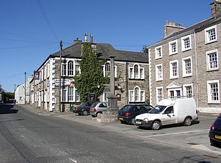
Kirkby Stephen is a market town and civil parish in Cumbria, North West England. Historically part of Westmorland, it lies on the A685, surrounded by sparsely populated hill country, about 25 miles (40 km) from the nearest larger towns: Kendal and Penrith. The River Eden rises 6 miles (9.7 km) away in the peat bogs below Hugh Seat and passes the eastern edge of the town. At the 2001 census the parish had a population of 1,832, increasing to 1,822 at the 2011 Census. The settlement had a 2011 population of 1,522.

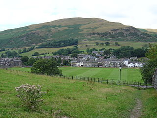
Sedbergh is a small town and civil parish in Cumbria, England. The 2001 census gave the parish a population of 2,705, increasing at the 2011 census to 2,765. Historically in the West Riding of Yorkshire, it lies about 10 miles (16 km) east of Kendal, 28 miles (45 km) north of Lancaster and about 10 miles (16 km) north of Kirkby Lonsdale, just within the Yorkshire Dales National Park. It stands at the foot of Howgill Fells, on the north bank of the River Rawthey, which joins the River Lune 2 miles (3 km) below the town.

Shap is a linear village and civil parish located among fells and isolated dales in Eden district, Cumbria, England, in the historic county of Westmorland. The parish had a population of 1,221 in 2001, increasing slightly to 1,264 at the 2011 Census.

Askham is a village and civil parish in the Eden district of Cumbria, England. It is in the historic county of Westmorland. According to the 2001 census the parish had a population of 360, decreasing slightly to 356 at the 2011 Census. It is situated in the eastern edge of the Lake District National Park, 4 miles (6.4 km) south of Penrith. Nearby are the remains of Lowther Castle, the site of the annual Lowther Show, a three-day event of country pursuits.

Bootle is a village and civil parish in the Borough of Copeland in Cumbria, England. The parish had a population of 745 in the 2001 census, decreasing slightly to 742 at the 2011 census. Historically in Cumberland, the village is in the Lake District National Park, and is close to the Irish Sea coast. Near to Bootle is the Eskmeals Firing Range, which was a large employer but in the mid to late 1990s reduced the workforce. Also within the parish is Hycemoor, a hamlet situated 1.2 miles (1.9 km) north-west of Bootle, where Bootle railway station is located.

Seascale is a village and civil parish on the Irish Sea coast of Cumbria, England, historically within Cumberland. The parish had a population of 1,747 in 2001, increasing slightly to 1,754 at the 2011 Census.
Gilling with Hartforth and Sedbury is a civil parish in North Yorkshire, England. It includes the villages of Gilling West and Hartforth. The civil parish population at the 2011 census was 534.

Beckermet is a village and civil parish in Cumbria, England, between Egremont and Seascale. The parish had a population of 1,619 in the 2011 census.

Holme is a village and civil parish in the South Lakeland district of Cumbria, England, about 2 miles (3.2 km) north of Burton-in-Kendal and 3 miles (4.8 km) south east of Milnthorpe. The parish had a population of 1,167 at the 2001 census, increasing to 1,486 at the 2011 Census.

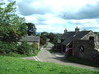
Crosby Garrett is a hamlet and civil parish in the Eden District of Cumbria, England. It was formerly in the county of Westmorland. In the 2011 census Crosby Garrett was grouped with Waitby to give a total of 195.

Greystoke is a village and civil parish on the edge of the Lake District National Park in Cumbria, England, about 4 miles (6.4 km) west of Penrith. At the 2001 census the parish had a population of 642, increasing marginally to 654 at the 2011 Census. The village centres on a green surrounded by stone houses and cottages.

Cliburn is a village and civil parish in the Eden district of Cumbria, England. The civil parish includes the hamlet of Town Head. In 2001 the population was 204, increasing to 274 at the 2011 Census.

Murton is a small village and civil parish in the Eden District of Cumbria, England. The parish had a population of 330 in 2001, rising to 360 at the 2011 Census. Settlements within the parish include the villages of Hilton, Langton, Brackenber and various small farms, houses and cottages. The town of Appleby-in-Westmorland is to the south-west.

Ellenborough is a suburb of the town of Maryport, Cumbria, England, historically within Cumberland.

Great Orton is a village in the parish of Orton, in the City of Carlisle district of the English county of Cumbria. The population of the civil parish taken at the 2011 census was 453. Historically, the village is part of Cumberland.

Culgaith is a village and civil parish in the Eden district of Cumbria, England. It is located on the River Eden, between Temple Sowerby and Langwathby. At the 2001 census the parish had a population of 721, increasing to 826 at the 2011 Census.

Waitby is a small village and civil parish in the Eden district of Cumbria, England. The parish contains two small villages, Waitby and Smardale, plus the small hamlets of Riddlesay, Stripes and Leases, all of which are in the farmed and enclosured northern part at an elevation of around 200–300m. The southern half of the parish is mostly heath and unused for agriculture, it rises to Smardale fell; which it includes, at elevations between 300 and 400m. The civil parish of Ravenstonedale forms the boundary to the south. The western border with Crosby Garrett civil parish is formed by Scandal Beck. To the north and east lie Soulby and Kirkby Stephen civil parishes respectively. The population of the civil parish as measured at the 2011 Census was less than 100. Details are included in the parish of Crosby Garrett.

Hethersgill is a village and a civil parish in the Carlisle district, in the county of Cumbria, England. Hethersgill has a church called St Mary's Church.


