Eden District

Last updated

Eden District
Eden DC logo.svg
Eden UK locator map.svg
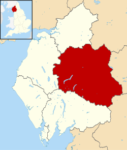
Shown within Cumbria
Sovereign state United Kingdom
Constituent country England
Region North West England
Ceremonial county Cumbria
Historic county Cumberland (part)
Westmorland (part)
Founded1 April 1974 (1974-04-01)
Abolished31 March 2023 (2023-03-31)
Admin. HQ Penrith
Government
  TypeEden District Council
   Leadership:Alternative - Sec.31
Area
  Total827 sq mi (2,142 km2)
Population
 (2021)
  Total54,955
  Density66/sq mi (26/km2)
Time zone UTC+0 (Greenwich Mean Time)
  Summer (DST) UTC+1 (British Summer Time)
ONS code 16UF (ONS)
E07000030 (GSS)
Ethnicity99.6% White
Website https://www.eden.gov.uk/

Eden was a local government district in Cumbria, England, based at Penrith Town Hall in Penrith. It was named after the River Eden, which flowed north through the district toward Carlisle. Its population of 49,777 at the 2001 census, [1] increased to 52,564 at the 2011 Census. [2] A 2019 estimate was 53,253. [3] In July 2021 it was announced that, in April 2023, Cumbria would be divided into two unitary authorities. [4] On 1 April 2023, Eden District Council was abolished and its functions transferred to the new authority Westmorland and Furness, which also covers the former districts of Barrow-in-Furness and South Lakeland. [5]

Contents

Extent

The Eden District area of 2,156 sq. km (832 square miles) made it, after 2009, the eighth largest in England and the largest non-unitary district. It also had the lowest population density of any district in England and Wales, with a mean of 25 persons per square kilometre. [6]

In 2011, the population was 5 per cent above its 2001 level. [6]

The district council was created on 1 April 1974 under the Local Government Act 1972, from Penrith Urban District, Alston with Garrigill Rural District and Penrith Rural District, all in Cumberland, and Appleby Municipal Borough, part of Lakes urban district and North Westmorland Rural District, all in Westmorland. The district included parts of the Lake District and Yorkshire Dales national parks.

Green space

It was shown in a national detailed Land Use Survey by the Office for National Statistics in 2005 that Eden District had the second lowest proportion of land taken up by roads of any district in England: 0.8 per cent, fractionally greater than Craven in North Yorkshire, which also adjoins the Pennines. This compares with a maximum of over 20 per cent in four London boroughs and the City of London. [7]

In that detailed survey (to the nearest square metre) it was shown that Eden District had the greatest proportion of green space (which excludes domestic gardens) of any district, 97.9 per cent, as shown by the following extract:

District% Green space (June 2005) [7]
Copeland 96.0%
Scarborough 96.1%
Ryedale 96.3%
West Somerset 96.6%
Northumberland 96.7%
West Devon 97.2%
Richmondshire 97.5%
Eden97.9%

Wards

Below is a list of the wards that formed Eden (with numbers of councillors):

Map

Amenities

Eden included King George's Fields, named after King George V, at Appleby and Patterdale.

The council owned the Penrith Leisure Centre, which is run by a private company under contract. The council also owned a number of playing fields and recreation grounds elsewhere in the district, notably the sports grounds at Frenchfield near Carleton on the outskirts of Penrith. It also owned and ran Penrith and Eden Museum and the Penrith Tourist Information Centre.

See also

Related Research Articles

<span class="mw-page-title-main">Westmorland</span> Historic county of England

Westmorland is a historic county in Northern England.

<span class="mw-page-title-main">Cumberland</span> Historic county of England

Cumberland is a historic county in Northern England, it mainly corresponds to the district of Cumberland and the part of Westmorland and Furness including Penrith.

<span class="mw-page-title-main">Eden Valley Railway</span> Former railway

The Eden Valley Railway (EVR) was a railway in Cumbria, England. It ran between Clifton Junction near Penrith and Kirkby Stephen via Appleby-in-Westmorland.

<span class="mw-page-title-main">Orton, Westmorland and Furness</span> Village in Cumbria, England

Orton is a village and civil parish in Cumbria, England. It lies 15 miles (24 km) south of Penrith, 8 miles (13 km) from Appleby-in-Westmorland and 1.5 miles (2.4 km) from the M6 motorway. The village is in the upper Lune Valley, at the foot of Orton Scar in the Orton Fells. The Lake District is nearby. The parish includes a wide area outside the village, and had a population of 594 in 2001, decreasing to 588 at the 2011 Census.

<span class="mw-page-title-main">Penrith and The Border (UK Parliament constituency)</span> Parliamentary constituency in the United Kingdom, 1950 onwards

Penrith and The Border is a constituency in Cumbria represented in the House of Commons of the UK Parliament since 2019 by Neil Hudson, a Conservative.

<span class="mw-page-title-main">Westmorland and Lonsdale (UK Parliament constituency)</span> Parliamentary constituency in the United Kingdom, 1983 onwards

Westmorland and Lonsdale is a constituency in the south of Cumbria, represented in the House of Commons of the UK Parliament since 2005 by Tim Farron, the former leader of the Liberal Democrats (2015–2017).

<span class="mw-page-title-main">Shap</span> Village and civil parish in Cumbria, England

Shap is a village and civil parish located among fells and isolated dales in Westmorland and Furness, Cumbria, England. The village is in the historic county of Westmorland. The parish had a population of 1,221 in 2001, increasing slightly to 1,264 at the 2011 Census.

The Barony of Westmorland also known as North Westmorland, the Barony of Appleby, Appleshire or the Bottom of Westmorland, was one of two baronies making up the English historical county of Westmorland, the other being the Barony of Kendal. Both of them evolved from medieval feudal baronies. Geographically, the barony covered the northern part of the larger county of the same name, and was divided into two wards – East Ward and West Ward. It covered an area similar to that of the former Eden District of the new county of Cumbria, although it did not include Penrith, which was the administrative capital of the district.

Brough Sowerby is a village and civil parish in the Eden district of Cumbria, England. It is located 22.3 miles south east of the town Penrith. According to the 2001 census it had a population of 127, increasing to 137 at the 2011 Census. The village is near the River Belah. 'A township in Brough parish, Westmoreland; 1½ mile S of Brough. Acres, 1,083. Real property with Kaber, £3,664. Pop., 140. Houses, 32.' There are quite a few Black Bull inns in the area surrounding Brough Sowerby, this comes from the old Scottish black cattle that were driven through Kirkby Stephen.

Penrith was a rural district within the administrative county of Cumberland, England that existed from 1894 to 1974 with slight boundary changes in 1934.

<span class="mw-page-title-main">Kirkby Thore</span> Human settlement in England

Kirkby Thore is a small village and civil parish in Cumbria, England, in the historic county of Westmorland. It is close to the Lake District national park and the Cumbrian Pennines. It includes the areas of Bridge End, in the southwest by the A66, and Cross End in the northeast of the village. In the 2001 census, the parish had a population of 731, increasing to 758 in the 2011 Census. The market town of Appleby-in-Westmorland is about five miles away, and the larger town of Penrith is about eight miles away.

<span class="mw-page-title-main">Newbiggin-on-Lune</span> Human settlement in England

Newbiggin-on-Lune is a village in the Eden district of Cumbria, England. Historically in Westmorland it is about 4 miles (6.4 km) south west of Kirkby Stephen, and lies on the main A685 route from Brough to Tebay. Nearby to the north is located the Smardale Gill Viaduct on the dismantled former South Durham & Lancashire Union Railway between Tebay and Kirkby Stephen East railway station. To the south lies the Howgill Fells including Green Bell 1,985 feet.

There are a number of listed buildings in Cumbria. The term "listed building", in the United Kingdom, refers to a building or structure designated as being of special architectural, historical, or cultural significance. Details of all the listed buildings are contained in the National Heritage List for England. They are categorised in three grades: Grade I consists of buildings of outstanding architectural or historical interest, Grade II* includes significant buildings of more than local interest and Grade II consists of buildings of special architectural or historical interest. Buildings in England are listed by the Secretary of State for Culture, Media and Sport on recommendations provided by English Heritage, which also determines the grading.

<span class="mw-page-title-main">Westmorland and Furness</span> District in Cumbria, England

Westmorland and Furness is a unitary authority area in Cumbria, England. The economy is mainly focused on tourism around both the Lake District and Cumbria Coast, shipbuilding and the port in Barrow-in-Furness, and agriculture in the rural parts of the area.

Penrith and Solway is a proposed constituency of the House of Commons in the UK Parliament. Further to the completion of the 2023 Periodic Review of Westminster constituencies, it will first be contested at the next general election.

References

  1. UK Census (2001). "Local Area Report – Eden Local Authority (E07000030)". Nomis. Office for National Statistics . Retrieved 27 March 2021.
  2. UK Census (2011). "Local Area Report – Eden Local Authority (E07000030)". Nomis. Office for National Statistics . Retrieved 27 March 2021.
  3. City Population. Retrieved 28 March 2021.
  4. "Next steps for new unitary councils in Cumbria, North Yorkshire and Somerset". GOV.UK. Retrieved 1 January 2022.
  5. "Local Government Reorganisation. Delivering Two New Councils for Cumbria". Archived from the original on 1 April 2023. Retrieved 1 January 2022.
  6. 1 2 Lucy Townsend and Kathryn Westcott (17 July 2012). "Census 2011: Five lesser-spotted things in the data". BBC News Magazine. Retrieved 17 July 2012.
  7. 1 2 Key Statistics: Dwellings; Quick Statistics: Population Density; Physical Environment: Land Use Survey 2005 Archived 11 February 2003 at the Wayback Machine 2011 census

54°40′00″N2°45′16″W / 54.6667°N 2.7544°W / 54.6667; -2.7544