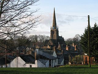
Workington is a coastal town and civil parish at the mouth of the River Derwent on the west coast in Cumbria, England. At the 2011 census it had a population of 25,207.

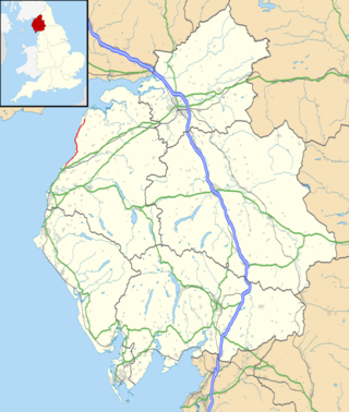
Cumberland is an area of Northern England which was historically a county and is now fully part of Cumbria. The county was bordered by Northumberland to the north-east, County Durham to the east, Westmorland to the south-east, Lancashire to the south, and the Scottish counties of Dumfriesshire and Roxburghshire to the north. The area includes the city of Carlisle, part of the Lake District and North Pennines, and the Solway Firth coastline.

Cockermouth is a market town and civil parish in the Cumberland unitary authority area of Cumbria, England, so named because it is at the confluence of the River Cocker as it flows into the River Derwent. The mid-2010 census estimates state that Cockermouth has a population of 8,204, increasing to 8,761 at the 2011 Census.

The A596 is a primary route in Cumbria, in northern England, that runs between Thursby and Workington. For its entirety the A596 parallels the A595, and meets the A595 at both ends. The A596 begins its course at a roundabout junction with the A595 at Thursby, before continuing past the towns of Wigton and Aspatria. As it travels further towards the coast, it reaches the town of Maryport, where there is a junction to the B5300 heading up the coast to Silloth via Allonby, Mawbray, and Beckfoot. It then crosses over the River Derwent, skirting the eastern edge of Workington shortly before terminating at the junction with the A595 at Lillyhall.

Workington was a constituency in Cumbria represented in the House of Commons of the UK Parliament.

A civil parish in England is the lowest unit of local government. There are 284 civil parishes in the ceremonial county of Cumbria, with most of the county being parished. At the 2001 census, there were 359,692 people living in those 284 parishes, accounting for 73.8 per cent of the county's population.

Broughton is a civil parish in Cumbria, England, consisting of Great Broughton and Little Broughton. It is located on the River Derwent, about 6 miles (9.7 km) east of Workington and 3 miles (4.8 km) west of Cockermouth. According to the 2001 census it had a population of 1,727, decreasing slightly to 1,704 at the 2011 Census.

Broughton Moor is a village and civil parish in Cumbria, England. It is situated on an extensive moor about 2 miles (3.2 km) north of Broughton, 5 miles (8.0 km) north west of Cockermouth, 2.5 miles (4.0 km) south of Maryport and 4.5 miles (7.2 km) north of Workington.

Bridekirk is a village and civil parish in the Cumberland district in the county of Cumbria, England. It is around 3.2 kilometres (2 mi) north of the Derwent river and about the same distance from the nearest large town of Cockermouth just south of the river. Bridekirk is just outside the Lake District National Park and is not far from the Maryport and Carlisle Railway.

Mealsgate is a village in Cumbria, England, historically within Cumberland.

Dearham is a village and civil parish in Cumbria, historically part of Cumberland, near the Lake District National Park in England. It lies about 2 miles (3.2 km) east of Maryport and 5 miles (8.0 km) west of Cockermouth.

Great Broughton is a village and former civil parish, now in the parish of Broughton, in the Cumberland district, in the ceremonial county of Cumbria, England. It caters strongly for visitors. The estimated resident population was 1,823 in 2017.

Dovenby is a village and former civil parish, now in the parish of Bridekirk, in the Cumberland district, in the county of Cumbria, England. It is on the A594 road and is 2.5 miles (4.0 km) north west of Cockermouth, 2.6 miles (4.2 km) east of Dearham, 4.5 miles (7.2 km) east of Maryport, 7.4 miles (11.9 km) north east of Workington and 27 miles (43.5 km) south west of Carlisle. In 1931 the parish had a population of 163.

The B5300 is a B road which runs for approximately twelve miles between the towns of Silloth and Maryport in the Allerdale borough of Cumbria, United Kingdom. From north to south, it passes through the villages of Blitterlees, Beckfoot, Mawbray, Dubmill, and Allonby. It runs through the Solway Coast Area of Outstanding Natural Beauty, passes close to the Salta Moss Site of Special Scientific Interest, Milefortlet 21, a Roman archaeological site, the salt pans, a remnant of the Solway plain's medieval saltmaking industry, and the village of Crosscanonby. It is an important route for carrying goods to and from Silloth docks and Maryport harbour. It is also the major road connecting smaller coastal settlements with Maryport and Silloth, from where other roads lead to Workington, Whitehaven, Wigton, and Carlisle. A short section of the road between Dubmill and Mawbray was closed in February 2019 due to coastal erosion, and reopened in June 2019.

Hayton is a village in the Cumberland unitary authority area of Cumbria, England. It is the only settlement in the civil parish of Hayton and Mealo. Historically located in Cumberland, and on a minor road between the B5300 and the A596, it is approximately 2 miles from the coast. Nearby settlements include the town of Aspatria and the villages of Oughterside and Prospect. A small tributary called Patten Beck runs across the village, through the grounds of the castle.

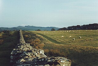
Cumberland is a unitary authority area in Cumbria, England, which means that it is a non-metropolitan county and district. It borders Scotland, Northumberland, Westmorland and Furness, and the Irish Sea. Part of the area is in the Lake District National Park and notable landmarks include Carlisle Cathedral, Carlisle Castle and Hadrian's Wall.

Penrith and Solway is a constituency of the House of Commons in the UK Parliament Further to the completion of the 2023 Periodic Review of Westminster constituencies, it was contested for the first time at the 2024 general election, since when it has been represented by Markus Campbell-Savours of the Labour Party.


