Cumberland is a historic county in North West England, covering part of the Lake District as well as the northern Pennines and the coast of Solway Firth. Cumberland had an administrative function from the 12th century until 1974, when it was subsumed into Cumbria, a larger administrative area which also covered Westmorland and parts of Yorkshire and Lancashire. In April 2023, Cumberland was revived as an administrative entity when Cumbria County Council was abolished and replaced by two unitary authorities, one of which is named Cumberland and includes most of the historic county, with the exception of Penrith and the surrounding area.
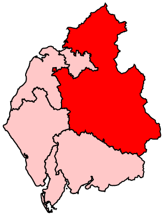
Penrith and The Border is a constituency in Cumbria represented in the House of Commons of the UK Parliament since 2019 by Neil Hudson, a Conservative.

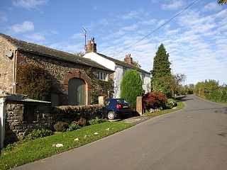
Beaumont is a village and civil parish in the City of Carlisle district of Cumbria, England. The village lies four miles north-west of Carlisle on the banks of the River Eden.

Burgh by Sands is a village and civil parish in the Cumberland unitary authority area of Cumbria, England, situated near the Solway Firth. The parish includes the village of Burgh by Sands along with Longburgh, Dykesfield, Boustead Hill, Moorhouse and Thurstonfield. It is notable as the site of the first recorded North African (Moorish) military unit in Roman Britain, garrisoning the frontier fort of Aballava on Hadrian's Wall in the 3rd century AD. It is also where Edward I of England died in 1307.
Kirkoswald is a village, civil parish, and former market town located in Westmorland and Furness, England, about 9 miles (14 km) from Penrith. The village is in the historic county of Cumberland. The village, referred to colloquially as KO, had a population of 870 at the 2001 census, which rose to 901 at the 2011 Census.
Dacre is a small village, civil parish and electoral ward in the Lake District National Park in the Eden District of Cumbria, England, and historically in Cumberland. In the 2001 census, the parish, which includes Newbiggin and Stainton, had a population of 1,326, increasing to 1,438 at the 2011 Census.

Crosby-on-Eden is the combined name for two small villages, High Crosby and Low Crosby, within the civil parish of Stanwix Rural near Carlisle, in the Cumberland district, in the ceremonial county of Cumbria, England. It was formerly a parish in its own right under the name Crosby upon Eden. In 1931 the parish had a population of 238. On 1 April 1934 the parish was abolished and merged with Stanwix Rural, part also went to Wetheral.

Cumrew is a small village and civil parish in north-east Cumbria, England. About 7 miles (11 km) south of Brampton and 13 miles (21 km) east of Carlisle. The population of the civil parish taken at the 2001 census was 85, increasing to 131 at the 2011 Census.

Irthington is a village and civil parish within the City of Carlisle district in Cumbria, England, situated to the north-east of Carlisle Lake District Airport. The population in 2011 was 860 according to the 2011 census.

Walton is a village and civil parish in the far north of Cumbria, England. It is located 10 miles (16 km) from Carlisle and is about 2 miles (3 km) north of Brampton, on the north bank of the River Irthing. Nearby villages include Newtown, Banks and Lanercost.

Laversdale is a village in Cumbria, England, situated to the north of Carlisle Lake District Airport. In 1870-72 the township had a population of 428. One of its more distinctive buildings is a thatched tithe barn, now a private house. The manor of Laversdale traditionally lies within the parish and bailiwick of Irthington in the Barony of Gilsland, and covers 3200 acres. It was held by the Earl of Carlisle until the 1980s.
Belle Vue is a suburb of Carlisle, Cumbria, United Kingdom. The ward population taken at the 2011 census was 6,491.

Drumburgh is a small settlement in Cumbria, England. It is 13 kilometres (8 mi) northwest of the city of Carlisle and is on the course of Hadrian's Wall, near to Burgh by Sands. The village is sited on a gentle hill with a good view in all directions over the surrounding lowlands.

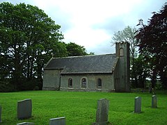
St Andrew's Church stands near the village of Aikton, Cumbria, England. It is an active Anglican parish church in the deanery of Carlisle, the archdeaconry of Carlisle, and the diocese of Carlisle. Its benefice is united with those of St Michael, Burgh by Sands, St Mary, Kirkandrews-on-Eden with Beaumont, and St Peter, Kirkbampton. The church is recorded in the National Heritage List for England as a designated Grade I listed building.
Kirkandrews-on-Eden or Kirkandrews-upon-Eden, in the past known as Kirkanders, is a village and former civil parish, now in the civil parish of Beaumont, in the Cumberland unitary authority area of Cumbria, England. The village is 4 miles northwest of Carlisle. Kirkandrews forms part of the Barony of Burgh together with the nearby villages Monkhill, Grinsdale, Rattlingate and Burgh-by-Sands. In 1931 the civil parish had a population of 145.

Monkhill is a small village in the civil parish of Beaumont, in the City of Carlisle district, in the county of Cumbria, England. Nearby settlements include the small city of Carlisle and the villages of Burgh by Sands and Kirkandrews-on-Eden. Monkhill has a pub called the Drovers Rest Inn and a Methodist Chapel with adjoining School Room which holds local village events. The village is situated on the course of a vallum associated with Hadrian's Wall and is near the narrowest point of the River Eden, the site was a crossing point for Roman troops, Scottish border raiders, and cattle drovers. Monkhill, today, is a quiet little hamlet.
Castle Carrock is a village and civil parish on the B6413 road, in the City of Carlisle District, in the English county of Cumbria about 3 miles (4.8 km) south of Brampton. The population of the Civil Parish was 303 in 2001 and rose to 328 by 2011. It has a pub, The Duke of Cumberland, a primary school and many walks. More recently Castle Carrock is known for 'Cumbria's Most Friendly Music Festival' Music on the Marr which takes place each year at the end of July. It attracts a diverse crop of music, entertainers, artists and poets from around the world.

The history of medieval Cumbria has several points of interest. The region's status as a borderland coping with 400 years of warfare is one. The attitude of the English central government, at once uninterested and deeply interested, is another. As a border region, of geopolitical importance, Cumbria changed hands between the Angles, Norse, Strathclyde Brythons, Picts, Normans, Scots and English; and the emergence of the modern county is also worthy of study.
Beaumont is a civil parish in the Carlisle district of Cumbria, England. It contains 26 listed buildings that are recorded in the National Heritage List for England. Of these, one is listed at Grade II*, the middle of the three grades, and the others are at Grade II, the lowest grade. The parish contains the settlements of Beaumont, Kirkandrews-upon-Eden, Monkhill, and Grinsdale, and is otherwise mainly rural. Most of the listed buildings are houses and associated structures, farmhouses and farm buildings. The other listed buildings include churches and associated structures, a former windmill, and a public house.