Listed buildings in Beaumont, Cumbria

Last updated

Beaumont is a civil parish in the Carlisle district of Cumbria, England. It contains 26 listed buildings that are recorded in the National Heritage List for England. Of these, one is listed at Grade II*, the middle of the three grades, and the others are at Grade II, the lowest grade. The parish contains the settlements of Beaumont, Kirkandrews-upon-Eden, Monkhill, and Grinsdale, and is otherwise mainly rural. Most of the listed buildings are houses and associated structures, farmhouses and farm buildings. The other listed buildings include churches and associated structures, a former windmill, and a public house.

Beaumont, Cumbria village in the United Kingdom

Beaumont is a village and civil parish in the City of Carlisle district of Cumbria, England. The village lies four miles north-west of Carlisle on the banks of the River Eden.

Civil parish territorial designation and lowest tier of local government in England, UK

In England, a civil parish is a type of administrative parish used for local government, they are a territorial designation which is the lowest tier of local government below districts and counties, or their combined form, the unitary authority. Civil parishes can trace their origin to the ancient system of ecclesiastical parishes which historically played a role in both civil and ecclesiastical administration; civil and religious parishes were formally split into two types in the 19th century and are now entirely separate. The unit was devised and rolled out across England in the 1860s.

City of Carlisle City & non-metropolitan district in England

The City of Carlisle is a local government district of Cumbria, England, with the status of a city and non-metropolitan district. It is named after its largest settlement, Carlisle, but covers a far larger area which includes the towns of Brampton and Longtown, as well as outlying villages including Dalston, Scotby and Wetheral. The city has a population of 107,524. and an area of 1,039.97 square kilometres (402 sq mi), making it the largest city in England by area.

Contents

Key

Map all coordinates using: OpenStreetMap  ·  Google Maps
Download coordinates as: KML  ·  GPX
Grade Criteria [1]
II* Particularly important buildings of more than special interest
II Buildings of national importance and special interest

Buildings

Name and locationPhotographDateNotesGrade
St Mary's Church
54°55′27″N3°01′08″W / 54.92405°N 3.01876°W / 54.92405; -3.01876 (St Mary's Church)
St Mary's Church, Beaumont.jpg
The church was restored in 1784, 1872 and 1888. It is built in calciferous sandstone and red sandstone on a chamfered plinth, and has a green slate roof with coped gables and a cross finial. It consists of a nave, a south porch, a chancel and a north vestry. On the west gable is an open bellcote. At the entrance to the church is a re-used Norman arch. [2] [3]
The Croft
54°54′56″N3°00′26″W / 54.91553°N 3.00712°W / 54.91553; -3.00712 (The Croft)
Originally a farmhouse, it is built in clay and cobble on a chamfered stone plinth, and has a thatched roof. It has a single storey with an attic, and there is a single-storey extension to the rear added in 1778. The doorway and sash windows have plain stone surrounds, and in the extension is a dated lintel. Inside are three pairs of full crucks. [4]
George Sibson Tomb Chest
54°54′47″N2°58′50″W / 54.91301°N 2.98054°W / 54.91301; -2.98054 (George Sibson Tomb Chest)
1715The tomb chest is in the churchyard of St Kentigern's Church. It is in sandstone, and is rectangular on a chamfered plinth. On the sides are plain panels, and the slab has a chamfered moulded edge. On the slab are carved coats of arms and inscriptions. [5]
John Sibson Tomb Chest
54°54′47″N2°58′50″W / 54.91301°N 2.98064°W / 54.91301; -2.98064 (John Sibson Tomb Chest)
1734The tomb chest is in the churchyard of St Kentigern's Church. It is in sandstone, and is rectangular on a chamfered plinth. On the sides are plain panels, and the slab has a chamfered moulded edge. On the slab are inscriptions dated up to 1901. [6]
Barn, Manor House
54°54′57″N3°00′32″W / 54.91578°N 3.00879°W / 54.91578; -3.00879 (Barn, Manor House)
The barn is built in clay, with repairs in brick and cobbles, and a roof of sandstone slabs. It is in a single storey, and has plank doors in a projecting cart entrance. [7]
St Kentigern's Church
54°54′47″N2°58′50″W / 54.91306°N 2.98044°W / 54.91306; -2.98044 (St Kentigern's Church)
St Kentigern's Church, Grinsdale - geograph.org.uk - 172137.jpg
1738–40The church was rebuilt on old foundations. It is a small church, it is rendered on a stone plinth, and it has a green slate roof with coped gables and a cross finial. The church consists of a nave, a chancel, and a west tower. The tower has two stages, slit vents, louvred bell openings in a sandstone arch, and a battlemented parapet. [8] [9]
Beech House
54°54′58″N3°00′38″W / 54.91624°N 3.01057°W / 54.91624; -3.01057 (Beech House)
The house is in brick with quoins and a green slate roof. There are two storeys, three bays, and sash windows in moulded architraves. [10]
Hollow Creek
54°54′55″N3°00′27″W / 54.91526°N 3.00744°W / 54.91526; -3.00744 (Hollow Creek)
A brick farmhouse with a roof of Welsh slate and sandstone slate, in two storeys and three bays. The doorway has a plain surround, and the sash windows have moulded architraves. [11]
Knockupworth Hall
54°53′59″N2°58′59″W / 54.89981°N 2.98299°W / 54.89981; -2.98299 (Knockupworth Hall)
A stuccoed house on a chamfered plinth, with quoins and a green slate roof. There are two storeys and three bays, with a two-storey one-bay extension to the left. On the front is a prostyle Roman Doric porch, and the doorway has a moulded architrave. The windows are sashes in moulded surrounds. [12]
The Manor House
54°54′56″N3°00′30″W / 54.91563°N 3.00824°W / 54.91563; -3.00824 (The Manor House)
The main part of the house is in brick with a Welsh slate roof. It has two storeys and three bays. There is a lower two-storey, one-bay extension to the left, and a two-storey wing at the rear, giving an L-shaped plan. In the main part, the original entrance has been converted into a French window; it has an architrave and a moulded and dentilled cornice. The windows are sashes that have segmental arches with keystones and stone sills. The left extension also has quoins, and the rear wing has a ground floor of split river cobbles. [13]
Outbuilding, The Manor House
54°54′57″N3°00′30″W / 54.91581°N 3.00838°W / 54.91581; -3.00838 (Outbuilding, Manor House)
The building is constructed in split river cobbles with sandstone quoins and it has a sandstone slate roof. There are two storeys, two bays, and a two-bay extension. In the main part are a plank door and a loft door, both with quoined surrounds, and in the extension is a garage door and a casement window. [14]
Monkhill Windmill
54°55′03″N3°01′35″W / 54.91752°N 3.02643°W / 54.91752; -3.02643 (Monkhill Windmill)
Converted windmill, Monkhill - geograph.org.uk - 173653.jpg
The former windmill is conical, with three storeys, and is built in sandstone. There are two ground floor entrances with wooden lintels, and windows at three levels. [15]
Myrtle Cottage
54°55′30″N3°01′08″W / 54.92497°N 3.01885°W / 54.92497; -3.01885 (Myrtle Cottage)
The house is built in river cobbles and random rubble, with quoins and a slate roof. There are two storeys and three bays, with a one-bay extension on each side. The doorway and sash windows have plain surrounds. [16]
Orchard House
54°55′29″N3°01′04″W / 54.92459°N 3.01774°W / 54.92459; -3.01774 (Orchard House)
A house in red and yellow sandstone on a chamfered stone plinth, with quoins, a moulded cornice, and a slate roof. There are two storeys and three bays, and a single-storey single-bay rendered extension to the right. The windows in the main part of the house are sashes, and in the extension they are casements. [2] [17]
Park Farmhouse
54°54′46″N2°59′09″W / 54.91279°N 2.98596°W / 54.91279; -2.98596 (Park Farmhouse)
1777The farmhouse is rendered, with a slate roof, and has two storeys and three bays. The doorway has a pilastered surround, moulded impost blocks, a patterned fanlight with a segmental arch, and a dated and inscribed false keystone. The windows are sashes in moulded architraves. [18]
Eden Bank Farmhouse
54°55′25″N3°01′05″W / 54.92365°N 3.01803°W / 54.92365; -3.01803 (Eden Bank Farmhouse)
1796The front of the farmhouse is stuccoed, and the rear is in cobbles and sandstone. It has a chamfered plinth, quoins, and a greenslate roof. There are two storeys and three bays. The doorway has a radial fanlight with a pilastered surround, a moulded segmental arch, and a false keystone. The windows are sashes in moulded architraves. [19]
Bunkershill
54°52′58″N2°59′14″W / 54.88279°N 2.98711°W / 54.88279; -2.98711 (Bunkershill)
1797 (probable)Originally one house and stables, later converted into three dwellings, it is rendered on a chamfered plinth, and has quoins, a moulded cornice and parapet, and a hipped green slate roof. There are two storeys and eleven bays, the right three bays having been the stables. The doorway has an architrave, side windows, and a moulded triangular pediment. On the front are two canted bay windows, the other windows being sashes in architraves. There are also doorways towards the left and in the right return. [20]
Beaumont House
54°55′25″N3°01′12″W / 54.92349°N 3.01991°W / 54.92349; -3.01991 (Beaumont House)
The house is in brick on a stone plinth, with quoins and a green slate roof. There are two storeys, three bays, a doorway with a plain surround and a fanlight with a segmental arch and a false keystone, and sash windows with flat brick arches and stone sills. [2] [21]
The Beeches
54°54′58″N3°00′38″W / 54.91622°N 3.01043°W / 54.91622; -3.01043 (The Beeches)
A brick house with a green slate roof, in two storeys and three bays. The doorway has a moulded surround with impost blocks, and a fanlight with a segmental head and a false keystone. The windows are sashes in plain surrounds. [22]
Dovecote
54°53′00″N2°59′17″W / 54.88330°N 2.98801°W / 54.88330; -2.98801 (Dovecote)
The dovecote is in mixed river cobbles and sandstone rubble, and has a Welsh slate roof. It is circular and has two storeys, plank doors and a loft door. Inside there are about 500 brick alcoves for nesting. [23]
Park Farm Cottage and barn
54°54′46″N2°59′09″W / 54.91287°N 2.98581°W / 54.91287; -2.98581 (Park Farm Cottage)
1805The cottage and barn are in brick on a plinth of cobble and sandstone, with stone dressings and a slate roof. In the centre is a flattened segmental arch with a dated keystone and a quoined surround. The cottage to the left has two storeys, three bays, a doorway with a stone surround, and sash windows that have stone sills and stone lintels with false keystones. The former cottage to the right of the arch has been incorporated into the barn which extends at right angles to the rear. The barn contains a cart entrance and a plank door. [24]
Drover's Rest
54°55′05″N3°01′26″W / 54.91805°N 3.02382°W / 54.91805; -3.02382 (Drover's Reste)
Drover's Rest, Monkhill.jpg
A public house, with the main part in brick and former stables to the right mainly in cobbles, all with a green slate roof. It has two storeys, the main part has two bays, and there is a single-storey single-bay lean-to at the left. The doorway has a plain stone surround, and the windows are casements. [25]
Wall, Drover's Rest
54°55′05″N3°01′26″W / 54.91794°N 3.02382°W / 54.91794; -3.02382 (Wall, Drover's Reste)
The low wall in front of the public house is in sandstone, it has rounded coping, and it curves at both ends. Between the wall and the road is a cobbled area. [26]
Grinsdale House
54°54′44″N2°59′13″W / 54.91216°N 2.98690°W / 54.91216; -2.98690 (Grinsdale House)
A rendered house with eaves modillions and a green slate roof. It has two storeys, three bays, a doorway and sash windows with plain surrounds, and a moulded cornice above the door. [27]
Hillcrest
54°55′25″N3°01′08″W / 54.92348°N 3.01899°W / 54.92348; -3.01899 (Hillcrest)
A stuccoed house with a Welsh slate roof. It has two storeys and three bays, flanked by recessed one-bay extensions. The sash windows and the doorway have plain surrounds, and above the door is a fanlight and a moulded cornice. [28]
Churchyard wall, St Mary's Church
54°55′27″N3°01′06″W / 54.92410°N 3.01839°W / 54.92410; -3.01839 (Churchyard wall, St Mary's Church)
Churchyard wall, Beaumont.jpg
1897The wall encloses the south and east sides of the churchyard. It is in mixed sandstone rubble and cobbles with chamfered sandstone coping. There are two openings, each has square gate posts with shaped caps, and one has a wrought iron overthrow. [29]

Related Research Articles

Camerton is a civil parish in the Borough of Allerdale in Cumbria, England. It contains three listed buildings that are recorded in the National Heritage List for England. All the listed buildings are designated at Grade II, the lowest of the three grades, which is applied to "buildings of national importance and special interest". The parish contains the village of Camerton and surrounding countryside. The listed buildings comprise a church, a country house, and a farmhouse and barn.

Dean is a civil parish in the Borough of Allerdale in Cumbria, England. It contains 37 listed buildings that are recorded in the National Heritage List for England. Of these, two are listed at Grade I, the highest of the three grades, one is at Grade II*, the middle grade, and the others are at Grade II, the lowest grade. The parish contains the villages of Dean, Deanscales, Pardshaw, Branthwaite, Ullock, and Eaglesfield, and the surrounding countryside. The oldest listed building is a churchyard cross, with its medieval base. The most important buildings from a heritage point of view are a church and a tower house, both of which are listed at Grade I. Most of he other listed buildings are houses and associated structures, or farmhouses and farm buildings. The other listed buildings include structures associated with the Friends, a war memorial, and a former packhorse bridge.

Holme Abbey is a civil parish in the Borough of Allerdale in Cumbria, England. It contains 15 listed buildings that are recorded in the National Heritage List for England. Of these, one is listed at Grade I, the highest of the three grades, one is at Grade II*, the middle grade, and the others are at Grade II, the lowest grade. The parish contains the village of Abbeytown and smaller settlements, and is otherwise rural. The most important building in the parish was Holmcultram Abbey part of which has been converted into a parish church, and other parts have been used in other buildings. Most of the other listed buildings are houses and associated structures, farmhouses and farm buildings.

Askerton is a civil parish in the Carlisle district of Cumbria, England. It contains eight listed buildings that are recorded in the National Heritage List for England. Of these, one is listed at Grade I, the highest of the three grades, and the others are at Grade II, the lowest grade. The parish includes the village of Kirkcambeck and is otherwise rural. The major building in the parish is Askerton Castle, a fortified house; this and buildings associated with it are listed. The other listed buildings are the Anglican parish church of St Kentigern, houses, one of which is a ruin, and a reconstructed arch.

Irthington is a civil parish in the Carlisle district of Cumbria, England. It contains 30 listed buildings that are recorded in the National Heritage List for England. Of these, one is listed at Grade II*, the middle of the three grades, and the others are at Grade II, the lowest grade. The parish contains the village of Irthington, and the smaller settlements of Laversdale, Newby East, Oldwall, Ruleholme, and Newtown, and is otherwise rural. Most of the listed buildings are farmhouses and farm buildings, and the others include private houses, milestones, a bridge, and a church.

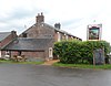
Nicholforest is a civil parish in the Carlisle district of Cumbria, England. It contains seven listed buildings that are recorded in the National Heritage List for England. Of these, one is listed at Grade II*, the middle of the three grades, and the others are at Grade II, the lowest grade. The parish is almost entirely rural, and the listed buildings consist of a country house that originated as a tower house, an outbuilding associated with it, a farmhouse and a barn, a milestone, a church, and a monument.

Muncaster is a civil parish in the Borough of Copeland, Cumbria, England. It contains 14 buildings that are recorded in the National Heritage List for England. Of these, two are listed at Grade I, the highest of the three grades, one is at Grade II*, the middle grade, and the others are at Grade II, the lowest grade. The parish contains the coastal village of Ravenglass and countryside to the east. The most important building in the parish is Muncaster Castle; this and buildings associated with it, including St Michael's Church and associated structures, are listed. The other listed buildings are houses, farmhouses, farm buildings, and a war memorial.

St Bees is a civil parish in the Borough of Copeland, Cumbria, England. It contains 38 buildings that are recorded in the National Heritage List for England. Of these, four are listed at Grade I, the highest of the three grades, two are at Grade II*, the middle grade, and the others are at Grade II, the lowest grade. The parish includes the village of St Bees and the surrounding coastline and countryside. In the 12th century a Benedictine priory was established in the parish. Most of this disappeared after the Dissolution of the Monasteries apart from the priory church, most of which became the Church of St Mary and St Bega, the parish church of the village, while most of the chancel was modified for other uses. Also in the village is St Bees School, an independent school. The church, the school, and a number of associated structures are listed. Most of the other listed buildings are houses and associated structures, and farmhouses and farm buildings. The other listed buildings include a bridge, a signal box, and two war memorials.

Ulpha is a civil parish in the Borough of Copeland, Cumbria, England. It contains six listed buildings that are recorded in the National Heritage List for England. Of these, one is listed at Grade II*, the middle of the three grades, and the others are at Grade II, the lowest grade. The parish is in the Lake District National Park, it contains the settlement of Ulpha and is otherwise sparsely populated, and consists mainly of moorland and mountain. The listed buildings stretch along the valley of the River Duddon, and comprise a church, a sundial in the churchyard, two bridges, a farmhouse and barn, and a house.

Whicham is a civil parish in the Borough of Copeland, Cumbria, England. It contains eleven listed buildings that are recorded in the National Heritage List for England. All the listed buildings are designated at Grade II, the lowest of the three grades, which is applied to "buildings of national importance and special interest". The parish contains the villages or hamlets of Silecroft, Kirksanton, Whicham and Whitbeck and is otherwise rural. The listed buildings comprise houses, farmhouses and farm buildings, two churches, a former brewery, a former mill, and a limekiln.

Asby is a civil parish in the Eden District, Cumbria, England. It contains 22 buildings that are recorded in the National Heritage List for England. Of these, one is listed at Grade I, the highest of the three grades, four are at Grade II*, the middle grade, and the others are at Grade II, the lowest grade. The parish contains the small villages of Great Asby and Little Asby, and is otherwise almost completely rural. Most of the listed buildings are houses and associated structures, farmhouses and farm buildings. The other listed buildings comprise a church, a lych gate, almshouses, a roadbridge, a footbridge, and two wells.

Castle Sowerby is a civil parish in the Eden District, Cumbria, England. It contains 19 buildings that are recorded in the National Heritage List for England. Of these, one is listed at Grade I, the highest of the three grades, two are at Grade II*, the middle grade, and the others are at Grade II, the lowest grade. The parish is almost entirely rural, and most of the listed buildings are houses, farmhouses, and farm buildings scattered around the parish. The other listed buildings are a church and a bridge.

Catterlen is a civil parish in the Eden District, Cumbria, England. It contains seven buildings that are recorded in the National Heritage List for England. Of these, one is listed at Grade I, the highest of the three grades, one is at Grade II*, the middle grade, and the others are at Grade II, the lowest grade. The parish contains the village of Newton Reigny and is otherwise rural. The listed buildings comprise a tower house and associated structures, a church, a house, farmhouses and farm buildings.

Dufton is a civil parish in the Eden District, Cumbria, England. It contains eleven listed buildings that are recorded in the National Heritage List for England. All the listed buildings are designated at Grade II, the lowest of the three grades, which is applied to "buildings of national importance and special interest". The parish contains the village of Dufton and the surrounding countryside. Most of the listed buildings are houses and associated structures, farmhouses and farm buildings in the village centre. Also in the village is a listed pump. Away from the centre of the village, and listed, are a church, its rectory and structures in the rectory garden.

Martindale is a civil parish in the Eden District, Cumbria, England. It contains eleven listed buildings that are recorded in the National Heritage List for England. Of these, one is listed at Grade II*, the middle of the three grades, and the others are at Grade II, the lowest grade. The parish is in the Lake District National Park, and is sparsely populated, the only centres of habitation being the hamlets of Howtown and Sandwick; most of the parish consists of countryside, moorland and fells. The listed buildings comprise houses and associated structures, farmhouses, farm buildings, two churches and a monument in a churchyard, and two bridges.

Mungrisdale is a civil parish in the Eden District, Cumbria, England. It contains 46 listed buildings that are recorded in the National Heritage List for England. Of these, three are listed at Grade II*, the middle of the three grades, and the others are at Grade II, the lowest grade. The parish is in the Lake District National Park, and is sparsely populated, consisting mainly of countryside, moorland and fells. There are small settlements at Mungrisdale, Mosedale, Haltcliff Bridge, Southerfell, Berrier, Hutton Moor End, Hutton Roof, Low Mill, and Swineside. Most of the listed buildings are houses, farmhouses and farm buildings, the other listed buildings including a Friends' meeting house, bridges, a church, a former saw mill, a former school, seven boundary stones, and a telephone kiosk.

Newbiggin is a civil parish in the Eden District, Cumbria, England. It contains 14 listed buildings that are recorded in the National Heritage List for England. Of these, one is listed at Grade II*, the middle of the three grades, and the others are at Grade II, the lowest grade. The parish includes the village of Newbiggin and the surrounding countryside. The most important building is Newbiggin Hall, originally a tower house and later a country house; the hall and associated structures are listed. The other listed buildings Include a church, items in the churchyard, a chapel, a bridge, farmhouses and farm buildings.

Ormside is a civil parish in the Eden District, Cumbria, England. It contains nine listed buildings that are recorded in the National Heritage List for England. Of these, one is listed at Grade I, the highest of the three grades, one is at Grade II*, the middle grade, and the others are at Grade II, the lowest grade. The parish contains the villages of Great Ormside and Little Ormside, and is otherwise rural. The most important buildings are an 11th-century church and a 14th-century hall; both of these and structures associated with them are listed. The other listed buildings are a house, farmhouses and farm buildings.

Hutton Roof is a civil parish in the South Lakeland District of Cumbria, England. It contains ten listed buildings that are recorded in the National Heritage List for England. All the listed buildings are designated at Grade II, the lowest of the three grades, which is applied to "buildings of national importance and special interest". The parish contains the village of Hutton Roof, and is otherwise entirely rural. The listed buildings consist of farmhouses, farm buildings. houses, a church, and a war memorial.

References

Citations

Sources

Historic England Executive non-departmental public body of the British Government, tasked with protecting the historical environment of England

Historic England is an executive non-departmental public body of the British Government sponsored by the Department for Culture, Media and Sport (DCMS). It is tasked with protecting the historical environment of England by preserving and listing historic buildings, ancient monuments and advising central and local government.

The National Heritage List for England (NHLE) is England’s official list of buildings, monuments, parks and gardens, wrecks, battlefields and World Heritage Sites. It is maintained by Historic England and brings together these different designations as a single resource even though they vary in the type of legal protection afforded to each. Conservation areas do not appear on the NHLE since they are designated by the relevant local planning authority.

Nikolaus Pevsner German-born British scholar

Sir Nikolaus Bernhard Leon Pevsner was a German, later British scholar of the history of art, especially of architecture.