Coniston is 25 miles (40km) northeast of Barrow-in-Furness, 20 miles (32km) west of Kendal and 42 miles (68km) north of Lancaster.
Toponym
The village's name is derived from konungr, the Old Norse for king, and tūn the Old English] for farmstead or village, meaning the "King's estate";[4] Ekwall[5] it is speculated that this settlement could have been the centre of a 'small Scandinavian mountain kingdom'. By the 12th century, it was known as "Coningeston".[6]
History
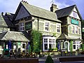
Coniston grew as both a farming village, and to serve local copper and slate mines.[7] It grew in popularity as a tourist location during the Victorian era, thanks partially to the construction of a branch of the Furness Railway, which opened to passenger traffic in 1859 and terminated at Coniston railway station.[8]
The poet and social criticJohn Ruskin also popularised the village, buying the mansion Brantwood on the eastern side of Coniston Water in 1871. Before his death, he rejected the option to be buried in Westminster Abbey, instead being laid to rest in the churchyard of St Andrew's, Coniston. Ruskin Museum, established in 1901, is both a memorial to Ruskin and a local museum covering the history and heritage of Coniston Water and the Lake District.[9]
Donald Campbell added to the profile of the village and lake when he broke four World Water Speed Records on the lake in the 1950s. He died attempting to break the world water speed record for the eighth time in 1967, when his jet boat, "Bluebird K7", crashed at 290mph (470km/h), having already set the record for the seventh time at Dumbleyung Lake, Western Australia in 1964. His body and boat (Bluebird K7) were discovered and recovered by divers in 2001 and he was buried in the new graveyard in Coniston in September 2001. A new wing has been built at the Ruskin Museum to accommodate the fully restored Bluebird K7 boat. It opened in late 2009 with the K7 due to have arrived in late 2011 or early 2012.[11]
The whole village was powered by hydroelectricity during the 1920s but this became so heavily taxed that the people there were forced to return to the national grid. Since 7 March 2007 a hydro-electric scheme has been in use to power up to 300 homes; being sited near the original.[7]
Geography
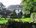
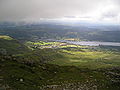
Coniston is located on the western shore of the northern end of Coniston Water.[12] It sits at the mouth of Coppermines Valley and Yewdale Beck, which descend from the Coniston Fells, historically the location of ore and slate mining.[7] Coniston's location thus developed as a farming village and transport hub, serving these areas. Coniston was situated in the very north-west of the historic county of Lancashire, with Coniston Old Man forming the county's highest point.[13]
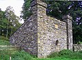
Mining
Two slate quarries still operate at Coniston, one in Coppermines Valley, the other at Brossen Stone on the east side of the Coniston Old Man. Both work Coniston's volcanic slates, being blue at Low-Brandy Crag in Coppermines Valley, and light green at Brossen Stone (bursting stone). The scenery around Coniston derives from Coniston Limestone and rocks of the Borrowdale Volcanic Group.
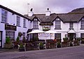
The creation of the Lake District National Park in 1951 provided a boost to tourism, with attractions such as the Ruskin Museum and ferry services across the lake developing. Coniston is a popular spot for hill-walking and rock-climbing; there are fine walks to be had on the nearby Furness Fells and Grizedale Forest, and some of the finest rock in the Lake District on the eastern face of Dow Crag, 3 miles (4.8km) from the village. The Grizedale Stages rally also takes place in Coniston, using the surrounding Grizedale and Broughton Moor (or Postlethwaite Allotment) forests. The village is also home to a number of hotels and two youth hostels, one at the edge of the village, the other in the nearby Coppermines Valley.
The village also has a football team, Coniston AFC, who play their home games at Coniston sports and social centre.
As with the rest of the British Isles, Coniston experiences a maritime climate with cool summers and mild winters. Rainfall is high, almost at 2,000 millimetres (79in) a year. Temperature extremes have ranged from −15.2°C (4.6°F) during February 1986,[20] to 30.3°C (86.5°F) during August 1990.[21] The nearest Met Office weather station is Grizedale, around 2.5 miles (4.0km) to the South East.
Climate data for Grizedale: 91m (299ft) 1991–2020 normals, extremes 1960–2007
Coniston is also an important local centre, with a secondary school (John Ruskin School), primary school (Coniston Church of England Primary School), bank, petrol station and other such services. It has also repeatedly been highly placed in the Village of the Year award, winning it in 1997.
Twinning
The village is twinned with Illiers-Combray.[26] The French village is associated with Marcel Proust for whom Ruskin's work was a source of inspiration.
This page is based on this Wikipedia article Text is available under the CC BY-SA 4.0 license; additional terms may apply. Images, videos and audio are available under their respective licenses.