Dow Crag

Last updated

Dow Crag
Dow Crag.jpg
Dow Crag from the Old Man of Coniston summit
Highest point
Elevation 778 m (2,552 ft)
Prominence 129 m (423 ft)
Parent peak The Old Man of Coniston
Listing Hewitt, Nuttall, Wainwright
Coordinates 54°22′10″N3°08′15″W / 54.36944°N 3.13744°W / 54.36944; -3.13744
Geography
Lake District National Park UK relief location map.png
Red triangle with thick white border.svg
Dow Crag
Location in Lake District, UK
Location Cumbria, England
Parent range Lake District, Southern Fells
OS grid SD262977
Topo map OS Landrangers 96, 97, Explorer OL6

Dow Crag is a fell in the English Lake District near Coniston, Cumbria. The eastern face is one of the many rock faces in the Lake District used for rock climbing.

Contents

The name Dow Crag originally applied specifically to the eastern face which looks down upon the tarn of Goat's Water, the fell itself having no need for a name before the inception of hill walking in the 19th century. As with many fells the name of a prominent feature was then applied to the whole mass. Dow was originally named Doe and still locally pronounced as "Doe". [1]

Topography

The Coniston (or Furness) Fells form the watershed between Coniston Water and the Duddon Valley to the west. The range begins in the north at Wrynose Pass and runs south for around 10 miles (16 km) before petering out at Broughton in Furness on the Duddon Estuary. Alfred Wainwright in his influential Pictorial Guide to the Lakeland Fells took only the northern half of the range as Lakeland proper, consigning the lower fells southward to a supplementary work The Outlying Fells of Lakeland. Dow Crag is the last fell in the northern section of the range and therefore qualifies as one of the 214 Wainwrights. Later guidebook writers have chosen to include the whole range in their main volumes. [1] [2]

The higher northern part of the range can be likened to an inverted 'Y' in plan. Brim Fell stands at the junction of the three arms with the northern branch continuing over Swirl How and Great Carrs. The south western branch traverses to Dow Crag and the south eastern to The Old Man of Coniston, with Goat's Water lying in a deep depression between the two. The connecting ridge from Dow Crag to Brim Fell crosses the depression of Goat's Hawse above the head of the tarn, the Dow Crag side in particular being steep and rough.

South of Dow Crag the ridge steps down over the subsidiary tops of Buck Pike (2,440 ft (740 m)) and Brown Pike (2,237 ft (682 m)) to the Walna Scar Road. This is primarily a pedestrian route - the summit being at 1,985 ft (605 m) - although it has seen use from off-road vehicles, together with the attendant erosion. It provides a crossing from Coniston village to Seathwaite in the Duddon valley and was originally constructed both to facilitate local trade and to serve the many slate quarries on these fells. The first section at either end is paved although the remainder is a stony bridleway.

Beyond the Walna Scar Road are the further tops of Walna Scar (2,040 ft (620 m)), White Maiden (1,995 ft (608 m)) and White Pike (1,960 ft (600 m)). Richards treats these as one fell (Walna Scar) in his recent Landranger guide. [1] South of White Pike is a profound drop to an area of rough country before the shapely pyramid of Caw rises skyward.

To the west long and gentle slopes run down from the summit of Dow Crag toward the Duddon, while further north on this flank is Seathwaite Tarn. The ground here also begins in a shallow descent, but turns steep above the tarn in a line of minor crags. Seathwaite Tarn is a reservoir in a side valley of the Duddon system. This was originally a much smaller waterbody, but was dammed early in the 20th century to provide drinking water for the Barrow in Furness area. The dam is almost 400 yd (370 m) long and is concrete cored with slate buttresses, the resulting depth being around 80 ft (24 m). Water is not abstracted directly from the tarn, but flows some distance downriver to an off-take weir. [3]

By contrast Goat's Water retains its natural form. Much smaller and enclosed by steep ground on three sides it contains both trout and char. [3] The outlet flows through a boulder field, becoming one of the headwaters of Torver Beck. This stream passes a disused quarry near the Tranearth climbing hut, keeping the workings topped up via an artificial but extremely picturesque waterfall. Torver Beck finally issues into Coniston Water to the south of Torver village.

A second tarn to the east of Dow Crag stands in a small hollow below Brown Pike. This is Blind Tarn, so named because it has no visible inlet or outlet. About a hundred yards across and twenty feet deep, [3] the tarn has a respectable population of trout. Whilst other theories are possible, it must be assumed they have been introduced for sport.

Summit

The summit bears no cairn, being a rocky point perched directly above the crag. The view south and west to the coast is excellent, but much of Lakeland is blotted out by the flanks of the Coniston range. The Scafells are far enough west to put in an appearance and Skiddaw and the Helvellyn range can be seen through Fairfield and Levers Hawse. [4]

Ascents

The simplest direct routes begin at either end of the Walna Scar Road, making for the summit from the top of the pass. Ascents can be made from Seathwaite Tarn (pathless) or to the north of Goat's Hawse, but these give no clue to the grandeur of the crag on the eastern side of the ridge.[ original research? ] For this the walker will leave the Walna Scar Road at The Cove, or climb to this point from Torver. From here Goat's Water is the next objective for views of Dow Crag. Two choices now present themselves- easy via Goat's Hause, or steep via the South Rake (see below).[ original research? ] Many walkers will also reach the fell using the good paths from The Old Man of Coniston and Brim Fell. [1]

Rock climbing

Dow Crag is composed of rhyolite and has an approximately 100 metre rock face with over 100 recognised climbing routes including:

South Rake is a scree filled gully towards the south of the crag, and is the easiest way up the crag, being a fairly easy scramble, especially for the less agile.

Dow is noted for being particularly cold, bleak and exposed, especially in summer, typical of the Cumbrian season. Dow Crag is usually approached from the Walna Scar road which connects the Duddon Valley with Coniston.

See UK Climbing crag database

Related Research Articles

<span class="mw-page-title-main">Old Man of Coniston</span> Mountain in the English Lake District, Cumbria, England

The Old Man of Coniston is a fell in the Furness Fells of the Lake District in Cumbria, England, and is the highest point of the historic county of Lancashire. It is at least 2,632.62 feet (802.42 m) high, and lies to the west of the village of Coniston and the lake, Coniston Water. The fell is sometimes known by the alternative name of Coniston Old Man, or simply The Old Man. The mountain is popular with tourists and fell-walkers with a number of well-marked paths to the summit. The mountain has also seen extensive copper and slate mining activity for eight hundred years, and the remains of abandoned mines and spoil tips are a significant feature of the north-east slopes.

<span class="mw-page-title-main">Bowfell</span> Mountain in the English Lake District, Cumbria, England

Bowfell is a pyramid-shaped mountain lying at the heart of the English Lake District, in the Southern Fells area. It is the sixth-highest mountain in the Lake District and one of the most popular of the Lake District fells for walkers. It is listed in Alfred Wainwright's 'best half dozen' Lake District fells.

<span class="mw-page-title-main">Fairfield (Lake District)</span> Fell in the English Lake District

Fairfield is a fell in the English Lake District. It is the highest of a group of hills in the Eastern Fells, standing to the south of the Helvellyn range.

<span class="mw-page-title-main">Cold Pike</span> Fell in the Lake District, Cumbria, England

Cold Pike is a fell in the English Lake District. It is a satellite of Crinkle Crags and stands above the Upper Duddon Valley.

<span class="mw-page-title-main">Pike of Blisco</span> Mountain in the English Lake District, Cumbria, England

Pike of Blisco, or Pike o' Blisco, is a mountain in the Lake District in Cumbria, England. Located between the valleys of Great Langdale and Little Langdale, its relative isolation from neighbouring fells together with slopes falling away immediately from the summit in all directions mean it has excellent views: the view of the Langdale Pikes across Great Langdale is particularly arresting.
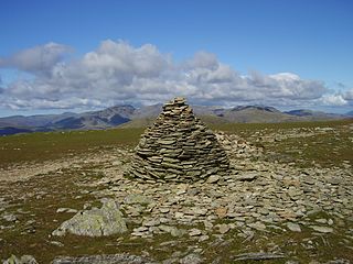
<span class="mw-page-title-main">Furness Fells</span>

<span class="mw-page-title-main">Stickle Pike</span> Mountain in the English Lake District, Cumbria, England

Stickle Pike is an outlying fell located in the southern Lake District near the small town of Broughton-in-Furness, with the summit situated between the lower Duddon Valley and the quiet smaller valley of Dunnerdale. Despite its low altitude the sharp, conical summit is prominent in views from the Broughton and high Furness areas. As with many of the Dunnerdale and Coniston fells, there are reminders of the area's former mining past in the form of many spoil heaps, disused levels and shafts. The fell is also notable for its wide-ranging views despite its low altitude, especially to the Scafells to the north and the sands of the Duddon Estuary to the south. A "stickle" is a hill with a prominent rocky top.

<span class="mw-page-title-main">Shipman Knotts</span>

Shipman Knotts is a fell in the English Lake District in Cumbria, England. It reaches a height of 587 metres (1,926 ft) and is situated in one of the quieter areas of the national park, 2 kilometres (1.2 mi) north-east of Kentmere village. Although not one of the best-known Lake District fells, it earned a separate chapter in Alfred Wainwright’s Pictorial Guide to the Lakeland Fells due to “Its characteristic roughness. .. rocky outcrops are everywhere on its steep slopes”.

<span class="mw-page-title-main">Heron Pike</span>

Heron Pike is a fell in the English Lake District, two kilometres east of Grasmere. It is part of the Fairfield group in the Eastern Fells. It should not be confused with the Heron Pike that forms part of Sheffield Pike, although it appears that, by coincidence, both Heron Pikes are exactly the same height.

<span class="mw-page-title-main">Grey Friar</span> Fell in the Lake District, Cumbria, England

Grey Friar is a fell in the English Lake District, it is one of the Coniston Fells and is situated 13 kilometres west-south-west of Ambleside. It reaches a height of 770 metres and stands to the north west of the other Coniston Fells, a little off the beaten track and tends to be the least visited of the group. It is quite a large fell and forms the eastern wall of the Duddon Valley for several kilometres, in fact all drainage from Grey Friar goes to the Duddon Valley and not to Coniston Water.

<span class="mw-page-title-main">Grey Crag</span> Fell in the Lake District, Cumbria, England

Grey Crag is a fell in the English Lake District. It stands to the east of Longsleddale in the Far Eastern Fells.

<span class="mw-page-title-main">Wetherlam</span> Mountain in the English Lake District, Cumbria, England

Wetherlam is a mountain in the English Lake District. It is the most northerly of the Coniston Fells, the range of fells to the north-west of Coniston village; its north-east slopes descend to Little Langdale.

Walna Scar is a hill in the English Lake District, lying just south of a pass of the same name in the Coniston Hills. Its summit at 2,035 feet (620 m) is only slightly higher than the pass.

<span class="mw-page-title-main">Swirl How</span> Fell in the Lake District, Cumbria, England

Swirl How is a fell in the English Lake District. It stands between Coniston and the Duddon Valley in the southern part of the District. It rivals the Old Man of Coniston as the highest point within the traditional County Palatine of Lancashire.

<span class="mw-page-title-main">Brim Fell</span> Fell in the Lake District, Cumbria, England

Brim Fell is a fell in the English Lake District. It stands to the west of Coniston village in the southern part of the District.

<span class="mw-page-title-main">Great Carrs</span> Fell in the Lake District, Cumbria, England

Great Carrs is a fell in the English Lake District. It stands above Wrynose Pass in the southern part of the District.

<span class="mw-page-title-main">Green Crag</span>

Green Crag is a fell in the English Lake District. It stands between Eskdale and the Duddon valley in the Southern Fells.

Middle Fell is a hill or fell in the English Lake District. It is a satellite of Seatallan standing above the northern shore of Wastwater. Middle Fell can be climbed from Greendale near the foot of Wastwater, and a fine view of the lake backed by the Wastwater Screes is visible from the summit.

<span class="mw-page-title-main">Southern Fells</span>

References

  1. 1 2 3 4 Richards, Mark: Southern Fells: Collins (2003): ISBN   0-00-711367-6
  2. Birkett, Bill: Complete Lakeland Fells: Collins Willow (1994): ISBN   0-00-218406-0
  3. 1 2 3 Blair, Don: Exploring Lakeland Tarns: Lakeland Manor Press (2003): ISBN   0-9543904-1-5
  4. Alfred Wainwright: A Pictorial Guide to the Lakeland Fells , Book 4: ISBN   0-7112-2457-9