
The Old Man of Coniston is a fell in the Furness Fells of the Lake District in Cumbria, England, and is the highest point of the historic county of Lancashire. It is at least 2,632.62 feet (802.42 m) high, and lies to the west of the village of Coniston and the lake, Coniston Water. The fell is sometimes known by the alternative name of Coniston Old Man, or simply The Old Man. The mountain is popular with tourists and fell-walkers with a number of well-marked paths to the summit. The mountain has also seen extensive copper and slate mining activity for eight hundred years, and the remains of abandoned mines and spoil tips are a significant feature of the north-east slopes.

Dale Head is a fell in the north-western sector of the Lake District, in northern England. It is 753 metres above sea level and stands immediately north of Honister Pass, the road between Borrowdale and Buttermere.

Cold Pike is a fell in the English Lake District. It is a satellite of Crinkle Crags and stands above the Upper Duddon Valley.

Great Langdale is a valley in the Lake District National Park in North West England, the epithet "Great" distinguishing it from the neighbouring valley of Little Langdale. Langdale is also the name of a valley in the Howgill Fells, elsewhere in Cumbria.

Holme Fell or Holm Fell is a fell in the Lake District in Cumbria, England. It is located between Coniston Water and Little Langdale, almost isolated from the neighbouring Coniston Fells by Yewdale Beck.

Pike o' Blisco, or Pike of Blisco, is a mountain in the Lake District in Cumbria, England. Located between the valleys of Great Langdale and Little Langdale, its relative isolation from neighbouring fells together with slopes falling away immediately from the summit in all directions mean it has excellent views: the view of the Langdale Pikes across Great Langdale is particularly arresting.

Sergeant Man is a fell in the English Lake District. It is properly a secondary summit of High Raise, but is given a separate chapter by Alfred Wainwright in his third Pictorial Guide nonetheless, as it "is so prominent an object and offers so compelling a challenge". Its rocky cone is indeed in great contrast to the grassy dome of High Raise.

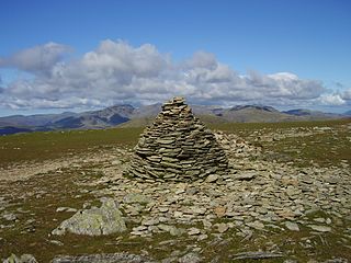
Dow Crag is a fell in the English Lake District near Coniston, Cumbria. The eastern face is one of the many rock faces in the Lake District used for rock climbing.

Steel Fell is a fell in the English Lake District, lying between Thirlmere and Grasmere. It is triangular in plan, the ridges running north, west and south east. Steel Fell rises to the west of the Dunmail Raise road and can be climbed from the summit, or from Grasmere and Wythburn.

Grey Friar is a fell in the English Lake District, it is one of the Coniston Fells and is situated 13 kilometres west-south-west of Ambleside. It reaches a height of 770 metres and stands to the north west of the other Coniston Fells, a little off the beaten track and tends to be the least visited of the group. It is quite a large fell and forms the eastern wall of the Duddon Valley for several kilometres, in fact all drainage from Grey Friar goes to the Duddon Valley and not to Coniston Water.

Swirl How is a fell in the English Lake District. It stands between Coniston and the Duddon Valley in the southern part of the District. It rivals the Old Man of Coniston as the highest point within the traditional County Palatine of Lancashire.

Black Fell is a fell in the English Lake District. It rises to the north of Tarn Hows, between Coniston and Hawkshead.
Brim Fell is a fell in the English Lake District. It stands to the west of Coniston village in the southern part of the District.

Great Carrs is a fell in the English Lake District. It stands above Wrynose Pass in the southern part of the District.
The Central Fells are a part of the Cumbrian Mountains in the Lake District of England. Reaching their highest point at High Raise, they occupy a broad area to the east of Borrowdale. The Central Fells are generally lower than the surrounding hills, the Lake District's dome-like structure having a slight dip in the middle. The range extends from the boggy ridge between Derwentwater and Thirlmere in the north, to the rock peaks of the Langdale Pikes in the south.

The Southern Fells are a part of the Cumbrian Mountains in the Lake District of England. Including Scafell Pike, the highest peak in England, they occupy a broad area to the south of Great Langdale, Borrowdale and Wasdale. High and rocky towards the centre of the Lake District, the Southern Fells progressively take on a moorland character toward the south-west. In the south-east are the well-known Furness Fells, their heavily quarried flanks rising above Coniston Water.

Little Langdale is a valley in the Lake District, England, containing Little Langdale Tarn and a hamlet also called Little Langdale. A second tarn, Blea Tarn, is in a hanging valley between Little Langdale and the larger Great Langdale to the north. Little Langdale is flanked on the south and southwest by Wetherlam and Swirl How, and to the north and northwest by Lingmoor Fell and Pike of Blisco. The valley descends to join with Great Langdale above Elter Water.

Levers Water is a small lake in the English Lake District. It is located at the head of the Coppermines Valley, above Coniston village. To its south-west is Raven Tor, a spur of Brim Fell, and to its north-west are Little How Crags and Great How Crags, on the eastern side of the north–south ridge leading to Swirl How.
Birk Fell Hawse Mine is a Site of Special Scientific Interest (SSSI) within the Lake District National Park in Cumbria, England. It is located on the Tilberthwaite Fells, near Wetherlam mountain, close to Little Langdale. This protected area has been designated because of the geology of the area.

