
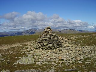
The Old Man of Coniston is a fell in the Furness Fells in the Cumbria, English Lake District and is the highest point of the historic county of Lancashire. It is at least 2,632.62 feet (802.42 m) high, and lies to the west of the village of Coniston and the lake, Coniston Water. The fell is sometimes known by the alternative name of Coniston Old Man, or simply The Old Man. The mountain is popular with tourists and fell-walkers with a number of well-marked paths to the summit. The mountain has also seen extensive copper and slate mining activity for eight hundred years, and the remains of abandoned mines and spoil tips are a significant feature of the north-east slopes.

Bowfell is a pyramid-shaped mountain lying at the heart of the English Lake District, in the Southern Fells area. It is the sixth-highest mountain in the Lake District and one of the most popular of the Lake District fells for walkers. It is listed in Alfred Wainwright's 'best half dozen' Lake District fells.

Dale Head is a fell in the north-western sector of the Lake District, in northern England. It is 753 metres or 2,470 feet above sea level and stands immediately north of Honister Pass, the road between Borrowdale and Buttermere.

Cold Pike is a fell in the English Lake District. It is a satellite of Crinkle Crags and stands above the Upper Duddon Valley.

The Duddon is a river of north-west England. It rises at a point 1,289 feet (393 m) above sea level near the Three Shire Stone at the highest point of Wrynose Pass. The river descends to the sea over a course of about 15 miles (24 km) before entering the Irish Sea at the Duddon Sands. In total, from source to the westernmost part of Duddon Sands, its length is 43 kilometres (27 mi). For its entire length the Duddon forms the boundary between the historic counties of Lancashire and Cumberland and since local government re-organisation in 1974 the Duddon has been in the ceremonial county of Cumbria.
High Stile is a mountain in the western part of the Lake District in North West England. It is the eleventh-highest English Marilyn, standing 807 metres (2,648 ft) high, and has a relative height of 362 metres (1,187 ft).

Holme Fell or Holm Fell is a fell in the Lake District in Cumbria, England. It is located between Coniston Water and Little Langdale, almost isolated from the neighbouring Coniston Fells by Yewdale Beck.

Pike of Blisco, or Pike o' Blisco, is a mountain in the Lake District in Cumbria, England. Located between the valleys of Great Langdale and Little Langdale, its relative isolation from neighbouring fells together with slopes falling away immediately from the summit in all directions mean it has excellent views: the view of the Langdale Pikes across Great Langdale is particularly arresting.

Seatallan is a mountain in the western part of the English Lake District. It is rounded, grassy and fairly unassuming, occupying a large amount of land. However, it is classed as a Marilyn because of the low elevation of the col connecting it to Haycock, its nearest higher neighbour to the north. The name Seatallan is believed to have a Cumbric origin, meaning "Aleyn's high pasture".

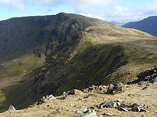
The Furness Fells are a multitude of hills and mountains in the Furness region of Cumbria, England. Historically part of Lancashire, the Furness Fells or High Furness is the name given to the upland part of Furness, that is, that part of Furness lying north of the line between Ulverston and Ireleth. The hills lie largely within the English Lake District.

Dow Crag is a fell in the English Lake District near Coniston, Cumbria. The eastern face is one of the many rock faces in the Lake District used for rock climbing.

Wetherlam is a mountain in the English Lake District. It is the most northerly of the Coniston Fells, the range of fells to the north-west of Coniston village; its north-east slopes descend to Little Langdale.

Swirl How is a fell in the English Lake District. It stands between Coniston and the Duddon Valley in the southern part of the District. It rivals the Old Man of Coniston as the highest point within the traditional County Palatine of Lancashire.
Brim Fell is a fell in the English Lake District. It stands to the west of Coniston village in the southern part of the District.

Great Carrs is a fell in the English Lake District. It stands above Wrynose Pass in the southern part of the District.

Green Crag is a fell in the English Lake District. It stands between Eskdale and the Duddon valley in the Southern Fells.

The Southern Fells are a group of hills in the English Lake District. Including Scafell Pike, the highest peak in England, they occupy a broad area to the south of Great Langdale, Borrowdale and Wasdale. High and rocky towards the centre of the Lake District, the Southern Fells progressively take on a moorland character toward the south-west. In the south-east are the well-known Furness Fells, their heavily quarried flanks rising above Coniston Water.

Seathwaite is a village in the Duddon Valley in the South Lakeland district of Cumbria in North West England. Historically in Lancashire, it lies within the Lake District National Park, and is part of the civil parish of Dunnerdale-with-Seathwaite, which has a population of 129. The nearby Seathwaite Tarn, west of the Coniston Fells, takes its name from the village. The village is north east of Hall Dunnerdale and south west of the tarn. It lies along the old Walna Scar road, which can be reached from the A595 in the south, or from the steep Hardknott–Wrynose pass road in the north, which leads off the A593 from Skelwith Bridge).
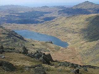
Seathwaite Tarn is a reservoir in the Furness Fells within the English Lake District. It is located to the south of Grey Friar and to the west of Brim Fell and north east of the village of Seathwaite on the east of the Duddon Valley.


