Black Fell (Lake District)

Last updated

Black Fell
Black Fell.jpg
Black Fell from Loughrigg Fell
Highest point
Elevation 323 m (1,060 ft)
Prominence 126 m (413 ft)
Parent peak Top o'Selside
Listing Wainwright
Coordinates 54°24′20″N3°01′00″W / 54.40557°N 3.01673°W / 54.40557; -3.01673
Geography
Lake District National Park UK relief location map.png
Red triangle with thick white border.svg
Black Fell
Location in Lake District, UK
Location Cumbria, England
Parent range Lake District, Southern Fells
OS grid NY341016
Topo map OS Landranger 89,90, Explorer OL7

Black Fell is a fell in the English Lake District. It rises to the north of Tarn Hows, between Coniston and Hawkshead.

Contents

Topography

Black Fell is the high point in the hilly area bounded by Windermere, Langdale and Coniston. It occupies an area of around one mile by two, clad mainly in fell grass with many small outcrops of rock. Despite its modest altitude Alfred Wainwright accorded Black Fell a chapter in his Pictorial Guide to the Lakeland Fells , partly due to its excellence as a view point. It represents the perimeter of the Lakeland Fells proper in his opinion, the land to the south falling within his supplementary volume, The Outlying Fells of Lakeland. Later guidebook writers have also included Black Fell within their remit. [1] [2]

The fell has no obvious connecting ridges in the manner of higher mountains, but in fact has a pivotal position in this area of the district. To the west over Oxen Fell High Cross (518 ft) is Holme Fell and an onward link to Wetherlam and the Furness Fells (Coniston Fells). To the south east a broad highland runs out between Windermere and Esthwaite Water, terminating in Claife Heights. Finally southward runs the 7 mile ridge of Grizedale Forest, capped by Carron Crag and Top o'Selside, Black Fell's topographical parent.

Black Fell's northern boundary is formed by Elter Water and the River Brathay. The broadleaved woodland of Brow Coppice stands above the village of Skelwith Bridge in the valley. Beyond the eastern slopes is a mile of gently falling country, running through plantations to the head of Windermere. There are many tarns within this landscape, most of them artificial. The largest are Blelham Tarn and the pools near the Drunken Duck (Inn) crossroads. On the western side is the A593 road from Coniston to Ambleside, crossing the minor pass of Oxen Fell.

South-west of Black Fell is Tarn Hows, a picturesque work of landscape design initiated by James Marshall in the 1860s. This is one of the most popular destinations in the Lake District, the mixture of water, rock and arboretum being finely contrived. Now owned by the National Trust, the motor traffic is so great that a one-way system had to be initiated as early as the 1960s. Tarn Hows is maintained by a dam at the south west corner and circumnavigated by a broad, level path, providing access to all. Few of the millions of visitors stray onto the slopes of Black Fell, or even know the name of the hill which provides the backdrop to so many photographs. [1] [3]

The whole fell was once owned by the Marshall family of Monk Coniston, before passing via a Mrs Heelis (better known as Beatrix Potter) to the National Trust, by whom it is held in perpetuity for the nation.

Although the lower slopes are wooded (except in the west), the top of the fell is open to the sky. In addition to the summit outcrop, somewhat optimistically titled Black Crag on maps, there are other tops at Great Cobble and Stephen How to the north, and Arnside and Torver Intakes to the south. A further feature on the southern flank of the fell is Iron Keld Plantation, through which the main access path to the summit climbs. There are some steeper areas, particularly at Pull Scar on the eastern side.

Geology

The fell is composed of the dacitic lapilli-tuff of the Lincomb Tarns Formation. Immediately to the east is the Brathay Fault, beyond which are sedimentary rocks of the Windermere Group. [4]

Summit

View north from Black Fell summit Black Fell, Lancashire.jpg
View north from Black Fell summit

A bridleway runs across the fell from the summit of the A593 in the west to Knipe Fold in the east, locally known as the "mountain road". [1] A further footpath branches off northward to the vicinity of Skelwith Bridge, providing the best access to the summit. This bears an Ordnance Survey triangulation column complete with a National Trust sign. 200 yards to the east a prominent cairn marks the best viewpoint for Windermere, whilst northerly views can be improved by the short march to Great Cobble. The panorama takes in both the high Coniston and Langdale Fells, and the lowlands and lakes to the south and west, a fine distillation of what Cumbria has to offer. [5]

Ascents

All ascents end via the short walk from the bridleway at Iron Keld to the summit, but starts can be made at Skelwith Bridge, High Park, Oxen Fell, Yew Tree Tarn, Tom Gill, Tarn Hows or Knipe Fold.

Related Research Articles

<span class="mw-page-title-main">Cold Pike</span> Fell in the Lake District, Cumbria, England

Cold Pike is a fell in the English Lake District. It is a satellite of Crinkle Crags and stands above the Upper Duddon Valley.

<span class="mw-page-title-main">Esk Pike</span> Fell in the Lake District, Cumbria, England

Esk Pike is a fell in the English Lake District, one of the cirque of hills forming the head of Eskdale.

<span class="mw-page-title-main">Great Langdale</span> Valley in Cumbria, England

Great Langdale is a valley in the Lake District National Park in North West England, the epithet "Great" distinguishing it from the neighbouring valley of Little Langdale. Langdale is also the name of a valley in the Howgill Fells, elsewhere in Cumbria.

<span class="mw-page-title-main">Holme Fell</span> Fell in Cumbria, England

Holme Fell or Holm Fell is a fell in the Lake District in Cumbria, England. It is located between Coniston Water and Little Langdale, almost isolated from the neighbouring Coniston Fells by Yewdale Beck.

<span class="mw-page-title-main">Pike o' Blisco</span> Mountain in the English Lake District, Cumbria, England

Pike o' Blisco, or Pike of Blisco, is a mountain in the Lake District in Cumbria, England. Located between the valleys of Great Langdale and Little Langdale, its relative isolation from neighbouring fells together with slopes falling away immediately from the summit in all directions mean it has excellent views: the view of the Langdale Pikes across Great Langdale is particularly arresting.

<span class="mw-page-title-main">Loughrigg Fell</span> Fell in the Lake District, Cumbria, England

Loughrigg Fell is a hill in the central part of the English Lake District. It stands on the end of the long ridge coming down from High Raise over Silver How towards Ambleside, and is separated from its neighbours by the depression of Red Bank.

<span class="mw-page-title-main">Seatallan</span> Mountain in Cumbria, England

Seatallan is a mountain in the western part of the English Lake District. It is rounded, grassy and fairly unassuming, occupying a large amount of land. However, it is classed as a Marilyn because of the low elevation of the col connecting it to Haycock, its nearest higher neighbour to the north. The name Seatallan is believed to have a Cumbric origin, meaning "Aleyn's high pasture".

<span class="mw-page-title-main">Dow Crag</span> Fell in the Lake District, Cumbria, England

Dow Crag is a fell in the English Lake District near Coniston, Cumbria. The eastern face is one of the many rock faces in the Lake District used for rock climbing.

<span class="mw-page-title-main">Yoke (Lake District)</span> Fell in the Lake District, Cumbria, England

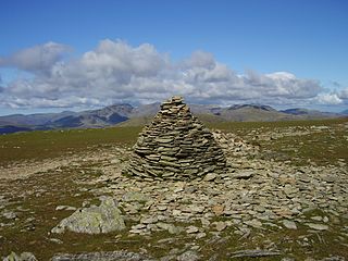
Yoke is a fell in the Lake District in Cumbria, England. It has a height of 706 metres (2,316 ft) and is situated in the far eastern sector of the national park, 6+12 kilometres ENE of the town of Ambleside. Yoke is the southern extremity of the long ridge that runs southwards from the fell of High Street. Yoke’s name is believed to be derived from the Old English language word geoc which is similar to the German word joch meaning mountain ridge.

<span class="mw-page-title-main">Low Pike</span>

Low Pike is a small fell in the English Lake District. It has a modest height of 508 m (1,667 ft) and is situated three kilometres north of Ambleside. Low Pike is well seen from the streets of the town as the first prominent fell on the ridge which continues northwards for a further four kilometres to Fairfield. This ridge is part of the Fairfield horseshoe walk and Low Pike is most commonly ascended as part of this.

Blea Rigg is a fell in the English Lake District, lying between the valleys of Easedale and Great Langdale. One of the Central Fells, it is a broad plateau with a succession of rocky tops. Many routes of ascent are possible, beginning either from Grasmere or Great Langdale, though the paths are often poorly marked and hard to follow.

<span class="mw-page-title-main">Grey Friar</span> Fell in the Lake District, Cumbria, England

Grey Friar is a fell in the English Lake District, it is one of the Coniston Fells and is situated 13 kilometres west-south-west of Ambleside. It reaches a height of 770 metres and stands to the north west of the other Coniston Fells, a little off the beaten track and tends to be the least visited of the group. It is quite a large fell and forms the eastern wall of the Duddon Valley for several kilometres, in fact all drainage from Grey Friar goes to the Duddon Valley and not to Coniston Water.

<span class="mw-page-title-main">Lingmoor Fell</span> Fell in the Lake District, Cumbria, England

Lingmoor Fell is a fell in the English Lake District, situated eight kilometres west of Ambleside. The fell reaches a height of 469 m (1,540 ft) and divides the valleys of Great Langdale and Little Langdale. The fell's name originates from the Old Norse word lyng meaning “heather covered”. The actual summit of the fell is named as Brown How on Ordnance Survey maps.

<span class="mw-page-title-main">Wetherlam</span> Mountain in the English Lake District, Cumbria, England

Wetherlam is a mountain in the English Lake District. It is the most northerly of the Coniston Fells, the range of fells to the north-west of Coniston village; its north-east slopes descend to Little Langdale.

<span class="mw-page-title-main">Swirl How</span> Fell in the Lake District, Cumbria, England

Swirl How is a fell in the English Lake District. It stands between Coniston and the Duddon Valley in the southern part of the District. It rivals the Old Man of Coniston as the highest point within the traditional County Palatine of Lancashire.

<span class="mw-page-title-main">Great Carrs</span> Fell in the Lake District, Cumbria, England

Great Carrs is a fell in the English Lake District. It stands above Wrynose Pass in the southern part of the District.

The Central Fells are a part of the Cumbrian Mountains in the Lake District of England. Reaching their highest point at High Raise, they occupy a broad area to the east of Borrowdale. The Central Fells are generally lower than the surrounding hills, the Lake District's dome-like structure having a slight dip in the middle. The range extends from the boggy ridge between Derwentwater and Thirlmere in the north, to the rock peaks of the Langdale Pikes in the south.

<span class="mw-page-title-main">Southern Fells</span>

The Southern Fells are a part of the Cumbrian Mountains in the Lake District of England. Including Scafell Pike, the highest peak in England, they occupy a broad area to the south of Great Langdale, Borrowdale and Wasdale. High and rocky towards the centre of the Lake District, the Southern Fells progressively take on a moorland character toward the south-west. In the south-east are the well-known Furness Fells, their heavily quarried flanks rising above Coniston Water.

Todd Crag is a hill and a satellite peak of Loughrigg Fell at 224 m (735 ft) it is not classed as a fell but is a vantage point near Ambleside

References

  1. 1 2 3 Richards, Mark: Southern Fells: Collins (2003): ISBN   0-00-711367-6
  2. Birkett, Bill: Complete Lakeland Fells: Collins Willow (1994): ISBN   0-00-218406-0
  3. Blair, Don: Exploring Lakeland Tarns: Lakeland Manor Press (2003): ISBN   0-9543904-1-5
  4. British Geological Survey: 1:50,000 series maps, England & Wales Sheet 38: BGS (1998)
  5. Alfred Wainwright: A Pictorial Guide to the Lakeland Fells , Book 4: ISBN   0-7112-2457-9