Bardsea

Last updated

Bardsea
Bardsea From Birkrigg.JPG
Bardsea Village with Chapel Island
Location map United Kingdom South Lakeland.svg
Red pog.svg
Bardsea
Location in South Lakeland
Location map United Kingdom Morecambe Bay.svg
Red pog.svg
Bardsea
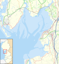
Location on Morecambe Bay
Cumbria UK location map.svg
Red pog.svg
Bardsea
Location within Cumbria
OS grid reference SD303732
Civil parish
District
Shire county
Region
Country England
Sovereign state United Kingdom
Post town ULVERSTON
Postcode district LA12
Dialling code 01229
Police Cumbria
Fire Cumbria
Ambulance North West
UK Parliament
List of places
UK
England
Cumbria
54°09′43″N3°04′23″W / 54.162°N 3.073°W / 54.162; -3.073 Coordinates: 54°09′43″N3°04′23″W / 54.162°N 3.073°W / 54.162; -3.073
Cowp Scar Mussel Bed, near to Bardsea, Cumbria CowpScarMusselBed(RogerTemple)Nov2007.jpg
Cowp Scar Mussel Bed, near to Bardsea, Cumbria

Bardsea is a village in the Low Furness area of Cumbria, England. It is two miles to the south-east of Ulverston on the northern coast of Morecambe Bay. It is in the historic county of Lancashire.

Contents

History

Bardsea, or Berretseige, is mentioned in the Domesday Book as one of the townships forming the Manor of Hougun held by Earl Tostig. [1] Also once part of the medieval manor of Muchland.

Bardsea was once a small farming and fishing village well into the 19th century. It was accessed mainly by crossing the treacherous sands of Morecambe Bay. The church of Holy Trinity was consecrated in 1853. Previously the area had been included within the parish of Urswick.

The area was also associated with the early Quaker movement. When founder George Fox married local landowner Margaret Fell, he took over Swarthmoor Hall and much of the land round Bardsea. There is an old Quaker burial ground nearby at Sunbrick on Birkrigg Common, where Margaret Fell was reputedly buried in 1702 (one authority suggests she was interred at the burial ground at Swarthmoor, although that is contradicted by other sources). George Fox himself was buried in London.

When iron ore mining and production led to industrialisation in Furness, Bardsea became a significant port, with steamers leaving for Fleetwood and Liverpool. That was short-lived, however, with the Furness Railway and Ulverston Canal taking business away from the village by the end of the Victorian period.

A branch line from Plumpton Junction, on the main railway to Barrow, which opened in 1883, was supposed to run to Bardsea and beyond, but the rails never got closer than Conishead Priory, about 1 mile (1.6 km) to the north. The line closed in 1917. [2]

Community

Bardsea currently has one used public house; the Ship Inn which was a farm in 1750. [3] Bardsea also has a converted Malt Kiln, dated 1829 and once part of the Well Wood estate, which is now used as a village hall. The Hartley family bought the hall and set up a trust deed in memory of local men who were killed in the war, handing over the malt Kiln to the community. [4]

Geography

Nearby locations of interest are the common with prehistoric Birkrigg stone circle, Sea Wood which once belonged to Lady Jane Grey, the Manjushri Centre at Conishead Priory and Chapel Island used as a sanctuary when crossing the sands.

When stood at the top of Birkrigg Common, it is possible to see the Sir John Barrow Monument and Morecambe Bay, as well as other local landmarks and the town of Ulverston.

Related Research Articles

<span class="mw-page-title-main">Ulverston</span> Market town in Cumbria, England

Ulverston is a market town and a civil parish in the South Lakeland district of Cumbria, England. In the 2001 census the parish had a population of 11,524, increasing at the 2011 census to 11,678. Historically in Lancashire, it lies a few miles south of the Lake District National Park and just north-west of Morecambe Bay, within the Furness Peninsula. Lancaster is 39 miles (63 km) to the east, Barrow-in-Furness 10 miles (16 km) to the south-west and Kendal 25 miles (40 km) to the north-east.

<span class="mw-page-title-main">Grange-over-Sands</span> English Victorian era town

Grange-over-Sands is a town and civil parish located on the north side of Morecambe Bay in Cumbria, England, a few miles south of the Lake District National Park. In the 2001 census the parish had a population of 4,042, increasing at the 2011 census to 4,114. Historically part of Lancashire, the town was created as an urban district in 1894. Since the 1974 local government re-organisation, it has been of the South Lakeland district of Cumbria, though it remains part of the Duchy of Lancaster.

<span class="mw-page-title-main">Furness</span>

Furness is a peninsula and region of Cumbria in northwestern England. Together with the Cartmel Peninsula it forms North Lonsdale, historically an exclave of Lancashire.

<span class="mw-page-title-main">Arnside</span> Human settlement in England

Arnside is a village and civil parish in Cumbria, historically part of Westmorland, near the border with Lancashire, England. The Lake District National Park is located a few miles North. Travelling by road, Arnside is 22 miles (35 km) to the south of Kendal, 25.3 miles (40.7 km) to the east of Ulverston, 35.2 miles (56.6 km) to the east of Barrow-in-Furness, 15.7 miles (25.3 km) to the west of Lancaster and 14.3 miles (23.0 km) to the east of Grange-over-Sands. In the 2001 census the parish had a population of 2,301, increasing at the 2011 census to 2,334.

<span class="mw-page-title-main">Dalton-in-Furness</span> Human settlement in England

Dalton-in-Furness is a town and former civil parish in the Borough of Barrow-in-Furness, Cumbria, England. In 2011 it had a population of 7,827. It is located 4.4 miles (7 km) north east of Barrow-in-Furness.

<span class="mw-page-title-main">Chapel Island</span>

Chapel Island is a limestone outcrop that lies in the Leven estuary of Morecambe Bay in England, less than one mile (1.6 km) from the shoreline at Bardsea in the area known as Ulverston Sands. It is located at 54.1741°N 3.0416°W. It is one of the Islands of Furness in the county of Cumbria, in the area of the historic county of Lancashire. The island is approximately 450 yards (410 m) long and just over 100 yards (91 m) at its widest. Its area is about 7.5 acres.

<span class="mw-page-title-main">Kents Bank</span> Human settlement in England

Kents Bank is a small village in Cumbria, England, so named for its proximity to the River Kent estuary. Part of the historic County Palatine of Lancashire, it is located 2 miles (3.2 km) south-west of Grange-over-Sands.

<span class="mw-page-title-main">Kirkby-in-Furness</span> Village in the South Lakeland district of Cumbria, England

Kirkby-in-Furness, generally referred to simply as Kirkby locally, is a village in the Furness area of Cumbria, England. Historically part of Lancashire, it's located close to the Lake District National Park. It is about 3 miles (5 km) south of Broughton in Furness, 5 miles (8 km) northwest of Ulverston and 9 miles (14 km) north of Barrow-in-Furness. It is one of the largest villages on the peninsula's north-western coast, looking out over the Duddon estuary. In 2019 it had an estimated population of 563.

<span class="mw-page-title-main">Urswick</span> Human settlement in England

Urswick is a civil parish that includes the villages of Great Urswick and Little Urswick. It is located in the Furness area of Cumbria, England. The villages are situated to the south-west of the town of Ulverston. In the 2001 census the parish had a population of 351, decreasing at the 2011 census to 1,397.

<span class="mw-page-title-main">Rampside</span> Human settlement in England

Rampside is a village in Cumbria, England. Historically in Lancashire, it is located a few miles south-east of the town of Barrow-in-Furness, in the north-western corner of Morecambe Bay on the Furness peninsula.

<span class="mw-page-title-main">Broughton-in-Furness</span> Town in Cumbria, England

Broughton in Furness is a market town in the civil parish of Broughton West in the South Lakeland district of Cumbria, England. It had a population of 529 at the 2011 Census. It is located on the south western boundary of England's Lake District National Park in the Furness region of Cumbria, which was originally part of Lancashire before 1974.

The Ulverstone [sic] and Lancaster Railway Company was short-lived as a business but the line that it built is still in daily use. The line runs from Lindal-in-Furness to Carnforth where it joins what was then the Lancaster and Carlisle Railway. The intermediate stations are: Cark and Cartmel, Kents Bank, Grange-over-Sands, Arnside and Silverdale.

<span class="mw-page-title-main">Aldingham</span> Human settlement in England

Aldingham is a village and civil parish in the South Lakeland district of Cumbria, England. Historically in Lancashire, it is situated on the east coast of the Furness peninsula, facing into Morecambe Bay, and is about 8 miles (13 km) east of Barrow-in-Furness, and 6 miles (9.7 km) south of Ulverston. The parish includes the nearby villages of Baycliff, Dendron, Leece, Gleaston, Newbiggin, Roosebeck, Scales and a number of smaller hamlets. According to the 2001 census the parish had a population of 1,187, reducing to 1,105 at the 2011 Census.

<span class="mw-page-title-main">Muchland</span> Manor in Low Furness, Cumbria, England

Muchland is a medieval manor in Low Furness in the county of Cumbria in northern England. The manor was the seat of the Lords of Aldingham, and included at its peak the villages of Bardsea, Urswick, Scales, Stainton, Sunbrick, Baycliff, Gleaston, Aldingham, Dendron, Leece and Newbiggin. The area also features the historic remains of Gleaston Castle, Aldingham Castle, Gleaston Water Mill, the Druids' Temple at Birkrigg, plus many prehistoric remains around Urswick and Scales.

<span class="mw-page-title-main">Dendron, Cumbria</span> Human settlement in England

Dendron is a small village in South Cumbria, England. It is situated around three miles from the town of Barrow-in-Furness. The village was once just a collection of farms, but many of the old farm buildings have now been converted into houses for commuters working in Barrow, Ulverston and Dalton.

<span class="mw-page-title-main">Cumbrian toponymy</span>

Cumbrian toponymy refers to the study of place names in Cumbria, a county in North West England, and as a result of the spread of the ancient Cumbric language, further parts of northern England and the Southern Uplands of Scotland.

<span class="mw-page-title-main">Conishead Priory</span>

Conishead Priory is a large Gothic Revival building on the Furness peninsula near Ulverston in Cumbria. The priory's name translates literally as "King's Hill Priory". Since 1976, the building has been occupied by a Buddhist community.

<span class="mw-page-title-main">Birkrigg</span> Area of countryside in Cumbria, England

Birkrigg or Birkrigg Common is an open-area of limestone countryside near the town of Ulverston on the Furness Peninsula in southern Cumbria, England. There is extensive limestone pavement on Birkrigg, which is protected under The Wildlife and Countryside Act 1981. Birkrigg's peak is at 136 metres (446 ft), but its position as the high point on the east of the Furness Peninsula affords it extensive views to the Lake District, Yorkshire Dales, Howgills and across Morecambe Bay to Blackpool.

The Manor of Hougun is the historic name for an area which now forms part of the county of Cumbria in North West England. Of the three most northern counties of England surveyed in the Domesday Book of 1086, only the southern band of land in the south of Cumbria was recorded. The westernmost entries for Cumbria, covering the Duddon and Furness Peninsulas are largely recorded as part of the Manor of Hougun. The entry in Domesday Book covering Hougun refers to the time when it was held by Tostig Godwinson, Earl of Northumbria.

<span class="mw-page-title-main">Bay Cycle Way</span> Cycle route around Morecambe Bay in NW England

The Bay Cycle Way is an 80-mile (130 km) cycling route around Morecambe Bay in Lancashire and Cumbria in north west England. Most of it forms National Cycle Route 700, while other sections are waymarked as NCN 6, NCN 69 and NCN 70.

References

  1. Cumbria: Hougun (The Domesday Book On-Line)
  2. "Brief History of the Bardsea Branch of the Furness Railway". Disused Stations. Retrieved 4 March 2020.
  3. The Ship Inn - Bardsea