
Hitchin is a market town and unparished area in the North Hertfordshire district in Hertfordshire, England, with an estimated population of 35,842.

Harpenden is a town and civil parish in the City and District of St Albans in the county of Hertfordshire, England. The population of the built-up area was 30,240 in the 2011 census, while the population of the civil parish was 29,448. Harpenden is a commuter town, with a direct rail connection to Central London and property prices well over triple the national average.

Baldock is a historic market town and unparished area in the local government district of North Hertfordshire in the county of Hertfordshire, England, where the River Ivel rises. It lies 33 miles (53 km) north of London, 15 miles (24 km) southeast of Bedford, and 14 miles (23 km) north northwest of the county town of Hertford. Nearby towns include Royston to the northeast, Letchworth and Hitchin to the southwest and Stevenage to the south.

North Hertfordshire is one of ten local government districts in the county of Hertfordshire, England. Its council is based in Letchworth. The district borders East Hertfordshire, Stevenage, Welwyn Hatfield, St Albans, Central Bedfordshire, Luton, and South Cambridgeshire.

Redbourn is a village and civil parish in Hertfordshire, England, lying on Watling Street, three miles (4.8 km) from Harpenden, four miles (6.4 km) from St Albans and five miles (8.0 km) from Hemel Hempstead. The civil parish had a population of 6,913 according to the 2011 Census.

Markyate is a village and civil parish in north-west Hertfordshire, close to the border with Bedfordshire and Buckinghamshire.

Everton is a small rural village of about 200 dwellings and civil parish in the Central Bedfordshire district of Bedfordshire, England about 9 miles (14 km) east of the county town of Bedford.

Ickleford is a large village situated on the northern outskirts of Hitchin in North Hertfordshire in England. It lies on the west bank of the River Hiz and to the east of the main A600 road. The population at the time of the 2011 census was 1,833.

Holwell is a small village and a civil parish two miles north of Hitchin in Hertfordshire, England, near the Bedfordshire border. The parish was historically part of Bedfordshire, being transferred to Hertfordshire on 30 September 1897. At the 2011 Census the population of the village was 361.
Codicote is a large village, and civil parish about seven miles (11 km) south of Hitchin in Hertfordshire, England. It has timber-framed and chequered brick houses, of special interest being the 18th-century Pond House and the half-timbered Taverners Place. Codicote Lodge is 18th-century and Codicote Bury 17th-century. The church, mostly rebuilt in 1853, retains 13th-century work in its nave and aisles. A most unusual structure north of the village is the Node Dairy and Stud, erected in 1927. It is circular in design, and thatched, with a circular courtyard and a tower which is, in fact, a silo.
Hexton is a small village and civil parish in Hertfordshire, England, about 6 miles (10 km) west of Hitchin.
Little Wymondley is a village and former civil parish situated between Hitchin and Stevenage, now in the parish of Wymondley, in the North Hertfordshire district, in the county of Hertfordshire, England. Paradoxically, it has a larger population than its near neighbour Great Wymondley. At the 2011 Census the population of the built-up area of Little Wymondley was 995. In 1931 the parish had a population of 445.

Ashwell is a village and civil parish in Hertfordshire situated 4 miles (6 km) north-east of Baldock.

Caddington is a village and civil parish in the Central Bedfordshire district of Bedfordshire, England. It is between the Luton/Dunstable urban area, and St.Albans/HarpendenHertfordshire.

Clifton is a village and civil parish in the English county of Bedfordshire. The original hundred of Clifton is named after it.

Offley is a civil parish in the English county of Hertfordshire, between Hitchin and Luton. The main village is Great Offley, and the parish also contains the nearby hamlets of Little Offley and The Flints. In the south-west of the parish, near Luton, there are the hamlets of Cockernhoe, Mangrove Green and Tea Green, and also the Putteridge Bury estate; these have LU2 postcodes and 01582 telephone numbers.
King's Walden is a civil parish in the English county of Hertfordshire. The name includes an apostrophe, but this is often omitted.

Hertford Heath is a village and civil parish near the county town of Hertford in Hertfordshire, England. The population at the 2011 Census was 2,672.

Hertingfordbury is a small village in Hertfordshire, England, close to the county town of Hertford. It was mentioned in the Domesday Book. Hertingfordbury is also the name of a neighbouring civil parish, which does not contain the village. Hertingfordbury Village is located within the Castle ward of local government Hertford Town Council. The population of the civil parish as of the 2021 census was 689.
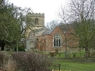
Langley is a hamlet and civil parish in the non-metropolitan district of North Hertfordshire and county of Hertfordshire. The population was 175 in the 2011 census. It is located four miles south of Hitchin, on the B656 road near the large town of Stevenage. Minsden Chapel lies within the parish.

