Related Research Articles
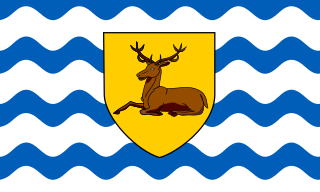
Hertfordshire is one of the home counties in southern England. It borders Bedfordshire and Cambridgeshire to the north, Essex to the east, Greater London to the south, and Buckinghamshire to the west. For government statistical purposes, it forms part of the East of England region.

Middlesex is a historic county in southeast England. Its area is almost entirely within the wider urbanised area of London and mostly within the ceremonial county of Greater London, with small sections in neighbouring ceremonial counties. Three rivers provide most of the county's boundaries; the Thames in the south, the Lea to the east and the Colne to the west. A line of hills forms the northern boundary with Hertfordshire.

The home counties are the counties of England that surround London. The counties are not precisely defined but Buckinghamshire and Surrey are usually included in definitions and Berkshire, Essex, Hertfordshire and Kent are also often included. Other counties further from London — such as Bedfordshire, Cambridgeshire, Hampshire, Oxfordshire, East Sussex and West Sussex — are not normally regarded as home counties, although on occasion may be thought of as such due to their proximity to London and their connection to the London regional economy.
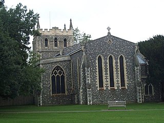
Royston is a town and civil parish in the District of North Hertfordshire and county of Hertfordshire in England.
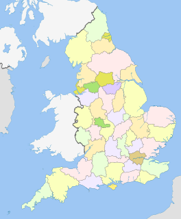
The counties of England are areas used for different purposes, which include administrative, geographical, cultural and political demarcation. The term 'county' is defined in several ways and can apply to similar or the same areas used by each of these demarcation structures. These different types of county each have a more formal name but are commonly referred to just as 'counties'. The current arrangement is the result of incremental reform.
The counties and areas for the purposes of the lieutenancies, also referred to as the lieutenancy areas of England and informally known as ceremonial counties, are areas of England to which lords-lieutenant are appointed. Legally, the areas in England, as well as in Wales and Scotland, are defined by the Lieutenancies Act 1997 as "counties and areas for the purposes of the lieutenancies in Great Britain", in contrast to the areas used for local government. They are also informally known as "geographic counties", to distinguish them from other types of counties of England.
A Scout County is an administrative division within The Scout Association of the United Kingdom. There are currently 115 Counties and Areas in the United Kingdom. These bodies are responsible for providing programmes and support for their member Scout Districts.
The Metropolitan Police District (MPD) is the police area which is policed by the Metropolitan Police Service in London. It currently consists of the Greater London region, excluding the City of London. The Metropolitan Police District was created by the Metropolitan Police Act 1829 as an ad hoc area of administration because the built-up area of London spread at the time into many parishes and counties without an established boundary. The district expanded as the built up area grew and stretched some distance into rural land. When county police forces were set up in England, those of Essex, Hertfordshire, Kent and Surrey did not cover the parts of the counties within the MPD, while Middlesex did not have a county force. Similarly, boroughs in the MPD that elsewhere would have been entitled to their own police force did not have them.

Barnet was a local government district in south Hertfordshire from 1863 to 1965 around the town of Barnet.

Melbourn Rural District was a rural district in Cambridgeshire, England, from 1894 to 1934.
England is divided by a number of different regional schemes for various purposes. Since the creation of the Government Office Regions in 1994 and their adoption for statistical purposes in 1999, some historical regional schemes have become obsolete. However, many alternative regional designations also exist and continue to be widely used.
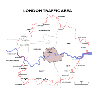
The London Traffic Area was established by the London Traffic Act 1924 to regulate the increasing amount of motor traffic in the London area. The LTA was abolished in 1965 on the establishment of the Greater London Council.

Administrative counties were subnational divisions of England used for local government from 1889 to 1974. They were created by the Local Government Act 1888, which established an elected county council for each area. Some geographically large historic counties were divided into several administrative counties, each with its own county council. The administrative counties operated until 1974, when they were replaced by a system of metropolitan and non-metropolitan counties under the Local Government Act 1972.

The King's England is a topographical and historical book series written and edited by Arthur Mee in 43 volumes. The first, introductory, volume was published in 1936; in 1989, The King's England Press was established to reprint the series.
Heart East is a regional radio station owned and operated by Global as part of the Heart network. It broadcasts to the East of England from studios in Milton Keynes.
Ashwell Rural District was a rural district in Hertfordshire, England from 1894 to 1935, covering an area in the north-east of the county.
References
- ↑ Ordnance Survey First Series sheet 46 1834
- ↑ Ordnance Survey 6 inch sheets Hertfordshire VI, VII 1884
- ↑ Elcock, H, Local Government (1994).
- ↑ Statutory Instrument 1989 No. 133 The Cambridgeshire, Essex, Hertfordshire and Lincolnshire (County Boundaries) Order 1989 (Coming into force 1 April 1989)
- ↑ Statutory Instrument 1992 No. 1696 The Greater London and Hertfordshire (County Boundaries) Order 1992 (Coming into force 1 April 1993)
- ↑ Statutory Instrument 1992 No. 2119 The Greater London and Hertfordshire (County Boundaries) Order 1992 (Coming into force 1 April 1993)
- ↑ Statutory Instrument 1993 No. 441 The Essex, Greater London and Hertfordshire (County and London Borough Boundaries) Order 1993 (Coming into force 1 April 1994)