Meppershall | |
---|---|
Village | |
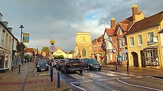
Meppershall High Street | |
Location within Bedfordshire | |
Population | 2,044 [1] 1,745 (2011 Census) [2] https://centralbedfordshire.communityinsight.org/map/?subregion=18599&indicator=census11_p04_all_20210101# |
OS grid reference | TL140366 |
Unitary authority | |
Ceremonial county | |
Region | |
Country | England |
Sovereign state | United Kingdom |
Post town | Shefford |
Postcode district | SG17 |
Dialling code | 01462 |
Police | Bedfordshire |
Fire | Bedfordshire and Luton |
Ambulance | East of England |
UK Parliament | |
Meppershall is a hilltop village in Bedfordshire near Shefford, Campton, Shillington, Stondon and surrounded by farmland. The village and the manor house are mentioned in the Domesday Book in 1086 - with the entry reading: Malpertesselle/Maperteshale: Gilbert FitzSolomon.
The Manor House belonged to the De Meppershall family for nearly 300 years following 1086. The present house is early 17th century.
Until 1844 Meppershall was partially in Hertfordshire. The detached portion of Hertfordshire was transferred to Bedfordshire in 1844, following the Counties (Detached Parts) Act 1844.
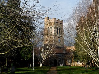
St. Mary's church dates back to the Normans. The Parish Records of St Mary, Meppershall, have been published on CD by the Parochial Church Council. [3]
Before the advent of greenhouses, Meppershall was a very poor community with large families living in two up, two down type thatched cottages built of brick with stone floors. However, so many greenhouses were built in the village that it was known as a "glass city," growing salad crops for local markets, which were shipped further afield via the railway.
As well as farming, the village earned its income from coprolite digging. Coprolite is the fossilised dung of pre-historic creatures, which when ground and treated with sulphuric acid produces a superphosphate fertiliser. To extract it, a long trench was dug on one side of a field. The overlaying clay was then dug out until the nodule bed was reached. If the depth of clay to be removed was more than eight to nine feet, the trench was made in two or three steps, and as the nodules were taken out, so the trench was refilled with the earth already removed.[ citation needed ] The nodule bed was shovelled into barrows and taken to the washing mill. This consisted of a circular iron trough with a pivot in the centre to which a set of travelling rakes was attached, these being dragged round by horses, and a constant stream of water was kept running through the trough until the clay washed off. The dirty water then was drained off and the nodules carted away. The coprolite was worth about £3 a ton in 1890, yielding some 300 tons per acre. A good fossil digger could earn as much as £2 a week. This industry has also died out.
Little Barford is a hamlet and civil parish in the Borough of Bedford in Bedfordshire, England about 7 miles (11 km) northeast of the county town of Bedford.
Studham is a village and civil parish in the county of Bedfordshire. It has a population of 1,182. The parish bounds to the south of the Buckinghamshire border, and to the east is the Hertfordshire border. The village lies in the wooded south facing dip slope of the Chiltern Hills. The hamlet of Holywell is located to the north of Studham, and forms part of the same civil parish.
Potton is a town and civil parish in the Central Bedfordshire district of Bedfordshire, England, about 10 miles (16 km) east of the county town Bedford. The parish had a population in 2021 of 5,727. In 1783 the Great Fire of Potton destroyed a large part of the town. The parish church dates from the 13th century, and is dedicated to St Mary. Potton's horse fairs were some of the largest in the country.
Hinxworth is a village and civil parish in North Hertfordshire, England. It sits just off the Great North Road between Baldock and Biggleswade. It has a village hall, a park, a pub, a small church, a bus stop and a post box. The population at the 2011 Census was 313.
Ickleford is a large village situated on the northern outskirts of Hitchin in North Hertfordshire in England. It lies on the west bank of the River Hiz and to the east of the main A600 road. The population at the time of the 2011 census was 1,833.
Shefford is a town and civil parish in the Central Bedfordshire district of Bedfordshire, England. At the 2021 census it had a population of 7,311. It lies 10 miles (16 km) south-east of Bedford.
Marston Moreteyne is a large village and civil parish in Central Bedfordshire, England, located on the A421 between Bedford and Milton Keynes. The population was 4,560 at the 2001 census, and 4,556 at the 2011 census. The village is served by Millbrook railway station, approximately 1 mile (1.6 km) away on the Marston Vale Line.
Watton-at-Stone is a village and civil parish in Hertfordshire, England, and is midway between the towns of Stevenage and Hertford in the valley of the River Beane.
Caddington is a village and civil parish in the Central Bedfordshire district of Bedfordshire, England.
Barton-le-Clay is a large village and a civil parish in the Central Bedfordshire district of Bedfordshire, England, bordering Hertfordshire. The village has existed since at least 1066 and is mentioned in the Domesday Book.
Chicksands is a village and former civil parish, now in the parish of Campton and Chicksands in the Central Bedfordshire district of Bedfordshire, England. The village is on the River Flit and close to its parish village of Campton and the town of Shefford.
The Counties Act 1844, which came into effect on 20 October 1844, was an Act of Parliament of the United Kingdom which eliminated many outliers or exclaves of counties in England and Wales for civil purposes. The changes were based on recommendations by a boundary commission, headed by the surveyor Thomas Drummond and summarized in a schedule attached to the Parliamentary Boundaries Act 1832. This also listed a few examples of civil parishes divided by county boundaries, most of which were dealt with by later legislation. This Act was repealed in its entirety by the Local Government Act 1972.
Langford is a village and civil parish in the Central Bedfordshire district of the county of Bedfordshire, England about 10 miles (16 km) south-east of the county town of Bedford. The 2011 census gives the population as 3,091.
Trimley St. Martin is a village and civil parish in the East Suffolk district, in the county of Suffolk, England. It lies between the rivers Orwell and the Deben, on the long narrow tongue of land from Ipswich to Felixstowe referred to as the Colneis Hundred. In 2011 the parish had a population of 1942.
Whipsnade is a small village and civil parish in Bedfordshire, England. It lies on the eastward tail spurs of the Chiltern Hills, about 2+1⁄2 miles (4.0 km) south-south-west of Dunstable on the top of the Dunstable Downs, which drop away steeply to the south of the village.
Clophill is a village and civil parish clustered on the north bank of the River Flit, Bedfordshire, England. It is recorded in the Domesday Book of 1086 as Clopelle. "Clop" likely means 'tree-stump' in Old English. However, it also has cognate terms for clay, with which the soil of mid Bedfordshire is rich.
Eyeworth is a small, rural village and civil parish in the Central Bedfordshire district of the county of Bedfordshire, England; about 12.5 miles (20 km) east south-east of the county town of Bedford.
Houghton Conquest is a village and civil parish located in the Central Bedfordshire district of Bedfordshire, England. The parish also includes the hamlet of How End.
Southill is a rural village and civil parish in the Central Bedfordshire district of the county of Bedfordshire, England; about 8 miles (13 km) south-east of the county town of Bedford.