
Bedfordshire is a ceremonial county in the East of England. It is bordered by Northamptonshire to the north, Cambridgeshire to the north-east, Hertfordshire to the south and the south-east, and Buckinghamshire to the west. The largest settlement is Luton (225,262), and Bedford is the county town.

Leighton Buzzard is a market town in Bedfordshire, England, in the southwest of the county and close to the Buckinghamshire border. It lies between Aylesbury, Tring, Luton/Dunstable and Milton Keynes, near the Chiltern Hills.

Dagnall is a village in the parish of Edlesborough, in Buckinghamshire, England.

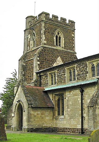
Eaton Bray is a village and civil parish in Bedfordshire, England. It is situated about three miles south-west of the town of Dunstable and is part of a semi-rural area which extends into the parish of Edlesborough. In the 2021 United Kingdom census the population of the parish was recorded as 2,644.

Linslade is a town in the civil parish of Leighton-Linslade, in the Central Bedfordshire unitary authority area of Bedfordshire, England. It borders the town of Leighton Buzzard. Linslade was transferred from Buckinghamshire in 1965. Before then, it was a separate urban district. It remained a part of the Diocese of Oxford until 2008 when it joined Leighton Buzzard in the Diocese of St Albans.

Hockliffe is a village and civil parish in Bedfordshire on the crossroads of the A5 road which lies upon the course of the Roman road known as Watling Street and the A4012 and B5704 roads.

Toddington is a large village and civil parish in the county of Bedfordshire, England. It is situated 5 miles north-north-west of Luton, 4 miles (6 km) north of Dunstable, 6 miles (10 km) south-west of Woburn, and 35 miles north-north-west of London on the B5120 and B579. It is 0.5 miles from Junction 12 of the M1 motorway and lends its name to the nearby motorway service station. The hamlet of Fancott also forms part of the Toddington civil parish.

Houghton Regis is a market town and civil parish in the Central Bedfordshire district of Bedfordshire, England.

Egginton – or Eggington as it is now known – is a village and civil parish in the Central Bedfordshire district of Bedfordshire, England, about three miles east of Leighton Buzzard.

Heath and Reach is a village and civil parish near the Chiltern Hills in Bedfordshire, England. It is 2 miles (3.2 km) north of Leighton Buzzard and 3 miles (4.8 km) south of Woburn and adjoins the county boundary with Buckinghamshire. Nearby places are Leighton-Linslade, Great Brickhill and the Duke of Bedford's Woburn Abbey, Woburn Safari Park and Woburn Golf Club.
Sewell is a hamlet located in the Central Bedfordshire district of Bedfordshire, England.
Stanbridge is a village and civil parish in Bedfordshire which lies 3 miles (5 km) east of Leighton Buzzard. It also borders the Bedfordshire villages of Hockliffe, Eggington, Tilsworth, Totternhoe and Billington.

Totternhoe Stone is a relatively hard chalk outcropping in the middle of the Lower Chalk in the Chiltern Hills in Hertfordshire, Buckinghamshire, Bedfordshire and Cambridgeshire, England. Geologically, it is located in the upper part of the Cenomanian stage of the Cretaceous.

Totternhoe Castle was a Norman castle in Totternhoe. Bedfordshire. Only earthworks survive. It is a Scheduled Monument, and part of Totternhoe Knolls Site of Special Scientific Interest.

Dunstable is a market town and civil parish in Bedfordshire, England, east of the Chiltern Hills, 30 miles north of London. There are several steep chalk escarpments, most noticeable when approaching Dunstable from the north. Dunstable is the fourth largest town in Bedfordshire and along with Houghton Regis forms the westernmost part of the Luton/Dunstable urban area.
Stanbridgeford railway station on the London and North Western Railway's branch line to Dunstable served the Bedfordshire villages of Stanbridge, Totternhoe, Eaton Bray and Tilsworth from 1849 to 1964. Once popular with visitors to the nearby Totternhoe Knolls and ramblers, the station closed against a background of falling passenger numbers and declining freight returns. The station building has survived into private ownership, but a section of the alignment to the east and west of the site has been taken into the A505 Leighton Southern Bypass. National Cycle Network route 6 runs to the east over the bypass as far as the outskirts of Dunstable.
Church End is a hamlet located in Bedfordshire, England.


