Bedfordshire is a ceremonial, non-metropolitan, and historic county in the East of England. It is bordered by Northamptonshire to the north, Cambridgeshire to the north-east and east, Hertfordshire to the south and south-east, and Buckinghamshire to the west. Since Bedfordshire County Council was abolished in 2009, the county has been administered by the three unitary authorities of the Borough of Bedford, Borough of Luton, and Central Bedfordshire. It is the fourteenth most densely populated county of England, with over half the population of the county living in the two largest built-up areas: Luton (258,018) and Bedford (106,940). Its highest elevation point is 243 metres (797 ft) on Dunstable Downs in the Chilterns.

South Bedfordshire was, from 1974 to 2009, a non-metropolitan district of Bedfordshire, in the East of England. Its main towns were Dunstable, Houghton Regis and Leighton Buzzard.

Bedfordshire is an English ceremonial county which lies between approximately 25 miles and 55 miles north of central London.

Mid Bedfordshire is a constituency represented in the House of Commons of the UK Parliament since 2005 by Nadine Dorries, of the Conservative Party. Apart from four early years, the constituency has returned a Conservative since its creation in 1918.

Luton Rural District was a local authority in Bedfordshire, England from 1894 to 1974. It covered an area which almost surrounded but did not include the towns of Luton and Dunstable.
The South Midlands League was a football league covering Bedfordshire and some adjoining counties in England. It was founded in 1922 as the Bedfordshire County League and merged with the Spartan League in 1997 to form the Spartan South Midlands League.

The A505 is a road in the East of England. It follows part of the route of the Icknield Way and the corresponding Icknield Way Path and runs from Leighton Buzzard in Bedfordshire to the A11 Abington Interchange North in Cambridgeshire.

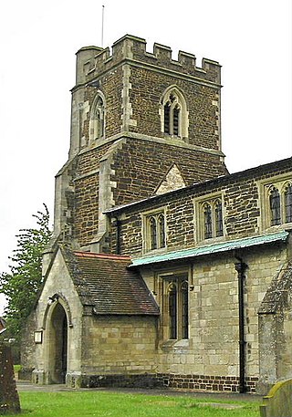
Stanbridge is a village and civil parish in Bedfordshire which lies 3 miles (5 km) east of Leighton Buzzard. It also borders the Bedfordshire villages of Hockliffe, Eggington, Tilsworth, Totternhoe and Billington.

Totternhoe is a village and civil parish in the Manshead hundred of the county of Bedfordshire, England.

Manshead was a hundred of Bedfordshire in England. It covered an area in the south-west of the county stretching from Salford to Studham and from Leighton Buzzard to Houghton Regis and Dunstable.
This is a list of High Sheriffs of Bedfordshire.

Dunstable is a market town and civil parish in Bedfordshire, England, east of the Chiltern Hills, 30 miles north of London. There are several steep chalk escarpments, most noticeable when approaching Dunstable from the north. Dunstable is the fourth largest town in Bedfordshire and along with Houghton Regis forms the westernmost part of the Luton/Dunstable urban area.

Central Bedfordshire is a unitary authority area in the ceremonial county of Bedfordshire, England. It was created in 2009.
Stanbridgeford railway station on the London and North Western Railway's branch line to Dunstable served the Bedfordshire villages of Stanbridge, Totternhoe, Eaton Bray and Tilsworth from 1849 to 1964. Once popular with visitors to the nearby Totternhoe Knolls and ramblers, the station closed against a background of falling passenger numbers and declining freight returns. The station building has survived into private ownership, but a section of the alignment to the east and west of the site has been taken into the A505 Leighton Southern Bypass. National Cycle Network route 6 runs to the east over the bypass as far as the outskirts of Dunstable.
This is an outline of Sport in Bedfordshire, a county in England.
This page is based on this
Wikipedia article Text is available under the
CC BY-SA 4.0 license; additional terms may apply.
Images, videos and audio are available under their respective licenses.


