Castle, Bedford

Last updated

Castle
Bedford Shopping Centre - Feb 2004.jpg
Bedford town centre, in Castle Ward
Bedfordshire UK location map.svg
Red pog.svg
Castle
Location within Bedfordshire
Population8,259  [1]
7,113 (2011 Census. Ward) [2]
OS grid reference TL052498
Unitary authority
Ceremonial county
Region
Country England
Sovereign state United Kingdom
Post town BEDFORD
Postcode district MK40, MK42
Dialling code 01234
Police Bedfordshire
Fire Bedfordshire and Luton
Ambulance East of England
UK Parliament
List of places
UK
England
Bedfordshire
52°08′13″N0°27′46″W / 52.13691°N 0.46287°W / 52.13691; -0.46287

Castle is an electoral ward and area of Bedford, Bedfordshire, England.

Contents

The boundaries of Castle Ward are approximately Bromham Road and Goldington Road to the north, Denmark Street to the east, Rope Walk to the south, with the Midland Main Line railway line and Ashburnam Road to the west.

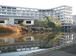
Castle Ward includes almost all of Bedford town centre, as well as the eastern section of the Castle Road neighbourhood. Castle is the only Ward in the town of Bedford to be located on both sides of the River Great Ouse.

In common usage the 'Castle' area is often synonymous with the Castle Road neighbourhood. [3] Since local government boundary changes in Bedford in 2011, however, the Castle Road neighbourhood has been split between Castle Ward and Newnham Ward.

History

Bedford Castle BedfordCastleNight.jpg
Bedford Castle

The name 'Castle' comes from Bedford Castle which is located in the ward. William II granted the Barony of Bedford to Paine de Beauchamp who built the castle. The castle was destroyed (slighted) in 1224 by Henry III. In 1166 the town of Bedford was given a charter. This was when Bedford Market was founded, and it is still held in Castle Ward.

To the south of the river, Cauldwell Priory was built in the area by Franciscan Friars in 1238. [4] The priory included a leper colony dedicated to St Leonard. The priory was dissolved by King Henry VIII in 1541, and around this time a new bridge was built over the River Great Ouse, and the town of Bedford began to expand to the south of the river. The river became navigable as far as Bedford by 1689. [5] Up until this time, Bedford was a small agricultural town, with wool being an important industry in the area for much of the Middle Ages. However, with the opening up of the River Great Ouse, wool declined in importance and brewing became a major industry in the town. [6]

In 1660 John Bunyan was imprisoned for 12 years in Bedford Gaol, which was located in present-day Castle Ward. It was here that he wrote The Pilgrim's Progress .

Bedford Corn Exchange BedfordCornExchange.JPG
Bedford Corn Exchange

The 19th Century saw Bedford transform into an important engineering hub. In 1832 Gas lighting was introduced into the area that is now Castle Ward, and the railway reached Bedford in 1846. Bedford's Corn Exchange was built in the area in 1849, and the first drains and sewers were dug in 1864. Bedford's growth in the 19th century saw the Castle area expand along the river to the east. [6]

After the Second World War, the Cauldwell Street neighbourhood of terraced houses was demolished, making way for new offices and public buildings, including headquarters for Bedford College and Bedfordshire County Council.

Bedford Borough Hall in Castle CountyHallRearBedford.JPG
Bedford Borough Hall in Castle

Governance

Castle is an unparished area, with all community services under the direct control of Bedford Borough Council. Castle elects two councillors to Bedford Borough Council, both currently from the Green Party, being the first Green Party councillors in Bedford.

Economy

Virtually all of the Bedford's central business district is located in Castle Ward, with many major High Street shops being located here. The main shopping areas of note are the High Street which includes a Wilko store, banks, many pubs, nightclubs and restaurants. The Harpur Centre is Bedford's main shopping centre. Branches of Boots, TK Maxx, Primark and various other stores are located here. Located in the eastern section of the Castle Road neighbourhood there are a host of smaller independent shops and community stores. [7]

Many of Bedford's central amenities are located in Castle Ward, including Bedford's main post office, market, magistrates court, Bedford bus station and Bedford railway station. Two of Bedford's largest hotels are located in the Ward - The Swan Hotel on the High Street, [8] and Mercure Bedford Centre Hotel situated across the river on St Mary's Street. [9]

Bedford College in Castle Ward BedfordCollegeEntrance.JPG
Bedford College in Castle Ward

Also south of the river, there are a few more shops located around the St Mary's Street/St John's Street/Cauldwell Street area. It is here that Bedford College is located, as well as a Farmfoods store. Borough Hall, the administrative headquarters of Bedford Borough Council is also located here. [10]

Education

Priory Primary School is located on Greyfriars, [11] while Castle Newnham School has a campus for primary school age pupils situated on Goldington Road. For secondary school education Bedford Free School is located on Cauldwell Street, though many Castle students attend either Biddenham International School or Castle Newnham School.

Bedford Girls' School is an independent school for girls aged 7–18, located on Cardington Road in Castle Ward. The school is part of the Harpur Trust. [12]

Bedford College has its main site on Cauldwell Street, and offers a range of further education courses including GCSEs, A Levels, Apprenticeships and Access courses. [13]

Religious sites

St. Paul's Church is in Castle Ward StPaulsChurchBedford.jpg
St. Paul's Church is in Castle Ward

There are many places of worship in Castle Ward, some of which serve the entire Bedford area -

Community facilities

The main open space in the Castle area is Russell Park and the Embankment of the River Great Ouse. The Bedford Corn Exchange, The Higgins Art Gallery & Museum and Esquires (a live music venue) are also located in Castle Ward.

Related Research Articles

<span class="mw-page-title-main">Bedfordshire</span> County of England

Bedfordshire is a ceremonial county in the East of England. It is bordered by Northamptonshire to the north, Cambridgeshire to the north-east, Hertfordshire to the south and the south-east, and Buckinghamshire to the west. The largest settlement is Luton (225,262), and Bedford is the county town.

<span class="mw-page-title-main">Bedford</span> Town in Bedfordshire, England

Bedford is a market town in Bedfordshire, England. At the 2011 Census, the population of its urban area, including Kempston and Biddenham, was 106,940. Bedford is also the county town of Bedfordshire and seat of the Borough of Bedford, a unitary authority that includes a significant rural area.

<span class="mw-page-title-main">Kempston</span> Human settlement in England

Kempston is a town and civil parish in the Borough of Bedford, Bedfordshire, England, situated around 2 miles (3.2 km) south-west of Bedford town centre. It had a population of 19,330 in the 2011 census, and forms part of the wider Bedford built-up area. The River Great Ouse separates it from the Queen's Park area of Bedford.

<span class="mw-page-title-main">Borough of Bedford</span> Unitary authority area in Bedfordshire, England

The Borough of Bedford is a unitary authority area with borough status in the ceremonial county of Bedfordshire, England. Its council is based in Bedford, its namesake and principal settlement, which is the county town of Bedfordshire. The Bedford built-up-area is the 71st largest in the United Kingdom and comprises the boundaries of the pre-1974 Bedford Municipal Borough, the town of Kempston and the village of Biddenham, with the BUA surrounded by a rural area with many villages. 75% of the borough's population live in the Bedford Urban Area and the five large villages which surround it, which makes up slightly less than 6% of the total land area of the Borough.

<span class="mw-page-title-main">Great Barford</span> Human settlement in England

Great Barford is a village and civil parish in the Borough of Bedford, Bedfordshire, England, around 5 miles (8.0 km) north-east of Bedford town centre. It lies on the River Great Ouse at grid reference TL129523. It is twinned with Wöllstein, Germany. The village is bypassed by the busy A421 road on the way between the M1 near Milton Keynes and the A1 near St Neots.

<span class="mw-page-title-main">Brickhill</span> Human settlement in England

Brickhill is a civil parish and electoral ward within northern Bedford in Bedfordshire, England.

<span class="mw-page-title-main">Maulden</span> Human settlement in England

Maulden is a village and civil parish located in the county of Bedfordshire. The village is located 1.5 miles east of Ampthill and about 8 miles (13 km) south of Bedford. It has about 1,250 homes and 3130 residents.

Riseley is a village and civil parish located in North Bedfordshire, England. The village name has had alternative spellings in the past such as Rislau, Riseleg, Riselai and Risely, however all these spellings are considered archaic. It has a population of 1,284 according to the 2001 census, increasing to 1,286 at the 2011 Census, and is near the villages of Bletsoe, Sharnbrook, Swineshead, Pertenhall, Keysoe, Thurleigh and Melchbourne. The nearest town to Riseley is Rushden in the neighbouring county of Northamptonshire, approximately 8 miles away to the north west. The county town of Bedford is approximately 9 miles to the South of Riseley. The village has one watercourse, which is a tributary of the River Ouse, flowing through it known locally as the 'Brook' around which in medieval times the village was built.

Renhold is a village and civil parish located on the River Ouse, in the Borough of Bedford, Bedfordshire, England. The parish church is situated some 4 miles (6.5 km) east-north-east of Bedford town centre. The former Bedfordshire County Council estimated the population of Renhold to be 1,800 in 2005, and forecast an increase to 2,320 by 2010.

Putnoe is an electoral ward on the northern side of Bedford, England.

<span class="mw-page-title-main">Cauldwell, Bedford</span> Human settlement in England

Cauldwell is an electoral ward and area within the town of Bedford, England.

<span class="mw-page-title-main">De Parys</span> Human settlement in England

De Parys is an electoral ward and area within the town of Bedford, Bedfordshire, England.

<span class="mw-page-title-main">Goldington</span> Human settlement in England

Goldington is part of Bedford, Bedfordshire, England. It encompasses much of the historic village and parish of Goldington that was merged with Bedford in 1934, although some parts of the old village are within the neighbouring Newnham ward. It also includes two modern estates that are part of Renhold parish.

<span class="mw-page-title-main">Harpur</span> Area of Bedford, England

Harpur is an electoral ward and area within the town of Bedford, England.

<span class="mw-page-title-main">Kingsbrook, Bedford</span> Human settlement in England

Kingsbrook is an electoral ward and area within the town of Bedford, England.

<span class="mw-page-title-main">Newnham, Bedford</span> Area of the town of Bedford, England

Newnham is an electoral ward and area within the town of Bedford, Bedfordshire, England.

Bedford Academy is a mixed secondary school and sixth form located in the Kingsbrook area of Bedford, Bedfordshire, England.

<span class="mw-page-title-main">Priory Country Park</span>

Priory Country Park is a country park located in the Newnham area of Bedford, England alongside the River Great Ouse. The park is managed by Bedford Borough Council.

References

  1. Neighbourhood Statistics. "Neighbourhood Statistics". Neighbourhood Statistics. Retrieved 6 August 2012.
  2. "Bedford Ward population 2011". Neighbourhood Statistics. Office for National Statistics. Retrieved 4 November 2016.
  3. "Castle Residents Association". 9 July 2015. Retrieved 9 July 2015.
  4. "Bedford - Victorian Super Sleuth Quiz 1 Extra - Bedfordshire's Virtual Library". Galaxy.bedfordshire.gov.uk. 15 February 2008. Archived from the original on 7 February 2012. Retrieved 6 August 2012.
  5. "'History of Bedford'". Bedford.gov.uk. Archived from the original on 8 December 2015. Retrieved 6 August 2012.
  6. 1 2 http://www.localhistories.org/bedford.html 'A brief history of Bedford' by Tim Lambert
  7. http://comearoundtobedford.moonfruit.com/ 'Featured Business'
  8. "'Town Centre Guide'".
  9. "Mercure Bedford Centre Hotel". all.accor.com/. Retrieved 5 August 2020.
  10. http://www.bedford.gov.uk/ Bedford Borough Council
  11. "Priory Lower School". Archived from the original on 31 December 2007. Retrieved 9 January 2008.
  12. "Welcome to Bedford Girls' School | Welcome to Bedford Girls' School |". Bedfordgirlsschool.co.uk. Retrieved 6 August 2012.
  13. http://www.bedford.ac.uk/ Bedford College
  14. http://www.stpaulschurchbedford.org.uk/ St Paul's Church
  15. http://www.bedfordspiritualistchurch.org/ Archived 20 December 2007 at the Wayback Machine Bedford Spiritualist Church
  16. "Mount Zion Church". Cambonli01.uuhost.uk.uu.net. Archived from the original on 23 May 2005. Retrieved 6 August 2012.
  17. http://www.rutlandroadchurch.org/ Archived 2008-03-29 at the Wayback Machine Rutland Road Church
  18. http://www.miraclecogic.org/ Archived 2008-04-17 at the Wayback Machine The Miracle of God in Christ Church
  19. 1 2 http://bedfordmuslims.co.uk/ Archived 2007-12-21 at the Wayback Machine Bedford & Castle Mosques
  20. http://www.bedfordpentecostal.org/ Archived 2007-11-27 at the Wayback Machine Bedford Pentecostal Church
  21. http://www.bedfordcongresshall.co.uk/ Archived 2007-11-29 at the Wayback Machine Bedford Salvation Army Congress Hall
  22. Bunyan Meeting Free Church & Museum Archived January 2, 2008, at the Wayback Machine
  23. "Polish Church of Sacred Heart of Jesus & St Cuthbert". Ppb.org.uk. Archived from the original on 10 February 2012. Retrieved 6 August 2012.
  24. http://www.panacea-society.org/ The Panacea Society
  25. http://www.acts-online.com/ Archived 2008-07-01 at the Wayback Machine St John's & St Leonard's Church
  26. "Southside Church". Southside Church. Archived from the original on 26 January 2010. Retrieved 6 August 2012.