Turweston is a village and civil parish in north-west Buckinghamshire, England. The village is beside the River Great Ouse, which bounds the parish to the north, west and south. Turweston is the most northwesterly parish in Buckinghamshire: the Ouse here forms the county boundary with Northamptonshire to the north and west and Oxfordshire to the south. Across the river, the Northamptonshire market town of Brackley is just west of Turweston, with the town centre about 1 mile (1.6 km) west of the village. The parish has an area of 1,295 acres (524 ha) and had a population of 211 at the 2011 Census.

The present St Mary's Church is located in the centre of the small village of Clophill, between Bedford and Luton in the county of Bedfordshire in the South Midlands of England. The new church, built in 1848, replaced the old church by order of the Church Commissioners in 1850. The old church building, formally The Church of St Mary The Virgin and known colloquially as Old St Mary's or The Old Parish Church, is at the edge of the village, and is estimated to be around 650 years old. It sits at the crest of the Greensand Ridge, offering views over the surrounding countryside. Its graveyard is a haven for wild flowers and wildlife. After the church moved to the village centre, incorporating various items from the old church building, the old building was converted for use as a mortuary chapel, but in the 1950s it fell into ruin.
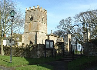
Newbottle is a civil parish and largely deserted village in West Northamptonshire, about 4 miles (6.4 km) west of the market town of Brackley. It is close to the Oxfordshire county boundary and about 4.5 miles (7.2 km) south-east of the town of Banbury.
Pavenham is a small village and civil parish on the River Great Ouse in the Borough of Bedford in Bedfordshire, England, about 6 miles (10 km) north-west of Bedford. Village amenities consist of St Peter's Church, a pub, Village hall, tennis Club, Cricket Club and golf club. The village is home to many clubs and societies including an active WI.
Bolnhurst is a small village and former civil parish, now in the parish of Bolnhurst and Keysoe, in the Borough of Bedford, Bedfordshire, England. The village is about 6 miles (9.7 km) north-northeast of Bedford town centre and about 6 miles (10 km) west of St Neots. In 1931 the parish had a population of 162.

Swineshead is a village and civil parish in the Borough of Bedford in the county of Bedfordshire, England.

Whichford is a village and civil parish in Warwickshire, England, about 5 miles (8 km) southeast of Shipston-on-Stour. The parish adjoins the county boundary with Oxfordshire and the village is about 4+1⁄2 miles (7 km) north of the Oxfordshire town of Chipping Norton.
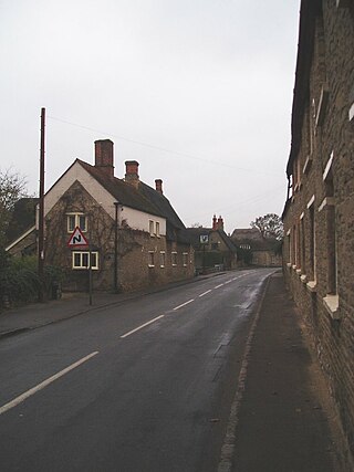
Middleton Cheney is a large village and civil parish in West Northamptonshire, England. The village is about 3 miles (5 km) east of Banbury in Oxfordshire and about 6 miles (10 km) west-northwest of Brackley. The A422 road between Banbury and Brackley used to pass through Middleton Cheney, but now bypasses it to the south.

Hasketon is a village and civil parish in the East Suffolk District of Suffolk, England.

Podington is a village and civil parish in Bedfordshire, England, United Kingdom. The village is within the electoral ward of Harrold in the Borough of Bedford. Podington lies around 16 km (9.9 mi) northwest of Bedford and is about 2 km (1.2 mi) east of the county border with Northamptonshire.

Hinwick is a hamlet in northwest Bedfordshire, England, United Kingdom; it is around nine miles north west of Bedford and is about 1 km (0.62 mi) east of the county border with Northamptonshire which is also the postal county. The hamlet is in the parish of Podington, which is sometimes called "Podington and Hinwick" and this parish was within the Hundred of Willey. Hinwick was recorded in the Domesday Book in 1086 as Haneuuich, also spelt Heneuuiche or Henewich and has also been recorded as Henewic and Hynewyk from the 13th century. In 1086, the population consisted of 19 households under six owners.

Harrold is a village, civil parish and electoral ward in Bedfordshire, England, nine miles north-west of Bedford on the north bank of the River Great Ouse, close to the county boundaries of Buckinghamshire and Northamptonshire. An ancient bridge links the village with Carlton with Chellington on the south bank. Immediately to the east of the village is Odell.

Knotting is a village and former civil parish, now in the parish of Knotting and Souldrop, in the Bedford district, in the ceremonial county of Bedfordshire, located near the border with Northamptonshire. Nearby places are, Sharnbrook, Podington, Odell, Melchbourne, Yelden, Newton Bromswold, Souldrop and Rushden over the border in Northamptonshire. In 1931 the parish had a population of 114. On 1 April 1934 the parish was abolished to form "Knotting and Souldrop".
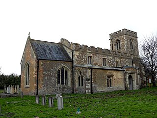
Greatworth is a village in the civil parish of Greatworth and Halse about 4 miles (6.4 km) north-west of Brackley, West Northamptonshire, England. The parish also includes the hamlet of Halse. In 2011, the settlement had a population of 708. The 2011 Census recorded the parish population as 890.

Milton Bryan is a village and civil parish located in Central Bedfordshire. It lies just off the A4012 road, near to its junction with the A5 at Hockliffe. The parish includes the ancient hamlets of Potsgrove & Battlesden. The village is best known for being the birthplace of Joseph Paxton, the designer of the Crystal Palace, who was born in Milton Bryan as the seventh son of a farming family along with its role in the Second World War.

St Denys' Church is a redundant Anglican church in the village of Little Barford, Bedfordshire, England. It is recorded in the National Heritage List for England as a designated Grade II* listed building, and is under the care of the Churches Conservation Trust.
St. George's Church, Edworth, is a redundant Anglican church in the village of Edworth, Bedfordshire, England. It is recorded in the National Heritage List for England as a designated Grade I listed building and is under the care of the Churches Conservation Trust. Edworth is about 3 miles (5 km) southeast of Biggleswade, to the east of the A1 road.

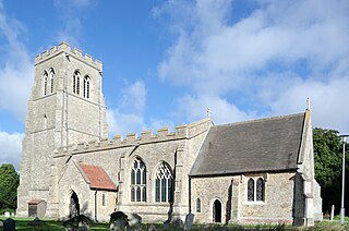
Church of All Saints is a Grade I listed church in Houghton Conquest, Bedfordshire, England. It became a listed building on 23 January 1961. The parish church, dedicated to All Saints, was built during the 14th century. There are also several monuments. Houghton Conquest's rectory was united with that of Houghton-Gildable in 1637, in the archdeaconry of Bedford, and diocese of Lincoln. It was under the patronage of the Master and Fellows of St John's College, Cambridge.

The Church of All Saints, Houghton Regis, Bedfordshire, is a medieval Grade I listed building. Characterised by flint and clunch checker work on the exterior, the church dates predominantly from the 13th and 14th centuries, with 15th century additions. All Saints' serves as the Parish Church for Houghton Regis, the parish including the town, parts of North Dunstable, Bidwell West, Thorn, and Linmere, as well as the hamlet of Sewell.

The Church of All Saints in Radwell in Hertfordshire is an Anglican parish church which falls within the Diocese of St Albans. It is a Grade II* listed building, having gained that status in 1968.