Kempston Rural

Last updated

Kempston Rural
Kempston Church End.jpg
Church End, Kempston
Bedfordshire UK location map.svg
Red pog.svg
Kempston Rural
Location within Bedfordshire
Population2,764 (2021) [1]
OS grid reference TL015479
Civil parish
  • Kempston Rural
Unitary authority
Ceremonial county
Region
Country England
Sovereign state United Kingdom
Post town BEDFORD
Postcode district MK43
Dialling code 01234
Police Bedfordshire
Fire Bedfordshire and Luton
Ambulance East of England
UK Parliament
List of places
UK
England
Bedfordshire
52°07′12″N0°31′00″W / 52.120116°N 0.516613°W / 52.120116; -0.516613

Kempston Rural is a civil parish in the Borough of Bedford in Bedfordshire, England.

Contents

History

Kempston Rural was formed in 1896 when the old parish of Kempston was split into two parts - Kempston Urban District (now the town of Kempston), and Kempston Rural parish.

Historically Kempston was a large but lightly populated parish, with a decentralised population pattern. The typical parish in pre-Industrial England had one main village, perhaps complemented by a few hamlets, but in Kempston the settlement around the church - Church End - has never had more than a dozen or so houses, so it has never dominated the parish. When urban growth arrived in Kempston in the 19th century it was concentrated in the eastern parts of the parish, around the neighbouring ends of East End and Up End (i.e. the area around the High Street and St John Street) and in Kempston New Town, close to the boundary of Bedford.

Geography

Kempston Rural is to the west of the town of Kempston, and comprises approximately the western half of the historical ecclesiastical parish of Kempston. The parish includes the small hamlets ("ends" in local parlance) of Box End, Church End, Gibraltar, Green End, West End and Wood End. These five ends each have a dozen or more houses, up to a hundred or so, with Box End and Wood End being the largest and most identifiable of the settlements.

The narrow south western extension of the parish was once known as Bourne End or Kempston Bourne, but the hamlet is now represented only by Meadow Farm. Other semi-forgotten "ends" in Kempston Rural - now represented by just a house or two - include Crow End and Littleworth End, in the Western part of the parish, and Moor End and Mill End, both of which lie to the north of Box End, towards Bromham.

Not all of "rural" Kempston is in Kempston Rural: there is one "end" of the old parish - Kempston Hardwick - which is now within the boundaries of the Stewartby civil parish, and the rural land either side of Ridge Road at the Bury and Bell End Farm, is in Kempston Urban.

All Saints' Church at Church End, was originally the parish church for the whole of Kempston, and is the most notable historical building in either part of Kempston.

Governance

Church Hall at Church End Church Hall, Kempston Church End.jpg
Church Hall at Church End

There are two tiers of local government covering Kempston Rural at civil parish and unitary authority level: Kempston Rural Parish Council and Bedford Borough Council. The parish council meets at the Church Hall in Church End.

For local election purposes Kempston Rural is in Turvey Ward, which also includes the civil parishes of Stagsden and Turvey. The area is represented on Bedford Borough Council by Mark Smith, elected in May 2007.

Related Research Articles

<span class="mw-page-title-main">Bedford</span> Town in Bedfordshire, England

Bedford is a market town in Bedfordshire, England. At the 2011 Census, the population of its urban area, including Kempston and Biddenham, was 106,940. Bedford is also the county town of Bedfordshire and seat of the Borough of Bedford, a unitary authority that includes a significant rural area.

<span class="mw-page-title-main">Kempston</span> Human settlement in England

Kempston is a town and civil parish in the Borough of Bedford, Bedfordshire, England, situated around 2 miles (3.2 km) south-west of Bedford town centre. It had a population of 19,330 in the 2011 census, and forms part of the wider Bedford built-up area. The River Great Ouse separates it from the Queen's Park area of Bedford.

<span class="mw-page-title-main">Little Barford</span> Human settlement in England

Little Barford is a hamlet and civil parish in the Borough of Bedford in Bedfordshire, England about 7 miles (11 km) northeast of the county town of Bedford.

<span class="mw-page-title-main">Borough of Bedford</span> Unitary authority area in Bedfordshire, England

The Borough of Bedford is a unitary authority area with borough status in the ceremonial county of Bedfordshire, England. Its council is based in Bedford, its namesake and principal settlement, which is the county town of Bedfordshire. The Bedford built-up-area is the 71st largest in the United Kingdom and comprises the boundaries of the pre-1974 Bedford Municipal Borough, the town of Kempston and the village of Biddenham, with the BUA surrounded by a rural area with many villages. 75% of the borough's population live in the Bedford Urban Area and the five large villages which surround it, which makes up slightly less than 6% of the total land area of the Borough.

<span class="mw-page-title-main">Bromham, Bedfordshire</span> Human settlement in England

Bromham is a village and civil parish in the Borough of Bedford in Bedfordshire, England, situated around 3 miles (4.8 km) west of Bedford town centre.

<span class="mw-page-title-main">Stagsden</span> Human settlement in England

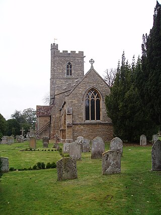
Stagsden is a small but historic village and civil parish located in the Borough of Bedford, northwest Bedfordshire, England, near the Buckinghamshire border. Situated around 4 miles (6.4 km) west of Bedford town centre on one of the main routes between it and Milton Keynes, the village was bypassed by the A422 in April 1992, to allow the increasing amount of traffic to avoid the 30 mph speed limit in Stagsden.

<span class="mw-page-title-main">History of Bedfordshire</span> History of Bedfordshire County in England

Bedfordshire is an English ceremonial county which lies between approximately 25 miles and 55 miles north of central London.

<span class="mw-page-title-main">Civil parishes in Bedfordshire</span> List of places

A civil parish is a country subdivision, forming the lowest unit of local government in England. There are 125 civil parishes in the ceremonial county of Bedfordshire, most of the county being parished: Luton is completely unparished; Central Bedfordshire is entirely parished. At the 2001 census, there were 312,301 people living in the 125 parishes, which accounted for 55.2 per cent of the county's population.

<span class="mw-page-title-main">Bedford (UK Parliament constituency)</span> Parliamentary constituency in the United Kingdom from 1801 to 1983 and from 1997 onwards

Bedford is a constituency represented in the House of Commons of the UK Parliament since 2017 by Mohammad Yasin of the Labour Party.

<span class="mw-page-title-main">Mid Bedfordshire (UK Parliament constituency)</span> Parliamentary constituency in the United Kingdom, 1918 onwards

Mid Bedfordshire is a constituency represented in the House of Commons of the UK Parliament by Alistair Strathern of the Labour Party since a 2023 by-election.

<span class="mw-page-title-main">Kempston Hardwick</span> Human settlement in England

Kempston Hardwick is a small hamlet on the edge of the town of Kempston in Bedfordshire, England. Historically it was one of the hamlets or "ends" scattered across the parish of Kempston. It is served by Kempston Hardwick railway station on the Marston Vale Line, which was one of the least-used stations in the UK railway network.

<span class="mw-page-title-main">Turvey, Bedfordshire</span> Human settlement in England

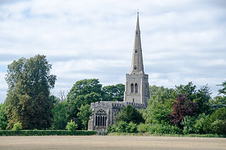
Turvey is a village and civil parish on the River Great Ouse in the Borough of Bedford, Bedfordshire, England, about 7 miles (11 km) west of Bedford town centre. The village is on the A428 road between Bedford and Northampton, close to the border with Buckinghamshire. The 2011 Census recorded the parish's population as 1,225.

<span class="mw-page-title-main">Caddington</span> Human settlement in England

Caddington is a village and civil parish in the Central Bedfordshire district of Bedfordshire, England.

Bedford Rural District was a rural district in Bedfordshire, England from 1894 to 1974. It surrounded but did not include the Municipal Borough of Bedford and Kempston Urban District.

<span class="mw-page-title-main">Colmworth</span> Village and civil parish in England

Colmworth is a village and civil parish in the Borough of Bedford in the county of Bedfordshire, England about 6.5 miles (10 km) north-east of Bedford.

<span class="mw-page-title-main">North Bedfordshire (UK Parliament constituency)</span> Parliamentary constituency in the United Kingdom, 1983–1997

North Bedfordshire was a county constituency in Bedfordshire. It returned one Member of Parliament (MP) to the House of Commons of the Parliament of the United Kingdom, elected by the first-past-the-post voting system.

Renhold is a village and civil parish located on the River Ouse, in the Borough of Bedford, Bedfordshire, England. The parish church is situated some 4 miles (6.5 km) east-north-east of Bedford town centre. The former Bedfordshire County Council estimated the population of Renhold to be 1,800 in 2005, and forecast an increase to 2,320 by 2010.

Box End is a small village located in the Borough of Bedford in Bedfordshire, England. It is in the civil parish of Kempston Rural.

Kempston was an urban district in Bedfordshire, England between 1896 and 1974.

References

  1. "Kempston Rural". City Population. Retrieved 21 September 2023.