The Priory Church of Saint Mary, Bushmead, commonly called Bushmead Priory, was a monastic foundation for Augustinian Canons, located at Bushmead in the County of Bedfordshire in England. It is a Grade I listed building.
St Neots is a town and civil parish in the Huntingdonshire district of Cambridgeshire, England. It is 18 miles (29 km) west of Cambridge. The areas of Eynesbury, Eaton Ford, Eaton Socon, and Wintringham form part of the town.

Eynesbury is an urban area in the civil parish of St Neots, in the Huntingdonshire district of Cambridgeshire, England. It mainly consists of housing, although there is an area of light industry, and a large supermarket. In addition there is a large area of open grassland and a caravan park.
Eaton Socon is a community in the civil parish of St Neots, in the Huntingdonshire district, in the county of Cambridgeshire, England. Eaton Socon is a component of the town of St Neots, located on its south-west margin. Eaton Socon lies on the west side of the River Great Ouse, and is bounded on the west by the A1 road and on the south by the A428 road. On the north side Duloe Brook delineates the boundary with Eaton Ford, which is also part of St Neots.

St Neots, historically in Huntingdonshire, is one of the largest towns in Cambridgeshire, England, after the cities of Cambridge and Peterborough. There is evidence of very early occupation in the area. In Roman times a fortified settlement was established, and present-day Eynesbury in particular became important, in addition to scattered settlements west of the River Great Ouse. A holy man named Saint Neot had died about the year 877 AD and his relics were held for a century in a parish in Cornwall. About 974 AD a Priory was established in the northern part of Eynesburydowner took the relics of Saint Neot from the Cornish church and conveyed them to Eynesbury. This brought fame to the Eynesbury Priory, and gradually that part of the town became known as St Neots.

Water Eaton is an area of Milton Keynes, Buckinghamshire, England and in the civil parish of Bletchley and Fenny Stratford. It is to the south of Fenny Stratford and contiguous with it. It is one of the ancient Buckinghamshire villages that became incorporated as part of Milton Keynes in 1967.

Abbess Roding is a village and former civil parish, now in the parish of Abbess, Beauchamp and Berners Roding and the Epping Forest District of Essex, England. The village is included in the eight hamlets and villages called The Rodings. It is in west Essex, 5 miles (8 km) north from Chipping Ongar, and 9 miles (14 km) west from the county town of Chelmsford. In 1931 the parish had a population of 169.

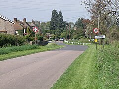
Swineshead is a village and civil parish in the Borough of Bedford in the county of Bedfordshire, England.
Eaton Socon was a rural district in Bedfordshire, England from 1894 to 1934.
Gosford and Water Eaton is a civil parish in the Cherwell district of the county of Oxfordshire, England. It is north of the city of Oxford and is crossed nearby by two major roads for, or by-passing, the city. The parish contains the village of Gosford and the hamlet of Water Eaton and as at the 2011 census had 1373 people resident across its 8.75 km2.
Eaton Socon Castle was a Norman fortification. It was constructed next to the River Great Ouse in what is now Eaton Socon, Cambridgeshire, England.

Gosford is a village immediately southeast of Kidlington, in the Cherwell district, Oxfordshire, England. It is in the civil parish of Gosford and Water Eaton. The 2011 Census recorded Gosford and Water Eaton's parish population as 1,373.

Duloe is a hamlet in the English county of Bedfordshire.
Wyboston, Chawston and Colesden is a civil parish located in the Borough of Bedford in Bedfordshire, in England.
Colesden is a small hamlet located in the English county of Bedfordshire. At the 2011 Census, the population of the hamlet was included in the civil parish of Wyboston, Chawston and Colesden.

Honeydon is a hamlet located in the Borough of Bedford in Bedfordshire, England.

Upper Staploe is a hamlet located in the Borough of Bedford in the county of Bedfordshire, England. The settlement is close to Honeydon and Staploe, and forms part of the Staploe civil parish. Upper Staploe lies close to the county border with the Huntingdonshire district of Cambridgeshire.

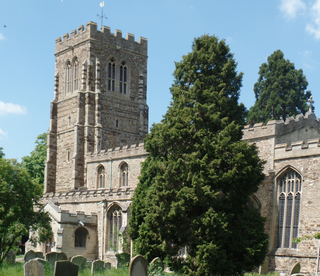
Thurleigh is a village and civil parish in the Borough of Bedford, north Bedfordshire, England, situated around 5 miles (8.0 km) north of Bedford town centre.

Eaton Socon Football Club is an association football club based in the areas of Eaton Socon and Eaton Ford, St Neots, England. They are currently members of the Spartan South Midlands League Division One and play at River Road, Eaton Ford, St Neots.