Wilstead

Last updated

Wilstead
Bedfordshire UK location map.svg
Red pog.svg
Wilstead
Location within Bedfordshire
Population3,270 (2011 Census including Herrings Green and Wixams ) [1]
OS grid reference TL073794
Civil parish
Unitary authority
Ceremonial county
Region
Country England
Sovereign state United Kingdom
Post town BEDFORD
Postcode district MK45
Dialling code 01234
Police Bedfordshire
Fire Bedfordshire and Luton
Ambulance East of England
UK Parliament
List of places
UK
England
Bedfordshire
52°04′00″N0°26′00″W / 52.0666°N 0.4333°W / 52.0666; -0.4333 Coordinates: 52°04′00″N0°26′00″W / 52.0666°N 0.4333°W / 52.0666; -0.4333
Wilstead All Saints Church Wilstead All Saints Church, 2010.jpg
Wilstead All Saints Church

Wilstead is a village and civil parish in Bedfordshire, England, just off the A6 Bedford to Luton road, about five miles south of Bedford town centre, and within the Borough of Bedford. The name of the village has been spelled in many different ways, including Wilshamstead and Wylhamstead. Wilstead is now the usual name of the village, but the civil parish is named Wilshamstead. The council estimated the population of the parish at 2,550 in 2005. Most of the inhabitants live in the main village, but some live in other hamlets and isolated houses.

Wilstead shops - a convenience store & pharmacy, Indian takeaway and Chinese takeaway. Two pubs - The Woolpack and The Red Lion are close by Wilstead Shops, 2010.jpg
Wilstead shops - a convenience store & pharmacy, Indian takeaway and Chinese takeaway. Two pubs - The Woolpack and The Red Lion are close by

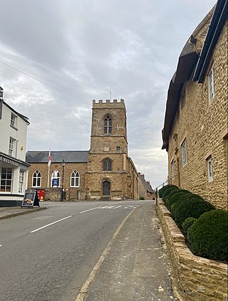
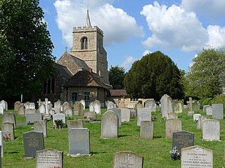
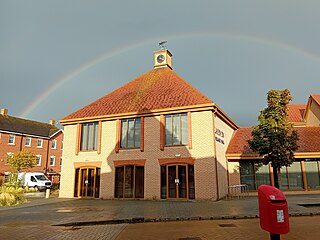
Near the centre of the village are a small shop that incorporates a sub post office with a sorting office, two pubs, a pharmacy/convenience store, an Indian takeaway, a Chinese takeaway and a small used car sales outlet. Wilstead Primary School is located in Cotton End Road, [2] as is the village hall, a modern building. The village also has a pre-school and two churches. Many allotments are close to the village playing fields. Playgrounds are located next to the primary school, off Long Meadow Drive. The Wilstead Jubilee Centre and Multi Use Games Area are in Jubilee Way, and a lawn bowls club is nearby.

On the eastern edge of the village towards the A600 road is the Herrings Green Activity Farm & Bird of Prey Centre. [3]

A thatched cottage in Wilstead, with the tower of All Saints Church visible in the background Wilstead Thatched Cottage.jpg
A thatched cottage in Wilstead, with the tower of All Saints Church visible in the background

Housing types include traditional farms, older houses (including thatched cottages and several Listed Buildings) and more modern, estate-type housing. Dwellings on the estate are generally of a more spacious character than the most modern developments. There is also a mobile home park called Briar Bank Park on the southern end of the village.

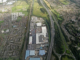
On the other (Western) side of the A6 is a large development of new, high density housing called Wixams. The new town is being developed in phases, with the first phase (Lakeview) originally located in the Wilshamstead civil parish, however a new Wixams civil parish was created for the area in 2015.

The yearly "Wilstead Ball" takes place the first Saturday of July and is a formal black tie and ball gown event. Taking place in a marquee in the grounds of one of the larger houses in the village, the money made from the event is normally allocated to a charity of the organisers preference. In recent years the event has sold out within days of the tickets sales being announced.

Related Research Articles

<span class="mw-page-title-main">Flitwick</span> Human settlement in England

Flitwick is a town and civil parish in Bedfordshire, England. It is mentioned in the Domesday Book of 1086 as "a hamlet on the River Flitt". The spelling Flytwyk appears in 1381.

<span class="mw-page-title-main">Haywards Heath</span> Human settlement in England

Haywards Heath is a town in West Sussex, England, 36 miles (58 km) south of London, 14 miles (23 km) north of Brighton, 13 miles (21 km) south of Gatwick Airport and 31 miles (50 km) northeast of the county town, Chichester. Nearby towns include Burgess Hill to the southwest, Horsham to the northwest, Crawley northwest and East Grinstead northeast. With only a relatively small number of jobs available in the immediate vicinity, mostly in the agricultural or service sector, many residents work "remotely" or commute daily via road or rail to London, Brighton, Crawley or Gatwick Airport for work.

<span class="mw-page-title-main">Farnley, Leeds</span> District of Leeds, West Yorkshire, England

Farnley is a district in Leeds, West Yorkshire, England, 2 miles (3.2 km) south-west of Leeds city centre, between Wortley, Bramley and the countryside around Pudsey and Gildersome, in the LS12 Leeds postcode area. It is part of the Leeds City Ward Farnley and Wortley with a population of 24,213 according to the 2011 Census. New Farnley is a nearby commuter village.

<span class="mw-page-title-main">Collier Street</span> Human settlement in England

Collier Street is a small village and civil parish in the Borough of Maidstone in Kent, England.

<span class="mw-page-title-main">Boughton, Northamptonshire</span> Village in Northamptonshire, England

Boughton is a village and civil parish in West Northamptonshire, England. It is situated approximately 4 miles (6 km) from Northampton town centre along the A508 road between Northampton and Market Harborough.

<span class="mw-page-title-main">Bacton, Suffolk</span> Human settlement in England

Bacton is a village and civil parish in Suffolk, England, about 8 kilometres (5.0 mi) north of Stowmarket. The village appeared as 'Bachetuna' in the Domesday Book and the area appears to have been settled at least since Roman times, with many interesting finds on the locally-organised annual metal-detecting days.

<span class="mw-page-title-main">Walderslade</span> Human settlement in England

Walderslade is a large suburb in Kent to the south of Chatham split between the unitary authority of Medway and the boroughs of Maidstone and Tonbridge & Malling in South East England. It was, until 1998, fully part of Kent and is still ceremonially associated via the Lieutenancies Act. It encompasses almost all the ME5 postcode district.

<span class="mw-page-title-main">Frampton Cotterell</span> Human settlement in England

Frampton Cotterell is a large village and parish, in South Gloucestershire, South West England, on the River Frome. The village is contiguous with Winterbourne to the south-west and Coalpit Heath to the east. The parish borders Iron Acton to the north and Westerleigh to the south-east, the large town of Yate is 2.1 miles (3.4 km) away. The village is 7.5 miles (12 km) north-east of the city of Bristol.

<span class="mw-page-title-main">Brickhill</span> Human settlement in England

Brickhill is a civil parish and electoral ward within northern Bedford in Bedfordshire, England.

<span class="mw-page-title-main">Ashill, Norfolk</span> Human settlement in England

Ashill is a village and civil parish in the English county of Norfolk. The village is between Watton and Swaffham.

<span class="mw-page-title-main">Auckley</span> Village and civil parish in South Yorkshire, England

Auckley is a village and civil parish in the City of Doncaster in South Yorkshire, England, about five miles east of Doncaster city centre. According to the 2001 census the parish had a population of 3,266, increasing to 3,745 at the 2011 Census. The parish includes the villages of Auckley and Hayfield Green.

Budbrooke is a small village and civil parish in the Warwick district of Warwickshire, England, about 2½ miles west of Warwick town centre. According to the 2001 census the parish had a population of 2,319, reducing to 1,863 at the 2011 Census. The majority of the population of Budbrooke live in Hampton Magna, a housing estate built in the late 1960s, with other smaller settlements in Budbrooke Village and Hampton on the Hill.

<span class="mw-page-title-main">Dickens Heath</span>

Dickens Heath is a large modern village and civil parish within the Metropolitan Borough of Solihull in the English county of West Midlands incorporating the much older hamlet of Whitlocks End. It was previously part of the civil parish of Hockley Heath, and borders Cheswick Green and Tidbury Green in Solihull, as well as Hollywood in Worcestershire.

Greatham is a village and civil parish in the East Hampshire district of Hampshire, England. It is 1.9 miles (3.1 km) north of Liss, just off the A3 road.

<span class="mw-page-title-main">Elstow</span> Human settlement in England

Elstow is a village and civil parish in the Borough of Bedford, Bedfordshire, England, about 2 miles (3.2 km) south of Bedford town centre.

Renhold is a village and civil parish located on the River Ouse, in the Borough of Bedford, Bedfordshire, England. The parish church is situated some 4 miles (6.5 km) east-north-east of Bedford town centre. The former Bedfordshire County Council estimated the population of Renhold to be 1,800 in 2005, and forecast an increase to 2,320 by 2010.

<span class="mw-page-title-main">Wixams</span> Human settlement in England

Wixams is a new town and civil parish located in Bedfordshire, England, which has been under construction since early 2007. It is expected to become the third largest settlement in the Borough of Bedford after Bedford itself and Kempston, and one of the largest new settlements founded in England since the British new towns movement of the first twenty five years after World War II. Part of the site is also in Central Bedfordshire. At the 2011 Census the population of the new town was included in the civil parish of Wilstead.

<span class="mw-page-title-main">Goldington</span> Human settlement in England

Goldington is an area of Bedford and electoral ward in the unparished area of Bedford, in the Bedford district, in the ceremonial county of Bedfordshire, England. It encompasses much of the historic village and parish of Goldington that was merged with Bedford in 1934, although some parts of the old village are within the neighbouring Newnham ward. It also includes two modern estates that are part of Renhold parish.

<span class="mw-page-title-main">Heydon, Norfolk</span> Village in Norfolk, England

Heydon is a village and civil parish in Norfolk, England.

Herrings Green is a hamlet in the civil parish of Cotton End, on the outskirts of Bedford, in the Bedford district, in the ceremonial county of Bedfordshire, England. The settlement is close to Cotton End and Wilstead. It is a tiny group of just 3 cottages and some farms on the Wilstead Road. Until 2019 Herrings Green forms part of the Eastcotts civil parish.

References

  1. "Civil Parish population 2011". Neighbourhood Statistics. Office for National Statistics. Retrieved 8 November 2016.
  2. "Wilstead Primary School" . Retrieved 7 September 2020.
  3. "Herrings Green Farm" . Retrieved 7 September 2020.