Northill has a small village green with duck pond, owned by the parish council.
Geography
Northill is 2 miles (3km) west southwest of Sandy, 3 miles (5km) west northwest of Biggleswade, 20 miles (32km) southwest of Cambridge and 42 miles (68km) north of Central London.
Area
The civil parish covers an area of 1,638 hectares (4,048 acres).[3] Its eastern boundary is the River Ivel.
Landscape
Topographically, Northill stands on a slightly elevated ridge that runs north to south. The village lies on the border of the Bedfordshire and Cambridgeshire Claylands and the Bedfordshire Greensand Ridge; National Character Areas designated by Natural England.[5] Central Bedfordshire Council has classified the local landscape around the village as within the Mid Greensand Ridge. The surrounding area is mostly arable farmland but there are significant areas of woodland to the west of the village, and parkland at Ickwell. The north and east of the parish form part of the predominantly flat, Lower Ivel Clay Valley.[6][7]
Elevation
The village centre is 34 metres (112ft) above sea level. The east of the parish is flat and ranges between 21 metres (69ft) and 26 metres (85ft). The land rises westwards to reach 70 metres (230ft).[8]
Geology and soil type
Northill village lies mainly on Oxford clay overlying Kellaways beds. Patches of glacial gravel (till) and boulder clay are to the west of the village. The eastern and northern parts of the parish lie on glacial gravel, and alongside the Ivel are superficial deposits of first and second terrace river gravel and alluvium. Ickwell lies on Ampthill Clay.[9] Around the village the soil is highly fertile, lime-rich, loamy and clayey with impeded drainage. The eastern area of the parish has soil of low fertility, which is freely draining and slightly acid with a loamy texture.[10]
The night sky and light pollution
Light pollution is the level of radiance (night lights) shining up into the night sky. The Campaign to Protect Rural England (CPRE) divides the level of night sky brightness into 9 bands with band 1 being the darkest i.e. with the lowest level of light pollution and band 9 the brightest and most polluted. Northill is in band 4. Darker sky is to the west but it is lighter towards Sandy and Biggleswade.[11][12]
The built environment
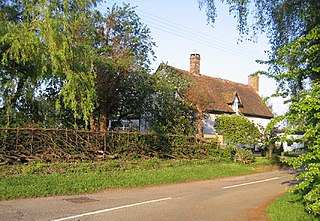
Along Thorncote Road, Northill are a number of grade II listed, 17th and 18th century thatched cottages of timber-frame construction with colour washed brick and render. A pair of timber framed, clay tiled gambrel roofed, colour washed roughcast rendered cottages date to about 1800. At the junction of Thorncote, Bedford and Ickwell Roads stands Northill Grange. It has a double pile plan; i.e. there are two buildings under separate roofs one behind the other. On Ickwell Road are a pair of early 19th century timber-framed cottages with weatherboarding and a clay tile roof.[13]
Part of the ancient hundred of Wixamtree, the village was originally known as North Givell,[14] meaning the northern part of territory of the River Ivel. A similar version of this place-name is first evidenced in the Domesday Book of 1086 which reads: Nortigble/Nortgiue(le): Pirot and Ralph from Eudo FitzHubert, Walter from Hugh de Beauchamp; William Speke. 1 1/2 mills. A variation of this spelling is "North Yevell" as seen in a 1440s legal record.[15]
The core of the village's buildings date back to the 14th century.[16] To this day many examples of thatched roofing exist around Northill.
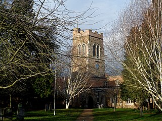
Among the buildings stemming from the 14th century is the village's AnglicanChurch of St Mary, which is built of ironstone and has been extensively restored over the subsequent centuries. The church itself contains fine examples of 17th-century painted glass.
In Home Wood is a largely undisturbed, well preserved medieval fishery. Alongside are earthworks of a sizeable artificial warren. The site is a scheduled monument managed by the Forestry Commission.[17]
Northill was the baptismal place, and possibly the birthplace, of clockmaker Thomas Tompion, who built the Pump Room Clock in 1709 that has since seen active service in the city of Bath. Thomas Tompion's father was the village blacksmith, whose forge can still be seen on the Green at Ickwell.
Governance
Northill Parish Council consists of 12 elected councillors.[18]
The village is part of Northill ward for elections to the Central Bedfordshire Unitary Authority.[19]
Bus route 74 to Bedford and Biggleswade operated by Grant Palmer runs hourly, daytime Monday to Saturday. Community bus operator, Ivel Sprinter runs a weekly service to Cambridge.
This section needs expansion. You can help by adding to it. (January 2025)
The Oak Farm and Sweet Briars Cottage areas are in the catchment zone for Robert Bloomfield Academy.[20] Those same communities are in the catchment zone for Samuel Whitbread Academy, which has upper secondary and sixth form.[21]
Events and amenities
The Crown public house next to St Mary's Church, dates back to the 17th century. The property is partly timber-framed and partly brick, with a colour washed roughcast render throughout. The roofs are made of old clay tiles.[22]
Northill Village Hall was built in the 1970s.
Northill is the starting place of the Ickwell May Day celebration that sees local floats and residents travel the mile or so to the neighbouring village of Ickwell. The May Day celebration has been held since 1565.
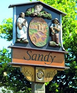
Sandy is a town and civil parish in Central Bedfordshire, England. It lies 8 miles (13 km) to the east of Bedford, 18 miles (29 km) to the south west of Cambridge and 43 miles (69 km) north of Central London. It had a population of 12,171 at the 2021 census.
Little Barford is a hamlet and civil parish in the Borough of Bedford in Bedfordshire, England about 7 miles (11 km) northeast of the county town of Bedford.
Old Warden is a village and civil parish in the Central Bedfordshire district of the county of Bedfordshire, England, about 6.5 miles (10 km) south-east of the county town of Bedford.
Everton is a small rural village of about 200 dwellings and civil parish in the Central Bedfordshire district of Bedfordshire, England about 9 miles (14 km) east of the county town of Bedford.
North East Bedfordshire was a constituency represented in the House of Commons of the Parliament of the United Kingdom from 1997 to 2024.
Broom is a small village in the civil parish of Southill, in the Central Bedfordshire district of Bedfordshire, England about 8.5 miles (14 km) south-east of the county town of Bedford.
Astwick is a hamlet and civil parish in the Central Bedfordshire district of the county of Bedfordshire, England. It lies 12+1⁄2 miles (20 km) south-east of the county town of Bedford. Its population is included within Stotfold civil parish.
Blunham is a village and civil parish in the Central Bedfordshire district of Bedfordshire, England, about 6 miles (10 km) east of Bedford town centre. At the 2011 census date its population was 946. The River Ivel forms the parish's eastern boundary in places and the River Great Ouse its western and northern boundaries. The village is just over 0.6 miles (1 km) to the west of the A1 road, and Route 51 of the National Cycle Network passes to the south.
Langford is a village and civil parish in the Central Bedfordshire district of the county of Bedfordshire, England about 10 miles (16 km) south-east of the county town of Bedford. The 2011 census gives the population as 3,091.
Stanford is a hamlet in the civil parish of Southill, in the Central Bedfordshire district, in the ceremonial county of Bedfordshire, England. It is about 8.5 miles (14 km) south-east of the county town of Bedford.
Tempsford is a village and civil parish in the Central Bedfordshire district of the county of Bedfordshire, England, about 7 miles (11 km) east north-east of the county town of Bedford.
Wrestlingworth is a village and former civil parish, now in the parish of Wrestlingworth and Cockayne Hatley, in the Central Bedfordshire district of the ceremonial county of Bedfordshire, England about 13 miles (21 km) east of the county town of Bedford. The 2011 census gives the population of the village proper as 591. The hamlet of Water End is to the south of the village. The population of Wrestlingworth and Cockayne Hatley civil parish in the 2011 census is shown as 744.
Eyeworth is a small, rural village and civil parish in the Central Bedfordshire district of the county of Bedfordshire, England; about 12.5 miles (20 km) east south-east of the county town of Bedford.
Southill is a rural village and civil parish in the Central Bedfordshire district of the county of Bedfordshire, England; about 8 miles (13 km) south-east of the county town of Bedford.
Ickwell is a small, rural village in the Central Bedfordshire district of the county of Bedfordshire, England about 6.5 miles (10 km) south-east of the county town of Bedford.
Sutton is a rural village and civil parish in the Central Bedfordshire district of Bedfordshire, England. It lies 11 miles (18 km) east of Bedford. At the 2001 Census, its population was 299. Main features are the packhorse bridge over the Potton Brook, the adjacent ford, and the Grade I listed All Saints' Parish Church.
Roxton is a small village and civil parish in the Borough of Bedford, Bedfordshire, England about 7 miles (11 km) north-east of the county town of Bedford.
Upper Caldecote is a village in the Central Bedfordshire district of Bedfordshire, England about 8 miles (13 km) south-east of Bedford.
Lower Caldecote is a hamlet in the civil parish of Northill and part of the Central Bedfordshire district of Bedfordshire, England. The county town of Bedford is 7.5 miles (12 km) to the west.
"Greensand Cycleway" signs for this route appeared in the first half of 2014. It covers roughly 40 miles (64 km), using minor roads and runs roughly in parallel with its sister walk, the Greensand Ridge Walk. The route traverses Bedfordshire, making brief forays into the neighbouring counties of Cambridgeshire and Buckinghamshire. Its southern endpoint is at Leighton Buzzard and the route runs north-east to Sandy. The waymarker for this route is simply Greensand Cycleway and the depiction of a bicycle on a brown background. There are some smaller, circular waymarkers employed to ensure continuity of the route for cyclists.
This page is based on this Wikipedia article Text is available under the CC BY-SA 4.0 license; additional terms may apply. Images, videos and audio are available under their respective licenses.