Eyeworth

Last updated • 3 min readFrom Wikipedia, The Free Encyclopedia

Eyeworth
EyeworthChurch.10.5.08.jpg
All Saints‘ Church, Eyeworth
Bedfordshire UK location map.svg
Red pog.svg
Eyeworth
Location within Bedfordshire
OS grid reference TL248455
Unitary authority
Ceremonial county
Region
Country England
Sovereign state United Kingdom
Post town SANDY
Postcode district SG19
Dialling code 01767
Police Bedfordshire
Fire Bedfordshire and Luton
Ambulance East of England
UK Parliament
List of places
UK
England
Bedfordshire
52°05′41″N0°10′43″W / 52.09459°N 0.1787°W / 52.09459; -0.1787

Eyeworth (also Eyworth) is a small, rural village and civil parish in the Central Bedfordshire district of the county of Bedfordshire, England; about 12.5 miles (20 km) east south-east of the county town of Bedford.

Contents

Eyeworth had a population of 86 in 2001. [1]

Geography

Eyeworth lies 4 miles (6 km) east of Biggleswade and just under 15 miles (24 km) south-west of Cambridge. The eastern parish boundary borders both Hertfordshire and Cambridgeshire at the River Rhee.

Landscape

Natural England has designated the area as part of The Bedfordshire and Cambridgeshire Claylands (NCA 88). Central Bedfordshire Council has classified the landscape as Dunton Clay Vale (5G). Most of the parish is open, arable farmland with medium to large fields. Eyeworth lies on a ridge of land that forms part of the watershed between the River Ivel to the west and the Rhee to the east. Tributary streams and drainage channels run through the area. Field boundaries are primarily short flailed, gappy hedges. The limited woodland creates a very open landscape. Occasional mature hedgerow trees and roadside oaks on grass verges are a feature. [2]

Elevation

The village centre is 50 metres (164 ft) above sea level and is the highest point in the parish. The land falls away quite sharply to 30 metres (98 ft) in the east but more gradually to the west and north. [3]

Geology and soil type

The centre and west of the parish lie on boulder clay; with gault to the east. [4] The whole parish has lime-rich loamy and clayey soils with slightly impeded drainage. [5]

History

The name is spelt Aieuuorde and Aisseuuorde in the Domesday Book. Eyeworth may mean 'island farm'. [6] The majority of the houses are Victorian, though the seventeenth century Church Farm remains.

The widow of Francis Bacon, née Alice Barnham, lived in Eyeworth following his death, and she died there in 1650. There were a number of minor skirmishes in the parish during the Civil War and it is reputed that Oliver Cromwell visited the village and damaged some of the church's icons. [7]

Population

Population growth in Eyeworth since 1801
YearPop.±%
180186    
1841128+48.8%
1881170+32.8%
1921120−29.4%
196189−25.8%
200186−3.4%
Source: A Vision of Britain through Time
Manor Farm House Manor Farm House, Eyeworth, Beds - geograph.org.uk - 188155.jpg
Manor Farm House
Cottages, Eyeworth Cottages, Eyeworth, Beds - geograph.org.uk - 168483.jpg
Cottages, Eyeworth

Governance

Eyeworth is part of Potton ward for elections to the Central Bedfordshire Unitary Authority.

Prior to 1894, Eyeworth was administered as part of the Hundred of Biggleswade. From 1894 until 1974 the village was in Biggleswade Rural District and from 1974 to 2009 in Mid Bedfordshire District.

Eyeworth was in the Mid Bedfordshire parliamentary constituency until 1997. Now in North East Bedfordshire, the elected member is Richard Fuller of the Conservative Party.

All Saints' Church

The village is home to a medieval church dedicated to All Saints whose building dates back to the fourteenth century, and is partly constructed from Totternhoe stone. The church's fifteenth-century spire was destroyed by lightning in 1967, and after the subsequent theft of the lead from its roof was replaced by a much smaller modern turret. [7]

The interior houses a number of medieval brasses and a monument to Sir Edmund Anderson (d.1605), founder of the Anderson line who were lords of the manor, and who was also a judge during the trial of Mary, Queen of Scots.

Public services

Eyeworth is in the Potton Public Water Supply Zone (RW50). The water supplied by Anglian Water comes from groundwater boreholes and is chloraminated and classed as hard. [8]

The Eastern Power Area of UK Power Networks is the distribution network operator for electricity. [9] There is no natural gas supply. [10]

The two nearest general hospitals are Bedford (Bedford Hospital NHS Trust) and Lister Hospital, Stevenage (East and North Hertfordshire NHS Trust). Ambulance services are provided by the East of England Ambulance Service NHS Trust. Bedfordshire Fire and Rescue Service and Bedfordshire Police cover the parish.

Potton is the nearest library.

Public transport

Centrebus (South) runs bus route no. 188 south to Biggleswade and Hitchin (journey time 45 minutes) and north to Wrestlingworth, Potton, and Sandy. The service is normally two hourly, daytime only, Monday to Saturday. [11]

The nearest railway station is Biggleswade.

Notable residents

Notable residents include Sir Peter Kendall, ex President of the National Farmers Union, who farms the land around the village with his brother Richard.

Related Research Articles

<span class="mw-page-title-main">Biggleswade</span> Market town in Bedfordshire, England

Biggleswade is a market town and civil parish in Central Bedfordshire in Bedfordshire, England. It lies on the River Ivel, 11 miles (18 km) south-east of Bedford. Its population was 16,551 in the 2011 United Kingdom census, This figure increased by 36% to 22,541 at the time of the 2021 United Kingdom census.

<span class="mw-page-title-main">Potton</span> English town and civil parish

Potton is a town and civil parish in the Central Bedfordshire district of Bedfordshire, England, about 10 miles (16 km) east of the county town Bedford. The parish had a population in 2021 of 5,727. In 1783 the Great Fire of Potton destroyed a large part of the town. The parish church dates from the 13th century, and is dedicated to St Mary. Potton's horse fairs were some of the largest in the country.

<span class="mw-page-title-main">Hinxworth</span> Human settlement in England

Hinxworth is a village and civil parish in North Hertfordshire, England. It sits just off the Great North Road between Baldock and Biggleswade. It has a village hall, a park, a pub, a small church, a bus stop and a post box. The population at the 2011 Census was 313.

<span class="mw-page-title-main">Everton, Bedfordshire</span> Human settlement in England

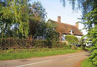
Everton is a small rural village of about 200 dwellings and civil parish in the Central Bedfordshire district of Bedfordshire, England about 9 miles (14 km) east of the county town of Bedford.

<span class="mw-page-title-main">Hundred of Biggleswade</span> Historic administrative division in Bedfordshire, England

Biggleswade was a historic hundred of English county of Bedfordshire. The hundred consisted of the town of Biggleswade and its surrounding area. The name Biggleswade comes from a concatenation of the Anglo Saxon words 'Biceil' and 'Waed'.

<span class="mw-page-title-main">Cockayne Hatley</span> Village in Bedfordshire, England

Cockayne Hatley is a village and former civil parish, now in the parish of Wrestlingworth and Cockayne Hatley, in the Central Bedfordshire district of the ceremonial county of Bedfordshire, England, 13 miles (21 km) east of the county town of Bedford. The population in 2007 was approximately 75 with 33 houses.

<span class="mw-page-title-main">Astwick</span> Hamlet in Bedfordshire, England

Astwick is a hamlet and civil parish in the Central Bedfordshire district of the county of Bedfordshire, England. It lies 12+12 miles (20 km) south-east of the county town of Bedford. Its population is included within Stotfold civil parish.

<span class="mw-page-title-main">Langford, Bedfordshire</span> Village in Bedfordshire, England

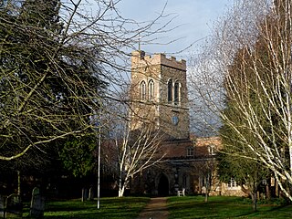
Langford is a village and civil parish in the Central Bedfordshire district of the county of Bedfordshire, England about 10 miles (16 km) south-east of the county town of Bedford. The 2011 census gives the population as 3,091.

<span class="mw-page-title-main">Northill</span> Village in Bedfordshire, England

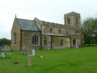
Northill is a village and civil parish in the Central Bedfordshire district of the county of Bedfordshire, England about 6.5 miles (10 km) southeast of the county town of Bedford.

<span class="mw-page-title-main">Stanford, Bedfordshire</span> Human settlement in England

Stanford is a hamlet in the civil parish of Southill, in the Central Bedfordshire district, in the ceremonial county of Bedfordshire, England. It is about 8.5 miles (14 km) south-east of the county town of Bedford.

<span class="mw-page-title-main">Dunton, Bedfordshire</span> Village in Bedfordshire, England

Dunton is a village and civil parish in the Central Bedfordshire district of the county of Bedfordshire, England; about 12 miles (19 km) east south-east of the county town of Bedford. The civil parish includes the hamlets of Newton and Millow.

<span class="mw-page-title-main">Edworth</span> Hamlet in Bedfordshire, England

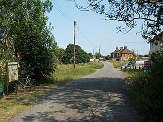
Edworth is a hamlet and civil parish in the Central Bedfordshire district of the county of Bedfordshire, England about 12 miles (19 km) south-east of the county town of Bedford. It sits just off the Great North Road (A1) between Baldock and Biggleswade. There are fewer than one hundred inhabitants. At the 2011 Census, Edworth's population was amalgamated with the civil parish of Dunton.

<span class="mw-page-title-main">Tempsford</span> Village in Bedfordshire, England

Tempsford is a village and civil parish in the Central Bedfordshire district of the county of Bedfordshire, England, about 7 miles (11 km) east north-east of the county town of Bedford.

<span class="mw-page-title-main">Wrestlingworth</span> Village in Bedfordshire, England

Wrestlingworth is a village and former civil parish, now in the parish of Wrestlingworth and Cockayne Hatley, in the Central Bedfordshire district of the ceremonial county of Bedfordshire, England about 13 miles (21 km) east of the county town of Bedford. The 2011 census gives the population of the village proper as 591. The hamlet of Water End is to the south of the village. The population of Wrestlingworth and Cockayne Hatley civil parish in the 2011 census is shown as 744.

<span class="mw-page-title-main">Tadlow</span> Village in Cambridgeshire, England

Tadlow is a small village and civil parish in South Cambridgeshire, England on the River Cam. It is 20 kilometres (12 mi) south-west of Cambridge and 9 kilometres (6 mi) north-east of Biggleswade, Bedfordshire. In 2001 the population was 181 and the area of the village is 681 hectares.

<span class="mw-page-title-main">Southill, Bedfordshire</span> Human settlement in England

Southill is a rural village and civil parish in the Central Bedfordshire district of the county of Bedfordshire, England; about 8 miles (13 km) south-east of the county town of Bedford.

<span class="mw-page-title-main">Sutton, Bedfordshire</span> Village in Bedfordshire, England

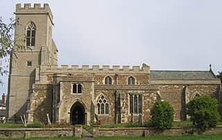
Sutton is a rural village and civil parish in the Central Bedfordshire district of Bedfordshire, England. It lies 11 miles (18 km) east of Bedford. At the 2001 Census, its population was 299. Main features are the packhorse bridge over the Potton Brook, the adjacent ford, and the Grade I listed All Saints' Parish Church.

<span class="mw-page-title-main">Upper Caldecote</span> Village in Bedfordshire, England

Upper Caldecote is a village in the Central Bedfordshire district of Bedfordshire, England about 8 miles (13 km) south-east of Bedford.

References

  1. "Parish Profile for Sutton / Eyeworth". Bedfordshire County Council. Archived from the original on 10 October 2007.
  2. "5G Dunton Clay Vale Landscape Character Area" (PDF). Central Bedfordshire. Retrieved 30 September 2019.
  3. "Eyeworth: elevation". Route Calculator. Retrieved 20 August 2019.
  4. "Sheet 204. Geological Survey of England & Wales". British Geological Survey. Retrieved 19 August 2019.
  5. "Soilscapes Viewer". LandIS - Land Information System. Cranfield University. Retrieved 20 August 2019.
  6. Skeat, Walter W (1906). The place-names of Bedfordshire. p.  64 . Retrieved 19 August 2019.
  7. 1 2 Alan Castle (2001). Walking in Bedfordshire. Cicerone Press Ltd.
  8. "Drinking Water Quality Information". Anglian Water. Retrieved 22 August 2019.
  9. "Check if you're in our area". UK Power Networks. Archived from the original on 2 November 2019. Retrieved 8 August 2019.
  10. "The non-gas map". The non-gas map. Retrieved 23 August 2019.
  11. "188 - Hitchin - Biggleswade - Wrestlingworth - Potton - Sandy". Bus Times. Retrieved 20 August 2019.

Commons-logo.svg Media related to Eyeworth at Wikimedia Commons