Astwick

Last updated

Astwick
The Parish Church of St Guthlac, Astwick. - geograph.org.uk - 95424.jpg
St Guthlac's parish church
Bedfordshire UK location map.svg
Red pog.svg
Astwick
Location within Bedfordshire
Population24 
OS grid reference TL215385
Unitary authority
Ceremonial county
Region
Country England
Sovereign state United Kingdom
Post town HITCHIN
Postcode district SG5
Dialling code 01462
Police Bedfordshire
Fire Bedfordshire and Luton
Ambulance East of England
List of places
UK
England
Bedfordshire
52°01′55″N0°13′55″W / 52.0319°N 0.2320°W / 52.0319; -0.2320

Astwick is a hamlet and civil parish in the Central Bedfordshire district of the county of Bedfordshire, England. It lies 12+12 miles (20 km) south-east of the county town of Bedford. Its population is included within Stotfold civil parish.

Contents

Geography

Astwick is by the River Ivel just to the north of Stotfold and lies 4 miles (6 km) south of Biggleswade and 19 miles (31 km) south-west of Cambridge. The Great North Road forms the eastern parish boundary with Hertfordshire. The A1 was improved around 1958; known as the Edworth to Astwick Turn scheme. It is the first non-motorway section of dual-carriageway north of the Baldock motorway bypass.

Altitude

The hamlet is 44 metres (144 ft) above sea level. The land rises to 74 metres (243 ft) in the north of the parish towards Topler's Hill. [1]

Geology and soil type

Land north of the main road through the hamlet is arable farmland and lies on boulder clay. To the south are pastures on largely grey and grey-blue clay but by the River Ivel is alluvium and river gravel. [2] The north of the parish has highly fertile lime-rich loamy and clayey soils with slightly impeded drainage. There is a narrow east–west band of freely draining lime-rich loamy soils followed by loamy soils with naturally high groundwater beside the River Ivel. [3]

The night sky and light pollution

Light pollution is the level of radiance (night lights) shining up into the night sky. The hamlet has an index of 1-2 nanoWatts (nW). This brightens to 2-4 nW alongside the A1 road but darkens to 0.5-1 nW in the western part of the parish. [4]

History

Astwick was first recorded in the Domesday Book in 1086 as Estuuiche. Its name means east farm, 'east' referring to its location on the eastern border of Bedfordshire. [5]

Archaeologist, William Ransom unearthed an Anglo-Saxon cemetery near Astwick in 1886. Finds, including a short sword and spearheads are in the collection of the Department of Medieval and Later Antiquities at the British Museum. [6]

The Parish Church of St Guthlac dates from the 15th-century, although there is evidence of an earlier structure on the site. The present tower was likely the central tower of a cruciform church. [7] An unusual feature is the protruding chimney; not normally something found on a church. [8]

Another notable building is the moated Astwick Bury, which dates from around 1700 and is Grade II listed. [9] [10]

Astwick Mill on the River Ivel was built in 1847 as a water-powered stone mill. It was converted to steam power in 1891 with the installation of six roller mills. In use as a corn mill until 1922, it is now a Grade II listed private residence. [11] [12]

Governance

The parish is too small to have a parish council and instead has a parish meeting.

Astwick is part of Stotfold and Langford ward for elections to the Central Bedfordshire Council.

Prior to 1894, Astwick was administered as part of the Hundred of Biggleswade. From 1894 until 1974 it was in Biggleswade Rural District and from 1974 to 2009 in Mid Bedfordshire District.

Astwick was in the Mid Bedfordshire parliamentary constituency until 1997. Since in North East Bedfordshire, the elected member is Richard Fuller of the Conservative Party.

Economy

There is a high intensity poultry unit at Vine Farm. The facility, as completed in July 2016, consists of eight poultry houses with a permitted capacity of 336,000 broilers. [13] Permission was given by the Environment Agency in October 2018 for an additional two sheds and an increase in total capacity to 442,000. [14]

Public services

Astwick is in the Potton Public Water Supply Zone (RW50). The water supplied by Anglian Water comes from groundwater boreholes and is chloraminated and classed as hard. [15]

The Eastern Power Area of UK Power Networks is the distribution network operator for electricity. [16] Cadent Gas owns and operates the area's gas distribution network. [17]

The two nearest general hospitals are Bedford (Bedford Hospital NHS Trust) and Lister Hospital, Stevenage (East and North Hertfordshire NHS Trust). Ambulance services are provided by the East of England Ambulance Service NHS Trust. Bedfordshire Fire and Rescue Service and Bedfordshire Police cover the parish.

The nearest public library is Stotfold.

Related Research Articles

<span class="mw-page-title-main">Biggleswade</span> Market town in Bedfordshire, England

Biggleswade is a market town and civil parish in Central Bedfordshire in Bedfordshire, England. It lies on the River Ivel, 11 miles (18 km) south-east of Bedford. Its population was 16,551 in the 2011 United Kingdom census, and its estimated population in mid-2019 had increased to 21,700, its growth encouraged by good road and rail links to London. The King's Reach development, begun in 2010, will provide 2,000 new homes to the east of the town.

<span class="mw-page-title-main">Sandy, Bedfordshire</span> Market town and civil parish in Central Bedfordshire, England

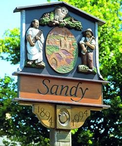
Sandy is a town and civil parish in Central Bedfordshire, England. It lies 8 miles (13 km) to the east of Bedford, 18 miles (29 km) to the south west of Cambridge and 43 miles (69 km) north of Central London. It had a population of 12,171 at the 2021 census.

<span class="mw-page-title-main">Potton</span> English town and civil parish

Potton is a town and civil parish in the Central Bedfordshire district of Bedfordshire, England, about 10 miles (16 km) east of the county town Bedford. The parish had a population in 2021 of 5,727. In 1783 the Great Fire of Potton destroyed a large part of the town. The parish church dates from the 13th century, and is dedicated to St Mary. Potton's horse fairs were some of the largest in the country.

<span class="mw-page-title-main">Everton, Bedfordshire</span> Human settlement in England

Everton is a small rural village of about 200 dwellings and civil parish in the Central Bedfordshire district of Bedfordshire, England about 9 miles (14 km) east of the county town of Bedford.

<span class="mw-page-title-main">Hundred of Biggleswade</span> Historic administrative division in Bedfordshire, England

Biggleswade was a historic 'hundred' of English county of Bedfordshire. The hundred consisted of the town of Biggleswade and its surrounding area. The name Biggleswade comes from a concatenation of the Anglo Saxon words 'Biceil' and 'Waed'.

<span class="mw-page-title-main">North East Bedfordshire (UK Parliament constituency)</span> Parliamentary constituency in the United Kingdom, 1997 onwards

North East Bedfordshire is a constituency represented in the House of Commons of the Parliament of the United Kingdom since 2019 by Richard Fuller, of the Conservative Party.

<span class="mw-page-title-main">Blunham</span> Human settlement in England

Blunham is a village and civil parish in the Central Bedfordshire district of Bedfordshire, England, about 6 miles (10 km) east of Bedford town centre. At the 2011 census date its population was 946. The River Ivel forms the parish's eastern boundary in places and the River Great Ouse its western and northern boundaries. The village is just over 0.6 miles (1 km) to the west of the A1 road, and Route 51 of the National Cycle Network passes to the south.

<span class="mw-page-title-main">Langford, Bedfordshire</span> Human settlement in England

Langford is a village and civil parish in the Central Bedfordshire district of the county of Bedfordshire, England about 10 miles (16 km) south-east of the county town of Bedford. The 2011 census gives the population as 3,091.

<span class="mw-page-title-main">Northill</span> Human settlement in England

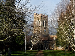
Northill is a village and civil parish in the Central Bedfordshire district of the county of Bedfordshire, England about 6.5 miles (10 km) southeast of the county town of Bedford.

<span class="mw-page-title-main">Stanford, Bedfordshire</span> Human settlement in England

Stanford is a hamlet in the civil parish of Southill, in the Central Bedfordshire district of the ceremonial county of Bedfordshire, England. It is about 8.5 miles (14 km) south-east of the county town of Bedford. In 1870–72 it had a population of 385.

<span class="mw-page-title-main">Dunton, Bedfordshire</span> Human settlement in England

Dunton is a village and civil parish in the Central Bedfordshire district of the county of Bedfordshire, England; about 12 miles (19 km) east south-east of the county town of Bedford. The civil parish includes the hamlets of Newton and Millow.

<span class="mw-page-title-main">Edworth</span> Human settlement in England

Edworth is a hamlet and civil parish in the Central Bedfordshire district of the county of Bedfordshire, England about 12 miles (19 km) south-east of the county town of Bedford. It sits just off the Great North Road (A1) between Baldock and Biggleswade. There are fewer than one hundred inhabitants. At the 2011 Census, Edworth's population was amalgamated with the civil parish of Dunton.

<span class="mw-page-title-main">Tempsford</span> Human settlement in England

Tempsford is a village and civil parish in the Central Bedfordshire district of the county of Bedfordshire, England, about 7 miles (11 km) east north-east of the county town of Bedford.

<span class="mw-page-title-main">Wrestlingworth</span> Human settlement in England

Wrestlingworth is a village and former civil parish, now in the parish of Wrestlingworth and Cockayne Hatley, in the Central Bedfordshire district of the ceremonial county of Bedfordshire, England about 13 miles (21 km) east of the county town of Bedford. The 2011 census gives the population of the village proper as 591. The hamlet of Water End is to the south of the village. The population of Wrestlingworth and Cockayne Hatley civil parish in the 2011 census is shown as 744.

<span class="mw-page-title-main">Eyeworth</span> Human settlement in England

Eyeworth is a small, rural village and civil parish in the Central Bedfordshire district of the county of Bedfordshire, England; about 12.5 miles (20 km) east south-east of the county town of Bedford.

<span class="mw-page-title-main">Southill, Bedfordshire</span> Human settlement in England

Southill is a rural village and civil parish in the Central Bedfordshire district of the county of Bedfordshire, England; about 8 miles (13 km) south-east of the county town of Bedford.

<span class="mw-page-title-main">Sutton, Bedfordshire</span> Human settlement in England

Sutton is a rural village and civil parish in the Central Bedfordshire district of Bedfordshire, England. It lies 11 miles (18 km) east of Bedford. At the 2001 Census, its population was 299. Main features are the packhorse bridge over the Potton Brook, the adjacent ford, and the Grade I listed All Saints' Parish Church.

<span class="mw-page-title-main">Upper Caldecote</span> Human settlement in England

Upper Caldecote is a village in the Central Bedfordshire district of Bedfordshire, England about 8 miles (13 km) south-east of Bedford.

Lower Caldecote is a hamlet in the civil parish of Northill and part of the Central Bedfordshire district of Bedfordshire, England. The county town of Bedford is 7.5 miles (12 km) to the west.

References

  1. "Astwick: elevation". Route Calculator. Retrieved 31 August 2019.
  2. "Sheet 204. Geological Survey of England & Wales". British Geological Survey. Retrieved 30 August 2019.
  3. "Soilscapes Viewer". LandIS - Land Information System. Cranfield University. Retrieved 30 August 2019.
  4. "Map". nightblight. Campaign for the Protection of Rural England. Retrieved 1 September 2019.
  5. "Astwick :: Survey of English Place-Names". epns.nottingham.ac.uk. Retrieved 3 February 2024.
  6. Kennett, David H. (1972). "Seventh Century Finds from Astwick" (PDF). Bedfordshire Archaeological Journal. 7: 45–51. Retrieved 15 October 2019.
  7. Page, William (1908). A History of the County of Bedford: Volume 2. London: Victoria County History. pp. 203–206. Retrieved 1 September 2019.
  8. "Church of Saint Guthlac". British Listed Buildings. Retrieved 1 September 2019.
  9. "Astwick, Bedfordshire". Britain Express. Retrieved 8 March 2014.
  10. "Astwick Bury". British Listed Buildings. Retrieved 8 March 2014.
  11. "Bowman's Mill, Astwick". Mills Archive. Retrieved 1 September 2019.
  12. "Bowman's water mill". Historic England. Retrieved 1 September 2019.
  13. "Vine Poultry Farm Case Study". Clarke Group Construction. Retrieved 1 September 2019.
  14. "Permitting Decision - Vine Farm" (PDF). assets.publishing.service.gov.uk. Retrieved 1 September 2019.
  15. "Drinking Water Quality Information". Anglian Water. Retrieved 7 September 2019.
  16. "Check if you're in our area". UK Power Networks. Retrieved 7 September 2019.
  17. "Map: who operates the gas distribution network?". ofgem. Retrieved 7 September 2019.