Chalgrave

Last updated

Chalgrave
All Saints, Chalgrave , Chequered Stonework - geograph.org.uk - 116127.jpg
All Saints church
Bedfordshire UK location map.svg
Red pog.svg
Chalgrave
Location within Bedfordshire
Population495  [1]
OS grid reference TL007382
Unitary authority
Ceremonial county
Region
Country England
Sovereign state United Kingdom
Post town LUTON
Postcode district LU4
Dialling code 01525
Police Bedfordshire
Fire Bedfordshire and Luton
Ambulance East of England
UK Parliament
List of places
UK
England
Bedfordshire
51°55′36″N0°32′05″W / 51.9267°N 0.5348°W / 51.9267; -0.5348
Signpost for Chalgrave Parish Chalgrave Parish Sign 326088 c8494e07-by-Rob-Farrow.jpg
Signpost for Chalgrave Parish

Chalgrave is a civil parish in the Central Bedfordshire district of Bedfordshire, England. The hamlets of Tebworth and Wingfield are in the west of the parish, with the church and manor in the east. Nearby places are Toddington (to the north), Chalton (to the east), Houghton Regis (to the south), and Hockliffe (to the west). Before 1929, the parish also included part of the village of Hockliffe. [2]

Contents

Chalgrave is part of the ward of 'Heath and Reach' which sends a Councillor to Central Bedfordshire Council. The ward includes the villages of Heath and Reach, Hockliffe, Eggington, Stanbridge, Tilsworth, Tebworth, and Wingrave. The ward was created in 2011 and has since been represented by Councillor Mark Versallion.

Origins

The name is derived from the Old English 'calc-græf', meaning a chalk trench. [3] A charter dated 926 AD recorded the grant of land at Cealhgraefan (Chalgrave) and Teobbanwyrthe (Tebworth) from Æthelstan, King of the Anglo-Saxons, to the thegn Ealdred. [4] By 1066 it had grown to 23 households and was owned mostly by Albert of Lorraine, who retained it after the Norman Conquest. [5] Albert was a cleric favoured by both Edward the Confessor and William the Conqueror, and received from them lands and houses in Bedfordshire and elsewhere. Chalgrave became the chief seat of the Loring family, who descend from Albert of Lorraine. [6]

Chalgrave church and manor

The location now known as Chalgrave, just south of Toddington, was called East Coten (meaning "east cottages") in the year 926. Here a church and manor house were established on well-drained soil at the top of the hill in the 11th or 12th century. At the beginning of the 13th century the church was rebuilt, and the manorial complex was moved east and then north to what is now Chalgrave Manor Farm. [2]

The Icknield Way Path passes through the village past the church on its 110-mile journey from Ivinghoe Beacon in Buckinghamshire to Knettishall Heath in Suffolk. The Icknield Way Trail, a multi-user route for walkers, horse riders and off-road cyclists also passes through the village.

Tebworth

Tebworth is a small Hamlet 1 mile west of the church, about 4½ miles east of Leighton Buzzard, about 40 miles (64 km) north of London, 1 mile east of Hockliffe, and 2 miles (3 km) south-west of Toddington.

Wingfield

Wingfield is a Hamlet almost 1 mile south-west of the church. Most of the houses are along Tebworth Road, which runs from Tebworth to the top of Lords Hill. Because of the location, there are a few well known people living in the Hamlet. Like Tebworth, it had developed as a settlement by the 13th century. [2]

Related Research Articles

<span class="mw-page-title-main">Horsenden</span> Human settlement in England

Horsenden is a hamlet and former civil parish, now in the parish of Longwick-cum-Ilmer, in Buckinghamshire, England. It is approximately one mile West of Princes Risborough, seven miles south of Aylesbury and three miles south-west of Chinnor in Oxfordshire. The Icknield Way passes just to the north of the village from north-east to south-west, although there is no connecting road through the hamlet itself. In 1931 the parish had a population of 53.

<span class="mw-page-title-main">Little Missenden</span> Human settlement in England

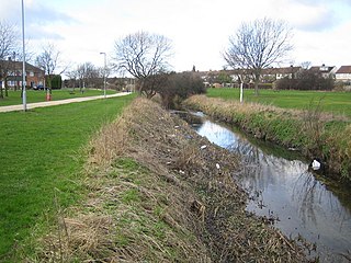
Little Missenden is a village and civil parish on the River Misbourne in Buckinghamshire, England. It is in the Chiltern Hills, about 3 miles (5 km) southeast of Great Missenden and 3 miles (5 km) west of Amersham. The village lies on the River Misbourne in the Misbourne valley.

<span class="mw-page-title-main">Woburn Sands</span> Human settlement in England

Woburn Sands is a town that straddles the border between Buckinghamshire and Bedfordshire in England, and also is part of the Milton Keynes urban area. The larger part of the town is in Woburn Sands civil parish, which is in the City of Milton Keynes, Smaller parts of the town are in the neighbouring parishes of Aspley Guise and Aspley Heath. The meandering boundary between Buckinghamshire and Bedfordshire means the Lower and Middle Schools that serve all of the town are both in Aspley Guise CP. Bedfordshire Police and Thames Valley Police both deal with law enforcement issues in the town. At the 2011 Census, the population of the civil parish (only) was 2,916, that of the built-up area was 5,959. Woburn Sands, Aspley Guise and Aspley Heath each has its own centre but together the three settlements are a contiguous built-up area.

<span class="mw-page-title-main">Hockliffe</span> Human settlement in England

Hockliffe is a village and civil parish in Bedfordshire on the crossroads of the A5 road which lies upon the course of the Roman road known as Watling Street and the A4012 and B5704 roads.

<span class="mw-page-title-main">Toddington, Bedfordshire</span> Human settlement in England

Toddington is a large village and civil parish in the county of Bedfordshire, England. It is situated 5 miles north-north-west of Luton, 4 miles (6 km) north of Dunstable, 6 miles (10 km) south-west of Woburn, and 35 miles north-north-west of London on the B5120 and B579. It is 0.5 miles from Junction 12 of the M1 motorway and lends its name to the nearby motorway service station. The hamlet of Fancott also forms part of the Toddington civil parish.

<span class="mw-page-title-main">Harlington, Bedfordshire</span> Human settlement in England

Harlington is a village and civil parish located in Bedfordshire, England, near the M1 motorway. The nearest town is Flitwick about 3 miles (4.8 km) to the north.

<span class="mw-page-title-main">Guilden Morden</span> Human settlement in England

Guilden Morden, England, is a village and parish located in Cambridgeshire about 16 miles (26 km) south west of Cambridge and 9 miles (14 km) west of Royston in Hertfordshire. It is served by the main line Ashwell and Morden railway station 3 miles (5 km) to the south in the neighbouring parish of Steeple Morden.

Warden Hill is a suburb of Luton, about 3 miles (4.8 km) north of the town centre, in Bedfordshire, England. It is roughly bounded by Central Bedfordshire to the north; Enderby Road, the A6 and Weybourne Drive to the south; Birdsfoot Lane, Grasmere Road, Icknield Way, and the A6 to the west; and Warden Hill and Galley Hill to the east.

<span class="mw-page-title-main">Eggington</span> Human settlement in England

Egginton – or Eggington as it is now known – is a village and civil parish in the Central Bedfordshire district of Bedfordshire, England, about three miles east of Leighton Buzzard.

<span class="mw-page-title-main">Heath and Reach</span> Human settlement in England

Heath and Reach is a village and civil parish near the Chiltern Hills in Bedfordshire, England. It is 2 miles (3.2 km) north of Leighton Buzzard and 3 miles (4.8 km) south of Woburn and adjoins the county boundary with Buckinghamshire. Nearby places are Leighton-Linslade, Great Brickhill and the Duke of Bedford's Woburn Abbey, Woburn Safari Park and Woburn Golf Club.

<span class="mw-page-title-main">Limbury</span> Human settlement in England

Limbury is a suburb of Luton, in the Luton district, in the ceremonial county of Bedfordshire, England, and was formerly a village before Luton expanded around it. The area is roughly bounded by Bramingham Road to the north, Marsh Road to the south, Bramingham Road to the west, and Catsbrook Road, Runfold Avenue, Grosvenor Road, Bancroft Road and Blundell Road to the east.

<span class="mw-page-title-main">Tebworth</span> Human settlement in England

Tebworth is a hamlet located in the Central Bedfordshire district of Bedfordshire, England.

<span class="mw-page-title-main">Leagrave</span> Human settlement in England

Leagrave is a former village and now a suburb of Luton, in the Luton district, in the ceremonial county of Bedfordshire, England, in the northwest of the town. The area is roughly bounded by Vincent Road, Torquay Drive and High Street to the north, Roman Road and Stoneygate Road to the south, the M1 to the west, and Marsh Road and Leagrave Park to the east.

<span class="mw-page-title-main">Wingfield, Bedfordshire</span> Human settlement in England

Wingfield is a hamlet located in the Central Bedfordshire district of Bedfordshire, England.

<span class="mw-page-title-main">Stanbridge, Bedfordshire</span> Human settlement in England

Stanbridge is a village and civil parish in Bedfordshire which lies 3 miles (5 km) east of Leighton Buzzard. It also borders the Bedfordshire villages of Hockliffe, Eggington, Tilsworth, Totternhoe and Billington.

<span class="mw-page-title-main">Tilsworth</span> Human settlement in England

Tilsworth is a small village and civil parish in Bedfordshire. It lies to the north west of Dunstable, and the Roman Watling Street (A5) forms the north east boundary of the parish of 1,200 acres (4.8 km2). The village lies on the gault clay, where springs well up just south of a gentle gravelly ridge. A large proportion of the area is still farmland.

<span class="mw-page-title-main">Cavenham</span> Human settlement in England

Cavenham is a village and civil parish in Suffolk, England, 10 kilometres (6 mi) northwest of Bury St Edmunds. It is in the local government district of West Suffolk, and the electoral ward of Manor. At the 2021 UK census, Cavenham Parish had a population of 141. In the 1870s it had a population of 229.

References

  1. ONS, Census 2021 Parish Profiles
  2. 1 2 3 Stephen Coleman, Chalgrave, Bedfordshire County Council (Bedfordshire Parish Surveys, Historic Landscape and Archaeology, 6), 1986, ISBN   0-907041-75-2, pp. 7, 15, 17-22.
  3. Nottingham University. "Key to English Place-names". kepn.nottingham.ac.uk. Retrieved 8 October 2023.
  4. Birch, Walter de Gray (1885). Cartularium saxonicum: a collection of charters relating to Anglo-Saxon history. Harvard University. London, Whiting & company (limited).
  5. "Chalgrave | Domesday Book". opendomesday.org. Retrieved 8 October 2023.
  6. "Parishes: Sharnbrook | British History Online". www.british-history.ac.uk. Retrieved 8 October 2023.