List of Sites of Special Scientific Interest in Hertfordshire

Last updated

Tring Reservoirs at sunrise Tring Reservoir.jpg
Tring Reservoirs at sunrise

Hertfordshire is a county in eastern England. It is bordered by Bedfordshire to the north, Cambridgeshire to the north-east, Essex to the east, Buckinghamshire to the west and Greater London to the south. The county town is Hertford. As of 2018, the county has a population of 1,184,400 [1] in an area of 634 square miles (1,640 km2). [2]

Contents

As of July 2019, there are 43 sites designated within this Area of Search, 36 of which have been designated for their biological interest and 7 for their geological interest. [3] In England the body responsible for designating SSSIs is Natural England, which chooses a site "because of its flora, fauna, or geological or physiographical features". [4]

Map all coordinates using: OpenStreetMap  
Download coordinates as: KML

Key

Interest

  • B = a site of biological interest
  • G = a site of geological interest

Other classifications

Sites

Site namePhotographBGArea [lower-alpha 1] Public
access
Location [lower-alpha 1] Other
classifications
Map [lower-alpha 1] Citation [lower-alpha 1] Description
Aldbury Nowers Aldbury Nowers.jpg Green check.svg19.8 hectares (49 acres)YES Tring
51°48′43″N0°37′19″W / 51.8120°N 0.6219°W / 51.8120; -0.6219 (Aldbury Nowers)
SP951135
HMWT [5] Map Citation The site hosts the flowers of chalk grassland and has butterfly habitats with several different species of butterfly including the Duke of Burgundy, hairstreaks and the Essex skipper. There are also large areas of woodland and calcareous grassland. [6] [7]
Alpine Meadow Alpine Meadow, Berkhamsted 5.JPG Green check.svg0.8 hectares (2.0 acres)YES Berkhamsted
51°46′57″N0°34′04″W / 51.7826°N 0.5677°W / 51.7826; -0.5677 (Alpine Meadow)
SP989103
HMWT [8] Map Citation This steeply sloping small meadow is a rare example of unimproved chalk grassland. Grass species include upright brome, false brome and sheep's fescue, and there are many orchids, especially common twayblade and common spotted orchid. [9]
Amwell Quarry Amwell Quarry 13.JPG Green check.svg37.1 hectares (92 acres)YES Great Amwell
51°47′52″N0°00′16″W / 51.7978°N 0.0045°W / 51.7978; -0.0045 (Amwell Quarry)
TL377129
HMWT, [10] SPA, SPA [11] Ramsar [12] Map Citation This is an internationally important site for wintering wildfowl, and is Britain's most important site for dragonflies. Plants include marsh dock and hairlike pondweed, both nationally rare. Amwell has a quarter of all British species of molluscs. [10] [13]
Ashridge Commons & Woods Clearing with Silver Birch on Pitstone Common - geograph.org.uk - 1185115.jpg Green check.svg627.3 hectares (1,550 acres)YES Little Gaddesden
51°48′42″N0°35′14″W / 51.8116°N 0.5871°W / 51.8116; -0.5871 (Ashridge Commons & Woods)
SP975135
CAONB, [14] NT [14] Map Citation Ths site is mainly semi-natural vegetation, with has extensive areas of woodland, grass and scrub. There are many species of breeding birds, including some which are rare nationally, such as firecrests. Other species which are rare in Hertfordshire are common redstart, nightingale and wood warbler. [15]
Ashwell Springs The Springs, Ashwell - geograph.org.uk - 774046.jpg Green check.svg0.3 hectares (0.74 acres)YES Ashwell
52°02′32″N0°08′59″W / 52.0421°N 0.1497°W / 52.0421; -0.1497 (Ashwell Springs)
TL270398
Map Citation The site consists of a series of freshwater springs, which provide a habitat for cold water, invertebrate animals, some of which are rare. The site is particularly important for flatworms, including Crenobia alpina and the Polycelis felina. [16]
Benington High Wood Benington High Wood 2.JPG Green check.svg20.7 hectares (51 acres)YES Benington
51°53′43″N0°08′02″W / 51.8952°N 0.1339°W / 51.8952; -0.1339 (Benington High Wood)
TL285235
Map Citation The site is ancient woodland, described by Natural England as "one of the best remaining examples in the county of the pedunculate oak-hornbeam of the ash-maple variety". Shrub species include field maple and hazel, with a higher ground flora diversity in clearings and rides. [17]
Blagrove Common Blagrove Common 1.JPG Green check.svg5.0 hectares (12 acres)YES Sandon
51°59′12″N0°04′13″W / 51.9868°N 0.0704°W / 51.9868; -0.0704 (Blagrove Common)
TL326338
HMWT [18] Map Citation The site is one of the few areas of unimproved marshy grassland in east Hertfordshire. It is crossed by a stream and has a rich diversity of vegetation, including a variety of orchids. [19] Kestrels often hunt mice and voles, which are common on the site. [18]
Bricket Wood Common Bricket Wood Common 4.JPG Green check.svg75.5 hectares (187 acres)YES Bricket Wood
51°41′47″N0°21′59″W / 51.6964°N 0.3664°W / 51.6964; -0.3664 (Bricket Wood Common)
TL130010
Map Citation The common is a remnant of a lowland heath, with much it on the heavy soils of boulder clay which have poor drainage and wet habitats. There are also areas of ancient woodland and dry heath. In drier heath areas there are heather, purple moor-grass and heath milkwort. [20]
Castle Lime Works Quarry Castle Lime Works Quarry.JPG Green check.svg1.4 hectares (3.5 acres)NO South Mimms
51°42′31″N0°13′22″W / 51.7087°N 0.2227°W / 51.7087; -0.2227 (Castle Lime Works Quarry)
TL229026
GCR [21] Map Citation Natural England states: "This reveals extensive piping in the top of the chalk resulting from solution at the Chalk - Tertiary sediment interface. Believed to have formed during the Tertiary and Pleistocene, it is the finest exposure of clay-filled pipes in the Chalk Karst of England." [22]
Croxley Common Moor Croxley Common Moor 6.JPG Green check.svg39.6 hectares (98 acres)YES Croxley Green
51°38′33″N0°26′11″W / 51.6425°N 0.4363°W / 51.6425; -0.4363 (Croxley Common Moor)
TQ083949
LNR [23] Map Citation The site is mainly grass heathland with some ancient woodland and hazel coppice. Over 250 species of plants have been recorded, including sheep sorrel, common bent and sheep's fescue. There are many ant hills made by yellow meadow ants. [24] [23]
Downfield Pit, Westmill Downfield Pit north 1.JPG Green check.svg0.3 hectares (0.74 acres)YES Ware
51°49′51″N0°02′37″W / 51.8308°N 0.0437°W / 51.8308; -0.0437 (Downfield Pit, Westmill)
TL349165
Map Citation The site provides an example of the complex sequence of Pleistocene gravels and clays laid down by the River Thames when it flowed through the Vale of St Albans before the river was diverted south by the Anglian ice age around 450,000 years ago. [25]
Frogmore Meadows Frogmore Meadows and River Chess 1.JPG Green check.svg4.6 hectares (11 acres)YES Chenies
51°40′47″N0°31′29″W / 51.6796°N 0.5247°W / 51.6796; -0.5247 (Frogmore Meadows)
TQ021989
CAONB, [26] HMWT, [27] Map Citation The site has marshy areas and fens next to the river, damp grassland and drier, more acidic areas. The river bank has water voles, and damp areas are dominated by meadow foxtail and Yorkshire fog, with some marsh marigold and marsh bedstraw. [28] [27]
Great Hormead Park Great Hormead Park 2.JPG Green check.svg15.0 hectares (37 acres)YES Great Hormead
51°56′36″N0°03′42″E / 51.9432°N 0.0616°E / 51.9432; 0.0616 (Great Hormead Park)
TL418292
Map Citation The site is coppiced ancient woodland on boulder clay. It has diverse tree species, including wych elm and hornbeam, resulting in a rich ground flora. Dog's mercury is dominant over most of the woodland floor, with plants such as angelica sylvestris and tufted hair grass in wetter areas. [29]
Hertford Heath Hertford Heath north 6.JPG Green check.svg29.1 hectares (72 acres)YES Hertford Heath
51°46′53″N0°02′14″W / 51.7813°N 0.0372°W / 51.7813; -0.0372 (Hertford Heath)
TL355110 &
TL350106
HMWT [30] Map Citation The heath is dominated by heather, and there are grass snakes and slow worms. Sphagnum mosses and creeping willow are found in wetter areas. Ponds support the rare water violet and a rich invertebrate fauna such as great crested and smooth newts, the water spider and eight species of dragonfly. [31] [30]
Hillcollins Pit Hillcollins Pit 3.JPG Green check.svg0.2 hectares (0.49 acres)YES Furneux Pelham
51°55′16″N0°05′43″E / 51.9211°N 0.0954°E / 51.9211; 0.0954 (Hillcollins Pit)
TL442268
GCR [32] Map Citation This disused gravel pit is the type site for the Westland Green Gravels, which were laid down by the ancestral River Thames 1.6 to 1.8 million years ago, and which show the river's ancient course. [33]
Hunsdon Mead Hunsdon Mead meadow in Hertfordshire, England.jpg Green check.svg34.2 hectares (85 acres)YES Harlow
51°46′47″N0°03′15″E / 51.7797°N 0.0541°E / 51.7797; 0.0541 (Hunsdon Mead)
TL418110
HMWT [34] Map Citation This is unimproved grassland which is subject to winter flooding. Notable grass species include meadow brome and the quaking grass briza media, and there are other unusual flora such as pepper saxifrage and green-winged orchid. [35]
Knebworth Woods Knebworth Woods 1.JPG Green check.svg128.8 hectares (318 acres)YES Stevenage
51°53′09″N0°13′02″W / 51.8857°N 0.2172°W / 51.8857; -0.2172 (Knebworth Woods)
TL228223
Map Citation The wood is ancient in origin and ecologically diverse. The dominant trees are oak and hornbeam. Ponds have unusual plant species, and the site is rich in fungi and bryophytes. Breeding birds include nightingales. [36]
Little Heath Pit Little Heath Pit 2.JPG Green check.svg1.2 hectares (3.0 acres)YES Potten End
51°45′48″N0°31′40″W / 51.7633°N 0.5278°W / 51.7633; -0.5278 (Little Heath Pit)
TL017082
GCR, [37] NT [38] Map Citation The lowest layer is gravel dating to the beginning of the Pleistocene 2.6 million years ago. A higher layer of gravel was laid down some 20,000 years ago, when the last ice age was at its maximum, and the site was cold tundra like western Siberia today. [39]
Moor Hall Meadows Moor Hall Meadows 1.JPG Green check.svg24.0 hectares (59 acres)YES Ardeley
51°55′16″N0°04′03″W / 51.9211°N 0.0674°W / 51.9211; -0.0674 (Moor Hall Meadows)
TL330265
Map Citation The site has a variety of types of meadows, with marshy grassland being the most extensive. Its rich flora makes it one of the most important grassland sites in the county. There is also a small ancient woodland which has a variety of breeding birds. [40]
Moor Mill Quarry, West Moor Mill Quarry, West.jpg Green check.svg0.2 hectares (0.49 acres)NO How Wood
51°42′43″N0°21′02″W / 51.7119°N 0.3506°W / 51.7119; -0.3506 (Moor Mill Quarry, West)
TL141027
GCR [41] Map Citation The pit displays the advance of ice during the Anglian glaciation around 450,000 years ago, which diverted the Thames south to its present course. The site is regarded by Natural England as of fundamental importance as the only one which demonstrates the diversion of the Thames from its pre-Anglian course. [42]
Northaw Great Wood Row of Hornbeams, Justice Hill, Northaw Great Wood - geograph.org.uk - 371191.jpg Green check.svg224.3 hectares (554 acres)YES Cuffley
51°43′22″N0°08′54″W / 51.7228°N 0.1483°W / 51.7228; -0.1483 (Northaw Great Wood)
TL280043
LNR [43] Map Citation The site has one of the county's most extensive areas of ancient hornbeam woodland, with other trees including oak and silver birch. Glades, streams and springs add to the biodiversity. [44]
Oddy Hill and Tring Park Tring park south.jpg Green check.svg36.0 hectares (89 acres)YES Tring
51°47′20″N0°38′50″W / 51.7890°N 0.6473°W / 51.7890; -0.6473 (Oddy Hill)
SP934109
51°47′01″N0°39′22″W / 51.7837°N 0.6561°W / 51.7837; -0.6561 (Tring Park)
SP928103
RHPG. [45] Map Citation This is one of the most extensive areas of unimproved chalk downland in Hertfordshire. The site has diverse grass and flowering plant species. Orchids include common spotted-orchid, common twayblade, greater butterfly-orchid and southern marsh-orchid. [46]
Oughtonhead Lane Oughtonhead Lane 3.JPG Green check.svg1.0 hectare (2.5 acres)YES Hitchin
51°57′19″N0°17′45″W / 51.9552°N 0.2959°W / 51.9552; -0.2959 (Oughtonhead Lane)
TL172299
GCR [47] Map Citation The site probably dates to the Hoxnian interglacial 420,000 to 300,000 years ago. It was then a marsh fed by springs, and it has a tufa which contains fossil land snails and mammal bones which show the climate and local environmental conditions. [48]
Patmore Heath Patmore Heath - geograph.org.uk - 82806.jpg Green check.svg8.5 hectares (21 acres)YES Albury
51°54′43″N0°05′47″E / 51.9120°N 0.0965°E / 51.9120; 0.0965 (Patmore Heath)
TL443258
HMWT [49] Map Citation The site is home to a large amount of dry grass, as well as marshy-areas. Much of the turf is dominated by Deschampsia, as well as occurrences of Anthoxanthum odoratum. Uncommon plants are heath rush and heath grass. There are a wide variety of dragonfly, including the emperor dragonfly. [50]
Plashes Wood Plashes Wood 8.JPG Green check.svg73.2 hectares (181 acres)YES Standon
51°52′01″N0°00′21″E / 51.8669°N 0.0058°E / 51.8669; 0.0058 (Plashes Wood)
TL382206
Map Citation The site is mainly oak and hornbeam woodland near the northern limit of its natural distribution. It has varied ground flora on soils from damp heavy clay to light gravels. There are also ponds and extensive clearings dominated by bracken, and other flora including hoary cinquefoil. [51]
Redwell Wood Redwell Wood 18.JPG Green check.svg52.6 hectares (130 acres)YES South Mimms
51°42′29″N0°14′45″W / 51.7081°N 0.2459°W / 51.7081; -0.2459 (Redwell Wood)
TL213025
Map Citation The site has ancient and secondary woodland, heath and scrub. The woodland canopy is dominated by pedunculate oak. Ground flora include bluebells and enchanter's-nightshade, while heathland species include heather and the rare creeping willow. [52]
Roughdown Common Roughdown Common 8.JPG Green check.svg3.7 hectares (9.1 acres)YES Hemel Hempstead
51°44′25″N0°29′06″W / 51.7402°N 0.4850°W / 51.7402; -0.4850 (Roughdown Common)
TL047057
CAONB [53] Map Citation This is one of the few examples of unimproved calcareous grassland in Hertfordshire. The dominant grasses are meadow fescue and meadow oat-grass, and there are colonies of orchids. It is the only site in the county where common juniper regenerates naturally. [54] [53]
Rye Meads Rye Meads Nature Reserve - geograph.org.uk - 199214.jpg Green check.svg60.3 hectares (149 acres)YES Rye House
51°46′34″N0°00′22″E / 51.7760°N 0.0061°E / 51.7760; 0.0061 (Rye Meads)
TL385105
Ramsar, [55] SPA [11] RSPB, [55] HMWT [56] Map Citation Part of this site is an ancient flood meadow which has a variety of habitats including reedbed, marshy grassland and fen. It is grazed by ponies and water buffalo. [56] There are also ponds which have kingfisher, snipe, green sandpiper, shoveler, gadwall and tufted duck. [57]
Sarratt Bottom Sarratt Bottom SSSI 2.JPG Green check.svg3.5 hectares (8.6 acres)NO Sarratt
51°40′46″N0°30′37″W / 51.6794°N 0.5102°W / 51.6794; -0.5102 (Sarratt Bottom)
TQ031989
Map Citation The site is a meadow beside the River Chess. It is an example of damp grassland which has been traditionally managed for grazing. There are also areas of swamp and marsh. The main plants in grassland areas include sweet vernal grass and meadow foxtail, and marsh horsetail and common spike-rush are common in damper areas. [58]
Sawbridgeworth Marsh Sawbridgeworth Marsh - geograph.org.uk - 1307690.jpg Green check.svg6.2 hectares (15 acres)YES Sawbridgeworth
51°49′15″N0°09′48″E / 51.8209°N 0.1634°E / 51.8209; 0.1634 (Sawbridgeworth Marsh)
TL492158
EWT [59] Map Citation The site is a river valley marsh close to the River Stort, which has a varied wetland flora. Grazing and cutting of the marsh in rotation maintain biological diversity. The site also has an important wetland fauna and many moth species. [60]
Sherrardspark Wood Sherrardspark Wood - Entrance from Campus West Car Park - geograph.org.uk - 1211226.jpg Green check.svg74.4 hectares (184 acres)YES Welwyn Garden City
51°48′37″N0°13′02″W / 51.8102°N 0.2172°W / 51.8102; -0.2172 (Sherrardspark Wood)
TL230139
LNR [61] Map Citation The site is an ancient semi-natural sessile oak and hornbeam wood on acid soils. There are also swallowholes fed by streams, and a woodland ride provides a habitat for invertebrates. [62]
Tewinbury Tewinbury 4.JPG Green check.svg7.3 hectares (18 acres)NO Tewin
51°48′34″N0°10′04″W / 51.8095°N 0.1679°W / 51.8095; -0.1679 (Tewinbury)
TL264139
HMWT [63] Map Citation The site borders the River Mimram. It has alluvial meadows and marshes which are rare in lowland Britain. There are areas of swamp and tall fens, with plants including butterbur and angelica. Otters have been observed on the riverbank, in possibly the only site in the county. [64] [63]
Therfield Heath Valley Plantation - geograph.org.uk - 110067.jpg Green check.svg146.5 hectares (362 acres)YES Therfield
52°02′32″N0°03′18″W / 52.0423°N 0.0549°W / 52.0423; -0.0549 (Therfield Heath)
TL335400
LNR, [65] SM [66] [67] Map Citation This site is described by Natural England as describing some to the richest chalkland in England. It is unimproved pasture which has a wide variety of plants including the rare pasque flower. There is a diverse insect fauna. [68]
Thorley Flood Pound Thorley Wash 6.JPG Green check.svg17.3 hectares (43 acres)YES Thorley
51°50′36″N0°09′41″E / 51.8434°N 0.1615°E / 51.8434; 0.1615 (Thorley Flood Pound)
TL490183
HMWT [69] Map Citation Habitats include tall wash grassland, which is now rare, marsh and waterlogged grassland. It has a wide variety of plant species, including reed sweet-grass and meadowsweet. There are flowers such as fen bedstraw and early marsh orchid. Breeding birds include snipe and water rails. [70]
Tring Reservoirs Startops Reservoir, Tring - Let there be Light - geograph.org.uk - 1221050.jpg Green check.svg100.0 hectares (247 acres)YES Tring
51°48′49″N0°40′06″W / 51.8135°N 0.6683°W / 51.8135; -0.6683 (Tring Reservoirs)
SP919136
SP905131
HMWT [71] Map Citation These four reservoirs are on the sites of ancient marshes, and their diverse fauna and flora include some dating back to their marshland origins. The site is important for breeding and wintering birds, including nationally important numbers of shovelers. The site is also significant for invertebrates. [72]
Tring Woodlands Beech and blackthorn -Herts county top 2.jpg Green check.svg24.1 hectares (60 acres)YES Tring
51°46′52″N0°40′20″W / 51.7812°N 0.6721°W / 51.7812; -0.6721 (Tring Woodlands)
SP917100
CAONB [73] Map Citation The wood has a rich flora, showing that it is well established. It is one of the best examples of semi-natural beech woodland in Hertfordshire. Plants include woodruff, wood anemone and dog's mercury, and there is a variety of woodland birds. [74]
Turnford and Cheshunt Pits North Met Pit, Cheshunt Gravel Pits - geograph.org.uk - 465961.jpg Green check.svg174.4 hectares (431 acres)YES Cheshunt
51°42′32″N0°01′07″W / 51.7090°N 0.0186°W / 51.7090; -0.0186 (Turnford & Cheshunt Pits)
TL370030
SPA [11] Map Citation This site includes ten former gravel pits, which are of national importance for wintering gadwalls and shovelers. It is also valuable for invertebrates, especially grasshoppers and bush-crickets. [75]
Wain Wood Wain Wood.jpg Green check.svg19.0 hectares (47 acres)YES Preston
51°54′56″N0°17′09″W / 51.9155°N 0.2858°W / 51.9155; -0.2858 (Wain Wood)
TL180255
Map Citation The wood lies on a north-east facing slope of decalcified boulder clay. The woodland area is also home to pedunculate oak and Quercus petraea , with much of the south of the area consisting of acidic grassland. There are many butterfly species, including Thecla quercus . [76]
Water End Swallow Holes Water End Swallow Holes SSSI - geograph.org.uk - 990507.jpg Green check.svg11.1 hectares (27 acres)YES Welham Green
51°43′26″N0°13′14″W / 51.7239°N 0.2206°W / 51.7239; -0.2206 (Water End Swallow Holes)
TL230043
Map Citation The site covers more than fifteen sinkholes, the only ones in chalk which are a permanent feature of the landscape. Next to the holes is a swamp area of willow carr which is biologically important, and in deep water there is reed sweet-grass. The site also has areas of woodland and grassland. [77]
Westwood Quarry Westwood Quarry 2.JPG Green check.svg0.1 hectares (0.25 acres)NO Watford
51°40′56″N0°27′08″W / 51.6823°N 0.4523°W / 51.6823; -0.4523 (Westwood Quarry)
TQ071993
GCR [78] Map Citation This site throws light on the early history of the River Thames, when it flowed through the Vale of St Albans, before it was diverted south to its present course during the Anglian Ice Age around 450,000 years ago. [79]
Whippendell Wood Glade in Whippendell Wood - geograph.org.uk - 1763434.jpg Green check.svg66.7 hectares (165 acres)YES Watford
51°40′07″N0°26′44″W / 51.6687°N 0.4455°W / 51.6687; -0.4455 (Whippendell Wood)
TQ076978
Map Citation This is ancient woodland, and the main trees are oak, ash, hazel and hornbeam. Ground flora include Yorkshire fog, bluebells and honeysuckle. There are diverse species of fungi, invertebrates and birds. [80]
Wormley-Hoddesdonpark Wood North Gate into Hoddesdon Park Wood - geograph.org.uk - 787144.jpg Green check.svg143.9 hectares (356 acres)YES Hoddesdon
51°45′32″N0°02′33″W / 51.7589°N 0.0425°W / 51.7589; -0.0425 (Wormley-Hoddesdonpark Wood North)
TL352085
TL325075
NNR, [81] WT, [81] NCR , [82] HMWT, [83] SAC [84] Map Citation The site is oak and hornbeam on acid gravel. The ground flora is diverse, including dog's mercury and yellow archangel. Small ponds and streams are important for bryophytes, and invertebrates include the green tiger beetle. [82]
Wormley-Hoddesdonpark Wood South Emanuel Pollards - geograph.org.uk - 347896.jpg Green check.svg196.2 hectares (485 acres)YES Cheshunt
51°44′39″N0°04′25″W / 51.7441°N 0.0735°W / 51.7441; -0.0735 (Wormley-Hoddesdonpark Wood South)
TL331068
NNR, [85] NCR , [86] SAC [84] Map Citation The site is oak and hornbeam woodland mainly on London clay. Plants in the variable ground flora include brambles, wood anemones and bluebells. Other habitats include marshland and acidic grassland. [86]

See also

Notes

  1. 1 2 3 4 Maps and citations for each site are taken from the Natural England database. The area and location of the site is shown on the citation. The listing is as in January 2016.

Related Research Articles

Essex Wildlife Trust Wildlife conservation charity

The Essex Wildlife Trust (EWT) is one of 46 wildlife trusts which cover the United Kingdom. The EWT was founded in 1959, and it describes itself as Essex's leading conservation charity, which aims to protect wildlife for the future and the people of the county. As of January 2017, it has over 34,000 members and runs 87 nature reserves, 2 nature parks and 11 visitor centres.

Berkshire, Buckinghamshire and Oxfordshire Wildlife Trust Wildlife conservation charity

The Berkshire, Buckinghamshire and Oxfordshire Wildlife Trust (BBOWT), is a wildlife trust covering the counties of Berkshire, Buckinghamshire and Oxfordshire in England.

Hertford Heath Human settlement in England

Hertford Heath is a village and civil parish near the county town of Hertford in Hertfordshire, England. The population at the 2011 Census was 2,672.

Aldbury Nowers

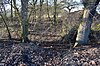
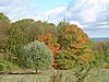
Aldbury Nowers is a 19.7 hectares biological Site of Special Scientific Interest (SSSI) in the Chiltern Hills, north-east of Tring in Hertfordshire. The site was notified in 1990 under the Wildlife and Countryside Act 1981. It is managed by the Hertfordshire and Middlesex Wildlife Trust. The site, formerly known as "Duchie's Piece," comprises two areas of hillside, linked by The Ridgeway. The calcareous meadow element of the site hosts the flowers of chalk grassland and has butterfly habitats with thirty-four different species of butterfly recently recorded, including the Duke of Burgundy, hairstreaks and the Essex skipper. The site also includes a "beech hanger", a type of upland ancient woodland, and is considered one of the best examples of this feature in Hertfordshire.

Patmore Heath

Patmore Heath is a 7.6 hectare biological Site of Special Scientific Interest in East Hertfordshire, 2 kilometres north-east of Albury, Hertfordshire. The site was notified in 1985 under the Wildlife and Countryside Act 1981. Patmore Heath is home to a large amount of dry grass, as well as marshy-areas. Much turf throughout the SSSI is dominated by Deschampsia, as well as occurrences of Anthoxanthum odoratum.

Wormley-Hoddesdonpark Wood North

Wormley-Hoddesdonpark Wood North is a 143.9 hectare woodland area in Hertfordshire which has been designated as a biological site of Special Scientific Interest. The site is listed as Grade 1 in A Nature Conservation Review, and is also designated a Special Area of Conservation. It is in Hoddesdon in the borough of Broxbourne, but part of the site is in East Hertfordshire.

Herts and Middlesex Wildlife Trust

Herts and Middlesex Wildlife Trust manages over 40 nature reserves covering nearly 810 hectares north of London, in Hertfordshire and the historic county of Middlesex, part of which is divided between the London boroughs of Barnet, Enfield, Harrow and Hillingdon. It has over 21,000 members, and is one of 46 Wildlife Trusts across the UK. It is a Registered Charity, with its Registered Office in St Albans, and had an income in the year to 31 March 2014 of over £1.5 million.

Frogmore Meadows

Frogmore Meadows is a 4.6 hectare biological Site of Special Scientific Interest in Hertfordshire and Buckinghamshire, north of the village of Chenies. It consists of two meadows in the Chilterns Area of Outstanding Natural Beauty, next to the River Chess, one of which is a Hertfordshire and Middlesex Wildlife Trust nature reserve. The planning authorities are Three Rivers District Council, Dacorum Borough Council and Chiltern District Council.

Hunsdon Mead

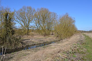
Hunsdon Mead is a 34 hectare biological Site of Special Scientific Interest (SSSI) west of Harlow and east of Roydon in Essex. The site is partly in Essex and partly in Hertfordshire, and it is jointly owned and managed by the Essex Wildlife Trust and the Herts and Middlesex Wildlife Trust. The SSSI also includes part of the neighbouring Roydon Mead. The planning authorities are East Hertfordshire District Council and Epping Forest District Council. Hunsdon Mead is registered common land.

Sawbridgeworth Marsh

Sawbridgeworth Marsh is a 6.3 hectare biological Site of Special Scientific Interest (SSSI) near Sawbridgeworth in Hertfordshire, apart from a small area in the north which is in Essex. It is managed by the Essex Wildlife Trust. The planning authorities are East Hertfordshire District Council and Uttlesford District Council.

Blagrove Common

Blagrove Common is a 4.0 hectare Site of Special Scientific Interest in Green End near Sandon in Hertfordshire. It is managed by the Hertfordshire and Middlesex Wildlife Trust, and the planning authority is North Hertfordshire District Council.

Hertford Heath nature reserve

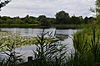
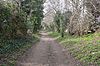
Hertford Heath nature reserve is a 28 hectare biological Site of Special Scientific Interest in Hertford Heath in Hertfordshire. It is managed by the Herts and Middlesex Wildlife Trust and the local planning authority is East Hertfordshire District Council.

Thorley Wash nature reserve

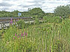
Thorley Wash or Thorley Flood Pound is a 17.3-hectare biological Site of Special Scientific Interest in Thorley, south of Bishop's Stortford in Hertfordshire. It was formerly a flood pound for the Stort Navigation, which was decommissioned in 2004 and converted to a more natural state. It was purchased by the Herts and Middlesex Wildlife Trust from the Environment Agency in 2011.

Fox Covert

Fox Covert is a 2.9 hectare nature reserve near Royston in North Hertfordshire. It is owned and managed by the Herts and Middlesex Wildlife Trust.

Hill End Pit Nature reserve in North Hertfordshire

Hill End Pit is a 0.7 hectare nature reserve on the site of a former chalk pit, in St Paul's Walden in North Hertfordshire. It was formerly managed by the Herts and Middlesex Wildlife Trust (HMWT). In February 2016 HMWT announced that three sites, Barkway Chalk Pit, Hill End Pit and Pryor's Wood, which HMWT managed on behalf of their owner, North Hertfordshire District Council, were to return to Council management as the Trust was no longer able to meet the cost. It has the largest colony of Azeca goodalli snails in Hertfordshire. Plants include viper's bugloss, cowslip and marjoram, there are butterflies such as common blue and gatekeeper, and many birds including woodpeckers.

Danemead

Danemead is a 5.6-hectare nature reserve west of Hoddesdon in Hertfordshire, managed by the Herts and Middlesex Wildlife Trust. It is part of the Wormley-Hoddesdonpark Wood North Site of Special Scientific Interest.

References

  1. "People and Place". Herts Insight. Retrieved 23 July 2019.
  2. "Area Measurements". Hertfordshire Local Information System. Archived from the original on 10 February 2015. Retrieved 10 February 2015.
  3. "Designated Sites View - Hertfordshire". Natural England. Retrieved 23 July 2019.
  4. "Guidelines for selection of biological SSSIs". Joint Nature Conservation Committee. Archived from the original on 23 January 2016. Retrieved 12 January 2016.
  5. "Aldbury Nowers". Herts and Middlesex Wildlife Trust. Archived from the original on 5 September 2015. Retrieved 11 January 2016.
  6. "Aldbury Nowers" (PDF). Natural England. Archived from the original (PDF) on 20 March 2009. Retrieved 21 February 2006.
  7. "Aldbury Nowers". Herts and Middlesex Wildlife Trust. Archived from the original on 23 July 2011. Retrieved 7 January 2011.
  8. "Alpine Meadow". Hertfordshire and Middlesex Wildlife Trust. Archived from the original on 21 December 2014. Retrieved 21 December 2014.
  9. "Alpine Meadow citation" (PDF). Sites of Special Scientific Interest. Natural England. Archived from the original (PDF) on 4 March 2016. Retrieved 21 December 2014.
  10. 1 2 "Amwell". Hertfordshire and Middlesex Wildlife Trust. Archived from the original on 19 April 2015. Retrieved 19 December 2014.
  11. 1 2 3 "Lee Valley". Joint Nature Conservation Committee. Archived from the original on 26 October 2016. Retrieved 16 January 2016.
  12. "Lee Valley". Ramsar Sites Information Service. Archived from the original on 20 December 2014. Retrieved 19 December 2014.
  13. "Amwell Quarry citation" (PDF). Sites of Special Scientific Interest. Natural England. Archived (PDF) from the original on 24 September 2015. Retrieved 19 December 2014.
  14. 1 2 "Ashridge Commons and Woods citation" (PDF). Sites of Special Scientific Interest. Natural England. Archived from the original (PDF) on 4 March 2016. Retrieved 4 January 2016.
  15. "Ashridge Commons & Woods citation" (PDF). Sites of Special Scientific Interest. Natural England. Archived from the original (PDF) on 4 March 2016. Retrieved 19 December 2014.
  16. "Ashwell Springs citation" (PDF). Sites of Special Scientific Interest. Natural England. Archived from the original (PDF) on 4 March 2016. Retrieved 12 January 2015.
  17. "Benington High Wood citation" (PDF). Sites of Special Scientific Interest. Natural England. Archived from the original (PDF) on 3 March 2016. Retrieved 3 January 2015.
  18. 1 2 "Blagrove Common". Hertfordshire and Middlesex Wildlife Trust. Archived from the original on 23 December 2014. Retrieved 12 January 2015.
  19. "Blagrove Common citation" (PDF). Sites of Special Scientific Interest. Natural England. Archived from the original (PDF) on 4 March 2016. Retrieved 12 January 2015.
  20. "Bricket Wood Common citation" (PDF). Sites of Special Scientific Interest. Natural England. Archived from the original (PDF) on 3 March 2016. Retrieved 7 December 2014.
  21. "Castle Lime Works Quarry (Karst)". Joint Nature Conservation Committee. Archived from the original on 4 March 2016. Retrieved 11 January 2016.
  22. "Castle Lime Works Quarry citation" (PDF). Sites of Special Scientific Interest. Natural England. Archived from the original (PDF) on 4 March 2016. Retrieved 15 January 2015.
  23. 1 2 "Croxley Common Moor". Local Nature Reserves. Natural England. 13 March 2013. Archived from the original on 9 August 2014. Retrieved 10 December 2014.
  24. "Croxley Common Moor citation" (PDF). Sites of Special Scientific Interest. Natural England. Archived from the original (PDF) on 4 March 2016. Retrieved 10 December 2014.
  25. "A Geological Conservation Strategy for Hertfordshire" (PDF). Hertfordshire RIGS Group. 2003. p. 43. Archived from the original (PDF) on 24 September 2015. Retrieved 4 February 2015.
  26. "Frogmore Meadows citation" (PDF). Sites of Special Scientific Interest. Natural England. Archived from the original (PDF) on 3 March 2016. Retrieved 11 December 2014.
  27. 1 2 "Frogmore Meadow". Herts and Middlesex Wildlife Trust. Archived from the original on 11 December 2014. Retrieved 11 December 2014.
  28. "Frogmore Meadows citation" (PDF). Sites of Special Scientific Interest. Natural England. Archived from the original (PDF) on 3 March 2016. Retrieved 11 December 2014.
  29. "Great Hormead Park citation" (PDF). Sites of Special Scientific Interest. Natural England. Archived (PDF) from the original on 3 March 2016. Retrieved 19 February 2015.
  30. 1 2 "Hertford Heath". Herts and Middlesex Wildlife Trust. Archived from the original on 11 April 2015. Retrieved 15 February 2015.
  31. "Hertford Heath citation" (PDF). Sites of Special Scientific Interest. Natural England. Archived from the original (PDF) on 4 March 2016. Retrieved 15 February 2015.
  32. "Furneux Pelham Gravel Pit (Hillcollins Pit) (Quaternary of the Thames)". Joint Nature Conservation Committee. Archived from the original on 19 February 2015. Retrieved 18 February 2015.
  33. "Hillcollins Pit citation" (PDF). Sites of Special Scientific Interest. Natural England. Archived (PDF) from the original on 4 March 2016. Retrieved 18 February 2015.
  34. "Hunsdon and Eastwick Meads". Herts & Middlesex Wildlife Trust. Archived from the original on 14 September 2016. Retrieved 11 January 2016.
  35. "Hunsdon Mead citation" (PDF). Sites of Special Scientific Interest. Natural England. Archived from the original (PDF) on 4 March 2016. Retrieved 22 December 2014.
  36. "Knebworth Woods citation" (PDF). Sites of Special Scientific Interest. Natural England. Archived from the original (PDF) on 24 September 2015. Retrieved 3 January 2015.
  37. "Little Heath Pit (Quaternary of the Thames)". Joint Nature Conservation Committee. Archived from the original on 18 August 2016. Retrieved 11 January 2016.
  38. "Little Heath Pit citation" (PDF). Sites of Special Scientific Interest. Natural England. Archived (PDF) from the original on 24 September 2015. Retrieved 25 February 2015.
  39. Information board on the site
  40. "Moor Hall Meadows citation" (PDF). Sites of Special Scientific Interest. Natural England. Archived (PDF) from the original on 24 September 2015. Retrieved 3 January 2015.
  41. "Moor Mill Quarry (Quaternary of the Thames)". Joint Nature Conservation Committee. Archived from the original on 4 March 2016. Retrieved 11 January 2016.
  42. "Moor Mill Quarry, West citation" (PDF). Sites of Special Scientific Interest. Natural England. Archived (PDF) from the original on 24 September 2015. Retrieved 7 December 2014.
  43. "Northaw Great Wood Country Park". Local Nature Reserves. Natural England. 14 March 2013. Archived from the original on 10 February 2015. Retrieved 22 March 2015.
  44. "Northaw Great Wood citation" (PDF). Sites of Special Scientific Interest. Natural England. Archived (PDF) from the original on 3 March 2016. Retrieved 23 December 2014.
  45. "Tring Park". English Heritage. Archived from the original on 13 January 2015. Retrieved 23 December 2014.
  46. "Oddy Hill and Tring Park citation" (PDF). Sites of Special Scientific Interest. Natural England. Archived (PDF) from the original on 4 March 2016. Retrieved 2 June 2016.
  47. "Oughtonhead Lane, Hitchin (Quaternary of East Anglia)". Joint Nature Conservation Committee. Archived from the original on 4 March 2016. Retrieved 11 January 2016.
  48. "A Geological Conservation Strategy for Hertfordshire" (PDF). Hertfordshire RIGS Group. 2003. Archived from the original (PDF) on 24 September 2015.
  49. "Patmore Heath". Herts and Middlesex Wildlife Trust. Archived from the original on 13 December 2014. Retrieved 11 December 2014.
  50. "Patmore Heath citation" (PDF). Sites of Special Scientific Interest. Natural England. Archived from the original (PDF) on 4 March 2016. Retrieved 11 December 2014.
  51. "Plashes Wood citation" (PDF). Sites of Special Scientific Interest. Natural England. Archived from the original (PDF) on 3 March 2016. Retrieved 11 March 2015.
  52. "Redwell Wood citation" (PDF). Sites of Special Scientific Interest. Natural England. Archived from the original (PDF) on 4 March 2016. Retrieved 16 January 2015.
  53. 1 2 "Roughdown Common". Chilterns Conservation Board. Archived from the original on 21 December 2014. Retrieved 21 December 2014.
  54. "Roughdown Common citation" (PDF). Sites of Special Scientific Interest. Natural England. Archived from the original (PDF) on 4 March 2016. Retrieved 21 December 2014.
  55. 1 2 "Rye Meads (SSSI SPA Ramsar)". Royal Society for the Protection of Birds, South East Hertfordshire Local Group. Archived from the original on 29 September 2015. Retrieved 28 September 2015.
  56. 1 2 "Rye Meads". Herts and Middlesex Wildlife Trust. Archived from the original on 17 July 2015. Retrieved 11 December 2014.
  57. "Rye Meads". Royal Society for the Protection of Birds. Archived from the original on 26 November 2014. Retrieved 11 December 2014.
  58. "Sarratt Bottom citation" (PDF). Sites of Special Scientific Interest. Natural England. Archived (PDF) from the original on 24 September 2015. Retrieved 11 December 2014.
  59. "Sawbridgeworth Marsh Nature Reserve". Essex Wildlife Trust. Archived from the original on 11 June 2016. Retrieved 28 December 2014.
  60. "Sawbridgeworth Marsh citation" (PDF). Sites of Special Scientific Interest. Natural England. Archived (PDF) from the original on 3 March 2016. Retrieved 28 December 2014.
  61. "Sherrardspark Wood". Local Nature Reserves. Natural England. Archived from the original on 4 March 2016. Retrieved 12 January 2016.
  62. "Sherrardspark Wood citation" (PDF). Sites of Special Scientific Interest. Natural England. Archived (PDF) from the original on 24 September 2015. Retrieved 2 June 2016.
  63. 1 2 "Tewinbury". Herts and Middlesex Wildlife Trust. Archived from the original on 2 April 2015. Retrieved 22 March 2015.
  64. "Tewinbury citation" (PDF). Sites of Special Scientific Interest. Natural England. Archived from the original (PDF) on 4 March 2016. Retrieved 22 March 2015.
  65. "Therfield Heath". Local Nature Reserves. Natural England. Archived from the original on 3 December 2013. Retrieved 26 July 2013.
  66. "1010428 - The National Heritage List for England". Archived from the original on 4 November 2013. Retrieved 12 January 2016.
  67. "1010431 - The National Heritage List for England". Archived from the original on 4 November 2013. Retrieved 12 January 2016.
  68. "Therfield Heath citation" (PDF). Sites of Special Scientific Interest. Natural England. Archived (PDF) from the original on 3 March 2016. Retrieved 2 June 2016.
  69. "Thorley Wash". Herts and Middlesex Wildlife Trust. Archived from the original on 13 December 2014. Retrieved 11 March 2015.
  70. "Thorley Flood Pound citation" (PDF). Sites of Special Scientific Interest. Natural England. Archived from the original (PDF) on 3 March 2016. Retrieved 11 March 2015.
  71. "Tring Reservoirs". Herts and Middlesex Wildlife Trust. Archived from the original on 27 April 2015. Retrieved 19 April 2015.
  72. "Tring Reservoirs citation" (PDF). Sites of Special Scientific Interest. Natural England. Archived (PDF) from the original on 4 March 2016. Retrieved 3 June 2016.
  73. "Tring Woodlands citation" (PDF). Sites of Special Scientific Interest. Natural England. Archived (PDF) from the original on 4 March 2016. Retrieved 14 January 2015.
  74. "Tring Woodlands citation" (PDF). Sites of Special Scientific Interest. Natural England. Archived (PDF) from the original on 4 March 2016. Retrieved 14 January 2015.
  75. "Turnford & Cheshunt Pits citation" (PDF). Sites of Special Scientific Interest. Natural England. Archived (PDF) from the original on 20 March 2009. Retrieved 3 June 2016.
  76. "Wain Wood citation" (PDF). Sites of Special Scientific Interest. Natural England. Archived (PDF) from the original on 3 March 2016. Retrieved 13 January 2015.
  77. "Water End Swallow Holes citation" (PDF). Sites of Special Scientific Interest. Natural England. Archived (PDF) from the original on 3 March 2016. Retrieved 13 January 2015.
  78. "Westwood Quarry (Quaternary of the Thames)". Joint Nature Conservation Committee. Archived from the original on 9 August 2016. Retrieved 12 January 2016.
  79. "A Geological Conservation Strategy for Hertfordshire" (PDF). Herts RIGS Group. 2003. p. 43. Archived (PDF) from the original on 6 August 2016. Retrieved 9 June 2016.
  80. "Whippendell Wood citation" (PDF). Sites of Special Scientific Interest. Natural England. Archived (PDF) from the original on 24 October 2012. Retrieved 9 June 2016.
  81. 1 2 "Broxbourne Woods". Countryside Management Service. Archived from the original on 9 March 2016. Retrieved 12 January 2016.
  82. 1 2 "Wormley-Hoddesdonpark Wood North citation" (PDF). Sites of Special Scientific Interest. Natural England. Archived (PDF) from the original on 3 March 2016. Retrieved 18 October 2015.
  83. "Danemead". Herts and Middlesex Wildlife Trust. Archived from the original on 16 February 2015. Retrieved 19 April 2015.
  84. 1 2 "Broxbourne Woods". Natural England. Archived from the original on 20 October 2017. Retrieved 17 October 2015.
  85. "Map of Wormley-Hoddesdonpark Wood South". Sites of Special Scientific Interest. Natural England. Archived from the original on 3 March 2016. Retrieved 10 January 2016.
  86. 1 2 "Wormley-Hoddesdonpark Wood South citation" (PDF). Sites of Special Scientific Interest. Natural England. Archived (PDF) from the original on 4 March 2016. Retrieved 10 January 2016.