List of Sites of Special Scientific Interest in Greater London

Last updated

Frays River in Frays Farm Meadows Frays River in Frays Farm Meadows.jpg
Frays River in Frays Farm Meadows

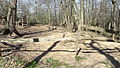
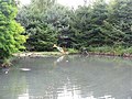
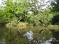
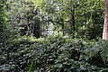
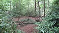
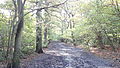
In England, Sites of Special Scientific Interest (SSSIs) are designated by Natural England, which is responsible for protecting England's natural environment. Designation as an SSSI gives legal protection to the most important wildlife and geological sites. [1] As of August 2019, there are 37 sites designated in Greater London, [2] 30 of which have been designated for their biological interest and 7 for their geological interest. Two sites are Special Protection Areas, three are Special Areas of Conservation, one is a Ramsar wetland site, two are national nature reserves, nine are local nature reserves, seven are Geological Conservation Review sites, one is a Nature Conservation Review site, one is on the Register of Historic Parks and Gardens and one includes a scheduled monument. Three sites are managed by the London Wildlife Trust, two by the Essex Wildlife Trust, two by the Kent Wildlife Trust, one by the Herts and Middlesex Wildlife Trust, one by the Royal Society for the Protection of Birds and one by the Wildfowl & Wetlands Trust.

Contents

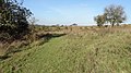
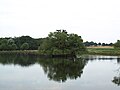
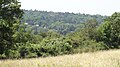
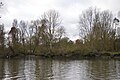
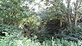
Greater London is one of the largest urban areas in Europe, with an area of 1,572 km2 (607 sq mi). [3] Its boundaries were set in 1965 when Greater London, which covers the 32 London boroughs and the City of London, was created. Almost two-thirds of it is green space and wetlands. [4] Its population according to the 2011 census was 8.17 million. [5]

Map all coordinates using: OpenStreetMap  
Download coordinates as: KML

Key

Interest

  • B = a site of biological interest
  • G = a site of geological interest

Access

  • Yes = free public access to all or most of the site
  • PP = free public access to part of the site
  • PL = public access at limited times
  • NO = no public access

Other classifications

Sites

Site namePhotographBGArea [lower-alpha 1] Public
access
Location [lower-alpha 1] Other
classifications
Map [lower-alpha 1] Citation [lower-alpha 1] Description
Abbey Wood Abbey Wood 'Fossil Bed'.JPG  Green check.svg6.3 hectares (16 acres)YES Abbey Wood
51°29′13″N0°07′46″E / 51.48706°N 0.12942°E / 51.48706; 0.12942 (Abbey Wood)
TQ481786
GCR [6] Map Citation The site exposes rocks dating to the late Palaeocene and early Eocene 50 to 60 million years ago. It has yielded one of only two Palaeocene birds found in Britain, the holotype of Marinavis longirostris, a large Procellariiform. [7] [8]
Barn Elms Wetland Centre Perch at the WWT London Wetland Centre - geograph.org.uk - 1446536.jpg Green check.svg 29.9 hectares (74 acres)YES Barnes
51°28′43″N0°13′59″W / 51.4786°N 0.2331°W / 51.4786; -0.2331 (Barn Elms Wetland Centre)
TQ228770
WWT [9] Map Citation The site is a mosaic of wetland areas, with open water, marshland and reed beds. It has nationally important numbers of shovelers, and other birds include gadwalls, little grebes, grey herons, mute swans and little ringed plovers. [10]
Bentley Priory Bentley Priory Summerhouse Lake 1.jpg Green check.svg 55.1 hectares (136 acres)YES Stanmore
51°37′19″N0°19′48″W / 51.622°N 0.330°W / 51.622; -0.330 (Bentley Priory)
TQ156297
LNR [11] Map Citation The dominant grasses in the site are common bent, red fescue and Yorkshire fog. Uncommon wild flowers include greater burnet, great burnet and spotted orchid. There are many birds including buzzard, spotted flycatcher, and bullfinch [12]
Brent Reservoir Welsh Harp Nature Reserve, London Borough of Barnet, NW9 (2050775047).jpg Green check.svg 68.6 hectares (170 acres)YES Hendon
51°34′16″N0°14′42″W / 51.571°N 0.245°W / 51.571; -0.245 (Brent Reservoir)
TQ217873
LNR [13] Map Citation The reservoir is mainly significant for its nesting birds, especially great crested grebes. Other birds include coots, little grebes, tufted ducks and gadwalls. There are also areas of swamp and wet woodland. [14]
Bushy Park and Home Park BushyParkAutumn.jpg Green check.svg 541.0 hectares (1,337 acres)YES Teddington
51°24′04″N0°20′06″W / 51.4010°N 0.3349°W / 51.4010; -0.3349 (Bushy Park and Home Park)
TQ159692
Map Citation The site has nationally important dead and decaying wood invertebrates, including the beetles Aeletes atomarius, Stenichnus godarti and Trichonyx sulcicollis. It also has ancient trees and acid grassland. [15]
Chingford Reservoirs King George V Reservoir.jpg Green check.svg 316.3 hectares (782 acres)NO Chingford
51°38′23″N0°01′13″W / 51.6398°N 0.0202°W / 51.6398; -0.0202 (Chingford Reservoirs)
TQ371953
Map Citation The reservoirs are major wintering grounds for wildfowl, including nationally important populations of shovelers and great crested grebes. There are also important numbers of goldeneye ducks, tufted ducks and goosanders. Over 85 species of wetland birds have been recorded. [16]
Crofton Woods Crofton Wood, Kyd Brook.JPG Green check.svg 76.6 hectares (189 acres)YES Crofton
51°22′44″N0°03′47″E / 51.379°N 0.063°E / 51.379; 0.063 (Crofton Wood)
TQ437665
Map Citation This is a large area of ancient woodland on London Clay, which supports many species of trees, shrubs and herbs. [17] Trees in the ancient wood are mainly oak and hazel. It has high botanical diversity, including fourteen species of sedge, and a rich invertebrate fauna. [18]
Croham Hurst Croham Hurst view.jpg Green check.svg 33.6 hectares (83 acres)YES South Croydon
51°21′03″N0°04′38″W / 51.3509°N 0.0773°W / 51.3509; -0.0773 (Croham Hurst)
TQ338632
Map Citation This site, on a steep hill, has a diverse community on its lower slopes of plants dominated by oak and hazel on rich soils overlying chalk. Further up, the trees are mainly beech on Thanet Sands, and towards the top the main trees are oak and birch on the acidic Blackheath pebble beds. [19] [20]
Denham Lock Wood Denham Lock Wood path.jpg Green check.svg 6.3 hectares (16 acres)YES Denham
51°33′58″N0°28′44″W / 51.566°N 0.479°W / 51.566; -0.479 (Denham Lock Wood)
TQ055863
LWT [21] Map Citation This is a poorly drained wet woodland and fen site which is skirted by the Frays River. The main trees are alder and crack willow in the wetter areas, and elsewhere oak and ash with a shrub layer of hazel. In winter there are wildfowl and in spring many flower species. Invertebrates include red cardinal beetles, banded demoiselles and the rare and protected Desmoulin's whorl snail. [22] [23] [24]
Downe Bank and High Elms High Elms pond.jpg Green check.svg 86.8 hectares (214 acres)YES Downe
51°19′52″N0°03′50″E / 51.331°N 0.064°E / 51.331; 0.064 (Downe Bank)
TQ438610
51°21′04″N0°04′30″E / 51.351°N 0.075°E / 51.351; 0.075 (High Elms)
TQ446625
KWT, [25] LNR [26] Map Citation Downe Bank is a meadow and woodland area associated with Charles Darwin, who lived locally. High Elms is woodland which has locally uncommon species, such as green hellebore, bird's-nest orchid, spurgelaurel and yellow bird's-nest. [27]
Elmstead Pit  Green check.svg0.05 hectares (0.12 acres)NO Elmstead
51°25′02″N0°02′43″E / 51.4171°N 0.0453°E / 51.4171; 0.0453 (Elmstead Pit)
TQ42327066
GCR [28] Map Citation The pit exposes an important layer of the Oldhaven or Blackheath Beds laid down about 50 million years ago during the Eocene epoch. It has a rich and diverse selection of fossil fauna from a sub-tidal estuarine environment. Fossils include molluscs, sharks' teeth and fish scales. [29]
Epping Forest Epping Forest, Strawberry Hill Pond - geograph.org.uk - 548653.jpg Green check.svg 1,728.0 hectares (4,270 acres)YES Epping
51°40′N0°03′E / 51.66°N 0.05°E / 51.66; 0.05 (Epping Forest)
TL475035
TQ405865
EWT, [30] NCR [30] SAC [31] Map Citation The forest has one of the few major examples of lowland wood pasture in England, with areas of pasture and wetland. According to Natural England it "supports a nationally outstanding assemblage of invertebrates, a major amphibian interest and an exceptional breeding bird community". [30]
Farthing Downs and Happy Valley Farthing Downs grassland.JPG Green check.svg 120.5 hectares (298 acres)YES Coulsdon
51°17′56″N0°07′55″W / 51.299°N 0.132°W / 51.299; -0.132 (Farthing Downs and Happy Valley)
TQ303572
SM [32] Map Citation This site has chalk and neutral grasslands and an area of ancient woodland. It has the largest British colony of the rare wildflower greater yellow-rattle, and nationally scarce herbs. Eight species of orchid have been recorded. [33]
Frays Farm Meadows Frays Farm Meadows horses.jpg Green check.svg 28.2 hectares (70 acres)YES Denham
51°33′50″N0°28′35″W / 51.5639°N 0.4765°W / 51.5639; -0.4765 (Frays Farm Meadows)
TQ057861
LWT, [34] LNR [35] Map Citation The meadows are one of the few remaining examples of unimproved wet alluvial grassland in Greater London. Linear features such as a river, an embankment, ditches and hedges, contribute to the rich diversity of plants and animals. Mammals on site include the nationally endangered water vole. [36] [37]
Gilbert's Pit Gilberts Pit, London Borough of Greenwich, SE7 (2252315297).jpg  Green check.svg5.2 hectares (13 acres)YES Charlton
51°29′20″N0°02′30″E / 51.4888°N 0.0418°E / 51.4888; 0.0418 (Gilbert's Pit)
TQ418786
GCR, [38] LNR [39] Map Citation This is an important Lower Tertiary site, displaying one of the most complete sequence of sediments in Greater London. The Paleocene Thanet and Woolwich Beds date to around 55 million years ago. Some of the beds yield many fossils of plants, sponges, molluscs, fish and reptiles. [40]
Hainault Forest Sheep Water Pond, Hainault Forest - geograph.org.uk - 280577.jpg Green check.svg 136.0 hectares (336 acres)YES Hainault
51°37′25″N0°07′56″E / 51.6236°N 0.1323°E / 51.6236; 0.1323 (Hainault Forest)
TQ477938
Map Citation This is mainly pedunculate oak and hornbeam on Claygate Beds, glacial gravels and boulder clay. There is a varied flora and fauna, including many bird species, including nightingales, wood warblers and spotted flycatchers. [41]
Hampstead Heath Woods Ken Wood, Hampstead Heath 3.JPG Green check.svg 16.6 hectares (41 acres)YES Hampstead
51°34′20″N0°10′08″W / 51.5721°N 0.1689°W / 51.5721; -0.1689 (North Wood, Hampstead Heath)
TQ270875
51°34′03″N0°10′03″W / 51.5676°N 0.1676°W / 51.5676; -0.1676 (Ken Wood, Hampstead Heath)
TQ271870
Map Citation The site has many old and over-mature trees, which provide an extensive dead wood habitat for invertebrates, including the nationally rare jewel beetle Agrilus pannonicus. The main trees are sessile oak and beech. The shrub layer is dominated by holly and rowan. [42]
Harefield Pit  Green check.svg1.8 hectares (4.4 acres)YES Harefield
51°35′53″N0°29′10″W / 51.598°N 0.486°W / 51.598; -0.486 (Harefield Pit)
TQ049898
GCR [43] [44] Map Citation This is described by Natural England as an important Tertiary site in the London Basin, which displays a sequence through the Upper Chalk, Reading Beds and London Clay. It is the only known source of charophytes in the Reading Beds, and these have potential for correlation with other localities in Europe. [45]
Harrow Weald Harrow Weald SSSI.JPG  Green check.svg3.7 hectares (9.1 acres)YES Harrow Weald
51°37′24″N0°20′41″W / 51.6233°N 0.3447°W / 51.6233; -0.3447 (Harrow Weald)
TQ147929
GCR [46] Map Citation It provides the most complete exposure of early Pleistocene gravel beds. They were formerly thought to have been of marine origin but recent research has cast doubt on this view. It is considered a key site for further studies. [47]
Hornchurch Cutting Hornchurch Cutting SSSI.JPG  Green check.svg0.8 hectares (2.0 acres)YES Hornchurch
51°33′49″N0°13′51″E / 51.5636°N 0.2308°E / 51.5636; 0.2308 (Hornchurch Cutting)
TQ547874
GCR [48] Map Citation This is at the southern edge of the Anglian ice sheet 450,000 years ago, the most extreme ice age during the Pleistocence ice ages of the last 2.58 million years. It is the type site for Hornchurch Till, boulder clay laid down by the ice sheet in the Ingrebourne Valley. [49]
Ingrebourne Marshes Ingrebourne Marshes, Berwick Pond.JPG Green check.svg 74.8 hectares (185 acres)YES Hornchurch
51°31′48″N0°12′25″E / 51.530°N 0.207°E / 51.530; 0.207 (Ingrebourne Marshes)
TQ532835
EWT, [50] LNR [51] Map Citation The site is the largest area of freshwater marsh in Greater London. It is very diverse, with large areas of reed sweet-grass, common reed swamp, wet neutral grassland and tall fen. There are two nationally rare Red Data Book species, the hoverfly Anasimyia interpuncta and the scarce emerald damselfly Lestes dryas . [52]
Inner Thames Marshes Rainham Marshes 30dec08.jpg Green check.svg 479.3 hectares (1,184 acres)YES Purfleet
51°29′24″N0°13′30″E / 51.490°N 0.225°E / 51.490; 0.225 (Inner Thames Marshes)
TQ531800
RSPB, [53] LNR [54] Map Citation The site has a wide variety of breeding and wintering birds, with internationally important numbers of wintering teal. The marshes also have rare plants and invertebrates, such as the pondweed Potamogeton pusillus and the emerald damselfly. [55]
Kempton Park Reservoirs Kempton Nature Reserve.JPG Green check.svg 25.6 hectares (63 acres)NO Kempton Park
51°25′34″N0°23′42″W / 51.426°N 0.395°W / 51.426; -0.395 (Kempton Park Reservoirs)
TQ118707
LNR, [56] Ramsar, [57] SPA [58] Map Citation Waders that breed regularly on the site include northern lapwing, common redshank, ringed plover and little ringed plover. The first successful inland breeding in the British Isles of pied avocet was at this reservoir. Other birds recorded include smew, garganey, Temminck's stint, spotted crake and red-necked phalarope. [59]
Keston And Hayes Commons Keston Common middle lake.JPG Green check.svg 26.6 hectares (66 acres)YES Keston
51°21′30″N0°02′05″E / 51.3584°N 0.0348°E / 51.3584; 0.0348 (Keston Common)
TQ417643
Map Citation This site has both acid dry and wet neutral grassland. Heather on dry infertile soil has unusual lichens. There are also areas of valley mire, a brook and ponds. [60]
Mid Colne Valley Mid Colne Valley Long Pond.jpg Green check.svg 132.0 hectares (326 acres)YES Harefield
51°35′35″N0°29′38″W / 51.593°N 0.494°W / 51.593; -0.494 (Mid Colne Valley)
TQ043896
HMWT [61] Map Citation The site is important for its breeding wetland birds and over-wintering water birds. Wintering birds which are present in nationally important numbers are great crested grebes, cormorants, shovelers and tufted ducks, and the number of gadwalls is internationally significant. The River Colne is important for bats, particularly Daubentons. [62]
Old Park Wood Old Park Wood path.jpg Green check.svg 16.7 hectares (41 acres)YES Harefield
51°36′40″N0°29′28″W / 51.611°N 0.491°W / 51.611; -0.491 (Old Park Wood)
TQ046913
HMWT [63] Map Citation The site is dissected by small valleys and has a variety of types of soil and plants. The trees are mainly oak, birch, hornbeam and ash. Golden saxifrage and marsh marigolds grow along small streams and there is a pond which is important for dragonflies and invertebrates. [64] [65]
Oxleas Woodlands Oxleas Wood path 1.JPG Green check.svg 72.7 hectares (180 acres)YES Eltham
51°28′01″N0°03′58″E / 51.467°N 0.066°E / 51.467; 0.066 (Oxleas Woodlands)
TQ442760
LNR [66] Map Citation The site is mature woodland on London Clay. Most of it is hazel with pedunculate or sessile oak, or birch and pedunculate oak. Insects include the beetles Oligota flavicormis and Scolytus intricatus , and the fly Dolichopus wahlbergi . [67]
Richmond Park Richmond Park Pen Ponds.jpg Green check.svg 856.0 hectares (2,115 acres)YES Richmond
51°26′N0°16′W / 51.44°N 0.27°W / 51.44; -0.27 (Richmond Park)
TQ200730
NNR, [68] SAC, [69] RHPG [70] Map Citation The park is an important refuge for wildlife, including woodpeckers, squirrels, rabbits, snakes, frogs, toads, stag beetles and many other insects plus numerous ancient trees and varieties of fungi. It is particularly notable for its rare beetles. [71]
Riddlesdown Riddlesdown view.JPG Green check.svg 32.0 hectares (79 acres)YES Kenley
51°19′25″N0°05′33″W / 51.3236°N 0.0926°W / 51.3236; -0.0926 (Riddlesdown)
TQ330600
Map Citation This is the largest area of calcareous scrub in Greater London, with a herb-rich chalk grassland. There are two nationally rare herbs, early gentian ( Gentianella anglica ) and round-headed rampion. Invertebrate species include the scarce Roesel's bush-cricket. [72]
Ruislip Woods Ruislip Woods 2.JPG Green check.svg 305.4 hectares (755 acres)YES Ruislip
51°35′35″N0°25′52″W / 51.593°N 0.431°W / 51.593; -0.431 (Ruislip Woods)
TQ081892
NNR [68] Map Citation This site has some of the largest unbroken blocks of semi-natural woodland in Greater London, almost all on clay soils, and it also has areas of wetland and grassland. It has some rare plant and insect species, including the orchid broad-leaved helleborine and the herb common cow-wheat. [73]
Ruxley Gravel Pits Ruxley Gravel Pits.JPG Green check.svg 18.7 hectares (46 acres)NO Orpington
51°24′36″N0°07′01″E / 51.410°N 0.117°E / 51.410; 0.117 (Ruxley Gravel Pits)
TQ474700
KWT [74] Map Citation There are four water filled pits with areas of fen. Over 500 plants species have been recorded and 169 birds, out of which 53 are breeding species. There are also 23 butterfly species, 23 dragonfly and over 500 beetles. Water quality is high. [75]
Saltbox Hill Saltbox Hill view.JPG Green check.svg 22.2 hectares (55 acres)YES Biggin Hill
51°19′30″N0°00′33″E / 51.3251°N 0.0093°E / 51.3251; 0.0093 (Saltbox Hill)
TQ402604
TQ408607
LWT [76] Map Citation Much of this site is chalk grassland which is rich in plants which are rare in Greater London, and it is one of only two sites in London which have the dark green fritillary butterfly. Ten species of orchid and over thirty of butterflies have been recorded. The site also has an area of woodland. [77] [78]
Syon Park Syon Park SSSI from the Thames Path 12.JPG Green check.svg 21.5 hectares (53 acres)PL Isleworth
51°28′34″N0°18′29″W / 51.4761°N 0.3080°W / 51.4761; -0.3080 (Syon Park)
TQ176766
Map Citation This meadow site has reed-grasses on lower ground, with rye-grass and meadow-grass higher up. There are many small ditches, and it is used by many over-wintering birds and has a number of rare invertebrate species, including uncommon flies. [79]
Walthamstow Marshes Walthamstow Marshes - geograph.org.uk - 93325.jpg Green check.svg 36.7 hectares (91 acres)YES Walthamstow
51°34′14″N0°03′00″W / 51.5706°N 0.0499°W / 51.5706; -0.0499 (Walthamstow Marshes)
TQ352875
Map Citation The site has areas of semi-natural wetland and some of drier grassland. There are a variety of marshland breeding birds, and butterflies such as the Essex skipper. Species such as the Roesel's bush-cricket are indicators of ancient marshland. [80]
Walthamstow Reservoirs Walthamstow Reservoirs.jpg Green check.svg 178.3 hectares (441 acres)NO Walthamstow
51°35′08″N0°03′05″W / 51.5855°N 0.0514°W / 51.5855; -0.0514 (Walthamstow Reservoirs)
TQ351892
SPA [81] Map Citation The Walthamstow Reservoirs support the most notable variety of breeding wetland birds among all of London's drinking water reservoirs. Great crested grebe, pochard, tufted duck, coot, yellow wagtail, sedge warbler and reed warbler are all regular breeding visitors. [82]
Wansunt Pit Wansunt Pit.JPG  Green check.svg1.9 hectares (4.7 acres)PP Dartford
51°26′28″N0°10′37″E / 51.44116°N 0.17701°E / 51.44116; 0.17701 (Wansunt Pit)
TQ514736
TQ515738
GCR [83] Map Citation The site exposes the Dartford Heath Gravel, and the relationship of this exposure to the Swanscombe sequence and the Thames Terraces is a controversial issue in Thames Pleistocene studies. [84] Stone tools have been found of Homo Heidelbergensis, dating from the Hoxnian Stage, an interglacial period between 424,000 and 374,000 years ago. [85]
Wimbledon Common Footpath on Wimbledon Common - geograph.org.uk - 879675.jpg Green check.svg 346.5 hectares (856 acres)YES Wimbledon
51°26′02″N0°14′10″W / 51.434°N 0.236°W / 51.434; -0.236 (Wimbledon Common)
TQ227720
SAC [86] Map Citation The common has an extensive area of wet acidic heathland, and other areas of dense semi-natural woodland on clay. There are many streams and plants uncommon in the London area. Other features are bog mosses and locally important breeding birds. [87]

See also

Notes

  1. 1 2 3 4 Maps and citations for each site are taken from the Natural England database. The area and location of the site is shown on the citation.

Related Research Articles

Essex Wildlife Trust Wildlife conservation charity

The Essex Wildlife Trust (EWT) is one of 46 wildlife trusts which cover the United Kingdom. The EWT was founded in 1959, and it describes itself as Essex's leading conservation charity, which aims to protect wildlife for the future and the people of the county. As of January 2017, it has over 34,000 members and runs 87 nature reserves, 2 nature parks and 11 visitor centres.

Kent Wildlife Trust Conservation charity in the UK

Kent Wildlife Trust (KWT) is a conservation charity in the United Kingdom that was founded in 1958, previously known as the Kent Trust for Nature Conservation. It aims to "work with people to restore, save and improve our natural spaces" and to "ensure that 30% of Kent and Medway – land and sea – is managed to create a healthy place for wildlife to flourish". In 2016 it had thirty-one thousand members and an annual income of £4 million. KWT manages over sixty-five nature reserves, of which twenty-four are Sites of Special Scientific Interest, two are national nature reserves, nine are Nature Conservation Review sites, seven are Special Areas of Conservation, three are Special Protection Areas, seven are local nature reserves, one is a Geological Conservation Review site, thirteen are in Areas of Outstanding Natural Beauty and one is a scheduled monument.

Suffolk Wildlife Trust

Suffolk Wildlife Trust (SWT) describes itself as the county's "nature charity – the only organisation dedicated wholly to safeguarding Suffolk's wildlife and countryside." It is a registered charity, and its headquarters is at Brooke House in Ashbocking, near Ipswich. It was founded in 1961, and is one of 46 wildlife trusts covering the Great Britain and Northern Ireland. As of March 2017, it has 13,200 members, and it manages 3,120 hectares of land in 60 nature reserves, most of which are open to the public. It had an income of £3.9 million in the year to 31 March 2017.

Wildlife Trust for Bedfordshire, Cambridgeshire and Northamptonshire Charity in Bedfordshire, Cambridgeshire and Northamptonshire

The Wildlife Trust for Bedfordshire, Cambridgeshire and Northamptonshire (WTBCN) is a registered charity which manages 126 nature reserves covering 3,945 hectares. It has over 35,000 members, and 95% of people in Bedfordshire, Cambridgeshire and Northamptonshire live within five miles of a reserve. In the year to 31 March 2016 it employed 105 people and had an income of £5.1 million. It aims to conserve wildlife, inspire people to take action for wildlife, offer advice and share knowledge. The WTBCN is one of 36 wildlife trusts covering England, and 46 covering the whole of the United Kingdom.

Berkshire, Buckinghamshire and Oxfordshire Wildlife Trust Wildlife conservation charity

The Berkshire, Buckinghamshire and Oxfordshire Wildlife Trust (BBOWT), is a wildlife trust covering the counties of Berkshire, Buckinghamshire and Oxfordshire in England.

London Wildlife Trust English nature conservation charity

London Wildlife Trust (LWT), founded in 1981, is a local nature conservation charity for Greater London. It is one of 46 members of the Royal Society of Wildlife Trusts, each of which is a local nature conservation charity for its area. The Trust aims to protect London's wildlife and wild spaces, and it manages over 40 nature reserves in Greater London. One of its campaigns is to turn London's gardens into mini-nature reserves, and it provides education services for schools. Local groups work on reserves and organise walks.

References

  1. "Sites of Special Scientific Interest: Designation". Natural England. Archived from the original on 6 March 2016. Retrieved 19 April 2016.
  2. "SSSIs in Greater London". Natural England. Retrieved 8 August 2019.
  3. Watson, Jo (25 July 2009). "Access to Nature Regional Targeting Plan - London" (PDF). Natural England. Archived from the original (pdf) on 14 July 2014. Retrieved 13 July 2014.
  4. "London". Natural England. Archived from the original on 12 January 2008. Retrieved 28 May 2014.{{cite web}}: CS1 maint: unfit URL (link)
  5. "2011 Census first results: London boroughs' populations by age by sex" (PDF). Greater London Authority. July 2012. Archived from the original (pdf) on 21 October 2014. Retrieved 6 June 2014.
  6. "Geological Conservation Review – search results for Abbey Wood". Joint Nature Conservation Committee. Archived from the original on 4 March 2016. Retrieved 13 January 2016.
  7. Natural England Citation, Abbey Wood
  8. "Geological Conservation Review, Volume 16: Fossil Fishes of Great Britain, Chapter 14: British Cenozoic fossil fishes sites, Site: ABBEY WOOD (GCR ID: 2903), 1980–2007" (PDF). Archived (PDF) from the original on 7 August 2016. Retrieved 31 May 2016.
  9. "London Wetland Centre". Wildfowl & Wetlands Trust. Archived from the original on 14 January 2016. Retrieved 13 January 2016.
  10. "Barn Elms Wetland Centre citation" (PDF). Sites of Special Scientific Interest. Natural England. Archived (PDF) from the original on 24 October 2012. Retrieved 30 May 2016.
  11. "Bentley Priory". Local Nature Reserves. Natural England. 1 March 2013. Archived from the original on 2 February 2014. Retrieved 22 January 2014.
  12. "Harrow Heritage Trust, Bentley Priory Nature Reserve". Archived from the original on 20 May 2016. Retrieved 31 May 2016.
  13. "Brent Reservoir/Welsh Harp". Local Nature Reserves. Natural England. 1 March 2013. Archived from the original on 2 February 2014. Retrieved 22 January 2014.
  14. "Brent Reservoir citation" (PDF). Sites of Special Scientific Interest. Natural England. Archived (PDF) from the original on 24 September 2015. Retrieved 30 May 2016.
  15. "Bushy Park and Home Park citation" (PDF). Sites of Special Scientific Interest. Natural England. Archived (PDF) from the original on 3 August 2020. Retrieved 30 May 2016.
  16. "Chingford Reservoirs citation" (PDF). Natural England. Archived from the original (PDF) on 3 March 2016. Retrieved 30 May 2016.
  17. Natural England, Crofton Woods citation
  18. "Crofton Wood". Greenspace Information for Greater London. 2006. Archived from the original on 24 December 2012. Retrieved 10 September 2012.
  19. "Croham Hurst citation" (PDF). Natural England. Archived from the original (PDF) on 20 March 2009.
  20. "Croydon Online, Croham Hurst". Archived from the original on 19 August 2012. Retrieved 31 May 2016.
  21. "Denham Lock Wood". London Wildlife Trust. Archived from the original on 5 September 2015. Retrieved 14 January 2016.
  22. "London Wildlife Trust, Denham Lock Wood". Archived from the original on 5 September 2015. Retrieved 16 January 2016.
  23. "Denham Lock Wood citation" (PDF). Sites of Special Scientific Interest. Natural England. Archived from the original (PDF) on 3 August 2020. Retrieved 20 January 2016.
  24. London Wildlife Trust noticeboard in Denham Lock Wood
  25. "Downe Bank". Kent Wildlife Trust. Archived from the original on 3 January 2018. Retrieved 14 January 2016.
  26. "High Elms". Local Nature Reserves. Natural England. 5 March 2013. Archived from the original on 2 February 2014. Retrieved 22 January 2014.
  27. "Downe Bank and High Elms citation" (PDF). Sites of Special Scientific Interest. Natural England. Archived (PDF) from the original on 3 August 2020. Retrieved 30 May 2016.
  28. "Elmstead Rock Pit, Chislehurst (Palaeogene)". Joint Nature Conservation Committee. Archived from the original on 5 September 2012. Retrieved 14 January 2016.
  29. "Elmstead Pit citation" (PDF). Sites of Special Scientific Interest. Natural England. Archived (PDF) from the original on 24 October 2012. Retrieved 30 May 2016.
  30. 1 2 3 "Epping Forest citation" (PDF). Sites of Special Scientific Interest. Natural England. Archived from the original (PDF) on 24 October 2012. Retrieved 30 May 2016.
  31. "Special Areas of Conservation: Epping Forest". Joint Nature Conservation Committee. Archived from the original on 20 February 2016. Retrieved 14 January 2016.
  32. "Regular aggregate field system, associated trackway and Anglo-Saxon barrow field on Farthing Down, 490m east of Hooley Farm". Historic England. Retrieved 14 January 2016.
  33. "Farthing Downs and Happy Valley citation" (PDF). Sites of Special Scientific Interest. Natural England. Archived from the original (PDF) on 3 August 2020. Retrieved 30 May 2016.
  34. "Frays Farm Meadows SSSI". London Wildlife Trust. Archived from the original on 31 March 2016. Retrieved 14 January 2016.
  35. "Frays Valley". Local Nature Reserves. Natural England. 4 March 2013. Archived from the original on 2 February 2014. Retrieved 22 January 2014.
  36. "Natural England, Cows MOOve in to rescue West London Meadow, Press release 22 May 2010". Archived from the original on 12 June 2010. Retrieved 31 May 2016.
  37. "Natural England Citation, Fray's Farm Meadows" (PDF). Archived (PDF) from the original on 5 August 2011. Retrieved 31 May 2016.
  38. "Charlton Sand Pit (Gilbert's Pit) (Palaeogene)". Joint Nature Conservation Committee. Archived from the original on 4 March 2016. Retrieved 15 January 2016.
  39. "Maryon Wilson Park and Gilbert's Pit". Local Nature Reserves. Natural England. 6 March 2013. Archived from the original on 2 February 2014. Retrieved 22 January 2014.
  40. "Gilbert's Pit (Charlton) SSSI citation" (PDF). Natural England. Archived from the original (PDF) on 3 August 2020. Retrieved 30 May 2016.
  41. "Hainault Forest citation" (PDF). Sites of Special Scientific Interest. Natural England. Archived (PDF) from the original on 24 October 2012. Retrieved 30 May 2016.
  42. "Hampstead Heath Woods citation" (PDF). Sites of Special Scientific Interest. Natural England. Archived (PDF) from the original on 24 October 2012. Retrieved 15 December 2014.
  43. "Harefield (Palaeogene)". Joint Nature Conservation Committee. Archived from the original on 4 March 2016. Retrieved 15 January 2016.
  44. "Harefield (Tertiary Palaeobotany)". Joint Nature Conservation Committee. Archived from the original on 4 March 2016. Retrieved 15 January 2016.
  45. "Natural England, Harefield Pit citation" (PDF). Archived (PDF) from the original on 24 October 2012. Retrieved 18 June 2011.
  46. "Harrow Weald Common (Quaternary of the Thames)". Joint Nature Conservation Committee. Archived from the original on 5 September 2012. Retrieved 15 January 2016.
  47. "Natural England, Harrow Weald citation" (PDF). Archived (PDF) from the original on 24 October 2012. Retrieved 18 June 2011.
  48. "Hornchurch Railway Cutting (Quaternary of the Thames)". Joint Nature Conservation Committee. Archived from the original on 4 March 2016. Retrieved 15 January 2016.
  49. "Hornchurch Cutting citation" (PDF). Sites of Special Scientific Interest. Natural England. Archived from the original (PDF) on 4 March 2016. Retrieved 15 January 2016.
  50. "Ingrebourne Valley". Essex Wildlife Trust. Archived from the original on 17 July 2016. Retrieved 23 May 2016.
  51. "Ingrebourne Valley". Local Nature Reserves. Natural England. 25 March 2015. Archived from the original on 4 March 2016. Retrieved 15 January 2016.
  52. "Ingrebourne Marshes citation" (PDF). Sites of Special Scientific Interest. Natural England. Archived from the original (PDF) on 3 March 2016. Retrieved 15 January 2016.
  53. "Rainham Marshes". Royal Society for the Protection of Birds. Archived from the original on 9 March 2016. Retrieved 15 January 2016.
  54. "Rainham Marshes". Local Nature Reserves. Natural England. 24 June 2015. Archived from the original on 3 March 2016. Retrieved 15 January 2016.
  55. "Inner Thames Marshescitation" (PDF). Sites of Special Scientific Interest. Natural England. Archived from the original (PDF) on 4 March 2016. Retrieved 31 May 2016.
  56. "Kempton". Local Nature Reserves. Natural England. 5 March 2013. Archived from the original on 19 October 2013. Retrieved 15 November 2013.
  57. "Designated Sites View: South West London Waterbodies". Ramsar Site. Natural England. Archived from the original on 9 November 2018. Retrieved 25 October 2018.
  58. "Designated Sites View: South West London Waterbodies". Special Protection Areas. Natural England. Archived from the original on 9 November 2018. Retrieved 25 October 2018.
  59. "Kempton Park Reservoirs citation" (PDF). Sites of Special Scientific Interest. Natural England. Archived from the original (PDF) on 24 October 2012. Retrieved 16 January 2016.
  60. "Keston and Hayes Commons citation" (PDF). Sites of Special Scientific Interest. Natural England. Archived from the original (PDF) on 4 March 2016. Retrieved 31 May 2016.
  61. "Broadwater Lake". Herts and Middlesex Wildlife Trust. Archived from the original on 19 April 2015. Retrieved 16 January 2016.
  62. "Herts & Middlesex Wildlife Trust, Broadwater Lake". Archived from the original on 15 April 2012. Retrieved 27 November 2011.
  63. "Old Park Wood". Herts and Middlesex Wildlife Trust. Archived from the original on 11 April 2015. Retrieved 16 January 2016.
  64. "Natural England, Old Park Wood SSSI designation" (PDF). Archived (PDF) from the original on 4 March 2016. Retrieved 18 June 2011.
  65. "Herts & Middlesex Wildlife Trust, Old Park Wood". Archived from the original on 7 March 2012. Retrieved 8 October 2011.
  66. "Oxleas/Shooters Hill Woodlands". Local Nature Reserves. Natural England. 24 March 2015. Archived from the original on 2 February 2014. Retrieved 16 January 2016.
  67. "Oxleas Woodlands citation" (PDF). Sites of Special Scientific Interest. Natural England. Archived (PDF) from the original on 24 October 2012. Retrieved 31 May 2016.
  68. 1 2 "London's National Nature Reserves". Natural England. Archived from the original on 17 September 2016. Retrieved 16 January 2016.
  69. "Richmond Park". Joint Nature Conservation Committee. Archived from the original on 2 October 2012. Retrieved 3 December 2012.
  70. "Richmond Park". Historic England. Archived from the original on 31 October 2015. Retrieved 16 January 2016.
  71. "London NNRs". Natural England. Archived from the original on 28 May 2012. Retrieved 20 June 2012.
  72. Natural England, Riddlesdown Unit 1
  73. "Ruislip Woods citation" (PDF). Sites of Special Scientific Interest. Natural England. Archived (PDF) from the original on 3 March 2016. Retrieved 31 May 2016.
  74. "Ruxley Gravel Pits". Kent Wildlife Trust. Archived from the original on 3 January 2018. Retrieved 16 January 2016.
  75. "Ruxley Gravel Pits citation" (PDF). Sites of Special Scientific Interest. Natural England. Archived (PDF) from the original on 4 March 2016. Retrieved 31 May 2016.
  76. "Saltbox Hill". London Wildlife Trust. Archived from the original on 5 September 2015. Retrieved 16 January 2016.
  77. "Greater London Authority/London Biodiversity Partnership 2007, Dark green fritillary butterfly" (PDF). Archived from the original (PDF) on 31 March 2012. Retrieved 31 May 2016.
  78. "Saltbox Hill citation" (PDF). Sites of Special Scientific Interest. Natural England. Archived from the original (PDF) on 4 March 2016. Retrieved 16 January 2016.
  79. "Syon Park citation" (PDF). Sites of Special Scientific Interest. Natural England. Archived (PDF) from the original on 24 October 2012. Retrieved 15 December 2014.
  80. "Walthamstow Marshes citation" (PDF). Sites of Special Scientific Interest. Natural England. Archived (PDF) from the original on 24 October 2012. Retrieved 31 May 2016.
  81. "Lee Valley". Joint Nature Conservation Committee. Archived from the original on 26 October 2016. Retrieved 16 January 2016.
  82. "Walthamstow Reservoirs citation" (PDF). Sites of Special Scientific Interest. Natural England. Archived (PDF) from the original on 24 October 2012. Retrieved 31 May 2016.
  83. "Wansunt Pit, Dartford Heath (Quaternary of the Thames)". Joint Nature Conservation Committee. Archived from the original on 10 April 2017. Retrieved 16 January 2016.
  84. "Natural England, Wansunt Pit SSSI citation" (PDF). Archived (PDF) from the original on 24 October 2012. Retrieved 18 June 2011.
  85. "Juby, Caroline (2011) London before London: Reconstructing a Palaeolithic Landscape, Royal Holloway, University of London, Department of Geography, p. 94" (PDF). Archived (PDF) from the original on 29 October 2013. Retrieved 31 May 2016.
  86. "Wimbledon Common". Joint Nature Conservation Committee. Archived from the original on 4 March 2016. Retrieved 16 January 2016.
  87. "Wimbledon Common citation" (PDF). Sites of Special Scientific Interest. Natural England. Archived from the original (PDF) on 24 October 2012. Retrieved 31 May 2016.