The Gloucestershire Wildlife Trust is the Gloucestershire local partner in a conservation network of 46 Wildlife Trusts. The Wildlife Trusts are local charities with the specific aim of protecting the United Kingdom's natural heritage. The Gloucestershire Wildlife Trust is managed by a board of trustees elected from its membership who provide overall direction for the development of the trust and there are advisory committees. The work of the trust is carried out through staff and volunteers.

The Essex Wildlife Trust (EWT) is one of 46 wildlife trusts which cover the United Kingdom. The EWT was founded in 1959, and it describes itself as Essex's leading conservation charity, which aims to protect wildlife for the future and the people of the county. As of January 2017, it has over 34,000 members and runs 87 nature reserves, 2 nature parks and 11 visitor centres.

Sulham and Tidmarsh Woods and Meadows is a 75.7-hectare (187-acre) biological Site of Special Scientific Interest west of Reading in Berkshire. Previously known as Pang Valley SSSI, the site is mostly sandwiched between the River Pang and the Sulham Road and includes Broom Copse, Herridge's Copse, Hogmoor Copse, Park Wood, Moor Copse and Barton's Copse. Much of the southern part of the site is the Berkshire, Buckinghamshire and Oxfordshire Wildlife Trust's Moor Copse Nature Reserve. The whole site lies within the North Wessex Downs Area of Outstanding Natural Beauty.

Frays River is a semi-canalised short river in England that branches off the River Colne at Uxbridge Moor and rejoins it at West Drayton. It is believed to be a mainly man-made anabranch north of the confluence with the River Pinn to feed watermills in the Parish of Hillingdon. The river is believed to be named after John Fray who owned Cowley Hall in the fifteenth century. Other names for the river are the Uxbridge and Cowley Mill Stream, the Cowley Stream or the Colham Mill Stream. Two of the three mills in Hillingdon Parish recorded in the Domesday book are believed to have been located on the southern section of the river.

Rye Meads is a 58.5-hectare (145-acre) biological Site of Special Scientific Interest (SSSI) in Rye House, Hoddesdon, Hertfordshire. It is one of series of wetlands and reservoirs situated along the River Lea, to the north-east of London. It is part of the Lea Valley Ramsar site and a Special Protection Area.

The Colne Valley Regional Park is 43 square miles (110 km2) of parks, green spaces and reservoirs alongside the often multi-channel River Colne and parallel Grand Union Canal, mainly in Hertfordshire and Buckinghamshire, with parts in the London Borough of Hillingdon, Berkshire and a small area in Surrey.

Old Park Wood is a 16.7-hectare (41-acre) Site of Special Scientific Interest in Harefield in the London Borough of Hillingdon. The south-east part is an 8-hectare (20-acre) nature reserve owned and managed by the Hertfordshire and Middlesex Wildlife Trust.
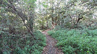
Denham Lock Wood is a 6.3-hectare (16-acre) biological Site of Special Scientific Interest (SSSI) next to the Grand Union Canal, and near Denham in the London Borough of Hillingdon. It was notified in 1986 and is managed by the London Wildlife Trust on behalf of Hillingdon Council. It lies within the Colne Valley Regional Park.

Mid Colne Valley is a 132 hectare biological Site of Special Scientific Interest in Harefield in the London Borough of Hillingdon and Denham in South Buckinghamshire. Its main importance lies in its extensive diversity of birdlife in lakes in former gravel pits.

Box Farm Meadows (Stuart Fawkes reserve) (grid reference ST865997) is a 8.3-hectare (21-acre) biological Site of Special Scientific Interest in Gloucestershire, notified in 1985. This was formerly known as Balls Green Pastures. The reserve is situated at the southern edge of Box village and one mile east of Nailsworth.

Salmonsbury Meadows is an 18-hectare (44-acre) biological and geological Site of Special Scientific Interest in Gloucestershire, notified in 1985. The site is listed in the 'Cotswold District' Local Plan 2001-2011 as a Key Wildlife Site (KWS).

Denham Country Park is a 69-acre public park and Local Nature Reserve in Buckinghamshire and the London Borough of Hillingdon. It is part of the 42 square mile Colne Valley Regional Park, and the Colne Valley Park Visitor Centre and cafe are located in Denham Country Park.

