Fryent Country Park

Last updated

Greater London UK location map 2.svg
Red pog.svg
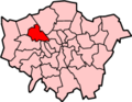
Location of Fryent Country Park in Greater London

Fryent Country Park, together with Barn Hill Open Space, is a large park situated in the north of the London Borough of Brent. It covers 103 hectares (254 acres) [1] of rolling fields and small woods.

Contents

Fryent was also a ward of the London Borough of Brent. Its population at the 2011 Census was 13,445. [2]

Significant features

Barn Hill in the south-west of the park is a wooded hill that rises to 86 metres (282 ft). A fish pond is found at the top of the Hill. Numerous other ponds can be seen in the rest of the park. Gotfords Hill (63 metres (207 ft)) and Beane Hill (65 metres (213 ft)) are other high points in the park. Parallel to Fryent Way is an ancient track known as Hell Lane or Eldestrete which may date back to Saxon times or earlier. [3] There is also a farm near the Slough Lane entrance, one of the closest farms to the centre of London.

Wildlife

Horses at Fryent Fryent Country Park horses1.jpg
Horses at Fryent

The woodland comprises English oak, hornbeam, elm, ash and some fruit trees which also occur in the hedges along with blackthorn. The park is considered the best surviving example of Middlesex countryside in the Brent basin and has a population of the nationally rare plant the narrow-leaved bitter-cress (Cardamine impatiens). [4]

History

Barn Hill, called Bardonhill in 1547, was landscaped by Humphry Repton in 1792 as part of a local landowner's country park. [5] The Fryent Park hay meadows are small remnants of two manors, one originally in the ownership of King Edward the Confessor. [6]

Access

Fryent Way Fryent way.jpg
Fryent Way

The park is bisected by the A4140 Fryent Way that links Kingsbury with Wembley, and which leads south-east towards the North Circular Road. A car park is available halfway down this road. The nearest underground is at Kingsbury Station on the Jubilee line, while the Barn Hill Open Area, or at least the summit of it, is nearer to Wembley Park and Preston Road stations. The 206 bus terminates on the south side of the park and other bus routes run to the east (Church Lane), north (Kingsbury Road) and west (Preston Hill). The Capital Ring footpath crosses the site. However, the road Fryent Way, linking Kingsbury Circle and Salmon Street, has no bus service.

Awards

Fryent Country Park was awarded a Green Flag Award in 2010/2011 for being a well-managed park or open space. [7] The Green Flag Award scheme is the benchmark national standard for parks and green spaces in England and Wales.[ dead link ] [8] It is also a Local Nature Reserve. [9] [10]

In 2014 London in Bloom awarded the park a silver gilt award in its Country Park of the Year category. [11]

Sport

The Liddiard Cup cross country race is annually staged here in late October.

Bibliography

Ordnance Survey. (2006). No. 173 Explorer Map: London North. Southampton: Ordnance Survey.

Snow, Len. (1990). Brent, Wembley, Willesden and Kingsbury: A pictorial history. Chichester: Phillimore & Co Ltd.

See also

Related Research Articles

<span class="mw-page-title-main">Cricklewood</span> Human settlement in England

Cricklewood is an area of London, England, which spans the boundaries of three London boroughs: Barnet to the east, Brent to the west and Camden to the south-east. The Crown pub, now the Clayton Crown Hotel, is a local landmark and lies 5 miles (8 km) north-west of Charing Cross.

<span class="mw-page-title-main">Kenton, London</span> Human settlement in England

Kenton is a district in north-west London, England, to the east of Harrow and historically in Middlesex. As with surroundings in Harrow, Wembley and Kingsbury, the area was a product of Metroland suburbia of the early 20th century. Both the London and North Western Railway and Metropolitan Railway reached the area by the 1920s. The main road through Kenton, the east-west Kenton Road, is a busy and important road that links Harrow to the major Edgware Road. The road now forms the boundary between the London boroughs of Harrow and Brent.

<span class="mw-page-title-main">Kingsbury, London</span> Human settlement in England

Kingsbury is a district of northwest London in the London Borough of Brent. Its ancient scope stretches to include various distinct areas that were once small villages until the inter-war period. Kingsbury was in 2001 a ward and in 2011 was identifiable with the Fryent and Barnhill wards approximately. Today it forms a quiet suburb between Fryent Country Park to the west and the Brent Reservoir to the east, along with a Jubilee line tube station and accompanying shopping district on the western side. The postal district is NW9 which it shares with Colindale and West Hendon.

<span class="mw-page-title-main">Neasden</span> Human settlement in England

Neasden is a suburban area in northwest London, England. It is located around the centre of the London Borough of Brent and is within the NW2 (Cricklewood) and NW10 (Willesden) postal districts. Neasden is near Wembley Stadium, the Welsh Harp, and Gladstone Park; the reservoir and River Brent marks its boundaries with Kingsbury and Wembley, while Gladstone Park and the Dudding Hill line separates it from Dollis Hill and Church End respectively. The A406 North Circular Road runs through the middle of Neasden; to the west is the Neasden Underground Depot, Brent Park retail area and the St Raphael's Estate; on the east is Neasden tube station, the large Neasden Temple, and former Neasden Power Station. The area is known as the place where Bob Marley lived after moving from Jamaica, living at a house in The Circle; the house was honoured with a blue plaque in 2012.

<span class="mw-page-title-main">London Borough of Brent</span> Borough in United Kingdom

Brent is a borough in north-west London. It is known for landmarks such as Wembley Stadium, the Swaminarayan Temple and the Kiln Theatre. It also contains the Welsh Harp reservoir and the Park Royal commercial estate. The local authority is Brent London Borough Council.

<span class="mw-page-title-main">Wembley</span> Suburb of London

Wembley is a large suburb in the London Borough of Brent, north-west London, 8 miles (13 km) northwest of Charing Cross. It includes the neighbourhoods of Alperton, North Wembley, Preston, Sudbury, Tokyngton and Wembley Park. The population was 102,856 in 2011.

<span class="mw-page-title-main">River Brent</span> River in London, England

The River Brent is a river in west and northwest London, England, and a tributary of the River Thames. 17.9 miles (28.8 km) in length, it rises in the Borough of Barnet and flows in a generally south-west direction before joining the Tideway stretch of the Thames at Brentford.

<span class="mw-page-title-main">Wembley Park</span> Human settlement in England

Wembley Park is a district of the London Borough of Brent, England. It is roughly centred on Bridge Road, a mile northeast of Wembley town centre and 7.6 miles (12 km) northwest from Charing Cross.

<span class="mw-page-title-main">Brent North (UK Parliament constituency)</span> UK Parliament constituency in England since 1974

Brent North is a constituency represented in the House of Commons of the UK Parliament since 1997 by Barry Gardiner of the Labour Party.

<span class="mw-page-title-main">Municipal Borough of Wembley</span> Former municipal borough in Middlesex, England

Wembley was an urban district and later a municipal borough in Middlesex, England from 1894 to 1965.

<span class="mw-page-title-main">Parks and open spaces in the London Borough of Brent</span>

The London Borough of Brent, an Outer London borough to the north west of the conurbation, has about 100 parks and open spaces within its boundaries. These include recreation and sports grounds, a large country park, and a large reservoir. The main areas of open space are:

<span class="mw-page-title-main">North Wembley</span> Human settlement in England

North Wembley is a district in North West London, England. It is located in the London Borough of Brent and is mostly made up of the 1930s Sudbury Court Estate. North Wembley forms the north-western part of the district of that is its namesake. The major roads in the area are East Lane, Watford Road, and Sudbury Court Drive. Most of it is part of the Wembley HA0 postcode area, but a small part in the east falls under Wembley HA9, and parts in the west fall under Harrow HA1.

<span class="mw-page-title-main">Brent London Borough Council elections</span> Local elections in London

Brent London Borough Council in London, England is elected every four years. Since the last boundary changes in 2002, 63 councillors have been elected from 21 wards.

<span class="mw-page-title-main">Sudbury, London</span> Human settlement in England

Sudbury is a suburb in the London Borough of Brent, located in northwest London, United Kingdom. The suburb forms the western part of Wembley and is centred around 0.6 miles (1 km) west of Wembley Central railway station.

<span class="mw-page-title-main">Roe Green Park</span>

Roe Green Park is a park in the London Borough of Brent, northwest London, England. The Barn Hill Conservation Group maintain the Roe Green walled garden that is within the park. Roe Green Village was built between 1918 and 1920, using Prussian/German prisoners of war as cheap labour after World War I. The park was incorporated and thus taken under council control between 1935 and 1938.

The North and West London Light Railway (NWLLR), formerly known as the Brent Cross Railway, was a proposal for a light rail system in North and West London in the UK. It was put forward by the London group of the Campaign for Better Transport and by the Coalition for a Sustainable Brent Cross Cricklewood.

<span class="mw-page-title-main">Gladstone Park, London</span> Park in the Dollis Hill area of London

Gladstone Park is situated in the Dollis Hill area of north-west London. It is about 35 hectares in area.

The 1968 Brent Council election took place on 9 May 1968 to elect members of Brent London Borough Council in London, England. The whole council was up for election and the Conservative party gained overall control of the council.

<span class="mw-page-title-main">Masons Field</span>

Masons Field is a 2.9 hectare Local Nature Reserve (LNR) in Kingsbury in the London Borough of Brent. It was declared an LNR in 2013, it is owned by London Underground Ltd and managed by Brent Council on a 125-year leasehold.

References

  1. Brent Council. (2007). Fryent Country Park. Details Archived September 29, 2007, at the Wayback Machine
  2. "Brent Ward population 2011". Neighbourhood Statistics. Office for National Statistics. Retrieved 20 October 2016.
  3. Article on Hell Lane
  4. Management Plan by Brent Council Archived May 13, 2006, at the Wayback Machine
  5. Details of history of Barn Hill by Brent Council [Accessed 3 August 2007]. "Brent Council - Planning and building control". Archived from the original on 27 September 2007. Retrieved 3 August 2007.{{cite web}}: CS1 maint: bot: original URL status unknown (link)
  6. Philip Grant (2004). “The hay meadows of Kingsbury: a look at their history”. Article prepared for Brent Archive. Archived 2013-08-26 at archive.today
  7. Fryent Country Park. Archived November 21, 2011, at the Wayback Machine
  8. Green Flag.
  9. "Fryent Country Park". Local Nature Reserves. Natural England. 5 March 2013. Retrieved 22 January 2014.
  10. "Map of Fryent Country Park". Local Nature Reserves. Natural England. Retrieved 22 January 2014.
  11. "London in Bloom".

51°34′39″N00°16′21″W / 51.57750°N 0.27250°W / 51.57750; -0.27250