Ealing Common

Last updated

Ealing Common Ealing Common - geograph.org.uk - 17075.jpg
Ealing Common
Greater London UK location map 2.svg
Red pog.svg
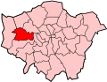
Ealing Common's location in London

Ealing Common is a large open space (approx 47 acres or 19 hectares) in Ealing, West London.

Contents

Boundaries

Old drinking fountain Ealing-Common-old-drinking-fountain-DMS-01.jpg
Old drinking fountain

The Ealing Common Area is bounded by Ealing Town Centre to the west, North Ealing and Hanger Hill to the north, Acton to the east and South Ealing and South Acton to the south.

The Ealing Common open space is bounded by Gunnersbury Ave (A406) to the east and the Uxbridge Road to the north. A smaller area of the common extends to the east of Gunnersbury Ave, including Leopold Road. The western boundary includes The Common and Warwick Dene, with Elm Avenue to the south. Some distance to the south is also the much larger Gunnersbury Park.

Ownership

The Ealing Common open space is a common land as designated by the 1866 Metropolitan Commons Act.

History

In August 1733 a cricket match was played on the common between Ealing & Acton and London Cricket Club. [1]

Flora

Ealing Common preserves a large area of open space with fine avenues of horse chestnut trees, most of which were planted in the late Victorian period, following the purchase of the common land by the Ealing Local Board. The northern part of the common has a large English oak tree at its centre, and London plane trees are also found with the horse chestnuts around the perimeter of the common. Charles Jones was the borough surveyor responsible for the layout.

In the south-west corner of Ealing Common there is a small enclosed park, called Warwick Dene, with rose beds at its centre.

Other information

There is a local Conservation Area which includes streets around the common.

Ealing Common is also informally used by some as the name of the area in the London Borough of Ealing surrounding Ealing Common station, which is named after the common; however, it is officially part of the Ealing district.

Related Research Articles

<span class="mw-page-title-main">Chiswick</span> Riverside district of London, England

Chiswick is a district of west London, England. It contains Hogarth's House, the former residence of the 18th-century English artist William Hogarth; Chiswick House, a neo-Palladian villa regarded as one of the finest in England; and Fuller's Brewery, London's largest and oldest brewery. In a meander of the River Thames used for competitive and recreational rowing, with several rowing clubs on the river bank, the finishing post for the Boat Race is just downstream of Chiswick Bridge.

<span class="mw-page-title-main">London Borough of Hounslow</span> London borough in United Kingdom

The London Borough of Hounslow is a London borough in West London, England, forming part of Outer London. It was created in 1965 when three smaller borough councils amalgamated under the London Government Act 1963. It is governed by Hounslow London Borough Council.

<span class="mw-page-title-main">London Borough of Ealing</span> Borough in United Kingdom

The London Borough of Ealing is a London borough in West London. It comprises seven major towns: Acton (W3), Ealing, Greenford (UB6), Hanwell (W7), Northolt (UB5), Perivale (UB6) and Southall. With a population of 367,100 inhabitants, it is the third most populous London borough.

<span class="mw-page-title-main">Ealing</span> London Borough in United Kingdom

Ealing is a district in West London, England, 7.5 miles (12.1 km) west of Charing Cross in the London Borough of Ealing. Ealing is the administrative centre of the borough and is identified as a major metropolitan centre in the London Plan.

<span class="mw-page-title-main">Acton Town tube station</span> London Underground station

Acton Town is a London Underground station in the south-west corner of Acton, West London, in the London Borough of Ealing, close to the border with the London Borough of Hounslow. The station is served by the District and Piccadilly lines and is in Travelcard Zone 3. On the District line, it is between Chiswick Park and Ealing Common stations, and on the Piccadilly line it is between Hammersmith and Ealing Common on the Uxbridge branch & South Ealing on the Heathrow branch. Acton Town station was opened as Mill Hill Park on 1 July 1879 by the District Railway. It remained as a terminus until on 1 May 1883 and 23 June 1903 the DR opened two branches from Acton Town to Hounslow Town and Park Royal & Twyford Abbey respectively. On 4 July 1932 the Piccadilly line was extended to Acton Town. District line services to both the Hounslow and Uxbridge branches were withdrawn completely on 9 and 10 October 1964 after which operations were provided by the Piccadilly line alone.

<span class="mw-page-title-main">West Ealing</span> Human settlement in England

West Ealing is a district in the London Borough of Ealing, in West London. The district is about three-quarters of a mile (1.2 km) west of Ealing Broadway. Although there is a long history of settlement in the area, West Ealing in its present form is less than one hundred years old. West Ealing falls under the postcode district W13 and neighbours Hanwell, Ealing, Perivale and Northfields

<span class="mw-page-title-main">Shipbourne</span> Human settlement in England

Shipbourne is a village and civil parish situated between the towns of Sevenoaks and Tonbridge, in the borough of Tonbridge and Malling in the English county of Kent. In 2020 it was named as the most expensive village in Kent.

<span class="mw-page-title-main">Parks and open spaces in the London Borough of Ealing</span>

The London Borough of Ealing, one of the outer London boroughs although not on the periphery, has over 100 parks and open spaces within its boundaries. These include allotments, cemeteries, playgrounds, and golf courses in addition to the larger open spaces such as nature conservation areas.

<span class="mw-page-title-main">Gunnersbury Park</span> Human settlement in England

Gunnersbury Park is a park in the London Borough of Hounslow between Acton, Brentford, Chiswick and Ealing, West London, England. Purchased for the nation from the Rothschild family, it was opened to the public by Neville Chamberlain, then Minister of Health, on 21 May 1926. The park is currently jointly managed by Hounslow and Ealing borough councils. A major restoration project funded by the Heritage Lottery Fund was completed in 2018. The park and garden is Grade II listed.

<span class="mw-page-title-main">Uxbridge Road</span> Road in west London

Uxbridge Road is the name of the A4020 road in West London. The 12-mile (19 km) route starts at Shepherd's Bush Green and goes west towards Uxbridge. It passes through Acton, Ealing, Hanwell, Southall, Hayes, and Hillingdon.

<span class="mw-page-title-main">North Acton</span> Human settlement in England

North Acton is a part of Acton in west London, and is within the London Borough of Ealing. It runs adjacent to the industrial district of Park Royal. Historically part of the Municipal Borough of Acton in the county of Middlesex, it has formed part of the London Borough of Ealing since 1965.

<span class="mw-page-title-main">Tooting Commons</span> Two adjacent areas of common land in south west London, England

The Tooting Commons consist of two adjacent areas of common land lying between Balham, Streatham and Tooting, in south west London: Tooting Bec Common and Tooting Graveney Common.

South Acton is an area in Acton, West London, 6.4 miles (10.3 km) west of Charing Cross. At the 2001 census, Acton, comprising the wards of East Acton, Acton Central, South Acton and Southfield, had a population of 53,689 people.

<span class="mw-page-title-main">Ealing Common Depot</span> London Underground railway depot on the District Line

Ealing Common Depot is a London Underground railway depot on the District line, located between Acton Town and Ealing Common stations in west London, England. It is the oldest of the main depots on the Underground, having been built in 1905, when the District Railway was upgraded for electric traction. All depot facilities were moved there from Lillie Bridge Depot, and it was known as Mill Hill Park Works. It subsequently became Ealing Common Works, and its status was reduced to that of a depot in 1922, when Acton Works was opened, and took over responsibility for all major overhauls. Most of the functions of Acton Works were devolved back to the depots, including Ealing Common, in 1985.

<span class="mw-page-title-main">Hanger Hill</span> Area of London

Hanger Hill or Haymills Estate is a local area and ward of the London Borough of Ealing around Hanger Lane. It was developed in the interwar period when affluent Londoners began to move out of Central London for more green spaces. The estate features spacious houses and flats designed by architects Douglas Smith and Barley.

<span class="mw-page-title-main">Llandaff Fields</span> Multi-use park and playings fields in Cardiff, Wales

Llandaff Fields is a large parkland spanning parts of central and northern Cardiff, Wales.

<span class="mw-page-title-main">Gunnersbury Triangle</span> Nature reserve in Ealing and Hounslow, UK

Gunnersbury Triangle is a 2.57-hectare (6.4-acre) local nature reserve in Chiswick, in the London boroughs of Ealing and Hounslow, immediately to the east of Gunnersbury. It was created in 1983 when, for the first time in Britain, a public inquiry ruled that a planned development of the land could not go ahead because of its value for nature. It opened as a nature reserve in 1985.

<span class="mw-page-title-main">Royal Borough of Kensington and Chelsea Cemetery, Hanwell</span> Cemetery in Uxbridge Road, Hanwell London

Royal Borough of Kensington and Chelsea Cemetery, Hanwell is located on the north side of the Uxbridge Road in Hanwell, London, England.

<span class="mw-page-title-main">Belmont Pastures</span>

Belmont Pastures is a 1.3 hectare Local Nature Reserve and Site of Borough Importance for Nature Conservation, Grade II, in Belmont in the London Borough of Sutton. It is owned by Sutton Council and managed by the council together with Sutton Nature Conservation Volunteers.

<span class="mw-page-title-main">St Stephen's Church, Ealing</span> Christian congregation and community centre


St Stephen's Church is a Church of England church on Castlebar Hill in Ealing. It was founded in 1867 as a mission and is now established as a separate parish. The first church building was a temporary iron church which was then replaced in 1876 by a substantial Victorian Gothic stone building which is now Grade II listed. Subsidence made that unsafe and it was deconsecrated in 1979. It has been converted to flats but still forms the landmark centrepiece of the St Stephen's Conservation Area. The congregation now holds services on the site of the church hall which has been redeveloped as the third church building and community centre.

References

  1. Buckley, G. B. (1935). Fresh Light on 18th Century Cricket. Cotterell. p. 8.

Coordinates: 51°30′36″N0°17′38″W / 51.510°N 0.294°W / 51.510; -0.294