Chislehurst is a suburban district of south-east London, England, in the London Borough of Bromley. It lies east of Bromley, south-west of Sidcup and north-west of Orpington, 10 miles (16 km) south-east of Charing Cross. Before the creation of Greater London in 1965, it was in Kent. According to the 2021 census, Chislehurst has a population of 15,600.
Sidcup is an area of south-east London, England, primarily in the London Borough of Bexley. It is 11.3 miles (18.2 km) south-east of Charing Cross, bordering the London Boroughs of Bromley and Greenwich. It was part of Kent prior to the creation of Greater London in 1965.

The London Borough of Bexley is a London borough in south-east London, forming part of Outer London. It has a population of 248,287. The main settlements are Sidcup, Erith, Bexleyheath, Crayford, Welling and Old Bexley. The London Borough of Bexley is within the Thames Gateway, an area designated as a national priority for urban regeneration. The local authority is Bexley London Borough Council.

Bexley is an area of south-eastern Greater London, England and part of the London Borough of Bexley. It is sometimes known as Bexley Village or Old Bexley to differentiate the area from the wider borough. It is located 13 miles (21 km) east-southeast of Charing Cross and south of Bexleyheath.
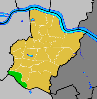
Chislehurst and Sidcup Urban District was a local government district and civil parish in north west Kent, England from 1934 to 1965.

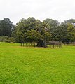
Foots Cray is an area of South East London, England, within the London Borough of Bexley. Prior to 1965 it was in the historic county of Kent. It is located south-east of Sidcup, north of Orpington and north west of Swanley.

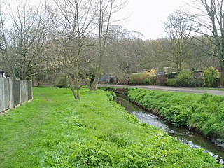
The River Cray is the largest tributary of the River Darent. It is the prime river of outer, south-east Greater London, rising in Priory Gardens, Orpington, where rainwater percolates through the chalk bedrock of the Downs to form a pond where the eroded ground elevation gives way to impermeable clay. Initially it flows true to form northwards, past industrial and residential St Mary Cray, through St Paul's Cray and through Foots Cray, where it enters the parkland Foots Cray Meadows, flowing under by Five Arches bridge. It then flows by restored Loring Hall (c.1760), home of the Lord Castlereagh who killed himself there in 1822. It continues through North Cray and Bexley. It neighbours a restored Gothic (architecture) cold plunge bath house, built around 1766 as part of Vale Mascal Estate. It is then joined by the River Shuttle and then continues through the parkland of Hall Place, which was built for John Champneys in 1540. The Cray turns eastward through Crayford and Barnes Cray to join the Darent in Dartford Creek. The Creek is a well-watered partly tidal inlet between Crayford Marshes and Dartford Marshes by a slight projection of land, Crayford Ness. The villages through which the Cray flows are collectively known as "The Crays".
The River Shuttle is a small tributary of the River Cray in London, United Kingdom.

Old Bexley and Sidcup is a constituency in Greater London represented in the House of Commons of the UK Parliament since its 1983 creation. Its first Member of Parliament (MP) was former Prime Minister Edward Heath, who previously represented Bexley (1950–1974) and Sidcup (1974–1983). The seat has been held since a 2021 by-election by Louie French of the Conservative Party, following the death of incumbent James Brokenshire.
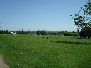
Danson Park is a public park in the London Borough of Bexley, South East London, located between Welling and Bexleyheath. At 75 hectares, it is the second largest public park in the borough, and the most used by the community. Opened in 1925, it is often considered the finest green open space in the borough, and is Grade II listed on the Register of Historic Parks and Gardens. The park also gives its name to the electoral ward that covers the park and the surrounding area. The park is located at grid reference TQ472752. The southern boundary of both the park and the ward is delineated by Rochester Way, the A2 road.
Albany Park is an area in south east London, England, within the London Borough of Bexley. It is located 12.0 miles (19 km) south east of Charing Cross. Located midway between Sidcup and Bexley, Albany Park is situated on high ground overlooking the valleys of the River Cray and the River Shuttle.
The London Borough of Bexley owns and maintains over 100 parks and open spaces within its boundaries, with a total of 638 hectares. They include small gardens, river and woodland areas, and large parks with many sporting and other facilities.

St Mary Cray is an area of South East London, England, within the London Borough of Bromley. Historically it was a market town in the county of Kent. It is located north of Orpington, and 13 miles (21 km) south-east of Charing Cross.
St Paul's Cray is an area of South East London, England, within the London Borough of Bromley in Greater London. Prior to 1965 it was within the historic county of Kent. It is located south of Sidcup and north of Orpington.
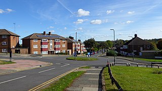
Longlands is an area of South East London that straddles the boundary of both the London Borough of Bexley and the Royal Borough of Greenwich. It lies north west of Sidcup and south east of Eltham.

Wyncham Stream is a small river within the London Boroughs of Bexley and Bromley in southeast London, England, United Kingdom. It is 5.6 km (3.5 mi) in length and is a tributary of the River Shuttle.
Ruxley is a rural settlement of South East London, England that straddles the boundary of the London Boroughs of Bromley and Bexley. It is located 13 miles southeast of Charing Cross, the traditional centre of London, in the Metropolitan Green Belt between Sidcup and Swanley and is also adjacent to the Greater London border with the county of Kent.

North Cray is an area in South East London, England, within the London Borough of Bexley. It is located east of Sidcup and south of Bexleyheath and is 12.6 miles (20.3 km) south-east of Charing Cross, the traditional centre of London in the Metropolitan Green Belt.

Foots Cray Place was one of the four country houses built in England in the 18th century to a design inspired by Palladio's Villa Capra near Vicenza. Built in 1754 near Sidcup, Kent, Foots Cray Place was demolished in 1950 after a fire in 1949. Of the three other houses in England, Nuthall Temple in Nottinghamshire was built 1757 and demolished in 1929; the other two survive: Mereworth Castle and Chiswick House, both now Grade I listed buildings. A modern fifth example, Henbury Hall, was built near Macclesfield in the 1980s. Another example of a similar structure in England is the Temple of the Four Winds at Castle Howard, which is a garden building not a house.

Bexley London Borough Council, also known as Bexley Council is the local authority for the London Borough of Bexley in Greater London, England. It is a London borough council, one of 32 in London. The council has been under Conservative majority control since 2006. It is based at Bexley Civic Offices in the Bexleyheath area of the borough.
Copies of A History of Footscray can be purchased from Bexley Archaeological Group Bexley Archaeological Group