
Moat Mount Open Space is a 110-hectare park and nature reserve in Mill Hill in the London Borough of Barnet. It is part of Moat Mount Open Space and Mote End Farm Site of Borough Importance for Nature Conservation, Grade II, which includes Barnet Gate Wood and Scratchwood Countryside Park, but is separate from Scratchwood itself, which is a neighbouring park and nature reserve. Most of the site is open to the public, but Mote End Farm and some other areas are private. Scratchwood and Moat Mount are a Local Nature Reserve.

High Elms Country Park is an extensive 250-acre (100 ha) public park on the North Downs in Farnborough in the London Borough of Bromley. It is a Local Nature Reserve, and together with the neighbouring Downe Bank, a Site of Special Scientific Interest. The park surrounds High Elms Golf Course, and has extensive woodland, chiefly oak and beech, chalk meadows and formal gardens. It also has a cafe, a visitor centre, nature and history trails and car parks.

Stanmore Country Park is a 30.7-hectare (76-acre) public park, Local Nature Reserve and Site of Metropolitan Importance for Nature Conservation in Stanmore in the London Borough of Harrow. It is owned and managed by Harrow London Borough Council.

Coppetts Wood and Scrublands is a 14.5-hectare (36-acre) Site of Borough Importance for Nature Conservation, Grade I, between Muswell Hill and Friern Barnet in the London Borough of Barnet. It is part of the Coppetts Wood and Glebelands Local Nature Reserve.

Oak Hill Wood is a 10-hectare Local Nature Reserve (LNR) and a Site of Borough Importance for Nature Conservation Grade I, in East Barnet, London. It is owned by the London Borough of Barnet, and part of it is a 5.5-hectare nature reserve managed by the London Wildlife Trust.
Big Wood and Little Wood are two patches of woodland in Hampstead Garden Suburb in the London Borough of Barnet. They are a Site of Borough Importance for Nature Conservation, Grade 1, and a Local Nature Reserve. Big Wood is 7.3 hectares and Little Wood is 1.2 hectares.

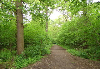
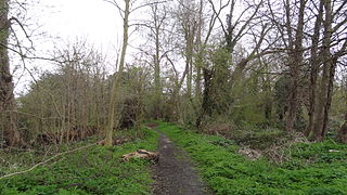
Westbere Copse is an eight hectares Local Nature Reserve and Site of Borough Importance for Nature Conservation, Grade 1, in West Hampstead in the London Borough of Camden. It is located at the corner of Westbere Road and Minster Road, next to the railway. The site is owned by Network Rail and is leased to Camden Council for use as a nature reserve. The nature reserve is composed of Westbere Copse itself, sections of railside, and an old orchard at Medley Gardens. There is no access to the railway land or the orchard. Westbere Copse is divided into a northern half which has free public access and a southern half, called Jenny Wood Nature Reserve, which is named after one of the founders of the site who died in 1988. This is only open at weekends.

One Tree Hill is a defining feature of Honor Oak, mostly in London Borough of Southwark but with parts also in the London Borough of Lewisham. It includes a 7 hectare public park, local nature reserve and Site of Borough Importance for Nature Conservation, Grade 1, which is owned and managed by Southwark Council. Its name, and that of the Honor Oak area, derive from the Oak of Honor, a tree on the hill which marked the southern boundary of the Norman Honour of Gloucester.
Gillespie Park is a 3.4 hectare Local Nature Reserve and Site of Metropolitan Importance for Nature Conservation in Highbury in the London Borough of Islington. It also hosts the Islington Ecology Centre, which provides environmental education for schools and organises walks and talks for adults. It is owned and managed by Islington Council. The site is protected by Fields in Trust through a legal "Deed of Dedication" safeguarding the future of the space as public recreation land for future generations to enjoy.

Morden Park is a 50-hectare (120-acre) public park and Site of Borough Importance for Nature Conservation, Grade 1, in the district of Morden Park in the London Borough of Merton. Of this, 28 hectares is a Local Nature Reserve. It is owned and managed by Merton Council. It includes Morden Park House.
Ravensbury Park is a public park in Mitcham in the London Borough of Merton. An area of 7 hectares is designated a Local Nature Reserve. The River Wandle runs along the southern boundary of the park, which is also part of the Upper Wandle River Site of Metropolitan Importance for Nature Conservation.
Cranmer Green is a 3.2 hectare local nature reserve and Site of Local Importance for Nature Conservation in Mitcham in the London Borough of Merton. It is owned and managed by Merton Council. It is a triangular area bounded by Cranmer Road, King George VI Avenue and a railway line.

The Spinney, Carshalton is a 0.4 hectare local nature reserve in Carshalton in the London Borough of Sutton, England. It is owned by Sutton Council and managed by the council and Sutton Nature Conservation Volunteers. It used to be managed by the London Wildlife Trust.

Wandle Valley Wetland is a 0.6 hectare Local Nature Reserve in Carshalton in the London Borough of Sutton. It is owned by the Council and managed by the Council together with Sutton Nature Conservation Volunteers.

Wilderness Island is the 2.7 hectare island between the Wandle and Wrythe in Carshalton in the London Borough of Sutton. It is designated a Local Nature Reserve and a Site of Metropolitan Importance for Nature Conservation, is owned by Sutton Council and is managed by the London Wildlife Trust.

Devonshire Avenue Nature Area is a 0.4 hectare Local Nature Reserve and Site of Borough Importance for Nature Conservation, Grade II, in South Sutton in the London Borough of Sutton. It is owned by Sutton Council and managed by the Council and Sutton Nature Conservation Volunteers.

Belmont Pastures is a 1.3 hectare Local Nature Reserve and Site of Borough Importance for Nature Conservation, Grade II, in Belmont in the London Borough of Sutton. It is owned by Sutton Council and managed by the council together with Sutton Nature Conservation Volunteers.

Cuddington Meadows is a 1.4-hectare (3.5-acre) Local Nature Reserve and Site of Borough Importance for Nature Conservation, Grade I, in Belmont in the London Borough of Sutton. It is owned by Sutton Council and managed by the council together with Sutton Nature Conservation Volunteers.

The Wood is a public park in Surbiton in the Royal Borough of Kingston upon Thames in London. Part of it is a bird sanctuary named after the naturalist Richard Jefferies. The 1.5-hectare site is designated as a Local Nature Reserve called 'The Wood and Richard Jefferies Bird Sanctuary'.
