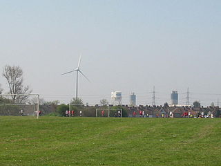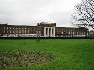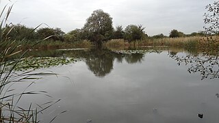
The London Borough of Barking and Dagenham is a London borough in East London. It lies around 9 miles (14.4 km) east of Central London. The borough was created in 1965 as the London Borough of Barking; the name was changed in 1980. It is an Outer London borough and the south is within the London Riverside section of the Thames Gateway; an area designated as a national priority for urban regeneration. At the 2011 census it had a population of 187,000. The borough's three main towns are Barking, Chadwell Heath and Dagenham. The local authority is the Barking and Dagenham London Borough Council. Barking and Dagenham was one of six London boroughs to host the 2012 Summer Olympics.

Dagenham is a town in East London, England, within the London Borough of Barking and Dagenham. Dagenham is centred 11.5 miles (18.5 km) east of Charing Cross.
Hornchurch Country Park is a 104.5-hectare park on the former site of Hornchurch Airfield, south of Hornchurch in the London Borough of Havering, east London.

Eastbrookend Country Park is an 84-hectare park and Local Nature Reserve in Dagenham in the London Borough of Barking and Dagenham, in England. Together with the neighbouring Chase Nature Reserve it is also designated a Site of Metropolitan Importance for Nature Conservation.

The London Borough of Barking and Dagenham, one of the outer London boroughs, has over 25 parks, gardens and open spaces within its boundaries. These provide the "green lungs" for leisure activities.

Coppetts Wood and Scrublands is a 14.5-hectare (36-acre) Site of Borough Importance for Nature Conservation, Grade I, between Muswell Hill and Friern Barnet in the London Borough of Barnet. It is part of the Coppetts Wood and Glebelands Local Nature Reserve.

Cranebank is a Local Nature Reserve on the east bank of the River Crane in Hatton in the London Borough of Hounslow. It is owned and managed by Hounslow Council. It is also part of The Crane Corridor Site of Metropolitan Importance for Nature Conservation.

Belsize Wood is a 0.7 hectare Local Nature Reserve and a Site of Borough Importance for Nature Conservation, Grade II, in Belsize Park in the London Borough of Camden. It is a steeply sloping site divided into a northern half, which is always open to the public and is of lesser ecological value, and a southern part which is in a better state of conservation, and which is only open at weekends. The two halves are separated by a public footpath between Lawn Road and Aspern Grove. The site is owned and managed by Camden Council.

The Chase is a nature reserve in Dagenham in London. Most of it is in the London Borough of Barking and Dagenham, with a small part in Havering. It is owned by the boroughs, and managed by London Borough of Barking & Dagenham - Parks & Countryside Ranger Service. The boroughs have designated the sections in their respective boroughs as Local Nature Reserves. The Chase, together with the neighbouring Eastbrookend Country Park, is also designated a Site of Metropolitan Importance for Nature Conservation.

Beam Valley Country Park is a 74-hectare park in Dagenham in the London Borough of Barking and Dagenham. Most of it is designated as a Local Nature Reserve (LNR) called Beam Valley, but a narrow strip next to the River Beam south from Western Avenue is a separate LNR called Beam Valley. The park is also designated as two Sites of Borough Importance for Nature Conservation, Grade 1, one north and the other south of South Dagenham Road.

Dagenham Village Churchyard or St Peter and St Paul's Churchyard is a 0.88 hectare Local Nature Reserve in Dagenham in the London Borough of Barking and Dagenham. It is owned by the borough council.

Parsloes Park is a 58 hectare public park in Dagenham in the London Borough of Barking and Dagenham. It is owned and managed by the borough council. A small area opposite the Wren Road entrance is managed for wildlife and designated as a Local Nature Reserve called Parsloes Park Squatts.

Ripple Nature Reserve is an 8.3-hectare (21-acre) Site of Metropolitan Importance for Nature Conservation and Local Nature Reserve in Dagenham in the London Borough of Barking and Dagenham. It is owned by the borough council.

Scrattons Eco Park or Scrattons Farm Eco Park is a small nature reserve in Dagenham in the London Borough of Barking and Dagenham. It is owned and managed by the council. It was formerly marshland and allotments, but by the late 1990s the former allotments had become overgrown and inaccessible, and it was decided to convert it into an ecological park. It now has blocks of bramble with grass paths, preserving existing trees and shrubs. The aim is to create a range of habitats for plants, birds, insects and mammals.

Bedfont Lakes Country Park is a 72.5-hectare Local Nature Reserve and Site of Metropolitan Importance for Nature Conservation in Bedfont in the London Borough of Hounslow.

Morden Park is a 50-hectare (120-acre) public park and Site of Borough Importance for Nature Conservation, Grade 1, in the district of Morden Park in the London Borough of Merton. Of this, 28 hectares is a Local Nature Reserve. It is owned and managed by Merton Council. It includes Morden Park House.

Blondin Park is an 8.5-hectare (21-acre) public park in Northfields in the London Borough of Ealing. It has allotments area and sports pitches. It is owned by Ealing Council and managed by the Council together with the Friends of Blondin Park. An area of 2.3 ha in the south-west corner is a Local Nature Reserve, and the nature area and allotments are a Site of Local Importance for Nature Conservation.


