
Mayfair is an area in London, England and is located in the City of Westminster. It is in Central London and part of the West End. It is between Oxford Street, Regent Street, Piccadilly and Park Lane and one of the most expensive districts in the world.
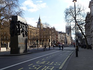
Whitehall is a road and area in the City of Westminster, Central London, England. The road forms the first part of the A3212 road from Trafalgar Square to Chelsea. It is the main thoroughfare running south from Trafalgar Square towards Parliament Square. The street is recognised as the centre of the Government of the United Kingdom and is lined with numerous departments and ministries, including the Ministry of Defence, Horse Guards and the Cabinet Office. Consequently, the name "Whitehall" is used as a metonym for the British civil service and government, and as the geographic name for the surrounding area.

Regent's Park is one of the Royal Parks of London. It occupies 410 acres (170 ha) in north-west Inner London, administratively split between the City of Westminster and the Borough of Camden. In addition to its large central parkland and ornamental lake, it contains various structures and organizations both public and private, generally on its periphery, including Regent's University and London Zoo.

Belgravia is a district in Central London, covering parts of the areas of the City of Westminster and the Royal Borough of Kensington and Chelsea.
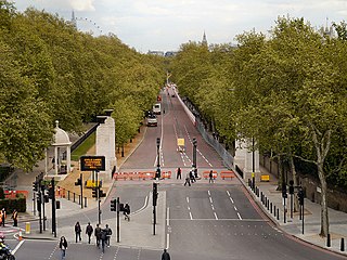
Constitution Hill is a road in the City of Westminster in London. It connects the western end of The Mall with Hyde Park Corner, and is bordered by Buckingham Palace Gardens to the south, and Green Park to the north. At the top of the rise in the roadway at the Corner is the Wellington Arch, near where the road is flanked by the Memorial Gates war memorial.
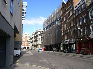
Bow Street is a thoroughfare in Covent Garden, Westminster, London. It connects Long Acre, Russell Street and Wellington Street, and is part of a route from St Giles to Waterloo Bridge.

Pall Mall is a street in the St James's area of the City of Westminster, Central London. It connects St James's Street to Trafalgar Square and is a section of the regional A4 road. The street's name is derived from pall-mall, a ball game played there during the 17th century, which in turn is derived from the Italian pallamaglio, literally "ball-mallet".

Bayswater Road is the main road running along the northern edge of Hyde Park in London. Originally part of the A40 road, it is now designated part of the A402 road.

Essex Road is a main road in Islington, London. It is part of the A104 and connects Islington High Street with Balls Pond Road via Essex Road railway station.
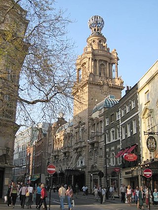
St Martin's Lane is a street in the City of Westminster, which runs from the church of St Martin-in-the-Fields, after which it is named, near Trafalgar Square northwards to Long Acre. At its northern end, it becomes Monmouth Street. St Martin's Lane and Monmouth Street together form the B404.

Sir Sydney Hedley Waterlow, 1st Baronet, was a British philanthropist and Liberal Party politician, principally remembered for donating Waterlow Park to the public as "a garden for the gardenless".

Lauderdale House is an historic house, now run as an arts and education centre, based in Waterlow Park, Highgate in north London, England.

Channing School is an independent day school for girls at Highgate Hill in Highgate, North London. Channing School is a member of the Girls' Schools Association. The junior school is for pupils aged four to twelve and includes the Early Years Foundation Stage (EYFS).
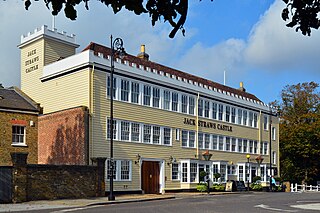
Jack Straw's Castle is a Grade II listed building and former public house on North End Way, Hampstead, north-west London, England close to the junction with Heath Street and Spaniards Road.

Devereux Court, a street in the City of Westminster located just south of the Strand and east of Essex Street, is completely pedestrianised. This narrow lane is lined with well-preserved seventeenth-century buildings. The court's distinctive dog-leg layout has remained unchanged since its establishment in the 1670s on the grounds of Essex House, a stately home renowned for its expansive gardens.

South Audley Street is a major shopping street in Mayfair, London. It runs north to south from the southwest corner of Grosvenor Square to Curzon Street.

Buckingham House was a residence of the Dukes of Buckingham and Chandos in Pall Mall, London. Designed by the Neoclassical architect Sir John Soane in 1790, it featured the Neo-Palladian style for the three-storey-high frontage. The construction work finished in 1795.

The Maypole in the Strand was a landmark maypole on the Strand, London, that was in place during the 17th and early 18th centuries, on the site of the current St Mary le Strand church.

Seething Lane is a street in the City of London. It connects All Hallows-by-the-Tower, Byward Street, with St Olave's Church, Hart Street. The street is named after an Old English expression meaning "full of chaff", which was derived from the nearby corn market in Fenchurch Street. Samuel Pepys lived there and is buried in St Olave's Church at the junction with Hart Street. A bust of Pepys, created by Karin Jonzen, sits in the public garden at the south end of the street.

Old Change was a street in the City of London, connecting Cheapside to Knightrider Street.


