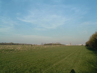
Wormwood Scrubs, known locally as The Scrubs, is an open space in Old Oak Common located in the north-eastern corner of the London Borough of Hammersmith and Fulham in west London. It is the largest open space in the borough, at 67 hectares, and one of the largest areas of common in London. The eastern part, known as Little Wormwood Scrubs, is cut off by Scrubs Lane and the West London line railway. It has been an open public space since the Wormwood Scrubs Act 1879.

The London Borough of Hammersmith and Fulham is a London borough in West London and which also forms part of Inner London. The borough was formed in 1965 as the London Borough of Hammersmith from the merger of the former Metropolitan Boroughs of Fulham and Hammersmith. The name was changed to Hammersmith and Fulham in 1979. The borough borders Brent to the north, the Royal Borough of Kensington and Chelsea to the east, Wandsworth to the south, Richmond upon Thames to the south west, and Hounslow and Ealing to the west.

Fulham is an area of the London Borough of Hammersmith & Fulham in West London, England, 3.6 miles (5.8 km) southwest of Charing Cross. It lies on the north bank of the River Thames, bordering Hammersmith, Kensington and Chelsea. The area faces Wandsworth, Putney, Barn Elms and the London Wetland Centre in Barnes. on the far side of the river.

Shepherd's Bush is a suburb of West London, England, within the London Borough of Hammersmith and Fulham 4.9 miles (7.9 km) west of Charing Cross, and identified as a major metropolitan centre in the London Plan.
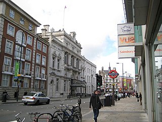
The Metropolitan Borough of Fulham was a metropolitan borough in the County of London between 1900 and 1965, when it was merged with the Metropolitan Borough of Hammersmith to form the London Borough of Hammersmith and Fulham. It was a riverside borough, and comprised the many centuries-long definition of Fulham so included parts often considered of independent character today Walham Green, Parsons Green, Hurlingham, Sands End and that part of Chelsea Harbour west of Counter's Creek. The SW6 postal district approximately follows this as does the direct, though less empowered, predecessor Fulham civil parish.
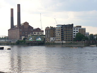
Counter's Creek, ending in Chelsea Creek, the lowest part of which still exists, was a stream that flowed from Kensal Green, by North Kensington and flowed south into the River Thames on the Tideway at Sands End, Fulham. Its remaining open watercourse is the quay of Chelsea Creek.

St. Quintin Park & Wormwood Scrubs was a railway station on the West London Railway on the border of North Kensington and Hammersmith & Fulham, West London. It was situated on an embankment next to North Pole Road, close to the road's junction with Wood Lane and near Wormwood Scrubs in what is now the London Borough of Hammersmith and Fulham.

Parsons Green is a mainly residential district in the London Borough of Hammersmith and Fulham. The Green itself, which is roughly triangular, is bounded on two of its three sides by the New King's Road section of the King's Road, A308 road and Parsons Green Lane. The wider neighbourhood is bounded by the Harwood and Wandsworth Bridge Roads, A217 road to the east and Munster Road to the west, while the Fulham Road, A3219 road may be said to define its northern boundary. Its southern boundary is less clearly defined as it merges quickly and imperceptibly with the Sulivan Court Estate and Hurlingham.

West Kensington, formerly North End, is an area in the ancient parish of Fulham, in the London Borough of Hammersmith and Fulham, England, 3.4 miles (5.5 km) west of Charing Cross. It covers most of the London postal area of W14, including the area around Barons Court tube station, and is defined as the area between Lillie Road and Hammersmith Road to the west, Fulham Palace Road to the south, Hammersmith to the north and West Brompton and Earl's Court to the east. The area is bisected by the major London artery the A4, locally known as the Talgarth Road. Its main local thoroughfare is the North End Road.

Chelsea and Fulham is a constituency in Greater London represented in the House of Commons of the UK Parliament by Ben Coleman of the Labour Party.
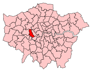
Hammersmith was a parliamentary constituency in the House of Commons of the UK Parliament represented from 2010 until its abolition for the 2024 general election by Andy Slaughter, a member of the Labour Party.
The Hammersmith and Fulham Parks Constabulary was a small constabulary responsible for policing the parks and open spaces of the London Borough of Hammersmith and Fulham. In 2013, it merged with the Royal Borough of Kensington and Chelsea Parks Police to form the Parks Police Service.

The Linford Christie Stadium is an athletics stadium in Wormwood Scrubs, West London, England.

Ravenscourt Park or RCP is an 8.3 hectares public park and garden located in the London Borough of Hammersmith and Fulham, England. It is one of the Borough's flagship parks, having won a Green Flag Award. Stamford Brook and Ravenscourt Park tube stations are close by.

Shepherd's Bush Green is an approximately 8-acre (3.2 ha) triangular area of open grass surrounded by trees and roads with shops in Shepherd's Bush, an area of west London which takes its name from the Green. The Green is also a ward of the London Borough of Hammersmith and Fulham. The population of the ward at the 2011 Census was 12,175.

Brook Green is an affluent sub-neighbourhood of Hammersmith in the London Borough of Hammersmith and Fulham. Located approximately 3.6 miles (5.8 km) west of Charing Cross, it is bordered by Kensington, Holland Park, Shepherd's Bush, Hammersmith and Brackenbury Village.
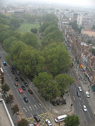
The Shepherd's Bush Conservation Area is a part of Shepherd's Bush, London, that has been established by the London Borough of Hammersmith and Fulham in order to promote the protection of local buildings of historic interest, and improve the character of the neighbourhood.
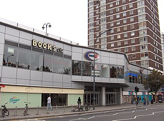
W12 is a shopping centre in Shepherd's Bush in the London Borough of Hammersmith and Fulham that is open from 06:00-23:30 daily and includes shops like Lidl, One Below and Poundland. The modern development borders the south side of Shepherd's Bush Green and was designed in the 1960s.

Hammersmith Park, known to many locals as "The BBC Park" is a public park in the London Borough of Hammersmith and Fulham. It includes a Japanese Garden, a gated children's play area, tennis courts and football pitches run by Play Football. Despite its name, it is located in Shepherd's Bush, not Hammersmith.


