
The London Borough of Bexley is a London borough in south-east London, forming part of Outer London. It has a population of 248,287. The main settlements are Sidcup, Erith, Bexleyheath, Crayford, Welling and Old Bexley. The London Borough of Bexley is within the Thames Gateway, an area designated as a national priority for urban regeneration. The local authority is Bexley London Borough Council.
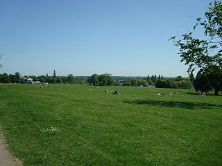
Danson Park is a public park in the London Borough of Bexley, South East London, located between Welling and Bexleyheath. At 75 hectares, it is the second largest public park in the borough, and the most used by the community. Opened in 1925, it is often considered the finest green open space in the borough, and is Grade II listed on the Register of Historic Parks and Gardens. The park also gives its name to the electoral ward that covers the park and the surrounding area. The park is located at grid reference TQ472752. The southern boundary of both the park and the ward is delineated by Rochester Way, the A2 road.
The London Borough of Bexley owns and maintains over 100 parks and open spaces within its boundaries, with a total of 638 hectares. They include small gardens, river and woodland areas, and large parks with many sporting and other facilities.

London Wildlife Trust (LWT), founded in 1981, is a local nature conservation charity for Greater London. It is one of 46 members of the Royal Society of Wildlife Trusts, each of which is a local nature conservation charity for its area. The Trust aims to protect London's wildlife and wild spaces, and it manages 36 nature reserves in Greater London. The Trust provides education services for schools. Local groups work on reserves and organise walks.

Foots Cray Meadows is an area of parkland and woodland 97 hectares in size, within the London Borough of Bexley, England. It borders the suburbs of Albany Park, Sidcup, Foots Cray, North Cray and Ruxley. The River Cray runs through it in a north-easterly direction. The London Loop, a public recreational walking path around London, also known as the "M25 for walkers", runs through the meadows parallel to the river from Sidcup Place, just south of the meadows. Two notable bridges cross the River Cray in the meadows: Five Arches bridge and the smaller Penny Farthing Bridge.

Stanmore Country Park is a 30.7-hectare (76-acre) public park, Local Nature Reserve and Site of Metropolitan Importance for Nature Conservation in Stanmore in the London Borough of Harrow. It is owned and managed by Harrow London Borough Council.

Stanmore Common is a 49.2-hectare public park, Local Nature Reserve and Site of Metropolitan Importance for Nature Conservation in Stanmore in the London Borough of Harrow in England. It is owned by Harrow Council and managed by the council with a local group. It was a biological Site of Special Scientific Interest, but was de-notified in the early 1990s.

Coppetts Wood and Scrublands is a 14.5-hectare (36-acre) Site of Borough Importance for Nature Conservation, Grade I, between Muswell Hill and Friern Barnet in the London Borough of Barnet. It is part of the Coppetts Wood and Glebelands Local Nature Reserve.

Oak Hill Wood is a 10-hectare Local Nature Reserve (LNR) and a Site of Borough Importance for Nature Conservation Grade I, in East Barnet, London. It is owned by the London Borough of Barnet, and part of it is a 5.5-hectare nature reserve managed by the London Wildlife Trust.

Mill Hill Old Railway Nature Reserve is a 2.3-hectare (5.7-acre) Site of Borough Importance for Nature Conservation, Grade II, in Mill Hill in the London Borough of Barnet.

Frays Farm Meadows is a 28.2-hectare (70-acre) biological Site of Special Scientific Interest near Denham in the London Borough of Hillingdon. It was notified as an SSSI in 1981, and has been managed by the London Wildlife Trust on behalf of Hillingdon Council since 1999. It is part of the Colne Valley Regional Park.

Wansunt Pit is a 1.9-hectare (4.7-acre) geological Site of Special Scientific Interest in Dartford Heath between Crayford in the London Borough of Bexley and Dartford in Kent. It is also a Geological Conservation Review site. It is important geologically because it exposes the Dartford Heath Gravel, and the relationship of this exposure to the Swanscombe sequence and the Thames Terraces is a controversial issue in Thames Pleistocene studies. The site is part of Braeburn Park, a nature reserve managed by the London Wildlife Trust.

Riddlesdown Common or Riddlesdown is a 43 hectare area of green space in Kenley, towards the northern end of the North Downs in the London Borough of Croydon. It is owned and maintained by the City of London Corporation, apart from two small areas, one of which is operated by the London Wildlife Trust and the other by Croydon Council. An area of 32 hectares is a biological Site of Special Scientific Interest. The name Riddlesdown also applies to the local district of residential housing. A trig point at the site indicates that it is 525 ft (160 m) above sea level.

Cranham Marsh is a 15.3 hectare Local Nature Reserve and a Site of Metropolitan Importance for Nature Conservation in Cranham in the London Borough of Havering. It is owned by Havering Council and managed by the Essex Wildlife Trust.

Fishpond Wood and Beverley Meads is a 5.8 hectare local nature reserve adjacent to Wimbledon Common in the London Borough of Merton. It is owned and managed by Merton Council.

Gutteridge Wood and Meadows is a Local Nature Reserve (LNR) in Yeading in the London Borough of Hillingdon, which is owned by Hillingdon Council and managed by the London Wildlife Trust (LWT). It is also part of the Yeading Brook Meadows Site of Metropolitan Importance for Nature Conservation, which includes two neighbouring reserves managed by the LWT, Ten Acre Wood and Yeading Brook Meadows LNRs.

Yeading Brook Meadows is a 17 hectare Local Nature Reserve (LNR) in Yeading in the London Borough of Hillingdon. It is owned by Hillingdon Council and managed by the London Wildlife Trust (LWT). In the north it adjoins Ten Acre Wood across the Golden Bridge and Charville Lane; it then stretches south along the banks of the Yeading Brook to Yeading Lane. The reserve is also part of the Yeading Brook Meadows Site of Metropolitan Importance for Nature Conservation, which includes two neighbouring LNRs managed by the London Wildlife Trust, Ten Acre Wood and Gutteridge Wood and Meadows.

Bradlaugh Fields is a 60-hectare (150-acre) open space in Northampton. The site is a former golf course. In 1987 it was proposed to build housing on the site, but after a campaign by local residents it was acquired by Northampton Borough Council and opened as a wildlife park in 1998. It was named after Charles Bradlaugh, a leading nineteenth century radical and atheist who was MP for Northampton. Three fields with a total area of 17.5 hectares are managed by the Wildlife Trust for Bedfordshire, Cambridgeshire and Northamptonshire as a nature reserve also called Bradlaugh Fields. Hills and Holes is at the southern end and two adjoining meadows, Scrub Field and Quarry Field, are at the northern end. Hills and Holes is an 8.3 hectare Local Nature Reserve (LNR) and Scrub Field is a 5.1-hectare (13-acre) LNR.


