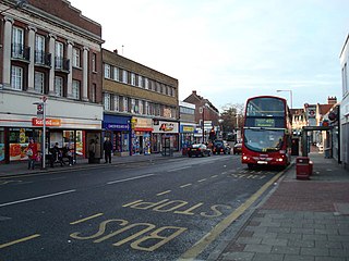
Sidcup is an area of south-east London, England, primarily in the London Borough of Bexley. It is 11.3 miles (18.2 km) south-east of Charing Cross, bordering the London Boroughs of Bromley and Greenwich. Before the creation of Greater London in 1965, it was in the historical county of Kent.

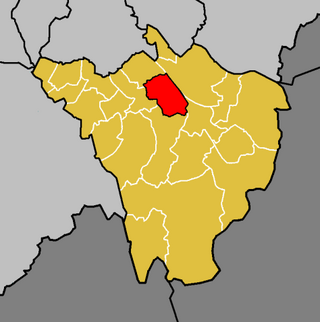
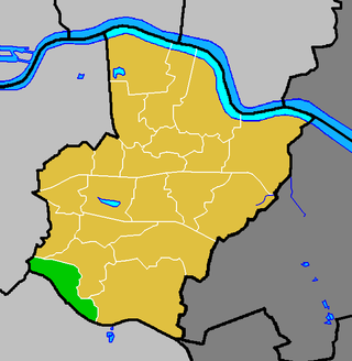
The London Borough of Bexley is a London borough in south-east London, forming part of Outer London. It has a population of 248,287. The main settlements are Sidcup, Erith, Bexleyheath, Crayford, Welling and Old Bexley. The London Borough of Bexley is within the Thames Gateway, an area designated as a national priority for urban regeneration. The local authority is Bexley London Borough Council.
Bickley is a district and a local government electoral ward in South East London, within the London Borough of Bromley. It is located 10.4 miles (16.7 km) south east of Charing Cross, bordering Elmstead to the north, Chislehurst to the north-east and east, Petts Wood to the south-east, Southborough to the south, Bromley to the south-west and west and Widmore to the north-west. Until 1965 it was in the historic county of Kent.

Bexley is an area of south-eastern Greater London, England and part of the London Borough of Bexley. It is sometimes known as Bexley Village or Old Bexley to differentiate the area from the wider borough. It is located 13 miles (21 km) east-southeast of Charing Cross and south of Bexleyheath.

Foots Cray is an area of South East London, England, within the London Borough of Bexley. Prior to 1965 it was in the historic county of Kent. It is located south-east of Sidcup, north of Orpington and north west of Swanley.
New Eltham is an area of south east London, in the London Boroughs of Greenwich and Bexley. It lies south east of Eltham and north west of Sidcup.

Old Bexley and Sidcup is a constituency created in 1983 and represented in the House of Commons of the UK Parliament represented since 2021 by Louie French of the Conservative Party.
Falconwood is an area of south east London within both the London Boroughs of Bexley and Greenwich. It is north east of Eltham and south west of Welling.

Eltham railway station is in the Well Hall area of Eltham, South East London, within the Royal Borough of Greenwich. It is 10 miles 68 chains (17.5 km) measured from London Victoria. It is in Travelcard Zone 4.

The Bexleyheath line runs for 8 miles (13 km) from Lewisham to Dartford in Kent. It separates from the North Kent Line just to the east of Blackheath Station, and rejoins the same line just south of Slade Green near Dartford.

The Dartford Loop Line is one of three lines linking London with Dartford in Kent, England. It lies to the south of the other two: the North Kent Line and the Bexleyheath Line.
Albany Park is an area in south east London, England, within the London Borough of Bexley. It is located 12.0 miles (19 km) south east of Charing Cross. Located midway between Sidcup and Bexley, Albany Park is situated on high ground overlooking the valleys of the River Cray and the River Shuttle.

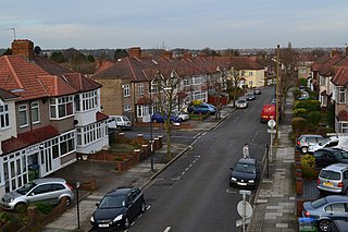
Blackfen is an area of south-east London, England, north of Sidcup in the London Borough of Bexley. Prior to 1965 it was in the county of Kent.
The London Borough of Bexley owns and maintains over 100 parks and open spaces within its boundaries, with a total of 638 hectares. They include small gardens, river and woodland areas, and large parks with many sporting and other facilities.

West Heath is an area of South East London within the London Borough of Bexley. It lies south of Abbey Wood and north of Welling.
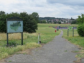
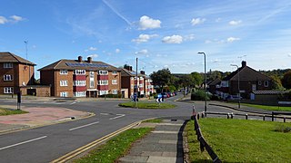
East Wickham is a district in south-east London, England, within the London Borough of Bexley. It is situated north of Welling, east of Shooter's Hill, south of Plumstead, south-west of Abbey Wood and west of West Heath, and 10.5 miles (16.9 km) east-southeast of Charing Cross. Prior to the creation of Greater London in 1965, East Wickham was in the administrative county of Kent.
Longlands is an area of South East London that straddles the boundary of both the London Borough of Bexley and the Royal Borough of Greenwich. It lies north west of Sidcup and south east of Eltham.
Chelsfield is an area in south-east London, England, within the London Borough of Bromley and, prior to 1965, in the historic county of Kent. It lies south of Goddington, west of Well Hill, north of Pratt's Bottom and east of Green Street Green. The area is split into two distinct areas – the historic 'village' section, and the newer development by the train station.
Well Hall is a place to the north of Eltham in the Royal Borough of Greenwich in southeast London, England, with no present formal boundaries and located 13.5 km (8.4 mi) east-southeast of Charing Cross. In the past Well Hall was the grounds of a manor house, and then a hamlet. Today it is a largely residential suburb and housing estate absorbed by the development of Eltham and London. It is centred on the main road between Eltham and Woolwich, on which many shops and businesses are located. Several major A roads including the South Circular Road and A2 road pass through the area, as does a railway line, serving Eltham station which is located in Well Hall. The Postcode that covers Well Hall and most of the Eltham area is SE9, and the 020 dialing covers the entire Royal Borough of Greenwich. Well Hall is split across two electoral wards, Eltham West on the west side of Well Hall Road, and Eltham North on the east side of Well Hall Road. In 2015 the population of these two wards combined was recorded as 24,621, although the wards cover a larger area than just Well Hall.

Avery Hill is an area of South East London mainly within Royal Borough of Greenwich, and with some parts in the London Borough of Bexley. It is located east of Eltham and north west of Sidcup. It is believed that the area is named after an aviary formerly located in the area.


