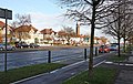
It lies immediately east of Hounslow and west of the River Thames and its tributary the River Crane. Isleworth's original area of settlement, alongside the Thames, is known as Old Isleworth. The northwest corner of the town, bordering on Osterley to the north and Lampton to the west, is known as Spring Grove.
Isleworth's former Thames frontage of approximately one mile, excluding that of the Syon Park estate, was reduced to little over half a mile in 1994 when a borough boundary realignment was effected in order to unite the district of St Margaret's wholly within London Borough of Richmond upon Thames. As a result, most of Isleworth's riverside is that part overlooking the 8.6-acre (3.5ha) islet of Isleworth Ait: the short-length River Crane flows into the Thames south of the Isleworth Ait, and its artificial distributary the Duke of Northumberland's River west of the Isleworth Ait, one of two Colne distributaries constructed for aesthetic reasons between 1600 and 1750.
Excavations around the eastern end of the Syon Park estate have unearthed evidence of a Romano-British settlement. 'Gislheresuuyrth', meaning in Old EnglishEnclosure belonging to [a man called] Gīslhere, is first referred to as a permanent settlement in an Anglo-Saxon charter in the year 695.[5]The Domesday Book says that during the reign (1042–1066) of Edward the Confessor the manor belonged to "Earl Algar" (probably Ælfgar of Mercia), and a modern road off South St today carries his name.[6]
Granted to St Valeri Barons
Isleworth was a well-cultivated farming and trading settlement, more valuable than many of its neighbours, stretching from the Middlesex bank of the River Thames west to the centre of Hounslow (including the land of later Hounslow Priory) and as far as the borders of Southall (in Hayes parish at the time) at the time of the Norman Conquest in 1066. The Domesday Book (1086) as Gistelesworde records its 55 ploughlands, 118 households and amount rendered, £72 per year, to its feudal system overlords.[7][8] After the Conquest, successive Norman barons of the St Valeri family held the manor of Isleworth but there is no evidence that they ever lived there – it being held as a source of revenue and power. One of the later barons gave several manorial rents and privileges to London's Hospital of St Giles. He also gave the church and advowson to the Abbey of St Valeri, which stood at the mouth of the Somme in Picardy.[9]
Transfer to Earldom of Cornwall
Coat of arms of Richard, First Earl of Cornwall
In 1227, when he took control of England from his childhood regents, Henry III seized Isleworth and other property of the St Valeri family and gave the manor to his brother, Richard, 1st Earl of Cornwall. He built a new moated manor house, which is described in the Black Book of the Exchequer – having a tiled roof, chimney, two bedchambers and an inner courtyard. Beyond the moat was an outer courtyard with a number of buildings for servants and supplies, and a short distance away was a watermill.
The exact location of this house is not recorded, but a report of an area long ago known as 'Moated Place' puts the likely place between the Northumberland Arms and Twickenham Road, with the watermill being near Railshead, on the River Crane (not where the traditional Isleworth mill 'Kidd's Mill', because the stream there is artificial and did not exist at that time).[6] The seemingly classic medieval manor house was burned down during the Second Barons' War in 1264.
Advowson, right to appoint the vicar
The Abbey of St Valeri in Picardy held the livings (benefices) and revenues of several English parish church lands and, responding to growing disquiet over these foreign holdings, in 1391 it transferred those of Isleworth (for a fee) to William of Wykeham, who endowed them to Winchester College, which he founded. The Wardens and Scholars of Winchester College therefore became proprietors of productive rectory (which had glebelands). This lasted for 150 years, then in 1543 King Henry VIII exchanged with Winchester certain manors elsewhere for five churches in Middlesex, including All Saints.
Four years later he gave the Isleworth rectory and advowson to the Edward Seymour, 1st Duke of Somerset, but they returned to the crown when the Duke was executed in 1552. Soon after, they were given to the Dean and Canons of St George's Chapel, Windsor, with whom they remain today.[10] The castle-like stone church tower by the river remains from this period, see below.
Transfer of Manor to Syon Monastery
In 1415 Henry V granted nuns from the Swedish Bridgettine order land on the bank of the Thames, in Twickenham parish opposite his new Sheen Palace, where they built their first house Syon Monastery. In 1422 Henry V transferred ownership of Isleworth Manor from the Duchy of Cornwall to Syon Monastery,[11] which in 1431 selected a new location within their manor to rebuild their monastery. This is the site of the present Syon House.[12]
Granted to Duke of Somerset
Henry VIII demolished most of Syon Monastery after 1539 and the site and manor was granted to Edward Seymour, 1st Duke of Somerset. It was Seymour who built Syon House in 1548. Lady Jane Grey was taken from here to the Tower by Royal barge in anticipation of her being crowned Queen of England.
Acquired by Earl of Northumberland
Forty-six years later, in 1594 Queen Elizabeth I granted a lease of the manor of Syon to Henry Percy, 9th Earl of Northumberland on his marriage to Dorothy Devereux the younger daughter of Walter Devereux, 1st Earl of Essex, who later received a grant of the freehold from King James I in 1604.[13] It has remained in the possession of the Percy family, now the Dukedom of Northumberland, for over four hundred years. The Royalist army occupied the house during the Battle of Brentford in November 1642. Syon Park was rebuilt and landscaped by the Adam brothers and "Capability" Brown between 1766 and 1773. It became the new home of the Dukes of Northumberland when Northumberland House in the Strand was demolished in 1874.
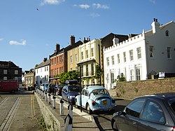
Georgian houses in Church Street, next to the parish church and facing the Thames
Much of Isleworth became orchards in the 18th century (including part of Hugh Ronalds' renowned nursery),[14] and then market gardens in the 19th century, supplying the London markets. Lower Square and Church Street still have buildings dating from the 18th and early 19th centuries. A striking element of this period was the establishment in Isleworth of many mansions and large houses, principally for aristocrats and high achievers. This phenomenon arose owing mainly to the collection of royal and noble residences and ecclesiastical establishments that already existed nearby. The subject is examined in depth in the "Notable houses" section.
There is evidence of a Black community in Isleworth in the 18th century. This community was primarily made up of enslaved people of colour, from Africa, Asia or the Caribbean. Some of these people had fled from bondage and chose to seek their freedom in the streets of London.[15] With very few exceptions, little is known about people of colour in 18th century London. However, as a result of contemporary sources like advertisements seeking the capture and return of runaway slaves, an insight can be gained into the lives of two people, Marina Dellap and Prince, who resided in the area in 1765.[16][17][18]
20th century
The first half of the 20th century for Isleworth generally was characterised by a very substantial amount of artisan and white-collar residential development throughout the town, at the expense of numerous market gardens. [19] The former western area was ceded to the town and parish of Hounslow, which was invested as a civil parish in 1927. This period also included the building of several new factories and offices, mostly towards the north-east, up to the town's eastern boundary with New Brentford. This rapid spread of building transformed the nature of Isleworth's layout in the space of just fifty years, from an agrarian pattern to an urban one.
Isleworth's former Thames frontage of approximately one mile, excluding that of the Syon estate, which is shared with Brentford, was reduced to 0.5 miles (0.80km) in 1994 when a borough boundary realignment was ordered by the UK's Local Government Minister to add land to the district of St Margarets, Twickenham.[20]
Geography
Elevations range from 27m (89ft) in the northwest to 4.9m (16ft) by the Thames at the opposite extreme OD. The boundaries are longstanding, subject to twentieth-century western and southern circonscriptions: Isleworth is east of the town of Hounslow which has more retail and offices, in the borough of that name; west of the River Thames; north of its tributary and the northern confluence of the Crane (before 1998 its southern channel); and south of the crest by the M4 motorway separating the Brent and Crane catchments.[21] Half of the River Crane flows into the Thames south of the Ait, and its distributary the Duke of Northumberland's River flows toward its midpoint from the west.
Amenities
Olympic gold medal-winning distance runner Mo Farah's gold post box is outside a large convenience shop; his senior school was Isleworth and Syon School
Isleworth is home to Isleworth Crown Court whose original remit has been expanded to include judicial work formerly conducted at the Middlesex Crown Court; an extension to create six new courtrooms was completed in 2009.[22]
The town's municipal facilities include a public library, a public leisure centre with swimming pool, a gymnasium, four recreation grounds, and a town hall.
Isleworth has been home to satellite television broadcaster Sky since its launch in 1989 by Rupert Murdoch. Originally centred on Grant Way, the sprawling campus around Gillette Corner once took in New Horizons Court and is now the sole occupier of the Centaurs Business Park, with offices, studios, production space, research and development facilities, plus a dedicated energy centre including a wind turbine by Arup Associates.[23]
The Boat Cathja is moored in Old Isleworth. This is unique 38 metre barge which has been the home of a mental health charity since 1996. It helps mentally disabled people a chance to hone into their artistic skills. Situated on the boat is the Sculpture "The Heron" by Martin Cotts.[24]
Isleworth was home to opera group Isleworth Baroque (now Richmond Opera) from 2002 to 2015.[25][26]
Hospitals
Brentford Workhouse Infirmary and West Middlesex Hospital (historic)
The Brentford Poor Law Union had a workhouse built in 1838 covering much land to the east of Twickenham Road in Isleworth. At the turn of the 20th century, this was totally rebuilt as an infirmary, with a much larger workhouse newly erected in the grounds.[27] This infirmary functioned until 1920, when it became 'West Middlesex Hospital'. In 1931 it was upgraded to a county hospital, but in 1948 (under the NHS) 'County' was dropped from its title. It later became a teaching hospital, and added 'University' to its title in 1980.[28] The Victorian buildings were closed in 2003, and redeveloped as housing, called Union Lane, after the original workhouse. The hospital was rebuilt on the adjacent site.[29]
This is a major acute hospital on the Twickenham Road, Isleworth, with 394 beds, providing the full range of services expected of a general hospital. It serves residents of both the London boroughs of Hounslow and Richmond. As a university hospital it is affiliated with Imperial College London. A programme of building, renovation and modernisation in recent years has resulted in the hospital offering modern facilities.
Percy House Auxiliary Military Hospital (historic)
Within the old union workhouse complex stood a school, facing Twickenham Road, called Percy House – Percy being the surname of the dukes of Northumberland. Owing to its gradual disuse as a school it was adapted to function as a military hospital during World War I of 1914–18. From 1915 onwards it treated some 5,000 war-wounded soldiers, and ceased operation at the end of 1918.[30] Among the VAD nurses was Sophia Duleep Singh. The building was demolished in 1978.[27]
Mogden Isolation Hospital (historic)
For nearly a hundred years an isolation hospital existed on the south side of Mogden Lane, which runs west from Twickenham Road. Opened in 1897, Mogden Isolation Hospital was renamed 'South Middlesex Fever Hospital' in 1938 but continued under local authority control. When the National Health Service was formed it became, in 1948, simply South Middlesex Hospital. It closed in 1991.[31]
The principal road in Isleworth is the London Road (A 315), which broadly follows the route of one of the early roads the Romans constructed in Britannia, namely Tamesis Street, built across the wide heathlands en route to Silchester, from where other roads led to Bath, Winchester and Salisbury.[32]
As this road from the centre of London passes through Westminster it is called 'Piccadilly' and then 'Knightsbridge'.In Kensington it is 'High Street', in Hammersmith 'King Street', in Chiswick it's the 'High Road', in Brentford it's the 'High Street', and as Isleworth's 'London Road' passes into Hounslow it again becomes 'High Street'.In former times it was part of the 'King's Highway' to Windsor.
A bigger road was completed in 1925, named the Great West Road (A 4), moving in much the same direction and forming the notional northern boundary of Isleworth. A six-lane dual carriageway for most of its length, with attendant cycle paths, it fulfilled the purpose of bypassing the bottlenecks of Brentford and Hounslow high streets to relieve the old road from London of traffic heading to and from Windsor and beyond. A later branch extension off this new road, named the Great South West Road, carried traffic south-westwards and this had the additional effect of relieving the London Road of traffic heading to and from Staines-upon-Thames and beyond.
The other throughway in this category is the Twickenham Road (A 310), which branches off London Road west of the Syon estate and takes traffic to Twickenham, Teddington and beyond. This was the King's Highway to Hampton Court, so in years past those houses fronting on Twickenham Road, such as Somerset House, Kendal House and the two Silver Halls would have been favoured with a royal gaze from time to time. [citation needed]
Electric trams started running in Isleworth in 1901, from a depot situated on the north side of London Road, near the border with Hounslow. The original operating company was London United Tramways, which was subsumed into the new London Passenger Transport Board in 1933. In 1935 the depot was converted to trolleybus operation. It was designed in a horseshoe shape with a travelator at the far end, which had a turntable added for the trolleybuses. [citation needed] Originally known as Hounslow Depot, it was renamed Isleworth and given the code "IH" in 1950. It had a capacity for 37 vehicles and only ever operated one service: the 57 tram route which, on conversion, became the 657 trolleybus route. Both the 57 and 657 operated between Hounslow and Shepherd's Bush Green via Isleworth, Brentford, Chiswick, and Goldhawk Road. From 1902 the Hounslow terminus of the 57 tram was the "Hussar" in Staines Road, Hounslow Heath. In July 1922 the service was cut back to terminate at the "Bell" at the western end of Hounslow High Street. A special turning place half a mile along Staines Road, at its junction with Wellington Road, was built for the 657 trolleybus. At different times there were ambitious plans to extend the tram lines westward to Staines-upon-Thames and even to Maidenhead, but these never came about and the modern replacement motor bus route 237 traverses exactly the same roads between Hounslow Heath and Shepherd's Bush as the trams did over 110 years ago (with a short extension to White City). [citation needed]
When the 657 figured in the final London trolleybus conversion of all, on 8 May 1962, Isleworth Depot was closed and its staff were transferred to nearby Hounslow Bus Garage (coded "AV"). The replacement motor bus service was provided by an extension of route 117, which up to then had run between Egham and Hounslow. [citation needed] In 1978 the 117 between Hounslow and Shepherd's Bush was superseded by an eastward extension to route 237. Until this time the 237 had operated between Chertsey and Hounslow with single deck buses – a truly suburban route. As part of the privatisation of London bus services, Hounslow Garage passed to London United that later was purchased by Transdev and later over by the RATP Group.
Another trolleybus service serving Isleworth was the 667, formerly the 67 tram, which passed through en route from Hampton Court to Hammersmith via Hampton Hill, Fulwell, Twickenham, Busch Corner, Brentford and Chiswick. Upon its transfer to motor bus operation, as part of the final London trolleybus conversions, the route had its number changed from 667 to 267. Tram 67, trolleybus 667 and motor bus 267 were all operated from Fulwell bus garage. The history of the ownership of Fulwell (coded "FW") is exactly as for Hounslow Garage above.
On Summer Bank Holidays a special service was operated between Shepherd's Bush and Hampton Court. In tram days this was route 65, but trolleybuses showed number 667 towards Hampton Court and 657 on the return journey. This service did not survive the trolleybuses' withdrawal.[citation needed]
A long-established motor bus route serving Isleworth (and Hounslow) was the number 37. This was one of the earliest motor bus routes introduced by the London General Omnibus Company and it originally ran from Isleworth to Peckham via St Margarets, Richmond, Barnes, Putney, Wandsworth, Clapham Junction, Clapham Common, Brixton, Herne Hill and East Dulwich. It was later extended westward to Hounslow (going round the back streets to avoid the low railway bridge in St John's Road and to serve Isleworth railway station) and for a brief time in the 1920s offered a summer Sunday service extension as far as Maidenhead. Even without that short-lived extension the 37 was one of London's longest routes. Between 1922 and 1938 its western terminus was the "Hussar" at Hounslow Heath but was then cut back to turn at Hounslow Bus Garage (later Bus Station). At the beginning the terminus in Isleworth was the forecourt of the Northumberland Arms public house and the destination boards displayed "ISLEWORTH Market Place". Later, for "short" journeys, this was changed to stands in Magdala Road and then in South Street, outside the Public Hall. In 1991 this historic route was curtailed to run between Peckham and Putney, and the section between Richmond and Hounslow via Isleworth became a new, more localised service numbered H37.
Rail
Isleworth has only one rail service. It consists of a loop branch line running off the minor main line service operated by South Western Railway between central London and Reading. On the down-service the loop begins at the Barnes junction, then travels through Chiswick and Brentford before entering Isleworth by crossing the River Brent just south of the A4 trunk road. Thereafter it serves the two stations of Syon Lane and Isleworth before leaving the town just north of the Woodlands estate and passing under Bridge Road. The service usually runs at fifteen-minute intervals. Following its next stop at Hounslow the loop re-enters the main line on the up-service shortly before the Whitton station.
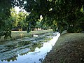
Typical pleasure boat of the mid-20th century seen from Isleworth Promenade in 1952
1840 George J Aungier: "There is a ferry, called Church Ferry, for foot passengers, from the church over the river to West Sheen, Kew, &c. and another at the southern extremity of the village, called Rails-head Ferry."[33]
1947 Rails-head Ferry still existed, more than fifty years after the nearby footbridge had been built.
1952 Typical pleasure boat of the mid-20th century seen here from Isleworth Promenade.
Notable residents
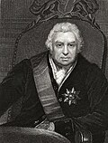
Sir Joseph Banks
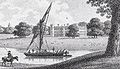
Banks' house, known as Spring Grove House
Spring Grove House in the 18th century
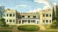
Spring Grove House in 1902
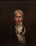
Vincent van Gogh, painted by himself ten years after residing in Isleworth
Peter Oliver (1594–1648), watercolour copyist and miniature portrait artist, lived in his native Isleworth. He painted many figures at the courts of Kings James I and Charles I.
Marina Dellap was a resident of Isleworth in 1765. She was enslaved and lived in the home of Mrs Dellap near All Saints’ Church in Isleworth. She ran away on 26 May 1765. Marina was in her 20s, had arrived from Jamaica about a year before, spoke English and had a child. She was a skilled seamstress.[16][17] It is likely that Marina arrived in England with Elizabeth Bouffan after the death of her husband Alexander Dellap, with whom they lived in St Catherine, Jamaica.[34]
Prince was a resident of Isleworth in 1765. He was enslaved by a merchant called Mr Shea. Prince was aged 24, from Guinea and a musician who played the French horn. Prince ran away from Mr Shea on 13 August 1765 and is likely to have known Marina Dellap. She was seen with someone matching Prince’s description (wearing an old brown livery coat turned up with red).[18]
In 1779, Sir Joseph Banks, botanist, took a lease on, and eventually bought, a house with thirty-four acres (14 hectares) along the northern side of what is now London Road. It became known as "Spring Grove House". Although he also had a home in central London, he spent much time and effort on his Isleworth property. He steadily created a renowned botanical masterpiece on the estate, achieved primarily with many of the great variety of foreign plants he had collected on his great travels around the world, particularly with Captain Cook to Australia and the South Seas. Banks died in 1820, and over the next thirty years the house was considerably modified and enlarged by a new owner, Henry Pownall, who then sold the estate in 1850 for partial redevelopment.
In 1804, J. M. W. Turner lived for a short time in Sion Ferry House in Isleworth, where he drew inspiration from the picturesque banks of the River Thames. His paintings thereafter include the Houses of Parliament and Hampton Court from the Thames.
Post-impressionist artist Vincent van Gogh moved to Isleworth in 1876 to become a teacher and assistant preacher at a local school. A blue plaque exists on the house he lived in alongside Twickenham Road.
Andrew Pears was the third generation head of the Pears soap business located in Isleworth, and in 1886 he bought Spring Grove House. He rebuilt it in 1892/94 on a grander scale, retaining the structure, facing the building with new red brickwork, and adding large rear extensions. This created a sizeable mansion, most of which still stands. The house is now part of West Thames College. There is a memorial to the Pears family in Isleworth cemetery, including Thomas Pears (1882–1912) who died on the RMS Titanic.
George Manville Fenn (1831-1909) was a prolific English novelist, journalist, editor and educationalist who lived in Isleworth and is buried there. Many of his novels were written for young adults.
Walter R. Booth (1869–1938), creator of the first British animated cartoon film, The Hand of the Artist, constructed his own outdoor studio in the back garden of Neville Lodge, Woodlands Road, Isleworth in 1906 with Harold Bastick as his cameraman. At least fifteen films a year were made up to 1915, after which he entered the publicity film market, making advertising shorts for Cadbury.
Arthur Penty (1875–1937), an architect and writer on guild socialism and distributism lived in Church Street, Old Isleworth (1926–1937). He is commemorated by a blue plaque.
Eileen Sheridan (1923–2023), a champion English cyclist of the 1940s and 1950s, lived in Church Street, Old Isleworth for many years.
Jack Simmons (1915–2000), historian, was born in Isleworth. In 1947 he became the first professor of history at University College, Leicester, which became the University of Leicester in 1957. He was the university's acting vice-chancellor from 1962 until 1975.
Ronald Chetwynd-Hayes (1919–2001) was born in Isleworth. For over 30 years, Chetwynd-Hayes published more than 200 short stories, 8 novels, and over 20 collections, as well as editing 24 anthologies including many of the Fontana Ghost Stories series of anthologies.
Sir David Attenborough (1926–) Born in Isleworth. His career as the face and voice of natural history programmes has endured for more than 60 years. He is best known for writing and presenting the nine Lifeseries, in conjunction with the BBC Natural History Unit.
Vince Taylor (1939–1991), British rock and roll singer and main inspiration for David Bowie's Ziggy Stardust persona, spent his early life in Isleworth.
Ellen Edith Hannah Redknap (1906–1991), author lived at Worton Way and wrote under the name of Erroll Collins. She was active during the 1940s, specialising in adventure and science fiction for boys.
In the 2001 feature film Gosford Park, Sir William McCordle had one of his factories in Isleworth and Robert Parks was raised in orphanage in Isleworth.
Northumberland House and others in Lower Square in one of Isleworth's conservation areas
A period of intense mansion-building occurred in the 18th and 19th centuries. There was a triple attraction to the area in those times. Its rural, waterside beauty had become well recognised over two hundred years or so, and a few palaces, monasteries and mansions already existed. Then the royal court began to appear at Kew, so the adjacent districts on both sides of the Thames became very fashionable places for the rich and famous to build their grand homes. Some of the cachet dropped away when the court eventually left Kew; most high-quality here survived well The Blitz and social turmoil to enable many to reach grade II* (the mid category) of architectural listed building.
Syon HouseDuke of SomersetDuke of Northumberland. (standing, listed Grade 1) Although this grand house has had a close connection with Isleworth for 450 years, it has very grand architecture as the only non-royal ducal main home ('seat') in Middlesex. It is chronicled in an exhaustive history.
Silver Hall in 1800, on the King's Highway to Teddington
Silver Hall No. 1 (South of North Street, with four acres)[1.6 hectares] Sir John Smith Bt, Privy to William & Mary Lady Harcourt, widow of Sir W Harcourt, Chancellor (Demolished 1801)[36][37]
Silver Hall No. 2 (North of North Street)Joseph Dixon. (Demolished 1950)[37]
Kendal House. (Twickenham Road, near Mill Plat)Duchess of Kendal (mistress to George I).[38]
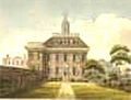
Somerset House
Gunnersbury House. (At the junction of Bridge Road and London Road) (Demolished c. 1972).[39]
Isleworth HouseSir William Cooper, chaplain to George III.[36]Renamed Nazareth House in 1892 when it was established as the present residential nursing home and convent.[39] (standing)
Countess of Charleville's VillaHarriet Charlotte Beaujolais (Campbell), Countess of Charleville.
Shrewsbury House lay to the east of Upper Square, in the area known as Lion Wharf, once Beck's Wharf, also Shrewsbury Wharf. The 14th Earl inherited the lease in 1719 and later by Act of Parliament gained full rights to the property (in exchange for certain fee-farm rents) from an almshouse charity established by a former landlord, Sir Thomas Ingram, from whom the 1st Duke of Shrewsbury had originally leased the site. Around 1778 the 14th Earl started the process by which the house converted to a school for boys of Roman Catholic parents.[40][41]
Gordon House at Railshead 1869
Gordon House, by the River Thames at Railshead Rd. (standing, listed Grade II*). General Humphrey Bland Lord James HayLord John Kennedy-Erskine. Lord and Lady Frederick GordonEarl of KilmoreyJudge T C Haliburton MP. In Lord Hay's time this was named 'Seaton House', after his ancestral home in Aberdeenshire. It was next bought by King William IV at 8,000 guineas for his (illegitimate) daughter Lady Augusta, who married Lord John Kennedy-Erskine of Dun, the son of the First Marquis of Ailsa who lived next door in St Margaret's House. Gordon House is being renovated.[36][42][43][44]
Spring Grove HouseSir Joseph BanksAndrew Pears.[36] (standing, Grade II)
In 1862 Francis Pears decided to expand his soap making business and bought land alongside the London Road for a factory. Another, larger, factory was opened along the opposite side of the road in the 1880s and soap was made on the site until 1962.His son Andrew bought the Spring Grove House estate in 1886 and greatly extended the house in 1894. Pictures are shown under 'Notable residents'.
Lacy HouseA 17th-century house rebuilt in 1750 for James Lacy, of Drury Lane Theatre. Lacy's son inherited the property but his extravagance compelled him to sell the house, to the Hon. Sir Edward Walpole K.B. He bequeathed it to his daughter, widow of Bishop of Exeter, and after that it was acquired by the Earl of Warwick. After him came the famous playwright Richard Sheridan, who by then had already produced his two masterpieces School for Scandal and The Rivals. Lacy House was demolished in the 1830s.[36][45]
St Margaret's House (Lacy House rebuilt and renamed)First Marquis of Ailsa.[36]
Kilmorey House (replaced St Margarets House in 1853). Built for 2nd Earl of Kilmorey but never lived in. Became the Royal Naval School for Girls (1856–1940).[36] (Demolished 1950).
Demography and housing
In the 2011 Census, the Isleworth ward of Hounslow was recorded as being 51% White British. Other significant ethnic groups were Other Whites (11.7%), Black Africans (7%), Indians (6.4%), and Other Asians (5.6%).[46] The proportion who ethnically identify as BAME (Black, Asian and minority Ethnic) was 34.8% of the population.[47]
63.3% of people living in Isleworth were born in England. The other most common countries of birth were India (3.1%), Somalia (2.1%), Ireland (1.7%) and Pakistan (1.4%).[48]
The largest religious affiliations in Isleworth are Christians (49.5%), those with no religion (20.7%), Muslims (13.9%), Hindus (3.7%) and Sikhs (2.4%).[48]
This page is based on this Wikipedia article Text is available under the CC BY-SA 4.0 license; additional terms may apply. Images, videos and audio are available under their respective licenses.