"}" id="mwDQ">
Bedfont is a suburb in the London Borough of Hounslow, approximately 15 miles (24 km) west of Charing Cross. Originally a distinct village, Bedfont has a large central conservation area around Bedfont Green. The majority of the housing was built at a time of an emerging economy of aviation and distribution-related businesses. The area was formerly part of the Staines Rural District and was one of the formerly agricultural areas chosen for significant low-rise social housing, planned and built in the mid 20th century.
Bedfont straddles Staines Road (A315) and traditionally includes North Feltham north of Staines Road – a mainly commercial area – and the neighbourhood of Hatton. [2] The heart of the area has many parks and the south-eastern streets and Cage Park are contiguous with the larger district of Feltham. East is the River Crane around which are a few remaining parts of Hounslow Heath.
The nearest railway station is at Feltham and the area adjoins the Hatton Cross Underground station on the Piccadilly line. Heathrow Airport is 2 miles (3 km) to the north.
A typical list of evolving Middle English orthography follows the Domesday Book's "Bedefunde" (1086). All forms confirm two components, the first unclear and the latter certain (in meaning). In the most orthodox Old English language (Old English), a tongue relatively little-written and standardised, funta or funde means spring or small pool.
Excavations before the building of Heathrow's Terminal 5 site (2 miles (3.2 km) north-west) found evidence of settlement during the Bronze Age, Iron Age and Roman periods, suggesting there may have been people living in and around the Bedfont area during these periods. [4] [5] However much of the parish soil was unworkable by the till, a large stony heath after which Hatton is named, Hounslow Heath, some turned into Bedfont Powder Mills by the 19th century in North Feltham and later industry/storage buildings. [6]
The obsolete locality name of West Bedfont mainly lies around Long Lane in the parish (area) of neighbouring Stanwell. It once had a small chapel. Its casting off from the rest of the parish and new allegiance to Stanwell church occurred at some point in its descent of the manor in the 12th century. [7] Larger East Bedfont, on the Greater London side of the boundary, has fallen again a little in size and developed into modern-day Bedfont: in the early 20th century some land was given over to Ashford. Later a swathe of Hatton's extent (its manor and its devolved estates) became North Feltham and a similar swathe the east of Heathrow airport. Hatton remains part of Bedfont in the Anglican community
The Parish Church of St Mary the Virgin is on the edge of the village green and is the oldest surviving church in the borough dating from around 1150. Its Norman chancel, chancel arch and south doorway have survived the centuries, as have medieval wall paintings from the mid 13th century, which were uncovered in 1865. [8]
The Domesday Book has an entry stating that the manors of Bedfont, Hatton and Stanwell were all held by William Fitz Other. From the early 14th century the Manor of East Bedfont was held by the Trinitarian Priory of Hounslow, before being taken by the Crown during the reformation. The Berkeley family of Cranford then held the manor before selling it to the Earl of Northumberland in 1656. Pates Manor, architecturally a Grade II listed building also in Bedfont, was held by the Page family, a branch of the Pages of Harrow on the Hill. [9] Col. John Page, a member of the family, became a wealthy Virginia merchant who served on the colonial council. [10]
Charles I licensed the Hounslow Sword Mill in 1630 on the banks of the Duke of Northumberland's River. The sword smiths, who came from Solingen in Germany, produced one thousand swords a month, which have become collector's items and an impressive collection of these can be seen at the Gunnersbury Park Museum. There is also one on display at Warwick University.
The Longford River, which also flows through Bedfont, also dates from the reign of Charles I.
During the English Civil War, when both the Royalist and Parliamentary armies passed through Bedfont, the mill was taken by Parliamentary forces, and was converted to a gunpowder mill in 1654.
This converted mill was supplemented by new mills closer to Baber Bridge, in the area now known as Donkey Woods. The manufacture of gunpowder was a dangerous occupation and workers were killed or maimed in many explosions down the years, with the mills being demolished and rebuilt a number of times. The water-powered gunpowder mills continued to be used until 1926 when they were closed by the then owners, Imperial Chemical Industries.
After the railway heyday the twentieth century saw motor cars take en masse to the old arterial coaching route and so prompted the Great South West Road in 1925 skirting the bulk of Bedfont south of today's airport and much of Hounslow in a decade when the Bath Road, which branches off, was also improved.
By 1946 another form of transport began to impact on the village when Heathrow Airport opened and became the largest employer in the area, with the effect of increasing the demand for local housing. The village of Heathrow was lost, as was some of the hamlet of Hatton. This sits beneath the airport's flight path, but The Green Man public house survives from around the 16th century together with a few period properties near the pub and London Underground station on the edge of the airport.
Bedfont has the rare status for a metropolitan traditional area (an old parish) in the UK to have two surviving manor houses: Pates, once owned by the Page family is behind the church, the oldest house in the Borough – one wing dates to the late 15th century. Fawns, on the south side of the Green, dates from the 16th century and was sold to the British Airways Housing Association in 1983 by Derek Sherborn of the family who had owned it from the 17th century. [11]
As population and coach services grew from the 17th to 18th centuries the number of inns in Bedfont grew to at least six. The Duke’s Head and The Bell were on Bedfont Green, and The Plough, The Sun, The White Horse and the Queen’s Head joined them in providing stabling and refreshments to the weary travellers and goods distributors on the road between London and much of Hampshire and the South West. The sole survivor is the Bell, now known as The Bell on the Green.
St Mary's church, the parish church of Bedfont, is of unknown foundation, although it retains its original Norman chancel and arch. There are wall paintings of Christ on the Cross and Christ in Glory, of about 1250 to the north of the arch. They were uncovered in 1865. In 1829, the church was enlarged, and there is a plaque in the porch commemorating this. In 1865 the original wooden tower and spire were removed and the nave lengthened. A new tower, spire, porch, and chancel doorway were built. The tower clock is of uncertain date: it may have been installed to commemorate Queen Victoria's Diamond Jubilee (1897) or King Edward VII's coronation (1902). The church is a Grade II listed building. [12]
The church is famous for the two yew trees in the churchyard, which are referred to as the 'yew trees into peacocks shorn' in a poem by George Colman the Elder, a friend of the actor-manager David Garrick. They were also the subject of Thomas Hood's poem 'The Two Peacocks of Bedfont'. The local legend is that 'two overbearing damsels . . dismissed a suitor with such contempt that in revenge he had the trees trimmed to typify them as two proud and haughty peacocks' and they were for two centuries the pride of the village. For a time they were not maintained but they were recreated in 1990 at the initiative of the chairman of Princes Sporting Club, David Spyer, who remembered in the early 50's being told about Hood's poem. In later years, on becoming interested in topiary work, he recalled the history of the trees and went to look at them. In discussion with the then vicar, he learnt that the local authority had given permission for them to be truncated, it was difficult to find anyone who could advise him on restoration of these trees. Eventually he was advised of a Dutch topiarist. Funds were raised from the local Bank and SGB supplied scaffolding and the Dutchmen came over and stayed with local parishioners, this happened over a three years until the trees began to take shape, they were then maintained by a local gardener, the dates '1704 – 1990' were then trained into the trees.[ citation needed ]
The building of the Great Western Railway between London and Bristol in 1841 marked the beginning of the end for the golden age of the stagecoach, and by 1847 stage and mail coaches had ceased to run to the west. The Waterloo to Staines line opened in 1848. It skirts the far south-west of the parish. For a few decades this left the roads less used by long-distance traffic. After the motorway network was built, this situation resumed
Captain Matthew Webb, who was the first man to swim the English Channel (25 August 1875), lived in The Limes, New Road, Bedfont from 1880 until 1883 when he died attempting to swim the rapids below the Niagara Falls.
Bedfont has three Non-League football teams :
Ward | Detached | Semi-detached | Terraced | Flats and apartments | Caravans/temporary/mobile homes/houseboats | Shared between households [1] |
---|---|---|---|---|---|---|
(ward) | 220 | 2,065 | 1,007 | 1,562 | 3 | 2 |
Ward | Population | Households | % Owned outright | % Owned with a loan | hectares [1] |
---|---|---|---|---|---|
(ward) | 12.701 | 4,859 | 18 | 30.2 | 445 |
Londonportal
Media related to Bedfont at Wikimedia Commons
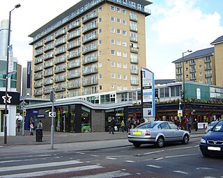
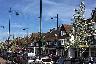
Hounslow is a large suburban district of West London, England, 10+3⁄4 miles west-southwest of Charing Cross. It is the administrative centre of the London Borough of Hounslow, and is identified in the London Plan as one of the 14 metropolitan centres in Greater London.
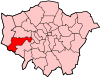
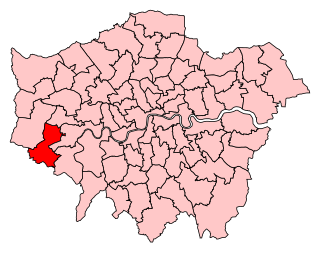
The London Borough of Hounslow is a London borough in west London, England, forming part of Outer London. It is governed by Hounslow London Borough Council.
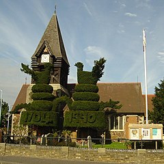
Feltham is a town in West London, England, 13 miles (21 km) from Charing Cross. Historically part of Middlesex, it became part of the London Borough of Hounslow in 1965. The parliamentary constituency of Feltham and Heston has been held by Labour Party MPs since 1992. In 2011, the population of the combined census area of Feltham, Bedfont and Hanworth was 63,368.
Hanworth is a district of West London, England. Historically in Middlesex, it has been part of the London Borough of Hounslow since 1965. Hanworth adjoins Feltham to the northwest, Twickenham to the northeast and Hampton to the southeast, with Sunbury-on-Thames to the southwest.
Harlington is a district of Hayes the London Borough of Hillingdon and one of five historic parishes partly developed into London Heathrow Airport and associated businesses, the one most heavily developed being Harmondsworth. It is centred 13.6 miles (21.9 km) west of Charing Cross. The district adjoins Hayes to the north and shares a railway station with the larger district, which is its post town, on the Great Western Main Line. It is in the west of the county of Greater London and until 1965 it was in the south-west corner of the historic county of Middlesex.
Heathrow or Heath Row was a wayside hamlet along a minor country lane called Heathrow Road in the ancient parish of Harmondsworth, Middlesex, England, on the outskirts of what is now Greater London. Its buildings and all associated holdings were demolished, along with almost all of the often grouped locality of The Magpies in 1944 for the construction of the new London Airport, which would later assume the name of Heathrow after 1967.
Ashford is a town in Spelthorne, in Surrey, England, 14 mi (23 km) west of central London. Its name derives from a crossing point of the River Ash, a distributary of the River Colne. Historically part of Middlesex, the town has been part of Surrey since 1965. Ashford consists of relatively low density low- and medium-rise buildings, none of them being high rise. If excluding apartments most houses are semi-detached. In 2011 it had a population of 27,382.
Stanwell is a village in the Spelthorne district, in Surrey, England. It is 16 miles (26 km) west of central London. A small corner of its land is used as industrial land for nearby Heathrow Airport. The rest of the village is made up of residential and recreational land. Historically part of the county of Middlesex, it has, like the rest of Spelthorne, been in Surrey since 1965. The village is to the south of the cargo-handling area of Heathrow Airport and to the east of the Staines Reservoirs. Stanwell is the northernmost settlement in Surrey, bordering Berkshire and Greater London.
Whitton is an area of the London Borough of Richmond upon Thames, England. Historically, it was the north-western part of Twickenham manor, bounded by the River Crane and the Duke of Northumberland's River.
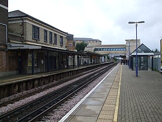
Feltham railway station serves Feltham in the London Borough of Hounslow, west London. It was opened on 22 August 1848 by the Windsor, Staines and South Western Railway.
Feltham and Heston is a constituency in Greater London created in 1974 and represented in the House of Commons of the UK Parliament. Its Member of Parliament (MP) since 2011 has been Seema Malhotra of the Labour and Co-operative Party, in political union with the Labour Party.
Hatton including Hatton Cross is a small settlement and locality in the London boroughs of Hillingdon and Hounslow, on the south-eastern edge of London Heathrow Airport and straddling the A30 road. Prior to 1965 it was in the county of Middlesex.
Feltham was an urban district in the former county of Middlesex, England from 1904 to 1965. As Middlesex was disbanded is 1965, Feltham now is a part of Greater London.
The London Borough of Hounslow is a peripheral London borough in the south-west of the conurbation; as such part of the Metropolitan Green Belt lies within its boundaries. It has one of London's largest Nature reserves as well as many smaller gardens and sports grounds. The major areas are:
Cranford is a suburban area straddling the London Boroughs of Hillingdon and Hounslow. It is located 12.5 miles (20 km) west of Charing Cross and immediately east of Heathrow Airport, from which it is separated by the River Crane. A village till the mid-20th century, Cranford was developed with the building of major roads in its area.
Elthorne was a hundred of the historic county of Middlesex, England.
Staines Rural District was a rural district of Middlesex in England from 1894 to 1930.
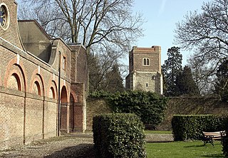
Hounslow Heath is a local nature reserve in the London Borough of Hounslow and at a point borders Richmond upon Thames. The public open space, which covers 200 acres (80 ha), is all that remains of the historic Hounslow Heath which covered more than 4,000 acres (1,600 ha). The present day area is bounded by A315 Staines Road, A3063 Wellington Road South, A314 Hanworth Road, and the River Crane.
The Duke of Northumberland's River or D. O. N. River consists of separate upper and lower artificial watercourses in west London, United Kingdom. The older name Isleworth Mill Stream/River more accurately describes the economic motivation behind its construction. The first section draws water via a sluice from the Colne — a source river which has seven distributaries, many of which are man-made — today an extended distance of about 5 miles (8 km) into the Crane; its lower section of about 1.8 miles (2.9 km) draws water from that small river in Whitton, Twickenham and discharges it via neighbouring Isleworth, passing Mill Plat into the tidal Thames. A sluice underneath Mill Plat feeds the main lake in Syon Park.
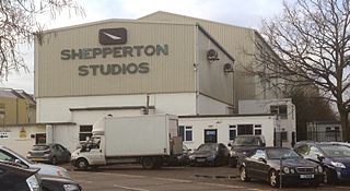
Littleton is a village in the borough of Spelthorne, approximately 16 mi (26 km) west of central London. Historically part of the county of Middlesex, it was transferred to Surrey in 1965. It is the location of Shepperton Studios.