Beddington

Last updated

Beddington
3 Beddington Park, London Borough of Sutton - Boating Lake.jpg
Beddington Park in the London Borough of Sutton
Greater London UK location map 2.svg
Red pog.svg
Beddington
Location within Greater London
Population21,004 
OS grid reference TQ305655
London borough
Ceremonial county Greater London
Region
Country England
Sovereign state United Kingdom
Post town Wallington
Postcode district SM6
Post townCroydon
Postcode district CR0
Dialling code 020
Police Metropolitan
Fire London
Ambulance London
UK Parliament
London Assembly
List of places
UK
England
London
51°22′16″N0°07′55″W / 51.371°N 0.132°W / 51.371; -0.132

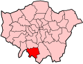
Beddington is a suburban settlement in the London Borough of Sutton on the boundary with the London Borough of Croydon. Beddington is formed from a village of the same name which until early the 20th century still included land which became termed entirely as Wallington. The latter was in the 13th century shown on local maps as Hakebrug, and named after a bridge on the River Wandle. The locality has a landscaped wooded park at Beddington Park – also known as Carew Manor; and a nature reserve and sewage treatment works in the centre and to the north of its area respectively. The population of Beddington according to the 2011 census is 21,044.

Contents

Beddington forms part of the Carshalton and Wallington constituency, which is represented in Westminster by Conservative Elliot Colburn. Of the six councillors that Beddington elects to Sutton Council (from the wards Beddington North and Beddington South), three are Liberal Democrats and three are Independents.

History

The village lay in Wallington hundred and until the 19th century was in secular and ecclesiastical terms a large parish in its own right. Wallington was for centuries a manor in Beddington parish and although known as a shorthand for the area stretching from Cheam to Addington and from Chaldon to Mitcham (inclusive). [1] Wallington superseded Beddington's former area almost completely in the early 20th century.

The settlement appears in the Domesday Book of 1086 as Beddinton(e) held partly by Robert de Watevile from Richard de Tonebrige and by Miles Crispin. Its Domesday Assets were: 6 hides; 1 church, 14 ploughs, 4 mills worth £3 15s 0d, 44 acres (0.18 km2) of meadow, woodland worth 10 hogs per year. It rendered: £19 10s 0d per year to its feudal system overlords. [2] In 1901 it consisted of 3,127.5 acres (12.657 km2), of which 1,439 acres were arable land, 614 permanent grass and 45 woods. As this was before the expansion of Wallington, it extends on the south over the chalk downs at Roundshaw and northwards on to the London Clay. Lavender and medicinal herbs were grown commercially in the parish. The population in 1901 was 4,812. The parish was bounded on the north by Mitcham Common, and the three parishes of Croydon, Beddington and Mitcham met on the railway line by Beddington Lane station. [3]

The 1911 Victoria County History documents Beddington in the period of its shrinkage.

Wallington is now more urban than Beddington; the hamlet in 1901 had a population of 5,152 on an area of 312 acres. In prehistoric times it also appears to have been the more important place, since it gave its name to the hundred. It is possible that the Roman remains mentioned above may be a relic of a formerly important place, and that its name may preserve the memory of the Wealas, the Romanized Britons, whom the Suthrige found here when Britain was [mostly] becoming England. In historical records, however, Wallington is not a place of importance. There was a chapel, but there is no record of a parish church. In Bishop Willis's visitation of 1725 the chapel is described as partly used for a barn, no service having taken place [in memory]. It was ruinous later in the century and was pulled down in 1797. There were extensive common fields, as was usual in the parishes on the north side of the chalk range. They were inclosed under an Act of 1812. In 1835 a system of allotments was established, which seems to have flourished for a time. A few old houses remain at Wallington Corner, but none of these appear to date from earlier than the beginning of the 19th century. [3]

A parish hall was built at Wallington in 1888, following its church and parish being set up in 1867 (in Beddington at the time). Holy Trinity Church school was built in 1896; the High School for girls was built in 1895 and enlarged in 1905. Thus it came about that Wallington took up most of the land of Beddington. [3]

A static inverter plant of HVDC Kingsnorth stood here in the late 20th century.

Beddington Mill

Beddington Mill in 2010 Beddington, Wandle Mill - geograph.org.uk - 1767182.jpg
Beddington Mill in 2010

The Domesday Book mentions two Mills at Beddington, and the current one is thought to have been the site of one of these. Once erroneously thought to have been owned in the late 16th century by Sir Walter Raleigh, an early 17th-century lease shows that it was in fact owned by the Carew family as a flour mill. In 1805 it was a snuff mill with a new owner, and it changed hands several times before being burnt down and replaced by the current building in 1891–1892 by Wallis & Co as a flour mill and bakery. [4]

The old – 18th-century or earlier – mill house remains to this day.

Beddington Park

Carew Manor, the former manor house of the Carew family, now Carew Manor School, Beddington Carew manor.jpg
Carew Manor, the former manor house of the Carew family, now Carew Manor School, Beddington

Carew Manor

Beddington Park was the former manor house of the Carew family, lost to money lenders (see George Samuel Ford) and bad debts by Charles Hallowell Hallowell Carew in the 1850s. [5] The Domesday Book mentions two Beddington estates and these were united by Nicholas Carew to form Carew Manor in 1381. The Manor, once a medieval moated house, was home to the Royal Female Orphanage from 1866 until 1968. It now contains council offices and Carew Manor School.

In about 1591 Sir Walter Raleigh secretly, and without royal permission, married one of Queen Elizabeth I's maids of honour, Elizabeth Throckmorton of Carew Manor. Raleigh spent time in the Tower of London for this and Elizabeth was expelled from the court but the marriage appears to have been a genuine love-match and survived the imprisonment. A popular story is that when Raleigh was beheaded by James I in 1618, Elizabeth claimed his embalmed head and kept it in a bag for the rest of her life. His body was buried in St Margaret's, Westminster, and after his wife's death 29 years later, Raleigh's head was returned to his tomb and interred at St. Margaret's Church. [6]

During the visit of visit of Christian IV to England in August 1606, the royal party visited Beddington, hosted by Sir George Carew. [7]

The Grade I listed great hall (or banqueting hall), [8] containing a fine hammerbeam roof, survives from the mediaeval house. In the grounds are part of the orangery built in the early 18th century around orange trees planted by Sir Francis Carew (claimed to be the first planted in England) and an early 18th-century Grade II* listed dovecote. [9]

Arms of Carew Or, 3 lions passant in pale sable Carew arms.svg
Arms of Carew Or, 3 lions passant in pale sable

Archaeologists have discovered a Tudor garden including a grotto at Carew Manor, believed to have been created by Sir Francis Carew in the 16th century. Its exact location has not been disclosed in order to protect it from looting. [10]

As well as Carew Manor, the family have given their name to a street in nearby Wallington, Carew Road.

Carew Arms

Arms of Carew: Or, 3 lions passant in pale sable [11] were the arms shown on the seal of "Nicholas de Carreu" (c. 1255 – 1311), appended to the Barons' Letter, 1301, which he joined as "Lord of Mulesford" and which were blazoned for the same bearer in the Caerlaverock Poem or Roll of Arms of 1300, when he was present at the Siege of Caerlaverock Castle. From him are descended the Carew baronets of Antony and of Haccombe, the Earl of Totnes and Baron Carew.

St Mary's Church

St Mary's Church St Mary's Church, Beddington - geograph.org.uk - 1212624.jpg
St Mary's Church

The Grade II* listed 14th-century flint parish church of St Mary's occupies a prominent position in Beddington Park, immediately south of what is now Carew Manor School. It contains an organ screen by William Morris. The church is designated at Grade II* for the following principal reasons: [12]

Transport

Beddington is served by the Wimbledon branch of the Tramlink network. The nearest railway station is Waddon.

The area is served by a number of bus routes, all of which are operated by Transport for London.

Namesakes

Beddington Heights, Calgary is named after Beddington, Surrey.

Nearest places

The boating lake in Beddington Park Boating lake, Beddington Park - geograph.org.uk - 1212630.jpg
The boating lake in Beddington Park

Related Research Articles

<span class="mw-page-title-main">Carshalton</span> Suburb of London

Carshalton is a town, with a historic village centre, in south London, England, within the London Borough of Sutton. It is situated 9.5 miles (15.3 km) south-southwest of Charing Cross, in the valley of the River Wandle, one of the sources of which is Carshalton Ponds in the middle of the village. Prior to the creation of Greater London in 1965, Carshalton was in the administrative county of Surrey.

<span class="mw-page-title-main">Mitcham</span> Human settlement in England

Mitcham is an area within the London Borough of Merton in Southwest London, England. It is centred 7.2 miles (11.6 km) southwest of Charing Cross. Originally a village in the county of Surrey, today it is mainly a residential suburb, and includes Mitcham Common. It has been a settlement throughout recorded history.

<span class="mw-page-title-main">Morden</span> Human settlement in England

Morden is a district and town in south London, England, within the London Borough of Merton, in the ceremonial county of Greater London. It adjoins Merton Park and Wimbledon to the north, Mitcham to the east, Sutton to the south and Worcester Park to the west, and is around 8 miles (13 km) south-southwest of Charing Cross. Prior to the creation of Greater London in 1965, for local government purposes, Morden was in the administrative and historic county of Surrey.

<span class="mw-page-title-main">Waddon</span> Human settlement in England

Waddon is a neighbourhood in the London Borough of Croydon, at the western end of the town of Croydon. The area borders the London Borough of Sutton.

<span class="mw-page-title-main">Wallington, London</span> Human settlement in England

Wallington is a town in the London Borough of Sutton, South London, England, 9.7 miles (15.6 km) south-west of Charing Cross. Before the Municipal Borough of Beddington and Wallington merged into the London Borough of Sutton in Greater London in 1965, it was part of the county of Surrey. Wallington is a post town in the SM postcode area.

<span class="mw-page-title-main">London Borough of Sutton</span> Borough in London, England

The London Borough of Sutton is an Outer London borough in London, England. It covers an area of 43 km2 (17 sq mi) and is the 80th largest local authority in England by population. It borders the London Borough of Croydon to the east, the London Borough of Merton to the north and the Royal Borough of Kingston upon Thames to the north-west; it also borders the Surrey boroughs of Epsom and Ewell to the west and Reigate and Banstead to the south. The local authority is Sutton London Borough Council. Its principal town is Sutton.

<span class="mw-page-title-main">River Wandle</span> Tributary of the River Thames, England

The River Wandle is a right-bank tributary of the River Thames in south London, England. With a total length of about 9 miles (14 km), the river passes through the London boroughs of Croydon, Sutton, Merton and Wandsworth, where it reaches the Thames. A short headwater – the Caterham Bourne – is partially in Surrey, the historic county of the river's catchment. Tributaries of the Wandle include Carshalton Ponds and Norbury Brook.

<span class="mw-page-title-main">Carshalton and Wallington (UK Parliament constituency)</span> UK Parliament constituency since 1983

Carshalton and Wallington is a constituency represented in the House of Commons of the Parliament of the United Kingdom since 2019 by Elliot Colburn, a Conservative.

<span class="mw-page-title-main">Parks and open spaces in the London Borough of Sutton</span>

The London Borough of Sutton, one of the peripheral London boroughs, has 89 parks and open spaces within its boundaries, a total area of 1500 acres (6 km2). Varied in size and layout, green spaces range from the compact Manor Park in Sutton town centre, through the medium-sized Grove Park, which forms part of the Carshalton Village conservation area, to the large and historic Oaks Park in the south of the borough. In the west of the borough is the large Nonsuch Park. The main parks are:

<span class="mw-page-title-main">Municipal Borough of Sutton and Cheam</span>

Sutton and Cheam was a local government district in northeast Surrey, England from 1882 to 1965.

<span class="mw-page-title-main">Municipal Borough of Beddington and Wallington</span>

Beddington and Wallington was, from 1915 to 1965, a local government district in north east Surrey, England. It formed part of the London suburbs, lying within the Metropolitan Police District and the London Passenger Transport Area. In 1965 it was abolished on the creation of Greater London.

<span class="mw-page-title-main">Hackbridge</span> Human settlement in England

Hackbridge is a suburb in the London Borough of Sutton, south-west London, just over two miles north-east of the town of Sutton itself. It is 8.8 miles (15 km) south-west of Charing Cross.

Carshalton was a constituency combining with areas to the south-west, then to the east instead, Carshalton which is a suburb on a long, north–south hillside south of London. The latter form saw it take up an eastern "half" of the London Borough of Sutton. It returned one Member of Parliament (MP) to the House of Commons of the Parliament of the United Kingdom.

<span class="mw-page-title-main">Woodmansterne</span> Village in Surrey, England

Woodmansterne is a village in the borough of Reigate and Banstead, Surrey, bordering Greater London, England. It sits on a small plateau of and a southern down slope of the North Downs and its ecclesiastical parish borders continue to span old boundaries and reach into Chipstead, Coulsdon and Wallington.

<span class="mw-page-title-main">Grove Park (Sutton)</span>

The Grove Park, or The Grove is a public park in Carshalton in the London Borough of Sutton. It is situated close to Carshalton Village in the area approximately bounded by the High Street, North Street and Mill Lane. The southwest corner of the park abuts one of Carshalton's ponds from where water flows through the park as the river Wandle.

<span class="mw-page-title-main">Wallington Hundred</span>

Wallington was an ancient hundred in the northeast of the historic county of Surrey, England. The majority of its area has been absorbed by the growth of London; with its name currently referring to the district of Wallington. Its former area now corresponds to the London Borough of Sutton, the majority of the London Borough of Croydon and parts of the London Borough of Merton as well as parts of the Districts of Epsom and Ewell, Reigate and Banstead and Tandridge in Surrey.

<span class="mw-page-title-main">Sutton Common</span>

Sutton Common is the name of former common land and a district and neighbourhood located in Sutton, London. The area is mostly located within the London Borough of Sutton, with some of the streets to the north and west of Sutton Common Park adjoining Lower Morden and Morden within the London Borough of Merton. Much of the area is taken up by the large Kimpton Park commercial and industrial estate, adjoining the A217. It is served by Sutton Common railway station. The area to the south and east of Oldfields Road uses an SM1 postcode and the area to the north and west uses SM3.

<span class="mw-page-title-main">Wallington Town Hall</span> Municipal building in London, England

Wallington Town Hall is a municipal building in Woodcote Road, Wallington, London. It is a Grade II listed building.

<span class="mw-page-title-main">Carshalton Council Offices</span> Municipal building in London, England

The Carshalton Council Offices is a former municipal building on The Square, Carshalton, London. The structure, which was briefly the headquarters of Carshalton Urban District Council before becoming a public library, is a Grade II listed building.

References

  1. H.E. Malden, ed. (1912). "The hundred of Wallington: Introduction and map". A History of the County of Surrey: Volume 4. Institute of Historical Research. Retrieved 26 January 2014.
  2. Surrey Domesday Book Archived 30 October 2007 at the Wayback Machine
  3. 1 2 3 H.E. Malden, ed. (1912). "Parishes: Beddington". A History of the County of Surrey: Volume 4. Institute of Historical Research. Retrieved 26 January 2014.
  4. "Information about the historic mill in Beddington". London Borough of Sutton. Archived from the original on 23 October 2014. Retrieved 18 October 2014.
  5. "Re Charles Hallowel Hallowell Carew, Esquire of Beddington Park, in the county of Surrey" (PDF). 15 October 1856. London Gazette. Archived (PDF) from the original on 2 December 2013. Retrieved 25 November 2013.
  6. Lloyd, J & Mitchinson, J: The Book of General I.
  7. Maurice Lee, Dudley Carleton to John Chamberlain, 1603–1624 (Rutgers UP, 1972), p. 87.
  8. Beddington Place (Great Hall Only), Sutton
  9. Pigeon House to North West of Beddington Place, Sutton
  10. "Carew Manor • Wandle Valley". Wandle Valley. Retrieved 13 March 2021.
  11. Debrett's Peerage, 1968, Carew Baronets, p.155
  12. Parish Church of St Mary the Virgin, Sutton