Bandonhill

Last updated

Bandonhill
Greater London UK location map 2.svg
Red pog.svg
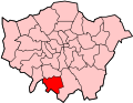
Bandonhill
Location within Greater London
London borough
Ceremonial county Greater London
Region
Country England
Sovereign state United Kingdom
Post town SUTTON
Postcode district SM6
Dialling code =
Police Metropolitan
Fire London
Ambulance London
London Assembly
List of places
UK
England
London
51°21′49″N0°08′00″W / 51.36360°N 0.133445°W / 51.36360; -0.133445 Coordinates: 51°21′49″N0°08′00″W / 51.36360°N 0.133445°W / 51.36360; -0.133445

Bandonhill (sometimes spelt as Bandon Hill) is a small locality in the London Borough of Sutton, located between Wallington and Beddington.

It is best known for Bandon Hill Cemetery, which opened in 1899. [1] Bandon Halt railway station formerly served the area, however this closed in 1914. [2]

Related Research Articles

Westbourne Green Human settlement in England

Westbourne Green is an area of Westbourne, London, the centre of the former hamlet of Westbourne, at the north-western corner of the City of Westminster. It is named for its location west of a bourne.

Knights Hill (West Norwood) Human settlement in England

Knights Hill is part of the A215 in West Norwood, London and an area of the London Borough of Lambeth.

Kensal Town Human settlement in England

Kensal Town is a residential sub-district of Kensal Green in north-west London. It is located at the northern tip of the Royal Borough of Kensington and Chelsea where it meets the City of Westminster. Although local residents generally consider the area to be North Kensington, it is officially and historically an area of Kensal Green. It is included in the W postcode area and was first recorded in 1876 as Kensal New Town. This name had been used since the 1840s to distinguish the area south of the Harrow Road, in between the Grand Union Canal and the Great Western Main Line, where new housing was largely occupied by Irish immigrants. By the late 19th century the area had deteriorated into a run-down slum, though it was much improved when the slums were cleared and replaced with new council housing during the mid-20th century.

Chase Cross Human settlement in England

Chase Cross is a district of the London Borough of Havering in London, England. Chase Cross lies 0.8 miles (1.2 km) east of Collier Row, 15 miles (26 km) northeast of Charing Cross and just under 2 miles (3 km) north of Romford. The name is thought to come from its position as a crossroads in the chase or Hainault Forest. The forest was cleared for agriculture in the 1850s, before being developed for housing in the 1930s.

Wall End Human settlement in England

Wall End is a locality in East Ham in East London, located in the borough of Newham. It is a little-used name for the area lying to the north of Beckton between Barking and East Ham. The name stems from an embankment wall that was formerly used to prevent flooding from the river Roding at the 'end' or 'outlying part' of East Ham. Much of the area consists of terraced housing dating from the building-boom of the late 19th century.

Lampton Human settlement in England

Lampton is a small area of Hounslow located on the Great West Road in the London Borough of Hounslow, between Hounslow town centre and Heston. Its name derives from the Old English for 'lamb farm.'

Little Woodcote Human settlement in England

Little Woodcote is an area in the London Borough of Sutton, and also in the London Borough of Croydon and it is located in the south-east of the borough south of Woodcote Green and Carshalton on the Hill. Nearby is Oaks Park. The area falls within the Carshalton South and Clockhouse Ward of Sutton Borough.

Woodcote Green Human settlement in England

Woodcote Green is an area in the London Borough of Sutton, located in the south-east of the borough south of Wallington. At the 2011 Census the population of the area was included in the Beddington South ward of Sutton Council.

Hazelwood, London Human settlement in England

Hazelwood is a hamlet in Greater London, England. It is located within the London Borough of Bromley, to the east of Downe.

Grange Mills Human settlement in England

Grange Mills is a very small area of east Balham in the London Borough of Lambeth, England. Rarely appearing on maps, it is essentially little more than a small industrial estate, located off Weir Road.

Foxbury Human settlement in England

Foxbury is an area in the London Borough of Bromley, located to the east of Chislehurst. It is home to the Grade II-listed Foxbury Manor, several educational institutes and a number of sports and athletic grounds.

Horns Green Human settlement in England

Horns Green is an area in the London Borough of Bromley located to the south of Cudham near the boundary with Kent.

Luxted Human settlement in England

Luxted is a hamlet in the London Borough of Bromley, located to the south of Downe. The area is rural, noted for its abundance of woods and grasslands.

South Street, Bromley Human settlement in England

South Street is a hamlet in the far south of the London Borough of Bromley, 16.5 miles (27 km) south south-east from Charing Cross. It is the highest settlement in all of London averaging about 220 metres (722 ft) above sea level. It is about 5 miles (8.0 km) from Junction 5 of the M25.

Russell Hill, Croydon Human settlement in England

Russell Hill is an area in the London Borough of Croydon, located to the north-west of Purley.

Spring Park, Croydon Human settlement in England

Spring Park is a small area in London, England. It is within the London Borough of Bromley and the London Borough of Croydon, straddling the traditional Kent-Surrey border along The Beck. Spring Park is located north of Addington, west of West Wickham and south of Monks Orchard and Shirley.

Heath Park, Havering Human settlement in England

Heath Park is an area of the London Borough of Havering situated to the east of Romford. It is a largely Edwardian estate built as a result of railway expansion.

Bushey Mead Human settlement in England

Bushey Mead is a small district of the London Borough of Merton, forming a small 'ladder' of terraced streets between Wimbledon Chase railway station and Raynes Park railway station. The housing was built in several steps during the period circa 1890 - 1913.

Copse Hill Human settlement in England

Copse Hill is a low-rise district of the London Borough of Merton to the south of Wimbledon Common, associated with Raynes Park its nearest railway station. It is on higher ground and has the largest green spaces associated with the Raynes Park/West Wimbledon area surrounding it. It was almost entirely privately developed; the nearest social housing areas are in Wimbledon, and Putney Vale.

Cottenham Park Human settlement in England

Cottenham Park is a small district of the London Borough of Merton located to the south of Copse Hill, north of Raynes Park, in West Wimbledon, London. It was named after Charles Pepys, 1st Earl of Cottenham.

References

  1. Willey, Russ. Chambers London Gazetter, p 18.
  2. Willey, Russ. Chambers London Gazetter, p 18.