Woodcote Green

Last updated

Woodcote Green
Greater London UK location map 2.svg
Red pog.svg
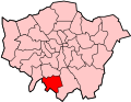
Woodcote Green
Location within Greater London
London borough
Ceremonial county Greater London
Region
Country England
Sovereign state United Kingdom
Historic county
  • Surrey
Postcode district SM6
Post town Wallington
Dialling code 020
Police Metropolitan
Fire London
Ambulance London
London Assembly
List of places
UK
England
London
51°20′55″N0°08′48″W / 51.348475°N 0.146687°W / 51.348475; -0.146687 Coordinates: 51°20′55″N0°08′48″W / 51.348475°N 0.146687°W / 51.348475; -0.146687

Woodcote Green is an area in the London Borough of Sutton, located in the south-east of the borough south of Wallington. [1] At the 2011 Census the population of the area was included in the Beddington South ward of Sutton Council.

Related Research Articles

Carshalton Human settlement in England

Carshalton is a town, with a historic village centre, in south London, England, within the London Borough of Sutton. It is situated 9.5 miles (15.3 km) south-southwest of Charing Cross, in the valley of the River Wandle, one of the sources of which is Carshalton Ponds in the middle of the village. Prior to the creation of Greater London in 1965, Carshalton was in the administrative county of Surrey.

Wallington, London Human settlement in England

Wallington is a town in the London Borough of Sutton, in South London, England. It is 9.7 miles (15.6 km) south south-west of Charing Cross. Before the Municipal Borough of Beddington and Wallington merged into the London Borough of Sutton in Greater London in 1965, it was part of the county of Surrey. Wallington is a post town in the SM postcode area.

London Borough of Sutton London borough in United Kingdom

The London Borough of Sutton is a London borough in South London, England and forms part of Outer London. It covers an area of 43 km2 (17 sq mi) and is the 80th largest local authority in England by population. It borders the London Borough of Croydon to the east, the London Borough of Merton to the north and the Royal Borough of Kingston upon Thames to the north-west; it also borders the Surrey boroughs of Epsom and Ewell and Reigate and Banstead to the west and south respectively. The local authority is Sutton London Borough Council. Its principal town is the eponymous Sutton.

South London Place in England

South London is the southern part of London, England, south of the River Thames, consisting of the London Borough of Bexley, Bromley, Croydon, Greenwich, Kingston, Lambeth, Lewisham, Merton, Richmond, Southwark, Sutton and Wandsworth.

Sutton, London Human settlement in England

Sutton is the principal town of the eponymous London Borough of Sutton in South London, England. It lies on the lower slopes of the North Downs, and is the administrative headquarters of the Outer London borough. It is 10 miles (16 km) south-south west of Charing Cross, and is one of the thirteen metropolitan centres in the London Plan. The population of the town was counted as 41,483 in the 2011 census, while the borough overall counted 204,525.

SM postcode area Postcode area within the United Kingdom

The SM postcode area, also known as the Sutton postcode area, is a group of seven postcode districts in England, within five post towns. These cover part of south-west London, as well as a small part of north Surrey.

Sutton and Cheam (UK Parliament constituency)

Sutton and Cheam is a constituency represented in the House of Commons of the UK Parliament since 2015 by Paul Scully, a Conservative.

Parks and open spaces in the London Borough of Croydon

The London Borough of Croydon has over 120 parks and open spaces within its boundaries, ranging from the 200 acre (80ha) Selsdon Wood Nature Reserve to many recreation grounds and sports fields scattered throughout the Borough. Croydon covers an area of 86.52 km², the 256th largest district in England. Croydon's physical features consist of many hills and rivers that are spread out across the borough and into the North Downs, Surrey and the rest of South London. Some of the open spaces in Croydon form part of the well-known London LOOP walks where the first section was opened on 3 May 1996 with a ceremony on Farthing Downs in Coulsdon. As a borough in Outer London it also contains some open countryside in the form of country parks. Croydon Council is associated with several other boroughs who are taking part in the Downlands Countryside Management Project. These boroughs are Sutton; and by Surrey County Council; the City of London Corporation; the Surrey districts of Reigate and Banstead and Tandridge; and the Countryside Agency. An additional partner is Natural Britain.

Parks and open spaces in the London Borough of Sutton

The London Borough of Sutton, one of the peripheral London boroughs, has 89 parks and open spaces within its boundaries, a total area of 1500 acres (6 km2). Varied in size and layout, green spaces range from the compact Manor Park in Sutton town centre, through the medium-sized Grove Park, which forms part of the Carshalton Village conservation area, to the large and historic Oaks Park in the south of the borough. In the west of the borough is the large Nonsuch Park. The main parks are:

Croydon and Sutton (London Assembly constituency)

Croydon and Sutton is a constituency represented in the London Assembly.

Hackbridge Human settlement in England

Hackbridge is a suburb in the London Borough of Sutton, south-west London, just over two miles north-east of the town of Sutton itself. It is 8.8 miles (15 km) south-west of Charing Cross.

Carshalton was a constituency combining with areas to the south-west, then to the east instead, Carshalton which is a suburb on a long, north-south hillside south of London. The latter form saw it take up an eastern "half" of the London Borough of Sutton. It returned one Member of Parliament (MP) to the House of Commons of the Parliament of the United Kingdom.

<i>Sutton & Croydon Guardian</i> Free local newspaper published in the London Boroughs of Sutton and Croydon

The Sutton & Croydon Guardian also known as Your Local Guardian, is a weekly free local newspaper published by Newsquest that covers the South London boroughs of Sutton and Croydon as well as surrounding areas. The newspaper is published every Wednesday and is distributed free of charge locally. It is sold for 60 pence at newsagents and other shops in and around the borough. In 2007, the newspaper had an average circulation of 99,753.

Ruffett and Big Woods

Ruffett Wood and Big Wood are adjoining woods with a total area of 7 hectares on the border of the London Borough of Sutton, close to the village of Woodmansterne. Big Wood is to the south and Ruffett Wood is to the north. They are owned by Sutton Council and managed by the Woodland Trust. They are designated a Local Nature Reserve and a Site of Borough Importance for Nature Conservation, Grade 1. The woods are the largest continuous area of woodland in the borough of Sutton.

Devonshire Avenue Nature Area

Devonshire Avenue Nature Area is a 0.4 hectare Local Nature Reserve and Site of Borough Importance for Nature Conservation, Grade II, in South Sutton in the London Borough of Sutton. It is owned by Sutton Council and managed by the Council and Sutton Nature Conservation Volunteers.

<i>Sutton armillary</i>

The Millennium Dial Armillary is one of six pieces of public art located in the town centre of Sutton in Greater London, England. The others include the Sutton heritage mosaic, the Sutton twin towns mural and the Messenger statue.

<i>Sutton twin towns mural</i>

The Sutton Twin towns mural is a large mural in the form of seven individual paintings situated in Sutton High Street in the town of Sutton in Greater London, England. It is one of six works of public art in Sutton town centre.

2018 Sutton London Borough Council election

The 2018 Sutton Council election took place on 3 May 2018 to elect members of Sutton Council in London. This was on the same day as other local elections.

References

  1. Willey, Russ. Chambers London Gazetter, p 561.