Little Woodcote

Last updated

Little Woodcote
Greater London UK location map 2.svg
Red pog.svg
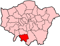
Little Woodcote
Location within Greater London
London borough
Ceremonial county Greater London
Region
Country England
Sovereign state United Kingdom
Post townCarshalton
Postcode district SM5/SM7
Post townBanstead
Dialling code 020
Police Metropolitan
Fire London
Ambulance London
UK Parliament
London Assembly
List of places
UK
England
London
51°20′15″N0°09′34″W / 51.337598°N 0.159567°W / 51.337598; -0.159567 Coordinates: 51°20′15″N0°09′34″W / 51.337598°N 0.159567°W / 51.337598; -0.159567

Little Woodcote is an area in the London Borough of Sutton, and also in the London Borough of Croydon and it is located in the south-east of the borough south of Woodcote Green and Carshalton on the Hill. [1] Nearby is Oaks Park. The area falls within the Carshalton South and Clockhouse Ward of Sutton Borough.

Contents

Little Woodcote Estate

Little Woodcote Estate was created after the First World War to provide "Homes for Fit Heroes". [2]

Local Buses

Local bus routes include 127, 166, 463, S4 (operates on Mondays to Saturdays) and school bus routes 612, 627 and 633.

Related Research Articles

<span class="mw-page-title-main">Carshalton</span> Suburb of London

Carshalton is a town, with a historic village centre, in south London, England, within the London Borough of Sutton. It is situated 9.5 miles (15.3 km) south-southwest of Charing Cross, in the valley of the River Wandle, one of the sources of which is Carshalton Ponds in the middle of the village. Prior to the creation of Greater London in 1965, Carshalton was in the administrative county of Surrey.

<span class="mw-page-title-main">Wallington, London</span> Human settlement in England

Wallington is a town in the London Borough of Sutton, South London, England, 9.7 miles (15.6 km) south-west of Charing Cross. Before the Municipal Borough of Beddington and Wallington merged into the London Borough of Sutton in Greater London in 1965, it was part of the county of Surrey. Wallington is a post town in the SM postcode area.

<span class="mw-page-title-main">London Borough of Sutton</span> London borough in United Kingdom


The London Borough of Sutton is an Outer London borough in south-west London, England. It covers an area of 43 km2 (17 sq mi) and is the 80th largest local authority in England by population. It borders the London Borough of Croydon to the east, the London Borough of Merton to the north and the Royal Borough of Kingston upon Thames to the north-west; it also borders the Surrey boroughs of Epsom and Ewell to the west and Reigate and Banstead to the south. The local authority is Sutton London Borough Council. Its principal town is the eponymous Sutton.

<span class="mw-page-title-main">Wallington railway station</span> Railway station in London

Wallington railway station is in the London Borough of Sutton in south London. The station, and all trains serving it, is operated by Southern, and is in Travelcard Zone 5. It is between Waddon and Carshalton Beeches, 13 miles 5 chains down the line from London Bridge, measured via Forest Hill.

<span class="mw-page-title-main">Carshalton railway station</span> National Rail station in London, England

Carshalton railway station is a railway station at Carshalton in the London Borough of Sutton in South London. It is located between Sutton and Hackbridge.

<span class="mw-page-title-main">Sutton railway station (London)</span> National Rail station in London, England

Sutton railway station (sometimes referred to as Sutton (Surrey) on tickets and timetables) is in the London Borough of Sutton in South London and is the main station serving the town of Sutton. It is served by Southern and Thameslink trains, and lies in Travelcard Zone 5, 14 miles 75 chains (14.94 miles, 24.04 km) down the line from London Bridge, measured via Forest Hill.

<span class="mw-page-title-main">Carshalton Beeches railway station</span> National Rail station in London, England

Carshalton Beeches railway station is in south Carshalton in the London Borough of Sutton in south London. The station, and all trains serving it, is operated by Southern, and is in Travelcard Zone 5. It is between Wallington and Sutton, 13 miles 72 chains down the line from London Bridge, measured via Forest Hill.

<span class="mw-page-title-main">Carshalton and Wallington (UK Parliament constituency)</span> UK Parliament constituency since 1983

Carshalton and Wallington is a constituency represented in the House of Commons of the Parliament of the United Kingdom since 2019 by Elliot Colburn, a Conservative.

<span class="mw-page-title-main">Oaks Park (London)</span>

Oaks Park is a public park in Carshalton in the London Borough of Sutton. It is bounded on the south by Croydon Lane (A2022), and on the east by Woodmansterne Road; smaller roads lie to west and north.

<span class="mw-page-title-main">St Helier, London</span> Housing estate in London

St Helier is a residential cottage estate in the London boroughs of Merton and Sutton. The portion of the estate north of Green Lane and Bishopsford Road is in Merton, the remainder is in Sutton.

<span class="mw-page-title-main">Worcester Park</span> Suburb of Greater London, England

Worcester Park is a suburban town in South West London, England. It lies in the London boroughs of Sutton and Kingston, and partly in the Surrey borough of Epsom and Ewell. The area is 10.1 miles (16.3 km) southwest of Charing Cross. The suburb's population was 16,031 at the time of the 2001 census. The suburb comprises the Worcester Park ward, an electoral area of the London Borough of Sutton with a population in 2011 of 11,655, as well as the Cuddington ward, an electoral area of Epsom and Ewell, which had a population of 5,791 at the time of the 2001 census.

<span class="mw-page-title-main">Parks and open spaces in the London Borough of Sutton</span>

The London Borough of Sutton, one of the peripheral London boroughs, has 89 parks and open spaces within its boundaries, a total area of 1500 acres (6 km2). Varied in size and layout, green spaces range from the compact Manor Park in Sutton town centre, through the medium-sized Grove Park, which forms part of the Carshalton Village conservation area, to the large and historic Oaks Park in the south of the borough. In the west of the borough is the large Nonsuch Park. The main parks are:

<span class="mw-page-title-main">Hackbridge</span> Human settlement in England

Hackbridge is a suburb in the London Borough of Sutton, south-west London, just over two miles north-east of the town of Sutton itself. It is 8.8 miles (15 km) south-west of Charing Cross.

Carshalton was a constituency combining with areas to the south-west, then to the east instead, Carshalton which is a suburb on a long, north–south hillside south of London. The latter form saw it take up an eastern "half" of the London Borough of Sutton. It returned one Member of Parliament (MP) to the House of Commons of the Parliament of the United Kingdom.

<span class="mw-page-title-main">A2022 road</span> Road in south London and northern Surrey

The A2022 is a non-primary road in England. It runs south-west into the foothills of the North Downs from West Wickham in the London Borough of Bromley through Selsdon, Sanderstead, Addington, Purley, the Woodcote part of that town, Banstead in Surrey and Epsom Downs through which it descends to a similar altitude as at its beginning to end at Epsom.

<span class="mw-page-title-main">Woodmansterne</span> Village in Surrey, England

Woodmansterne is a village in the borough of Reigate and Banstead, Surrey, bordering Greater London, England. It sits on a small plateau of and a southern down slope of the North Downs and its ecclesiastical parish borders continue to span old boundaries and reach into Chipstead, Coulsdon and Wallington.

<span class="mw-page-title-main">Grove Park (Sutton)</span>

The Grove Park, or The Grove is a public park in Carshalton in the London Borough of Sutton. It is situated close to Carshalton Village in the area approximately bounded by the High Street, North Street and Mill Lane. The southwest corner of the park abuts one of Carshalton's ponds from where water flows through the park as the river Wandle.

<span class="mw-page-title-main">The Wrythe</span>

The Wrythe is a district of Carshalton, South London, located in the London Borough of Sutton. The area is located 9.3 miles South of Charing Cross and is surrounded by the adjacent areas of Hackbridge and Croydon to the east, Morden and Mitcham to the north, Sutton to the west. The area is commonly referred to as Wrythe Green which is located at the centre of the neighbourhood. It is thought that the name derives from a spring which is related to the River Wandle which runs through the east of the area from the Carshalton ponds. The Wrythe had a population of 10,163 in the 2011 Census.

<i>Sutton armillary</i>

The Millennium Dial Armillary is one of six pieces of public art located in the town centre of Sutton in Greater London, England. The others include the Sutton heritage mosaic, the Sutton twin towns mural and the Messenger statue.

References

  1. Willey, Russ. Chambers London Gazetter, p 298.
  2. Homes Fit for Heroes, Surrey